29/10/2019-04/11/2019
Tesla’s navigation system and OSM 😉
1 | © Teslamotorsclub – Map data © OpenStreetMap contributors 🙂
Mapping
- SelfishSeahorse proposes the tagging of lanes on roads which are explicitly marked for pedestrians.
- StreetCred is a company founded by Randy Meech after MapZen folded. They now provide their POI data with an MVT-Tileserver, which can be used in iD as an extra custom layer.
- Hanikatu asked
 (automatic translation) how to tag objects that have more than one property. An example provided was multiple items attached to a single street light. Suggestions ranged from using multiple nodes through to using a
 type=noderelation. - Amazon Logistics traces unearthed a short way, part of a major inner-city one-way system, which has had incorrect access tagging for nearly 11 years.
- Opensnowmap.org now provides a more complete view of daily and weekly changes to ski pistes and winter sports-related elements in OpenStreetMap.
- Voting concluded for the new feature proposal
leisure=sunbathing_area. There were 18 votes in total and 2 non-voting comments. “Yes” got 13 votes or 72% which is just short of the 75% required for approval. - The tagging proposal contact:phone or phone missed the required three-quarters majority with 46 “yes” and 60 “no” votes. The proposal wanted to declare
contact:phone=*obsolete in favour of the older and much more commonphone=*. The topic has been controversial for a decade. - OpenStreetMap India pointed, on Twitter, to the success of OSM Kerala (India) in convincing the local government to support crowdsourced mapping by launching the Mapathon Keralam. The Hindu, India’s third-largest English newspaper, carries the story on their website.
- Luzandro has created (automatic translation) a map of possible new or missing roads in Austria based on BEV’s register of addresses.
- On Ilya Zverev’s suggestion (automatic translation) Russian border crossings are now being mapped. The mapping is being carried out with the help of a MapRoulette challenge.
 (automatic
 Community
- Tahira reported that Heidelberg’s first climathon event took place at EMBL with a 24 hour hackathon from 26 to 27 October as part of the “global Climathon”. Participants worked in teams on five challenges, all with an aspect of addressing climate change. First place was awarded to the BikeBuddy and Spring Up teams. Both winning teams comprised members from the GIScience research group Heidelberg University. The BikeBuddy team worked on a challenge, presented by HeiGIT.org, to identify attractive cycling routes so as to encourage people to travel by bike rather than car. This challenge was inspired by the research on pleasant routing at GIScience/HeiGIT. The main factor that the team focused on was the safety of cycling routes (street lights, etc.). The data was extracted from OpenStreetMap and integrated into a prototype using OpenRouteService.org.
- Branko Kokanović published a blog post (automatic translation) about his progress using open data about apartments in Serbia.
- OpenStreetMap US published Issue #1 of a brand new newsletter to share OpenStreetMap US activities and news from around the US and the world.
 (automatic
 OpenStreetMap Foundation
- Dorothea Kazazi informed the community about the procedure and the details of the upcoming OpenStreetMap Foundation board elections during the 13th Annual General Meeting. The deadline for putting yourself forward for election was 10 November 2019. If you want to vote, you have to become a member of the OSMF by 14 November 2019. At the time of writing, eight candidates have been nominated. The seats of Kate Chapman, Heather Leson, Mikel Maron and Frederik Ramm are available in this election with only Mikel Maron running for re-election. We encourage everyone to become member of the OSMF and participate. If you can’t afford the membership fee or you cannot transfer funds abroad, we’d like to point you to the OSMF Fee Waiver Program.
- Frederik Ramm informed the members of the OpenStreetMap Foundation that the board suggests a couple of changes to the Articles of Association, mainly related to the mass signup of employees of one company ahead of last year’s board election. Besides the AoA changes, which are required to pass a quorum of 75 percent of OSMF’s Normal Members during the upcoming Annual General Meeting, it is also suggested that the current “financial hardship” fee waiver for OSMF membership be replaced by a general fee waiver for community members with a “sizeable contribution”. The OSMF Board provided a pdf-file with details of the changes.
- Christoph Hormann (imagico) provides some advice for candidates for the upcoming OSMF board elections. The advice is particularly directed at the formulation of position statements and answering the general slate of questions posed to candidates.
- Joost Schouppe wrote about his first year as an OSMF board member. Topics covered include: what worries him about OSM in general, how heavy the burden weighs on just seven volunteers, and missing procedures. An interesting read and an interesting discussion as a follow-up.
Humanitarian OSM
- Heidelberg University’s GIScience Research Group published a blog article about the presentation titled “So much data, so little time: Getting the risk and impact data right for impact-based forecasting“, which they will hold during the 7th International Dialogue Platform on Forecast-based Financing in Berlin.
Education
- The IDEAL-VGI project aims to focus on the challenges of volunteered geographic information for land use classification and big earth observation data. The project is a collaboration between Heidelberg University’s GIScience Research Group and the Technical University of Berlin.
Maps
- Infos-Réseaux.com tweeted (automatic translation) that the milestone of 1000 circuits of the French electrical network mapped, was reached.
- The 30 day Map Challenge, hashtag #30daymapchallenge, is running throughout November. Many participants are using OpenStreetMap data. Spanholz has linked to an imgur album of selected images. The initiator of the challenge is Topi Tjukanov.
 (automatic
 switch2OSM
- The Strava app, which was specially developed for runners and cyclists, uses OSM as map material. Strava has recently introduced a new map rendering that emphasises the details that runners and cyclists most want to see.
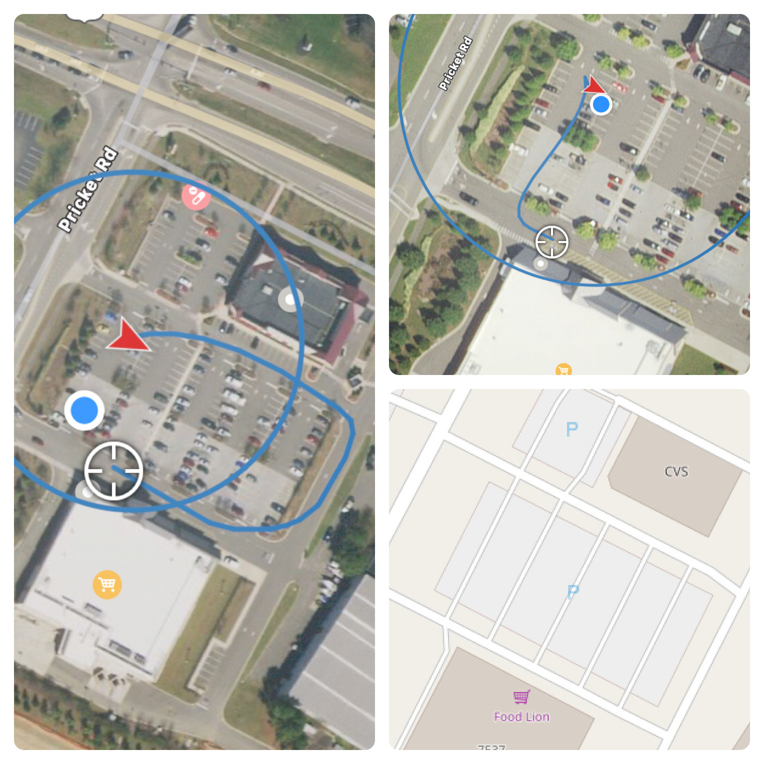
- [1] The Tesla driver Army_1 noticed that the route guidance of his car’s Smart Summon application, which allows the Tesla to drive autonomously to the owner’s location in parking lots, changes when he edits parking lanes on OSM.
Open Data
- Théophile Merlière, of the Etalab team, reports on the improvement and correction of errors in an official geolocated address database based on three walks of a few hours each and its publication on the BAN (Base Adresse Nationale) of France.
- Dr Adrian Mallory has written an opinion piece calling for collective action to make big data a force for wider social good, not as fuel for the hyper-wealthy, secretive forms of manipulation and further social inequality.
Releases
- JOSM 19.10 has been released. Major enhancements in this version are allowing zoom levels up to 24 in TMS layers, dropping support for https remote control, and adding GeoJSON importing.
- Please watch the thread “Update der OSM Software List“, in the German Forum, to stay informed about release changes of all OSM Software. Wambacher tries to update this excerpt from the OSM Software Watchlist every weekend. For example the Rel. 2.0 of the App Windy Maps is listed, where OSM-based online and offline maps with many POI, hiking and cycling paths are displayed. Wiki, photo and excursion tips included. Now with improved routing with voice control and tracking.
OSM in the media
- TV5Monde reports about the public transport mapping project in Bamako, Mali. Read more about the project on the wiki page (automatic translation).
Other “geo” things
- Archie Archambault is a craft mapper who believes that maps should be made by surveying and “being within the parameters of the space”. Archie is working on a project to create artistic maps that give you the “gist” of cities around the world.
- Victor shows (automatic translation) how to load free maps onto your Garmin Fenix or EDGE.
- Interested in attending a Wizards Unite event? Well, you’re too late for this one, but of interest to mappers is that the locations used were based on libraries mapped in OSM.
- In response to the third “Tokyo Public Transportation Open Data Challenge” Akihiko Kusanagi has built a real-time 3D digital map of Tokyo’s public transport system.
 (automatic
 Upcoming Events
| Where | What | When | Country |
|---|---|---|---|
| Kameoka | 京都!街歩き!マッピングパーティ:第14回 鍬山神社 | 2019-11-10 |  |
| Budapest | OSM Hungary Meetup reboot | 2019-11-11 |  |
| Taipei | OSM x Wikidata #10 | 2019-11-11 |  |
| Zurich | Stammtisch Zürich | 2019-11-11 |  |
| Lyon | Rencontre mensuelle pour tous | 2019-11-12 |  |
| Salt Lake City | SLC Mappy Hour | 2019-11-12 |  |
| Nitra | Missing Maps Mapathon Nitra #4 | 2019-11-12 |  |
| Hamburg | Hamburger Mappertreffen | 2019-11-12 |  |
| Wellington | FOSS4G SotM Oceania 2019 | 2019-11-12-2019-11-15 |  |
| Digne-les-Bains | HÉRuDi : l’Histoire Étonnante des Rues de Digne | 2019-11-12 | |
| Munich | Münchner Stammtisch | 2019-11-13 | |
| Wuppertal | OSM-Treffen Wuppertaler Stammtisch im Hutmacher 18 Uhr | 2019-11-13 | |
| Berlin | 137. Berlin-Brandenburg Stammtisch | 2019-11-14 | |
| Nantes | Réunion mensuelle | 2019-11-14 | |
| Encarnación | State of the Map Latam 2019 | 2019-11-14 |  |
| Niš | Missing Maps Mapathon Niš #1 | 2019-11-16 |  |
| Istanbul | Yer Çizenler | 2019-11-16 |  |
| Cologne Bonn Airport | Bonner Stammtisch | 2019-11-19 | |
| Reading | Reading Missing Maps Mapathon | 2019-11-19 |  |
| Lüneburg | Lüneburger Mappertreffen | 2019-11-19 | |
| Prešov | Missing Maps Mapathon Prešov #4 | 2019-11-21 | |
| Grand-Bassam | State of the Map Africa 2019 | 2019-11-22-2019-11-24 |  |
| Izmir | Yer Çizenler Mapathon with HKMO-Izmir | 2019-11-23 | |
| Bremen | Bremer Mappertreffen | 2019-11-25 | |
| Salt Lake City | OSM Utah Mapping Night | 2019-11-26 | |
| Düsseldorf | Stammtisch | 2019-11-27 | |
| Singen | Stammtisch Bodensee | 2019-11-27 | |
| Kilkenny | Kilkenny Mapping Event | 2019-11-30 |  |
| Nantes | Participation à « Nantes en sciences » | 2019-11-30 | |
| Cape Town | State of the Map 2020 | 2020-07-03-2020-07-05 |  |
Note: If you like to see your event here, please put it into the calendar. Only data which is there, will appear in weeklyOSM. Please check your event in our public calendar preview and correct it, where appropriate.
This weeklyOSM was produced by NunoMASAzevedo, Polyglot, Rogehm, SK53, SunCobalt, TheSwavu, YoViajo, derFred, doktorpixel14, jinalfoflia, anonymus.