15/06/2021-21/06/2021
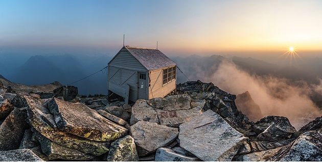
Hidden Peak Fire Lookout at sunset, with smokey haze from nearby fires [1] | © Nick Archibald – This file is from Wikimedia Commons
Mapping campaigns
- The Peruvian Space Agency (CONIDA), in coordination with other institutions, are organising the Mapathon 2021
 > : ‘United in observations for the community management of disaster risk’ to be held from 28 June to 2 July, The aim is that participants improve geospatial data related to disaster risk management. The mapathon is part of bicentennial celebrations of the independence of Peru,
 - The ‘Project of the Month Switzerland’ for June 2021 is / > about recording schools in OSM. There are helpful hints and links for this. Four charts show the changes to
amenity=school | kindergarten | college | universityover time.
 >
> 
 /
/  >
> Mapping
- [1] Voting is underway for the following proposals:
survey_point:structure=beacon/block/...,survey_point:datum_aligned=yes/noandsurvey_point:purpose=horizontal/vertical/both=*to tag the structure, condition, and purpose of a survey marker (until Sunday 4 July).leisure=bathing_placeto tag a place used for bathing and swimming, either official or informal. Mostly with an adjacent area to relax (until Tuesday 6 July).building=fire_lookoutandemergency=fire_lookoutto tag fire lookouts (until Wednesday 7 July).
- Deane Kensok of Esri shared that historical versions of Esri World Imagery, called Esri Wayback Imagery, can also be used for mapping.
- User Heinz V lamented > that his efforts to encourage mappers to leave meaningful changeset comments in Nepal, rather than a string of hashtags, have had little effect. A broader analysis reveals that this issue occurs in edits across the world.
- Christopher Beddow speculated about how the level of community participation in OSM compares with proprietary maps from Silicon Valley firms, which, like Apple recently, often focus on detailed mapping of major tech hubs such as San Francisco.
- Voting on the following proposals has closed:
tourism=giant_furnitureto tag any giant furniture meant to be a viewpoint or a tourism attraction was rejected with 9 votes for and 19 votes against.man_made=stupato substitute man_made=tower with tower:type=stupa was approved unanimously with 18 votes.
Community
- LittleMaps explored in detail the sealed and unsealed Australian roads in OpenStreetMap and reflected on the effort it took to get to where the map is now.
- lhirlimann shared > three blogposts from three districts of French Southern and Antarctic Lands, and express their amazement at the detailed mapping of some of these locations, such as the research base Alfred Faure on Île de la Possession in the Crozet Islands.
- OSM Fukushima (Japanese prefecture where SotM 2017 was held) mappers have published videos that talk about weeklyOSM and mapping topics.
 that talk about weeklyOSM and mapping topics.
OpenStreetMap Foundation
- The OSM Foundation is calling for volunteers to serve on a special committee to examine takeover protection.
- Guillaume Rischard, the treasurer of the OSM Foundation, has announced the Foundation’s possible move to the EU in a long email that is well worth reading. As was to be expected, the number of comments on this issue is extremely high.
- Board director Rory McCann belatedly summarised his OSM-related activities in March.
Local chapter news
- The OSM UK articles of association stipulate that two directors step down each year, and as they need a minimum of five directors to operate, they will have to appoint at least two new directors. Gareth gave more information here.
- The association of shopkeepers and craftsmen for the French town of Pontarlier have opened their data to OpenStreetMap. Information on its 500-ish members businesses is now fully integrated and up to date thanks to local group efforts. Monthly updates are planned.
Events
- The State of the Map 2021 Working Group is pleased to announce that the Conference Programme (9 to 11 July) is now available.
- Christoph Hormann (Imagico) previewed his State of the Map Q&A session on ‘Understanding the Map’. To assist in this he has set up a wiki page to collect examples suitable for discussion. The same information is also available on an etherpad.
Education
- A workshop, held by the Erasmus+ project euYoutH_OSM, explains step-by-step how to use uMap to create a map that shows locations of schools along with pictures of the schools, links to the schools’ websites, their phone numbers and social media links. This is an excellent example for developing your own projects.
Maps
- Amazon talked with Thomas Rosen about QueerMap, an OSM based LGBTQ+ map.
- AnyGIS (as we reported earlier) provides links to bulk download raster tiles from online maps for various apps. Not only is bulk downloading prohibited by some map providers, the maps packages provided by AnyGIS allow Locus to do so by faking user-agent and referrer headers in the requests Locus sends to map providers.
- Nicolelaine wrote about the possibilities of displaying post offices and postboxes using uMap and the Overpass API.
- Tomas Straupis highlighted an open source version of the Wang–Müller algorithm developed by Motiejus Jakštys. The algorithm tries to generalise lines according to cartographic requirements, such as saving or even exaggerating characteristic features.
Software
- French group Linux Alpes is hosting an instance of OSM24 covering South Eastern France. The application aims to display opening hours of different POIs using current OpenStreetMap data.
- The ‘Plastic Tracker’ is a tool to illustrate the fate of floating plastic 20 years from now, should you lose it today from your location or anywhere else in the world. Where will it go? How probable is it that it will reach the ocean? This tool will give you a possible answer to these questions and shows how far plastic can travel from its starting point.
Did you know …
- … the 15-minute city map? It shows > at a glance where in a German city residents are able to meet most of their needs within a short walk or bicycle ride from their homes.
- … there is a map that shows the river > basins and watersheds of Central Europe?
- … Röntgen? Started in September 2020 by enzet, it aims to be a simple renderer for OpenStreetMap with custom icons intended to display as many tags as possible.
- … Cycle Travel? It helps find the best and safest cycling routes in Europe, the USA, Australia and New Zealand. The next update features routes which avoid busy roads in many of these countries.
OSM in the media
- Thierry Jean is co-founder and president of the AddressForAll Institute, a collaborative, open and free database that aims to collect addresses. In this interview with Geocracia, he explains > why the best way to do this is through platforms like AddressForAll and OpenStreetMap.
- Top Gear’s Philippines site informed us about the progress of the project to improve the mapping of Manila’s bicycle routes in OpenStreetMap.
 >
> 
Other “geo” things
- Nicolas Ottersbach described > the status of the creation of a digital 3-D twin of the city of Bonn.
- Allen Downey spotted a very unusual colour ramp on a map used to illustrate a Washington Post article. One of the comments in the thread provides some explanation of its purpose: apparently this is to pick out a range of different cloud-top weather phenomena.
Upcoming Events
| Where | What | Online | When | Country |
|---|---|---|---|---|
| Dublin | OpenStreetMap Ireland AGM | 2021-06-26 |  | |
| Bremen | Bremer Mappertreffen (Online) | 2021-06-28 |  | |
| OSM Fiji Open Data Socialisation Workshop | 2021-06-29 | |||
| Missing Maps CZ Mapathon | 2021-06-29 | |||
| OSM Fiji Mapathon | 2021-06-30 | |||
| Clermont-Ferrand | Rencontre OpenStreetMap Clermont | 2021-06-30 |  | |
| DRK Missing Maps Mapathon – JOSM Einführung | 2021-07-01 | |||
| OSM Africa Monthly Mapathon: Map Nigeria | 2021-07-02 – 2021-08-02 | |||
| 2021-07-02 | ||||
| 臺北市 | OpenStreetMap x Wikidata Taipei #30 | ✓ | 2021-07-05 |  |
| Missing Maps London Mapathon | 2021-07-06 | |||
| Landau an der Isar | Virtuelles Niederbayern-Treffen | ✓ | 2021-07-06 | |
| Stuttgart | Stuttgarter Stammtisch (Online) | 2021-07-06 | | |
| Nordrhein-Westfalen | OSM-Treffen Bochum | 2021-07-08 | | |
| Berlin | 157. Berlin-Brandenburg OpenStreetMap Stammtisch | 2021-07-08 | | |
| State of the Map 2021 | 2021-07-09 – 2021-07-11 | |||
| Missing Maps Online Mapathon | 2021-07-12 | |||
| 20095 | Hamburger Mappertreffen | 2021-07-13 | | |
| Albuquerque | MapABQ July virtual meetup | 2021-07-16 |  |
Note:
If you like to see your event here, please put it into the OSM calendar. Only data which is there, will appear in weeklyOSM.
This weeklyOSM was produced by Lejun, Mannivu, Michael Montani, Nordpfeil, SK53, Supaplex, TheSwavu, YoViajo, derFred.