21.03.2023-27.03.2023

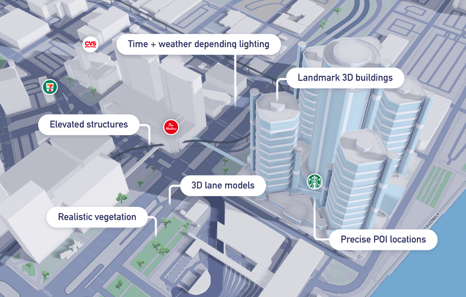
3D навігація в реальному часі від Mapbox з 3D моделями доріг на рівні смуг руху [1] | © Mapbox © OpenStreetMap contributors
Мапінг
- Анна-Кароліна Дістел, відома як b-unicycling, виявила
►
стояки для бідонів з молоком і нанесла на мапу чимало з них.
- chris_debian у своєму блозі
►
ділиться думками про оцінку якості покриття доріг та путівців за допомогою смартфона. Він надає перевагу автоматизованим оцінкам за допомогою додатків, що використовують датчики смартфонів, і перераховує такі як, наприклад, Roadroid або SmartRoadSense.
- Risturiz пояснив
►
, як за допомогою програми Fediphoto-Lineage, форка Fediphoto, можна зберігати фотографії, зроблені за допомогою StreetComplete і привʼязані до OSM Notes.
Спільнота
- Користувач Kateregga1 попросив
►
ChatGPT створити посібник з побудови спільноти OpenStreetMap. Ось що вийшло, і це дійсно вражає.
- Новий форум «community.osm.org» працює вже деякий час, тому Енді Таунсенд вирішив підсумувати
►
плюси і мінуси нового програмного забезпечення. Він задоволений функціональністю, але не дуже задоволений користувацьким досвідом.
Події
- Denrazir веде блог
►
про День відкритих даних 2023 року, який відсвяткувала організація YouthMappers в Університеті науки і технологій Південних Філіппін. Він був присвячений темі «Розширення можливостей штучного інтелекту та картографування за допомогою відкритих даних: Тренінг-семінар з RapID». Denrazir особливо радіє великій кількості жінок, які взяли участь у заході.
- Команда GIScience та HeiGIT оглядається назад
►
і спирається на численні доповіді на минулорічних конференціях. Зокрема, команда HeiGIT з аналізу великих просторових даних провела суботній воркшоп
►
«Аналіз змін в OSM з часом — доступ до повної історії даних OSM через фреймворк ohsome», Моріц Шотт виступив на FOSS4G з доповіддю
►
«Векторизація елементів OSM» та багато іншого.
Освіта
- Після французької та португальської, команда Мапери ООН [UN Mappers] пропонує новий безкоштовний онлайн-семінар на тему «OpenStreetMap та гуманітарне картографування», цього разу англійською мовою. Він відкритий для всіх, хто володіє англійською мовою і є новачком в OpenStreetMap. Реєстрація відкрита до 30 квітня 2023 року о 23:59 UTC. Семінар відбуватиметься щочетверга з 4 травня 2023 року по дві години протягом 9 тижнів, загалом 18 годин.
OSM дослідження
- Команда під керівництвом Ніколи Мілоєвіч-Дюпон та Фелікса Вагнера випустила EUBUCCO, наукову базу даних з окремих полігонів для більш ніж 200 мільйонів будівель у 27-ми країнах Європейського Союзу та Швейцарії, разом з трьома основними атрибутами — типом будівлі, висотою та роком побудови.
- HeiGIT повідомляє
►
, що osmlanduse отримав оновлення функціоналу. Завдяки співпраці GIScience та HeiGIT в рамках проекту IDEAL-VGI наші дослідники змогли додати ряд нових функцій до інтерактивної мапи. Два різних шари даних, з яких складається цей унікальний інструмент, тепер доступні окремо для вибору за допомогою перемикача шарів у верхньому правому куті.
Гуманітарний OSM
- HeiGIT створив
►
екземпляр порталу катастроф для регіону, що постраждав від землетрусу в Туреччині/Сирії, за підтримки Близькосхідної команди ГІС MSF (Лікарі без кордонів). Портал катастроф — це сервіс, який має на меті допомогти під час ліквідації наслідків стихійних лих, надаючи актуальну інформацію для планування маршрутів з урахуванням важкодоступних ділянок дорожньої мережі. Дані OSM оновлюються кожні 10 хвилин.
Мапи
- Янґ Ган презентує
►
тривимірну навігацію в реальному часі від Mapbox із 3D-моделями доріг на рівні смуг руху, виявленням транспортних засобів у реальному часі, визначними будівлями та реалістичною рослинністю, що додає деталізації та чіткості навігації.
А чи знаєте ви …
- … що VersaTiles прагне бути повноцінним FLOSS-стеком для створення, розповсюдження та використання тайлів мап на основі даних OpenStreetMap?
OSM в медіа
- Велосипедист Матіас Швіндт використовує
►
iPhone із застосунком Maps.Me як навігатор для подорожей велосипедом.
- Дізнайтеся
►
більше про те, як OpenStreetMap та відкриті дані допомогли гуманітарному реагуванню та обʼєднанню людей для надання допомоги у відповідь на землетрус у Туреччині та Сирії.
- Гаррі Вуд сказав, що бачив, як про ОСМ згадували в сюжеті програми BBC про проект Асоціації Рамблерів у Шотландії, де волонтери-пішоходи наносять на карту загублені пішохідні стежки.
Майбутні події
Якщо ви бажаєте бачити свою подію тут, додайте її до календаря OSM. До Тижневика WeeklyOSM потрапляють лише наявні в ньому дані.
Цей Тижневик OSM був створений Gontsa, MatthiasMatthias, Strubbl, andygol, darkonus, derFred.
Ми вітаємо ваші пропозиції посилань для наступного випуску через цю форму, та з нетерпінням чекаємо на вашу участь.