02/10/2018-08/10/2018
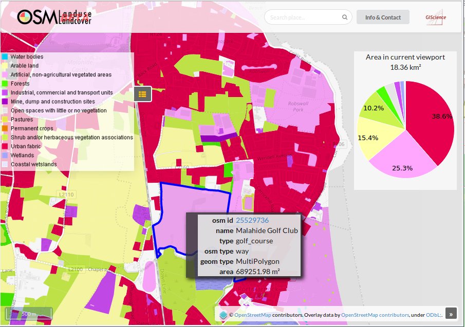
The tags landuse and landcover on https://osmlanduse.org [1] | © GIScience Research Group](http://www.geog.uni-heidelberg.de/giscience.html), Map data © OpenStreetMap contributors
Mapping
- The voting for the key
assembly_point:purpose=has started. The key is is intended to be used withemergency=assembly_pointwhere there is a need to specify the kind of hazard – fire, tsunami, earthquake, tornado. - Warin61 noticed that quite a few public transport route relations are broken. He describes the minimal requirements to make them pass the tests from GeoFabrik’s OSMInspector validation tool, which is a lot easier than having to go through the respective wiki pages documenting how to map bus and train route relations.
Community
- For the third consecutive year members of the OSM Mali community hosted a week-long OSM training camp in Segou for students of the local university. About 70 students have been taught OSM techniques since 2016.
OpenStreetMap Foundation
- Jinal Foflia explains the reasons and benefits of joining the OpenStreetMap Foundation (OSMF) and how to become a member. She also points out that a membership fee waiver program will be implemented soon.
- OSM US welcomes their new executive director. Jaye Matthews was selected from more than 40 applicants for the newly established full-time position. She has more than 20 years of experience in non-profit leadership, but is completely new to OpenStreetMap.
Events
- On October 19th a mapping party with specific focus on wheelchair accessibility will be held in Torino, Italy.
Humanitarian OSM
- The Indonesian Tribunnews reports (automatic translation) about the efforts of OpenStreetMap Indonesia to map the area affected by earthquakes and the devastating tsunami around Petobo, South Palu based on DigitalGlobe imagery taken on October 2nd.
- UBOS, Uganda’s national bureau for statistics, is taking an active role in mapping in OSM. Eleven core members have learned how to use JOSM, QGIS and mobile tools for surveying. There are many challenges to overcome in the country and OSM can help with that.
- Matthew Gibb asked experienced OSM mappers for help with the validation of roads in the Florida Panhandle ahead of Hurricane Michael. A task was created for this on the OSM US tasking manager.
- In September, faculty and students of the Centre for Interdisciplinary Methodologies, University of Warwick organised a workshop on “Making sense of humanitarian geospatial data to improve the impact of humanitarian interventions on health and wellbeing“. The workshop was co-convened by Médecins Sans Frontières (MSF UK), the Humanitarian OpenStreetMap Team (HOT), the Bangladesh Humanitarian OpenStreetMap Operations Team (BHOOT) and the Heidelberg Institute for Geoinformation Technology/GIScience Research Group at Heidelberg University. The event enabled participants to discuss current approaches and challenges and, most importantly, how to collaboratively address them.
- It is October, so HOT commemorates open source by involvement in Hacktoberfest. It is an annual event hosted by Digital Ocean, GitHub and Twilio to promote contributing to open source projects. HOT reminds readers of over 15 of their own active open source projects.
Maps
- Cartisan, a small Armenian-based cartography company, is creating a topographic hiking map of Dilijan National Park in Armenia. This will be the first modern topographic map set in Armenia. The map relies heavily on OSM data and the makers have greatly improved the OSM database in the area. The map (sample) is created exclusively with FOSS. They have launched a crowdfunding campaign, together with the local trail-building NGO, Transcaucasian Trail, to get the map produced.
- Raymond Inzitari wrote a post about how he started a business making wooden maps as artwork. It took him over six months of development to build a model that uses OSM data, convert it to a geodatabase and output an AI file that is required for the laser cutter.
Open Data
- François Lacombe asks whether OSM should participate in events such as the upcoming LinuxFoundation Energy Summit 2018. He argues that it is becoming increasingly common for energy infrastructure operators to replace proprietary data with OSM data.
Software
- The next release of VROOM, free software to solve vehicle routing problems, will handle time windows constraints. The feature is already available for beta testing through the project’s demo server.
- Sick of expensive map updates for your car’s built-in SatNav? A Raspberry Pi, an LCD screen and a few other components are all that is needed to create a DIY car navigation system that can provide free navigation based on OSM data overlaid on OpenMapTiles. The system can even include a rear view camera.
- Generation Streets, a game available on Steam, is using OSM to render an impressive 3D environment.
- Richard Fairhurst published a proof of concept for an OSM editor with a GUI that focuses primarily on street level imagery based mapping.
Programming
- Due to Oracle’s slimming down and reduction of available functionality in their latest Java release, the OSGeo Foundation is organising a code sprint for their Java-based projects (e.g. Geoserver) at several locations from October 22nd to 26th, for which they are looking for sponsors.
- The question whether the time has come to redevelop JOSM due to unpopular licensing changes in Oracle’s Java was asked on the mailing list. Responders point out that JOSM is compatible with the open-source Java implementation OpenJDK, and therefore does not require Oracle’s version of Java in the first place.
- The
avoid_polygonsfeature of the OpenRouteService API allows one to find alternative routes during flood events. To integrate real time information, a team of researchers at HeiGIT proposes a workflow to delineate flooded areas using Twitter data. - If you feel limited by how you can integrate a map into your website with Google Maps, Mapbox or Leaflet, you might want to have a look at the Vue.js framework and the d3.js library. Mikhail Panichev wrote a guide on how to create an interactive map with both of these JavaScript tools.
Did you know …
- … JOSM’s angle snap feature? This feature helps you to add a line parallel, perpendicular or at defined angles to a base segment.
- … the public transport map?
OSM in the media
- Centésimo Mono published an interview with Carlos Brys. Carlos Brys reports about the first mapathon in the province Misiones and refers especially to the principle of data acquisition on site.
 (automatic translation)
 (automatic
Other “geo” things
- The Scottish Parliament passed a law banning public bodies in Scotland from making maps which display the Shetland Islands “in a box” (usually located offshore from Aberdeen or next to the Orkneys). Twitter has extensive commentary, and Kenneth Field, an ESRI cartographer, provides a detailed breakdown of why insets (“boxes”) are the sensible cartographic choice.
- [1] The University of Heidelberg hosted a mapping session to show the power of crowdsourcing for map validation by collaboratively validating the land use and land cover map of Geneva with ESA’s Sentinel 2 and OpenStreetMap data. A preliminary version of the OSM Landuse Map can be found here.
- Chris Wayne wrote an article about creating maps for visually impaired people. In his article he covers the two most common approaches to accomplish this, which are are tactile maps (maps you can feel) and auditory maps (maps that talk in the literal sense).
- Another article that addresses the needs of blind people was written by Nicola Byrne. In her article she explains how to use 3D audio to guide blind people around cities, her experience with the system and how it works.
- Friends of the Earth have published a 100 second video, with each second representing one percent of the landuses in the UK. The video asks whether nature has the space that it deserves.
- The private blog addshore.com published an article about the increase in the number of Wikidata items over the past 6 months. The article gives a breakdown of the increase by region and mentions that the increase in Africa may be due to Wikimania 2018. Over the period about one million geolocalised items were added to Wikidata.
Upcoming Events
| Where | What | When | Country |
|---|---|---|---|
| Samara Mēda | Mapping party in Oktyabrsk | 2018-10-01-2018-10-14 |  |
| Berlin | 124. Berlin-Brandenburg Stammtisch | 2018-10-12 |  |
| Nantes | Participation au « Village des sciences » lors de la Fête de la Science à l’Hôtel de région | 2018-10-12-2018-10-14 |  |
| Frankfurt am Main | Intergeo 2018 | 2018-10-15-2018-10-18 | |
| Cologne Bonn Airport | Bonner Stammtisch | 2018-10-16 | |
| Lüneburg | Lüneburger Mappertreffen | 2018-10-16 | |
| Karlsruhe | Stammtisch | 2018-10-17 | |
| Vienna | Stammtisch | 2018-10-17 |  |
| Mumble Creek | OpenStreetMap Foundation public board meeting | 2018-10-18 |  |
| Moscow | Shemotehnica No. 18 in the office of “Urbica” | 2018-10-19 | |
| Hamburg | ITS-Hackathon “Mobility meets Logistics” | 2018-10-19-2018-10-20 | |
| Karlsruhe | Karlsruher Hackweekend | 2018-10-20-2018-10-21 | |
| Bremen | Bremer Mappertreffen | 2018-10-22 | |
| Nottingham | Pub Meetup | 2018-10-23 |  |
| Arlon | Espace public numérique d’Arlon – Formation Consulter OpenStreetMap | 2018-10-23 |  |
| Cologne | Köln Stammtisch | 2018-10-24 | |
| Lübeck | Lübecker Mappertreffen | 2018-10-25 | |
| Bengaluru | State of the Map Asia 2018 | 2018-11-17-2018-11-18 |  |
| Melbourne | FOSS4G SotM Oceania 2018 | 2018-11-20-2018-11-23 |  |
Note: If you like to see your event here, please put it into the calendar. Only data which is there, will appear in weeklyOSM. Please check your event in our public calendar preview and correct it, where appropriate.
This weeklyOSM was produced by Nakaner, PierZen, Polyglot, Rogehm, SK53, SunCobalt, TheSwavu, YoViajo, derFred, jinalfoflia, keithonearth.
OSM US is not a local (or otherwise) chapter of the OSMF and so it is a bit weird to find its news under the OSMF heading.