06/03/2018-12/03/2018
Warning: This export contains empty Articles
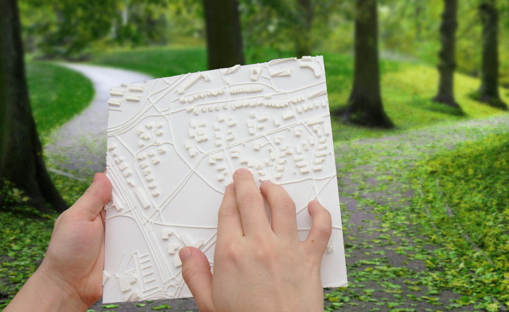
Ejemplo de un mapa tactil de TouchMapper 1 | Foto de TouchMapper
Acerca de nosotros
- El equipo checo de weeklyOSM decidió mover (automatic translation) todo el contenido fuera de la wiki OSM, debido a contínuos conflictos de edición.
Mapeando
- La sociedad británica de protección de aves, RSPB, presentó en el FOSS4GUK su trabajo usando drones para monitorear reservas de aves (resumen). Algunos datos adquiridos fueron agregados a OSM.
- Tramposos wiki están cambiando la definición de la etiqueta
aeroway=runway. - ¿Cómo proporcionarías un número de casa como 9 3/4? La lista de correo Tagging (Etiquetado) pondera el uso de Unicode ( ½ ) en vez de ASCII (1/2) y también discute cómo otros proveedores lo manejan. Los mapeadores de diferentes regiones también aportan con su experiencia local en el mapeo de estas fracciones.
- Matthijs Melissen inicia un hilo (conversación) en la lista de correo de etiquetado acerca del cambio venidero en la representación de límites anunciado por los desarrolladores de OSM Carto, la hoja de estilo predeterminada de osm.org. La discusión que continúa intenta distinguir problemas de etiquetado (cómo etiquetar precisamente elementos diferentes) de aquellos etiquetado-para-el-representador. La mayoría de los participantes concuerda en que la información ya existe para la representación precisa de los límites mundiales, y que el representador puede agregarlos por su cuenta en vez de pedir la duplicación de información.
- Gregory Marler ha comenzado a hacer diarios en vídeo de OSM hablando con una cámara cuando entra en el mapa. Estos no son tutoriales, sino un vistazo a lo que un mapeador nota cómo usa diferentes herramientas.
Comunidad
- Bryan Housel pide apoyo a través de Twitter para generar un índice de recursos locales para la comunidad de OSM, y así los nuevos maperos sepan donde encontrar información.
- Harry Wood informa acerca de eventos de preguntas y respuestas de OpenStreetMap Londres, un nuevo formato que se está volviendo bastante exitoso. Los eventos incluyen unas pocas presentaciones de abundante tiempo para conversación entre los participantes.
- Heather Leson resume la discusión recientemente realizada sobre "OSM y Género" y sobre las maneras en las que podría avanzarse.
- Nathalie Sidibe es la última Mapeadora del Mes! Ella comparte su experiencia de mapeo en lugares de Mali con un acceso mínimo de internet y cómo OSM empodera su activismo.
- Selene Yang examinó la tasa de género entre los nominados y ganadores de los Premios OSM e invitó a continuar a trabajar en la construcción de comunidades más diversas e incluyentes. Las respuestas a su entrada de diario intentan encontrar las posibles causas de la subrepresentación de mujeres en OSM, y la mayoría concuerda en que la eliminación de estas barreras beneficiaría a toda la comunidad.
Importaciones
- Ilya Zverev desearía importar 59,000 estaciones de gas de la base de datos NavAds en OSM. Christoph Hormann hace notar que la base de datos cubre varios países, lo que hace necesario la integración de las respectivas comunidades locales.
Fundación OpenStreetMap
- Están en línea las minutas de la reunión del Grupo de Trabajo de Licenciamiento del 8 de marzo. Los temas incluyen la Ordenanza Básica de Protección de Datos y la protección de menores.
- Están en línea las minutas Chat de la reunión del Grupo de Trabajo de Comunicaciones del 8 de marzo.
Eventos
- OSM Irlanda llevará a cabo su primera Reunión Anual General (RGA) el 24 de marzo para establecer una organización formal de lo que ha sido un colectivo suelto de personas de similares intereses que contribuyen a OSM por más de una década.
OSM Humanitario
- El Club de Geografía y SIG de la Universidad del Norte de Colorado mapea las rutas de los servicios de emergencia en Bogotá, Colombia para prepararse cuando ocurra un desastre.
- Día Internacional de la Mujer 2018 #pressforprogress | Noticias HOT
- Imágenes aéreas muestran claramente que milicias están quemando pueblos enteros en la RD Congo, causando que personas huyan y busquen refugio en Uganda. No está claro porqué se enciende la violencia tan de repente. Se sospechan motivaciones políticas.
- En Bélgica se organizará el tercer Mapatón Nacional de Mapas Faltantes a lo largo de 8 campus universitarios el sábado, 24 de marzo, por el Comité Nacional para la Geografía, en colaboración con OpenStreetMap Bélgica para ayudar a combatir el meningitis C en Nigeria.
Mapas
- El Wheelmap ahora usa
 datos de estacionamiento de Parkopedia (un proyecto comercial).
 datos de estacionamiento de Parkopedia (un proyecto comercial).
Software
- GIScience News Blog » Blog Archive » Openrouteservice for Disaster Management: Supporti…
Aplicaciones
- La fase de postulación para participar en el Google Summer of Code de este año está ahora abierta. El blog OSM anima a estudiantes que quieran participar en proyectos de código abierto en el ambiente OSM.
Releases
- La versión 0.10 del motor de enrrutamiento de código abierto GraphHopper ha sido liberada el 8 de marzo.
Conocías …
- … el motor de búsqueda de código abierto para datos geo Geoseer? La consulta "OpenStreetMap" devuelve este registro.
- … TouchMapper, un servicio que crea mapas 3D personalizados?
OSM en la prensa
- https://www.kamen-web.de/index.php/nachrichten/17147-kreis-liefert-bilder-fuer-die-weltkar…
Otras cosas “geo”
- Google Maps para iOS ahora soporta enrrutamiento de transporte público para pasajeros en silla de ruedas.
- Cómo se inició Mapbox.
Próximos eventos
| Dónde | Qué | Fecha | País |
|---|---|---|---|
| Lannion | 3e concours de contributions OpenStreetMap | 2018-03-01-2018-03-23 |  |
| Luneburgo | Lüneburger Mappertreffen | 2018-03-20 |  |
| Aeropuerto de Colonia/Bonn | Bonner Stammtisch | 2018-03-20 | |
| Nottingham | Pub Meetup | 2018-03-20 |  |
| Karlsruhe | Stammtisch | 2018-03-21 | |
| Toulouse | Réunion mensuelle | 2018-03-21 | |
| Aeropuerto de Colonia/Bonn | FOSSGIS 2018 | 2018-03-21-2018-03-24 | |
| Lubeca | Lübecker Mappertreffen | 2018-03-22 | |
| Quezon City | MAPAbabae: OpenStreetMap Workshop with Women and for Women | 2018-03-22 |  |
| Turín | MERGE-it 2018 | 2018-03-23-2018-03-24 |  |
| 8 university campuses | Third National Mapathon | 2018-03-24 |  |
| Brema | Bremer Mappertreffen | 2018-03-26 | |
| Graz | Stammtisch Graz | 2018-03-26 |  |
| Roma | Incontro mensile | 2018-03-26 | |
| Essen | Mappertreffen | 2018-03-27 | |
| Düsseldorf | Stammtisch | 2018-03-28 | |
| Osaka | もくもくマッピング! #15 | 2018-03-28 |  |
| Montreal | Les Mercredis cartographie | 2018-04-04 |  |
| Stuttgart | Stuttgarter Stammtisch | 2018-04-04 | |
| Bochum | Mappertreffen | 2018-04-05 | |
| Dresde | Stammtisch Dresden | 2018-04-05 | |
| Soleura | 2018 SOSM AGM and mapping party | 2018-04-07 |  |
| Rennes | Cartographie des rivières | 2018-04-08 | |
| Rennes | Réunion mensuelle | 2018-04-09 | |
| Lyon | Rencontre mensuelle pour tous | 2018-04-10 | |
| Múnich | Münchner Stammtisch | 2018-04-10 | |
| Nantes | Réunion mensuelle | 2018-04-10 | |
| Viersen | OSM Stammtisch Viersen | 2018-04-10 | |
| Posnania | State of the Map Poland 2018 | 2018-04-13-2018-04-14 |  |
| Disneyland Paris Marne/Chessy Railway Station | FOSS4G-fr 2018 | 2018-05-15-2018-05-17 | |
| Burdeos | State of the Map France 2018 | 2018-06-01-2018-06-03 | |
| Milán | State of the Map 2018 (international conference) | 2018-07-28-2018-07-30 | |
| Dar es-Salam | FOSS4G 2018 | 2018-08-29-2018-08-31 |  |
| Bangalore | State of the Map Asia 2018 (effective date to confirm) | 2018-11-17-2018-11-18 |  |
Nota: Si usted quiere ver su evento aquí, por favor escríbalo en el calendario. Sólo los datos que están ahí aparecerán en weeklyOSM. Por favor compruebe su evento en nuestra vista previa de calendario y corríjalo si es necesario..
Este semanarioOSM fue producido por Nakaner, Polyglot, Rogehm, SeleneYang, TheFive, YoViajo, derFred, piligab.