10/09/2019-16/09/2019
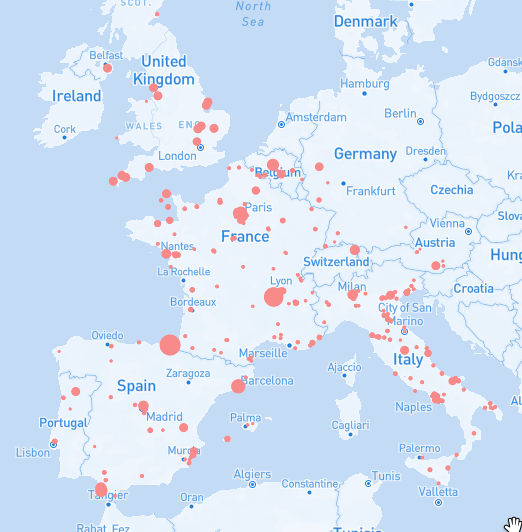
The still incomplete map “The Saints of Europe” 1 | data © openstreetMap contributors
Mapping
- Martijn Van Exel invited us, on Twitter, to view the MapRoulette presentation he gave at at SotM US.
- Dan Stowell tweeted that OSM-UK’s quarterly project has reached 100,000 solar panels. In his blog he summarises where both rooftop solar panels and larger solar farms have been mapped in the UK.
- Joseph Eisenberg has started a new proposal for
aerodrome=to allow a better classification of airports. With the possible values international, commercial, general_aviation, private and airstrip he plans to replaceaeroway=airstripandaerodrome:type=*. - Antoine Jaury suggests
reusable_packaging:offer=andreusable_packaging:accept=for shops accepting or proposing customer-owned reusable containers to reduce packaging waste. He asks for comments on his proposal. - Francesco Ansanelli proposes
highway=tourist_bus_stopfor a bus stop which is reserved for tourist buses and drafted a proposal. - Simon Poole reported (automatic translation) that after consultation with the AGIS, he has included their aerial photographs from March 2019 in the SOSM Mapproxy configuration.
- hüggelzwerg recommends the addition of
public_transport=stop_area_groupinto the public transport tagging scheme PTv2 and summarises (automatic translation) the reasons and advantages in his user diary. Apublic_transport=stop_area_grouprelation would include a number ofpublic_transport=stop_areamembers and would link them together at large public transport hubs. - Microsoft’s dataset with approximatley 125 million building footprints in the US is currently available in the RapiD editor as an experimental feature. If you zoom into the USA you can see the suggested buildings and roads.
More background is available at the website for RapiD and the GitHub page for the building footprint dataset. - Voting for Joseph Eisenberg’s proposal for campsite properties is underway and ends on 23 September 2019.
- Roland Olbricht is moderating a session at State of the Map on tagging governance. On the OSM-talk mailing list he asked for people’s views and feedback about which issues are important.
Community
- On Talk-AT there was a discussion (automatic translation) about a Golem article that discussed how Lyft automatically tries to detect errors in OSM via algorithms (which we covered last week). However, the article was not completely clear, because there is only automatic recognition of the errors, rather than editing them. For corrections, MapRoulette challenges are used.
- Sergey Golubev is trying (automatic translation) to find out in which cities of Russia the population is growing and in which it is not.
- Valery Trubin continues a series of interviews with Russian mappers. This time he talked to two newcomers (Ivan, aka BANO.notIT, and Victor Vyalichkin), who came to OSM earlier this year. Ilya Zverev draws attention (automatic translation) to the unexpected observations of these users.
OpenStreetMap Foundation
- Preliminary results of the OSM community survey have been released. Five of the OSMF Board members reflect on their views of the results in the OSMF Blog post.
Events
- Betaslb reported (automatic translation) on her user’s diary about a news item published by the Azorean local newspaper Diário Insular that the EuYoutH_OSM is in Heidelberg, Germany in a week to train in OSM and to attend SotM 2019.
- Videos of presentations at the 2019 State of the Map US are now available on the programme page of their website.
Humanitarian OSM
- Martin Dittus wrote a blog entry on how he completed a PhD titled Analysing Volunteer Engagement in Humanitarian Crowdmapping on community engagement in HOT and Missing Maps, in which he answers the question whether the most active contributors were “born or made”.
- HOT introduced a dashboard which displays the status of all HOT tools.
Maps
- The still incomplete map The Saints of Europe shows towns and cities of Europe that have been named after saints.
Licences
- There seem to be issues with CC-BY licensed data sources. OSM insists in having a waiver or explicit permission for using such licensed data. Graeme Fitzpatrick asked whether he can use Australian QTopo maps and learnt that while OSM requires permission, the data owner, the Queensland Department of Natural Resources, Mines and Energy, thinks CC-BY is sufficient for using the data in OSM – a situation that does not seem to be unique. Posts from Andrew Harvey and Simon Poole from OSM’s License Working Group provide some more background on this topic.
- Jez Nicholson updated the Copyright Infringement section on the United Kingdom Tagging Guidelines and asks others for their input as the Ordnance Survey dominates the numbers of mentions.
Software
- Poorly laid out paths are a typical problem in the landscaping of public spaces. As a result, unplanned paths appear on lawns and flowerbeds. The service Ant road planner will help to avoid this. It is based on OSM data.
Programming
- The Russian public organisation Greenhouse of social technologies, which recently released a plugin for WordPress shMapper (we wrote about it in issue 462), published (automatic translation) an article on Habr about how they developed this application. They also made a short video
 showing how to use this plugin.
 - There is another way (automatic translation) to bring together Strava Global Heatmap and OpenStreetMap. However, as Simon Poole reminds us: we do not currently have permission to use Strava data for OSM.
- The developer of the service “Sight Safari“, an app which can build interesting sightseeing routes in unfamiliar cities, published (automatic translation) an article on Habr, where they explained how they developed this application.
 showing how to use this plugin.
Releases
- Tobias Zwick released StreetComplete v14.0. Among other enhancements and new quest types, the real highlight is that it now supports the splitting of ways.
Did you know …
- … about the website “Agglomeration Era“, developed by the Russian company Urbica?
- … Orna, a top classic-style RPG, uses OpenStreetMap data for the map? The attribution is well buried on the website.
- … that Juno has opened a map of its drivers’ trips? Ilya Zverev tells us about it in his interview .
- … there is an online map version of Gary Gale’s Vaguely Rude Place Names?
OSM in the media
- Russian news agency TASS started a special project Mercator: It’s a flat, flat world!, which tells how these well-known maps were created.
Other “geo” things
Hollewegsare “roads or tracks that are significantly lower than the land on either side”. Dirk Kloosterboer used OpenStreetMap and elevation data, to find that streets namedhollowaymay be found in hilly areas, but not very often in high mountains.- One billion smartphone owners can now use the European satellite navigation system, Galileo, the operator announced in a press release. The system, which suffered a complete one week failure in July 2019, is expected to be fully operational this year and completed, with 24 operational and 6 active spare satellites, in 2021 with the start of the new Ariane 6 rocket, which might cause another delay as the first Ariane 6 test flight is scheduled for 2020.
- John Wyatt Greenlee created a map to answer the question of where people paid their rent in eels in England, during the 10th to 17th centuries, as part of the English Eel-Rents project.
- The INTERGEO, a trade fair and conference for geodesy, geoinformation and land management, will take place 17 to 19 September in Stuttgart, Germany for the 25th time. More information about the event can be found in the INTERGEO report 2019.
- Adam Van Etten described how In-Q-Tel are extracting roads topology from satellite imagery using computer vision.
- The tourist information office of the city of Oldenburg wants to switch (automatic translation) from Google Maps to an “own database” as a result of Google’s step to charge the organisation for its services from July 2018.
- An article on citylab.com summarises the most important information about Trump’s Dorian map. It includes an interview with Mark Monmonier, author of How to Lie With Maps (already published in its third edition).
- The worldwide Friday for Future movement, triggered by the strike of 16-year-old activist Greta Thunberg, was supported by many people around the world on 20 September in the form of peaceful demonstrations. In Germany alone, over 1.4 million people gathered in many cities to demonstrate for action on climate change. An interactive map of the planned demonstrations in Germany, based on OSM, was produced a few days ago.
 of the planned demonstrations in Germany, based on OSM, was produced a few days ago.
Upcoming Events
| Where | What | When | Country |
|---|---|---|---|
| Heidelberg | Erasmus+ EuYoutH OSM Meeting | 2019-09-18-2019-09-23 |  |
| Heidelberg | State of the Map 2019 [1] | 2019-09-21-2019-09-23 | |
| Bremen | Bremer Mappertreffen | 2019-09-23 | |
| Nottingham | Nottingham pub meetup | 2019-09-24 |  |
| Mannheim | Mannheimer Mapathons | 2019-09-25 | |
| Singen | Stammtisch Bodensee | 2019-09-26 | |
| Lübeck | Lübecker Mappertreffen | 2019-09-26 | |
| Riga | Latvian OSM Meetup | 2019-09-26 | Latvia |
| Düsseldorf | Stammtisch | 2019-09-27 | |
| Dortmund | Mappertreffen | 2019-09-27 | |
| Nagoya | 第2回まちマップ道場-伊勢湾台風被災地を訪ねる- | 2019-09-28 |  |
| Strasbourg | Rencontre périodique de Strasbourg | 2019-09-28 |  |
| Kameoka | 京都!街歩き!マッピングパーティ:第12回 穴太寺(あなおじ) | 2019-09-29 | |
| Mainz | Stammtisch | 2019-09-30 | |
| Rome | Incontro mensile | 2019-09-30 |  |
| London | London Missing Maps Mapathon | 2019-10-01 | |
| Stuttgart | Stuttgarter Stammtisch | 2019-10-02 | |
| Brno | State of the Map CZ+SK 2019 | 2019-10-02-2019-10-03 |  |
| Bochum | Mappertreffen | 2019-10-03 | |
| Nantes | Réunion mensuelle | 2019-10-03 | |
| Fujisawa | 湘南マッピングパーティ | 2019-10-05 | |
| Ballaghadereen | Map Ballaghadereen | 2019-10-05 |  |
| Budapest | OSM Hungary Meetup reboot | 2019-10-07 |  |
| Lyon | Rencontre mensuelle pour tous | 2019-10-08 | |
| Munich | Münchner Stammtisch | 2019-10-08 | |
| Salt Lake City | SLC Mappy Hour | 2019-10-08 |  |
| Hamburg | Hamburger Mappertreffen | 2019-10-08 | |
| Cologne | Köln Stammtisch | 2019-10-09 | |
| Arlon | Espace public numérique d’Arlon – Formation Consulter OpenStreetMap | 2019-10-09 |  |
| San José | Civic Hack & Map Night | 2019-10-10 | |
| Berlin | 136. Berlin-Brandenburg Stammtisch | 2019-10-11 | |
| Berlin | Berlin Hack Weekend Oktober 2019 | 2019-10-12-2019-10-13 | |
| Greater Manchester | Joy Diversion 8 | 2019-10-12 | |
| Santa Fe | State of the Map Argentina 2019 | 2019-10-12 |  |
| Prizren | State of the Map Southeast Europe | 2019-10-25-2019-10-27 |  |
| Dhaka | State of the Map Asia 2019 | 2019-11-01-2019-11-02 |  |
| Wellington | FOSS4G SotM Oceania 2019 | 2019-11-12-2019-11-15 |  |
| Grand-Bassam | State of the Map Africa 2019 | 2019-11-22-2019-11-24 |  |
Note: If you like to see your event here, please put it into the calendar. Only data which is there, will appear in weeklyOSM. Please check your event in our public calendar preview and correct it, where appropriate.
This weeklyOSM was produced by Polyglot, Rogehm, SK53, Silka123, SunCobalt, TheSwavu, YoViajo, derFred, geologist, muramototomoya, ᚛ᚏᚒᚐᚔᚏᚔᚋ᚜ 🏳️🌈.
Re: Orna’s attribution to OSM, there is also attribution in the app, but it’s at the bottom of its options menu rather than on the map itself
Maybe we could shoot the creator a suggestion on /r/OnraRPG to display more obvious attribution?