24/03/2020-30/03/2020
This is open – „Ça reste ouvert“ 1 | © caresteouvert.fr/mentions-legales CC-BY-SA | © map data OpenStreetMap contributors
Mapping
- Sören Reinecke plans to unify the tagging of playground equipment and has created a proposal for it.
- User GOwin writes about how the Philippines mapping community, especially in Luzon, are changing to weekly online map events called WeMap, a contraction of Wednesdays MapaTime.
- Joost Schouppe recommends
 (automatic translation) using this time of social distancing to wander around your neighbourhood and collect all paths. He was then asked for a tutorial, which he provided in his user diary.
 - Manonv and Kateregga1 have created a proposal for the tag
place=refugee_siteto solve the lack of consensus within the OSM community regarding the way to reference refugee camps in OSM. They incorporated the comments they received during February and want to initiate voting soon. - Chris Beddow of Mapillary has moved his webinar on mapping against COVID-19 from 2 April to 7 April at 18:00 CET. He will use tools ranging from Osmose to Pic4Review and MapRoulette to enrich OpenStreetMap. You can sign up for the webinar here.
- Dirk (kannix) wants to bring some order into the European waterway network and created a dedicated wiki page to coordinate the efforts.
 (automatic
 Community
- OpenStreetMap Foundation Japan has announced that it has set up a Slack workspace for Japanese mappers. From 21:00 (JST) on the announcement day an event to share mapping results and ask questions was held.
- Christopher Beddow wrote a diary reflecting on efforts to help the OpenStreetMap community improve detail around hospitals in Iran. He wonders how these lessons can be applied to mapping more areas around the world in response to COVID-19 and the increasing strain on medical facilities.
- On help.osm.org, as well as in the forums, there is a discussion about replacing the no longer supported OSQA software, that runs the help forum, with a Discourse Server. It was also suggested that the help Q&A site, the forum, and mailing lists could be combined with this software to make for less isolated discussions. This is actually an old suggestion, discussed on GitHub nearly two years ago.
- The Russian OSM community has localised welcome.openstreetmap.org and hosted it on its local domain. Recall that the source code for this site is on GitHub under a free licence, CC-BY, which allows anyone to make a copy.
- Apple has updated its task on MapRoulette for fixing bugs in the Russian road network. Join!
OpenStreetMap Foundation
- The OpenStreetMap Foundation announced its intentions to increase the number of available map layers on the main website. If you are interested in your map joining the exclusive club, namely ‘Standard’ (OpenStreetMap Carto), ‘Cycle Map’ (OpenCycleMap by Thunderforest), ‘Transport Map’ (Transport by Thunderforest) and HOT’s ‘Humanitarian’, you are invited to contact the Operations Working Group.
Events
- The ‘Open Data Day’ took place in Moscow (Russia) in early March. Not so long ago organisers of the event published videos from the conference.
- Yevgeny Shirinyan shared (automatic translation) his impressions of the Open Data Day which took place in Moscow (Russia) in early March. At the end of the post he concludes: ‘Open geodata, even, for example, OSM, create a very fertile ground for the development of education and commercial services’.
 from the conference.
Humanitarian OSM
- HOT tweeted that the HOT Summit 2020 live event, originally due to take place on 1 and 2 July in Cape Town, South Africa, will be postponed. They plan to have a live event and will share new dates and location later.
- Tyler Radford, Executive Director at HOT Inc., wrote a heads-up to the HOT community with information about the activity of HOT’s staff and pointed to ways to support them during the current crisis.
- GIM International, an information source for the geomatics industry, featured an article on how to predict the completeness of OSM in risk areas, in order to allow for planning disaster responses.
Education
- Former head of the Russian GIS company Urbica Andrey Karmatskiy published (automatic translation) into the public domain all the materials of their educational course on geoаnalytics (video , materials ).
- How do I replicate any city, in Blender, with OSM in 20 minutes? Watch this video.
Maps
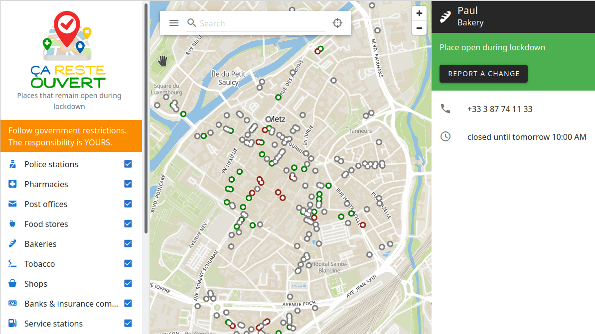
- The French community created caresteouvert.fr, a map that displays open places during the COVID-19 lockdown in France. Users can see which places are open or not to avoid unnecessary trips and thus limit the risk of contagion. Thousands of people have contributed to the map with a simple and integrated editor, and hundred of notes generated have been closed by OSM-fr Contributors. They are now looking to expand the data outside France, so contact them if you are interested in deploying it in your country. Visit github for more details.
- The University of Wisconsin-Madison (USA) created a map of its campus based on OSM.
- Heidelberg University’s GIScience Research Group investigated the impact of location-based games on vandalism in OSM based on experiences of Pokémon GO. The increased popularity of OSM following Pokémon GO’s decison to switch to OSM maps led to more harmful edits but also ‘that the community becomes faster at detecting and fixing these harmful edits over time’.
- User Cupivan created a map of Russian regions from OSM data. Unfortunately, the Crimean issue has still not been resolved in OSM.
switch2OSM
- The 360cities website, which publishes high-quality panoramic images, uses OSM as a basemap.
- The service for publishing and discussing ideas about the improvement of the urban environment of Tomsk (Russia) uses OSM as a basemap.
- Apparently one of the branches of the largest interregional distribution network company in Russia, Rosseti (MRSK, electricity supplier), uses OSM on its internal geoportal.
Software
- OSM Completionist is an analogue of the StreetComplete (Android) mobile app based on ‘Go map!’, but only for Apple (iOS) devices. The programme is under early testing. You can take part in testing it.
Programming
- Belarusian user Arkadiy Chubrik wrote a tool in C# which allows you to extract objects from PBF files as complete multi-nested structures without the need for large amounts of RAM, even when you are working with entire continents.
Releases
- The developers of the OpenRecycleMap project recently released (automatic translation) a mobile version of the app (only for Android). Currently available in five languages, OpenRecycleMap is a map where you can find receptacles for separate waste collection. It also allows you to add new waste collection points. The data is taken from and added to OpenStreetMap.
- A new version of ZombieTrackerGPS (automatic translation) has been released. It allows you to view maps and satellite images, find your position with GPS, plan travel routes, and track your movement on the map. The program is a free analogue of Garmin BaseCamp, capable of running on Linux.
Did you know …
- … about the Chrome browser extension ‘Map helper‘ (automatic translation), which makes it easier to work with maps?
- … about the Needgeo website where you can download OSM data of CIS countries, as well as of regions of Russia, Ukraine and Belarus, in PBF format?
- … that this site (automatic translation) provides daily updates of maps of Russian regions for Garmin devices? Data for them is taken from OSM. If you need a larger territory, such as the entire Federal district, you can download them here.
Other “geo” things
- Google’s CEO, Sundar Pichal, announced a new repository of public data to assist in combating COVID-19. As OSM Foundation board member Mikel Maron pointed out on Twitter, this may be a first for Google, promoting OSM.
- Mateus Santos, of the Wikimedia Tech Team, talked about ‘Understanding Wikimedia Maps and its challenges’.
- Sam Greenspan describes how the phrase ‘turn left at the place that used to be a Pizza Hut’ is recognised around the globe. If you have a UTBAPH in your area you can submit a photo of it to the Used to Be a Pizza Hut website.
- ZDNet reports about Strava’s new routes feature, which provides the user with personalised route recommendations based on suggestions from the Strava community and OpenStreetMap.
- An address is taken for granted by most of us. The Guardian dedicated a long-read article to addresses, providing background information and detailing the hurdles people without an address have to face.
- Russian map service 2GIS created a map of the spread of the coronavirus in Russia.
- Yandex (the Russian equivalent of Google) released (automatic translation) its own router and now has started to sell it.
Upcoming Events
Many meetings are being cancelled – please check the calendar on the wiki page for updates.
Note: If you like to see your event here, please put it into the calendar. Only data which is there, will appear in weeklyOSM. Please check your event in our public calendar preview and correct it, where appropriate.
This weeklyOSM was produced by Polyglot, Rogehm, SK53, Silka123, SunCobalt, TheSwavu, YoViajo, derFred.
Merci pour ce travail de veille et de traduction !! Merci !