12/01/2021-18/01/2021
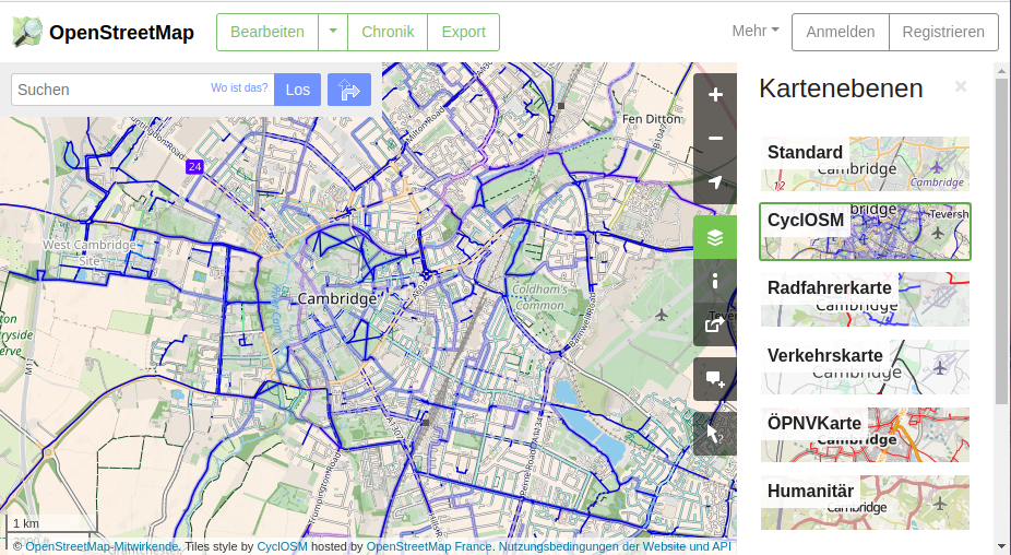
CyclOSM now a default layer on openstreetmap.org 1 | © Tiles style by CyclOSM hosted by OpenStreetMap France | map data © OpenStreetMap contributors
Mapping campaigns
- UN Mappers have opened new humanitarian mapping projects for UN peacekeeping missions:
The topographic data will support MONUSCO and UNISFA missions to secure peace in the area.
- The first UK Quarterly Project of 2021 is Green Spaces – parks, allotments, playgrounds and commons.
- Pascal Neis pointed out on Twitter that ‘unmapped places‘ is now available worldwide. This was prompted by a tweet by Said Turksever, who has made the Turkish ‘unmapped places’ available for mapping in a MapRoulette task.
Mapping
- OpenInfraMap added a statistics section, showing data about the power network by country. For OSM contributors, this is especially useful to identify mis-tagged power plants.
- The tagging proposal on
electricity=*, and the subtags, failed the third vote, with 8 nays on 16 votes cast. - The proposed tag
healthcare=vaccination_centre, for tagging a facility where people are vaccinated, was approved by 20 votes in favour and none against with one abstention. - Robhubi showed
 > how a complex multi-function building can be better represented though extending existing building polygons with a greater range of Simple 3D building objects and tags.
 >
> 
Community
- Joy Christine Nduta Kimani, a YouthMapper and a Geomatic engineering student at Jomo Kenyatta University of Agriculture and Technology (JKUAT), shared her experience participating in the URISA Student and Young Professional Digital Competition.
- Yves explained how OpenSnowMap is financed and made a plea for small donations to support the site.
- OpenStreetMap India announced a new Telegram channel for contributors in Rajasthan.
- A newly registered account, which seems to come from China, complained that OpenStreetMap does not follow China’s ‘One China’ policy and ‘correctly’ label Arunachal Pradesh and Taiwan as Chinese territories. The diary post attracted the attention of a member of the Data Working Group, and mappers from China and Taiwan. Previously we reported that Mapbox CN supplies a government-certified map version for China, which does not follow the on-the-ground principle of OpenStreetMap data.
OpenStreetMap Foundation
- Christine Karch is looking for volunteers, with various qualifications, to support the organising team for the SotM, the annual international OpenStreetMap conference.
- Chair of OSMF Allan Mustard announced that the 2021 survey of users and contributors, which we mentioned last week, is now available. The survey will remain open for responses until Sunday 14 February. The announcement raised concerns about whether the survey complies with the GDPR, but Allan Mustard considered them as trolling.
- Christoph Hormann has published > a preview of his traditional report as the FOSSGIS representative on the OSMF Advisory Board at the FOSSGIS General Meeting scheduled for March.
Local chapter news
- The nomination period for the OpenStreetMap US Board Elections will close on Sunday 24 January.
Humanitarian OSM
- In outlining the role of the new open mapping hub for Asia supported by HOT, Rebecca Firth introduces a new term hOSM, meaning humanitarian OpenStreetMap in contradistinction to HOT (Humanitarian OpenStreetMap Team), referring to the US incorporated not-for profit. This difficulty of distinguishing between a broader community of OSM participants with humanitarian interests and the specific activities of HOT has a long history. Just one example is this mailing list exchange back in 2014.
- The HOT upcoming community webinar on Friday 29 January will feature three COVID-19 Rapid Response micrograntees; iLab Liberia, OSM Senegal, and Public Lab Mongolia; and HOT’s COVID-19 activation team. You can read about the micrograntees here and here.
- Kontur has added new layers to their emergency mapping dashboard, Disaster Ninja, to show the most densely populated areas within a priority area for mapping (‘alert polygon’). The Urban Core layer highlights the most densely populated regions inside the hazard area, whilst the Settled Periphery layer complements it, showing the dispersed part of the population in the area.
Maps
- [1] With little fanfare, CyclOSM, a beautiful and practical bicycle-oriented map, was added to the default layers on openstreetmap.org.
- Fun with the map data of Wales: A tutorial with overpass queries and OpenStreetmap can be found here.
Software
- gb consite GmbH has developed a tool with the option of displaying the radius of movement around a clicked map point or a municipality (according to OSM
admin_level6 or 8), county, or Kreisfreie Städte (county-free city) in Germany. The 7-day incidences (from the national public health agency Robert Koch Institut) and the vaccination centres (from OSM) can be shown as overlays. - The new anti-COVID-19 regulations in Italy allow people living in municipalities with fewer than 5000 inhabitants to move within their region a maximum of 30 km, provincial capitals excluded. Users aborruso, napo and pigreco have created a programme > (the code is on GitHub ) able to define the zone for each municipality concerned.
- IpswichMapper wrote about a new application which they have created to make it easier to collect house numbers when surveying. The app has been published on GitHub.
 >
> Programming
- Behind the scenes osm2pgsql is an important piece of software, replicating and manipulating OSM data for map rendering from PostgreSQL databases. Many new features have been added to it recently. The developers have many new ideas and plenty of issues to look at. They are holding a virtual meetup on Tuesday 2 February at 18:00 UTC. After an introduction to their plans the remainder of the meeting is planned as a Q and A session focused on future priorities. Anybody can join; you don’t need to register. We reported earlier about OSMF sponsorship of this project.
- The Chemnitz University of Technology is looking for a research assistant to further develop the mapsforge_flutter rendering library, the components for rendering OSM indoor data, the JOSM plugin indoorhelper, and the indoor mapping of buildings themselves. Click here for the job description. Very good written and spoken German and English skills are required. The application deadline is 13 February.
Releases
- The editorial team alone cannot check the release status of the many software products in the OSM environment. Therefore, we would like to regularly present wambacher’s OSM software watchlist to the community. Walter masters the monitoring of updates with his own programming. The list is updated frequently (usually weekly) and is available in three languages . Beginners, advanced users, all users of OSM, can find OSM software products in the current version with corresponding platform and download options. Walter is also happy for tips, if a piece of OSM software is missing from the list.

 . Beginners, advanced users, all users of OSM, can find OSM software products in the current version with corresponding platform and download options.
 Did you know …
- … WeGlide? The new global evaluation platform for glider pilots uses OSM maps to visualise cross-country flights. The project is under development by three German pilots and will be used for competitions in the near future.
- … that Switzerland’s first official topographical map series, the Dufour Map, is celebrating its 175th anniversary? Replicas true to the original are being sold and the map is being made available for digital exploration – visitors can also leave their own traces there.
- … there is a ‘To do list’ JOSM plugin? This adds a to do list dialogue that makes it easy to go through large lists of objects. It helps the user to examine objects one at a time in order to edit or update them.
Other “geo” things
- Lewis Isaacs wrote in The Guardian about GPS art, amusingly described as ‘Human etch-a-sketch‘.
- BBC reported about a three year university research project in Kentucky and Colorado (a US FEDA $900,000 grant to the University of Kentucky) where researchers are training ‘drone cowboys’ to find cattle and assess their health and weight from the air.
- Hydro International reported that the Schmidt Ocean Institute’s research vessel Falkor has collected the first public seafloor data of the New Year, as part of a global effort to map the entire ocean floor by 2030.
- Michael Schultz (Heidelberg University) reported that the Horizon 2020 LandSense project was successfully concluded. A selection of the publications and deliverables produced are linked in the text. The project has enabled the group to pursue quality aspects of voluntarily collected geodata and to ramp up efforts related to OSM Landuse and Landcover.
- Sarah (Heidelberg University) has been investigating street networks and their quality, in order to find out which of the selected regions has the most detailed information in OpenStreetMap, as well as the best data consistency over the past 10 years.
- Matthias Fejes (Chemnitz University of Technology) reported > on approaches to achieving a seamless transition from outdoor to indoor navigation on smartphones for everyone.
- Theo Armour shared his efforts and ‘Mapifesto 2021-01-12’, a public declaration of intentions, opinions, and objectives that give direction to cartographers, mappers, and lovers of ways of representing reality in the many routes to mapping.
- Mapillary is making available Vistas 2.0, a major semantic annotation upgrade to their street-level image dataset (for AI training and validation) of 25,000 images from around the world.
Upcoming Events
| Where | What | Online | When | Country |
|---|---|---|---|---|
| San Jose | Virtual Civic Hack & Map Night | ✓ | 2021-01-22 |  |
| Warszawa | Virtual community meeting. | 2021-01-22 |  | |
| 臺中市 | 2021 OpenStreetMap x Wikidata 新手教學工作坊 | 2021-01-24 |  | |
| Bremen | Bremer Mappertreffen (Online) | 2021-01-25 |  | |
| Hlavní město Praha | Missing Maps CZ Mapathon 2021 #1 | ✓ | 2021-01-26 | cz |
| Ville de Bruxelles – Stad Brussel | Virtual OpenStreetMap Belgium meeting | ✓ | 2021-01-26 |  |
| HOT Community WG: Mapping for Covid 19 Response and Resilience: Global Coordination Supporting Local Action | 2021-01-29 | |||
| Warszawa | Virtual community meeting. | 2021-01-29 | | |
| Kampala | Mapping Uganda’s New Cities | 2021-01-30 – 2021-01-31 |  | |
| Roma | Compleanno Local Chapter italiano OSM | 2021-01-30 |  | |
| Delft | eMWRE Mapathon | ✓ | 2021-02-01 |  |
| 臺北市 | OSM x Wikidata #25 | 2021-02-01 | | |
| Osm2pgsql Virtual Meetup | 2021-02-02 | |||
| Missing Maps London Mapathon | 2021-02-02 | |||
| Landau an der Isar | Virtuelles Niederbayern-Treffen | ✓ | 2021-02-02 | |
| The European Missing Maps Mapathon | 2021-02-03 | |||
| San Jose | Virtual Civic Hack & Map Night | ✓ | 2021-02-05 | |
| Dresden | Dresdner OSM-Stammtisch | ✓ | 2021-02-04 | |
| Hamburg | Hamburger Mappertreffen | 2021-02-09 | | |
| München | Münchner OSM-Stammtisch | 2021-02-10 | | |
| Zürich | OSM-Treffen Zürich | 2021-02-11 |  | |
| Chippewa Township | OpenStreetMap Michigan Meetup | ✓ | 2021-02-12 | |
Note:
If you like to see your event here, please put it into the OSM calendar. Only data which is there, will appear in weeklyOSM.
This weeklyOSM was produced by Nordpfeil, PierZen, rogehm, SK53, Sammyhawkrad, TheSwavu, YoViajo, derFred, richter_fn.