20/07/2021-26/07/2021
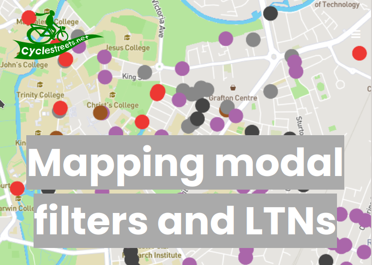
CycleStreets’ “how to map low-traffic neighbourhoods (LTNs)” [1]
Breaking news
- Three part-time positions are open with Trufi Association using OSM for public transport solutions. Applications are open until Sunday 8 August for an Administrative Coordinator, a Business Development Manager, and a Marketing and Communications Expert.
Mapping campaigns
- The Microsoft Open Maps team used the ‘Atlas’ tool to find data problems in OSM and have created MapRoulette challenges in the Australian Capital Territory, Tasmania and Victoria.
- Mapio Cymru, the map team using Welsh-language placenames from OSM, announced a collaboration with the National Library of Wales to extend their coverage, including links to WikiData.
Mapping
- Robin Lovelace wondered about how to map low-traffic neighbourhoods (LTNs) on OSM. There was lots of advice on Twitter, and GinaroZ created a wiki page summarising mapping recommendations.
- [1] … and CycleStreets followed up with their own detailed blog post.
- Some members of the OSM Discord channel have questioned the use of
source=Googleon various elements mapped in Haiti in January 2010. As Mikel Maron explains, this usage was explicitly permitted during the response to the 2010 Port-au-Prince Earthquake, and is documented on the wiki. - The somewhat vexed issue of German names in Poland has been raised again on the forum. Reference was made to the German ‘Standing Committee for Geographical Names’ (StAGN), which has a list of German exonyms
 /, and the corresponding Polish institution (KSNG).
 - Trufi’s SotM presentation on their approach to mapping public transport in Nouakchott, Mauritania is now online.
- Voting for
man_made=video_wall, to map digital outdoor screens, is underway until Friday 6 August. - Joel Reid asked, on OSM Help, how to map a range of buildings he encountered whilst doing some remote mapping in Nigeria.
- Reddit user Larken Young asked ‘Which part of a way that is split keeps the history?’. The answers only discuss how JOSM does it.
 /
/ , and the corresponding Polish institution (KSNG).
Community
- Frederik Ramm reported > in the forum how a misspelled street name in OSM led to the discovery of two websites that use OSM data without attribution. The two were admonished by FOSSGIS.

OpenStreetMap Foundation
- The LCCWG Moderation subcommittee is seeking feedback on its DRAFT Process for Moderation, which would apply to both osmf-talk and talk mailing lists. Discussion is open for comments on the OSM wiki until Wednesday 18 August.
- In the context of maintenance of the iD editor, former maintainer, Bryan Housel made some strong allegations regarding change of maintainer.
Events
- Geofabrik extends an invitation to the next OSM Hack Weekend in Karlsruhe on 18 and 19 September. Registration on the wiki is required.
Maps
- Alexander Tolksdorf is the creator of ‘Elektroauto Ladestationen in Deutschland’, a web application that shows charging stations for electric cars in Germany. There is also an app for Android and iOS.
- Back in 2017 Topi Tjukanow wrote a guide to animating routes with QGIS. Using this tutorial, Joe Davies has created his ‘Optimal routes from Madrid to 800 locations across mainland Spain’.
Software
- NextPit reviewed > the new Autobahn app released by Autobahn GmbH des Bundes (the state owned corporation that is responsible for German motorways), noting its advantages and disadvantages. After all, ‘© OpenStreetMap’ appears in the map view. That’s something. App menu entries are only in German.
Programming
- Zohaib summarised progress made on their Google Summer of Code project over the last 5–6 weeks.
Did you know …
- … the flosm OSM theme maps and the site > to create your own individual map themes?
- … the open source geo data search engine Geoseer? The query for ‘OpenStreetMap’ returns this record.
- … there is a list of OSM-based services? This is an alphabetically ordered list of projects and websites that use OpenStreetMap data. An example is the multilingual Historic Place, which offers worldwide rendering of all historical tags within OSM and additional special maps.
- … that 237 ventilation shafts of the London Underground metro have been mapped on OSM?
Other “geo” things
- Mapbox Horizon (Beta), now being distributed with the Navigation SDK V2, predictively delivers relevant roadway information to drivers, such as speed limits, incidents, congestion, or developer-defined custom datasets such as parking spot availability.
- Steve Mouzon compared the similar sized areas of a freeway interchange in Atlanta with the medieval and renaissance core of the city of Florence.
- For the cities of Gdańsk and Gdynia there are > new road, rail, industrial and aircraft noise maps. Click here > to go to the noise monitoring portal.
- Twitter user Uputronics spotted that GPS is currently broadcasting that a zero second leap second will happen in about four months’ time. This is due to the ‘drought’ of leap seconds and it will have been 256 weeks since the last one was added on 31 December 2016. The same thing also happened in 2003.
- Tomasz Larczyński, in an article for Trojmiasto.pl, described > his quest to find the true source of the river Strzyża in Gdańsk, giving us a tour of historical maps and conducting a field survey.
 >
> Upcoming Events
| Where | What | Online | When | Country |
|---|---|---|---|---|
| OSM Africa Monthly Mapathon: Map Nigeria | 2021-07-02 – 2021-08-02 | |||
| CARMERA Disability Independence Day Mapathon | 2021-07-26 – 2021-08-06 | |||
| 臺北市 | COSCUP 2021 OpenStreetMap x Wikidata 開放內容議程軌 | 2021-07-31 |  | |
| 名古屋市 | まちデータ@ナゴヤヒサヤ | 2021-07-31 | jp | |
| Ogresgala pagasts | Ogresgala kartēšanas pasākums | 2021-07-31 |  | |
| Bogotá Distrito Capital | Resolver notas de Bogotá creadas en OpenStreetMap | 2021-07-31 |  | |
| 京都市 | 京都!街歩き!マッピングパーティ:第25回 大徳寺 | 2021-08-01 | jp | |
| Open Mapping Hub Asia Pacific: Bangladesh National Dialogue | 2021-08-02 | |||
| City of Westminster | Missing Maps London Mapathon | 2021-08-03 |  | |
| Landau an der Isar | Virtuelles Niederbayern-Treffen | ✓ | 2021-08-03 |  |
| Stuttgart | Stuttgarter Stammtisch (Online) | 2021-08-03 | | |
| Nordrhein-Westfalen | OSM-Treffen Bochum | 2021-08-05 | | |
| OSM Africa Monthly Mapathon: Map Tanzania | 2021-08-06 | |||
| POI Community Meet Up | 2021-08-06 | |||
| 名古屋市 | まちデータ@名古屋伏見 | 2021-08-07 – 2021-08-08 | jp | |
| 臺北市 | OpenStreetMap x Wikidata Taipei #31 | 2021-08-09 | | |
| Hamburg | Hamburger Mappertreffen | ✓ | 2021-08-10 | |
| Zürich | OSM-Treffen Zürich | 2021-08-11 |  | |
| München | Münchner OSM-Treffen | ✓ | 2021-08-11 | |
| OpenStreetMap Michigan Meetup | 2021-08-13 | |||
| Eberswalde | 158. Berlin-Brandenburg OpenStreetMap Stammtisch | 2021-08-13 | | |
| HOTOSM Training Webinar Series: Beginner iD | 2021-08-14 | |||
| Bonn | 142. Treffen des OSM-Stammtisches Bonn | ✓ | 2021-08-17 | |
| Lüneburg | Lüneburger Mappertreffen (online) | 2021-08-17 | | |
| Köln | Stammtisch Köln | 2021-08-18 | |
Note:
If you like to see your event here, please put it into the OSM calendar. Only data which is there, will appear in weeklyOSM.
This weeklyOSM was produced by Nordpfeil, PierZen, RicoElectrico, SK53, Sammyhawkrad, TheSwavu, YoViajo, derFred, s8321414.