12.07.–18.07.2022
OSMTagChallenge [1] © Jean-Louis Zimmermann | © přispěvatelé OpenStreetMap
OSM CZ
- Co se stalo s poštovními schránkami v depu Břeclav?
- Další kroky pro vylepšování kontejnerů a sběrných dvorů s tříděným odpadem už asi jen v terénu.
OSM SK
- Je možné v OsmAnd nastavit, aby názvy, které nejsou v latince, zobrazoval v daném pořadí dle priority jazyka?
O nás
- WeeklyOSM sbírá relevantní informace o OSM z celého světa a informuje komunitu každý týden o tom, co je nového. Každé číslo je oznamováno na platformách Twitter, Mastodon, Telegram, na mail listech a rádi bychom jej také oznamovali na community.openstreetmap.org. Některé mail listy mají nicméně velmi malý provoz a správci listu tak mohou chtít omezit množství oznámení našeho týdeníku, které se v jejich listu objeví. Pokud je to váš případ, mohou nám správci daného listu dát vědět přes ‘lists zavináč weeklyosm.eu’?
Mapovací kampaně
- Uživatel sahilister ve svém deníku informuje o své snaze o systematické mapování škol v oblasti Chandigarh v severní Indii.
Mapování
- LuxuryCoop prezentuje
 > případy použití tagu
 placev Jižní Koreji a navrhuje možná vylepšení.
 >
> 
Komunita
- Hayden Clarkin zjistil, že s využitím nástroje Overpass Turbo lze jednoduše analyzovat využití půdy pro parkovací místa a ptá se, jak najít další super nástroje z ekosystému OSM.
Nadace OpenStreetMap
- Další veřejné zasedání rady Nadace OSM na osmvideo je plánováno na čtvrtek 28. července 13:00 UTC (čas ve vaší zóně). Podívejte se na zápis z poslední schůze na wiki.
Mapy
- Poslankyně Evropského parlamentu Anna Deparnay-Grunenberg, učinila trasu Bio.Vélo.Route oficiální / > . Jedná se o cyklistickou trasu spojující Stuttgart a Štrasburk. Jedná se součást oslav 60. výročí partnerství obou měst. Jak je vidět na webu, trasa plně využívá data OpenStreetMap a to skrze platformy Komoot a uMap. Byla vytvořena odpovídající relace, která bude potřebovat další doplnění.
- Tracestrack vydal hybridní mapový styl Osm-Carto/OpenTopoMap. S pomocí demonstrační stránky využívající Mapbox Globe ukazuje styl OSM-Carto obohacený o barevný reliéf terénu, stínování kopců a vrstevnice z OpenTopoMap. Přes tuto základní vrstvu lze překrýt několik různých vrstev s popisky.
 /
/  >
> Programování
- Sarah Hoffmann popisuje, jak byly do zdrojového kódu projektu Nominatim v Pythonu přidány anotace typů pro lepší udržitelnost tohoto software a také vysvětluje některé zkušenosti, které během tohoto procesu získala.
- korobkov shrnuje svůj postup o pěti krocích pro rychlé dokončení skupiny podobných úkolů pro OpenStreetMap v MapRoulette, pouze s využitím klávesnice a s minimální nebo žádnou manuální intervencí, s cílem dosáhnout frekvence jen několika sekund na úkol. Prostředkem je automatizace pomocí doplňků pro prohlížeč s využitím regulárních výrazů.
- PhysicsArmature navrhuje podobu rozšíření editoru JOSM pro mapování rozsáhlých oblastí objektů s odlišnou barvou.
Věděli jste …
- … že existuje video o práci s Mapillary a RapiD?
- … o všech možných způsobech, jak se přidat k Nadaci OpenStreetMap?
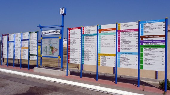
- [1] … o projektu OSMTagChallenge > ? OSMTagChallenge od Jean-Marie Favreaua z univerzity v Clermont-Ferrand je denní tagovací výzva, začínající o poledni UTC, ke společnému hledání vhodných tagů pro zřídka se vyskytující objekty ve Francii. Zdrojový kód projektu je dostupný na GitHubu.
- … že na instagramové stránce Mapperů OSN najdete i stručné průvodce s užitečnými tipy na mapování cest, budov a vodních toků?
Ostatní geo záležitosti
- Qiusheng Wu prezentuje nové vlastnosti nástroje geemap: volání javascriptových knihoven třetí strany EarthEngine z Pythonu. EarthEngine je postaven na projektu Open Earth Engine Library (OEEL) od Mathieu Graveyho. Jako příklad je uvedeno použití modulu JS grid od Gennadie Donchytse.
- OpenCage Geocoder sdílí svůj pohled na běžně neznámá geografická fakta o Francii.
- Christopher Beddow na svém blogu Worldbuilder píše o možnostech, které se otevírají s vizuálními polohovými systémy (VPS). Mluví o vývojářských nástrojích a posledních novinkách v systémech Google ARCore a Niantic Lightship.
- V článku, který je vlastně reklamou na britskou Ordnance Survey, píše Guardian, že tři čtvrtiny dospělých ve Spojeném království nejsou schopny číst mapy, a nabízí čtenářům rady, jak se v tom zlepšit.
Plánované události
| kde | co | online | kdy | země |
|---|---|---|---|---|
| 大阪市 | ひがよどの街を世界にシェア #01 | 23.07.2022 |  | |
| 京都市 | 京都!街歩き!マッピングパーティ:第32回 妙心寺 | 24.07.2022 | | |
| Plano Piloto | State of the Map Brasil 2022 (online) – Sessão 1 | 27.07.2022 |  | |
| Düsseldorf | Düsseldorfer OpenStreetMap-Treffen | ✓ | 27.07.2022 |  |
| [Online] OpenStreetMap Foundation board of Directors – public videomeeting | 28.07.2022 | |||
| 臺北市 | COSCUP 2022 OpenStreetMap x Wikidata 聯合議程軌 | 30.07.2022 |  | |
| iD for Beginner Training | 30.07.2022 | |||
| Buenos Aires | 4a reunión bimestral de OSM Latam (organiza OSM Argentina) | 30.07.2022 |  | |
| Ernakulam | OSM Kerala Community Meetup 2022 | 31.07.2022 |  | |
| OSMF Engineering Working Group meeting | 01.08.2022 | |||
| MapRoulette Monthly Community Meeting | 02.08.2022 | |||
| Stuttgart | Stuttgarter Stammtisch | 02.08.2022 | | |
| San Jose | South Bay Map Night | ✓ | 03.08.2022 |  |
| Londýn | Missing Maps London Mapathon | 02.08.2022 |  | |
| Salt Lake City | OSM Utah Monthly Meetup | 04.08.2022 | | |
| OSM Africa August Mapathon: Map Rwanda | 06.08.2022 | |||
| 新北市 | OpenStreetMap 街景踏查團 #3 | 07.08.2022 | | |
| Washington | MappingDC Mappy Hour | 10.08.2022 | | |
| Hamburk | Hamburger Mappertreffen | 09.08.2022 | | |
| Kolín n. Rýnem | 25. Stammtisch Köln | 10.08.2022 | | |
| Mnichov | Münchner OSM-Treffen | 10.08.2022 | | |
| Salt Lake City | OSM Utah Monthly Meetup | 11.08.2022 | | |
| Curych | 143. OSM-Stammtisch | 11.08.2022 |  |
Poznámka: Pokud zde chcete vidět vaši akci
Toto číslo přeložil tom.k a redakčně upravil mkyral. Budeme velmi rádi, pokud podpoříte a oceníte naši práci tím, že budete dílo dále šířit, např. sdílením na sociálních sítích (like, retweet, boost…). Předem za to děkujeme.
Každé číslo v CZ verzi je promováno zde: @osmcz |
  @osmcz |
  Talk-cz | osm_sk |
  rss
rss
Můžete nás kontaktovat e-mailem:  weekly@openstreetmap.cz
Originál tohoto souhrnu připravili: Nordpfeil, PierZen, SK53, SomeoneElse, Guillaume Rischard (Stereo), TheSwavu, derFred.