04/07/2023-10/07/2023
OpenCampingMap is looking for translators [1] © Sven Geggus © Contribuintes OpenStreetMap
Mapping
- adreamy wondered about how to map an intersection that is completely covered with pedestrian crossings overlapping in all directions. They proposed using
area:highway=pedestrian. - pluton_od blogged about high-occupancy vehicle lanes (HOV) and how they updated around 8,000 road segments in the United States from the deprecated tag
hov=lanetohov:lanes=*. - Brian Sperlongano has proposed a mechanical edit to remove the tag
service=driveway2. - The proposal to establish the keys
wheelchair:portable_ramp=*andwheelchair:portable_lift=*, for placing on public transport platforms to indicate whether a portable ramp or a portable wheelchair lift is present at the platform, is waiting for your comments.
Community
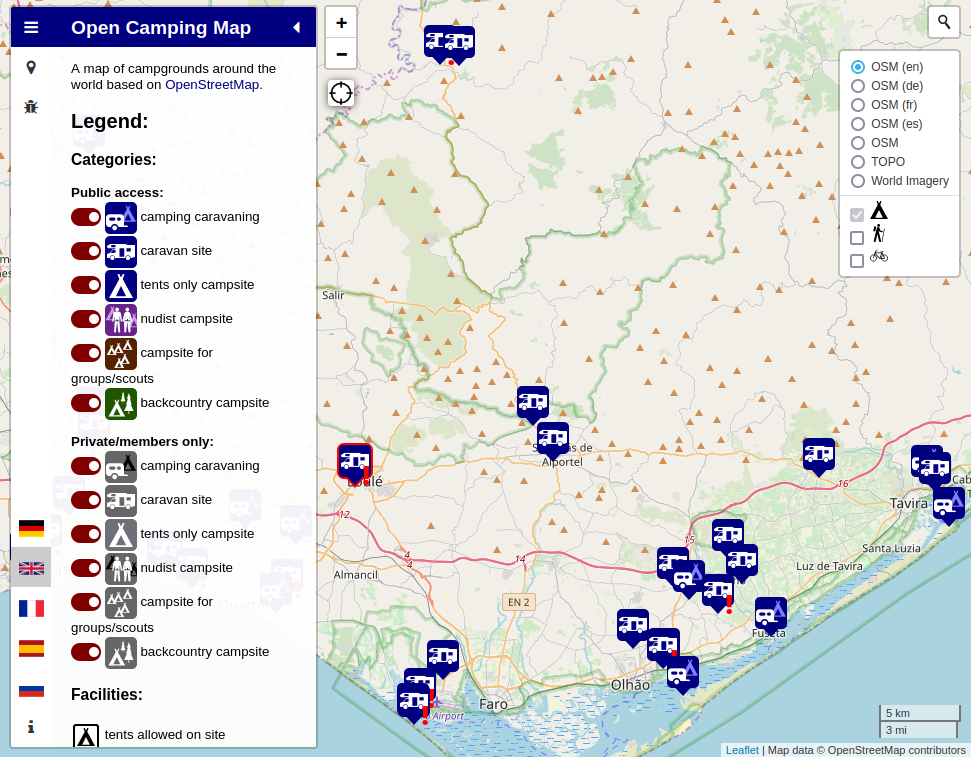
- [1] After having added more features in the English language version of his OpenCampingMap, Sven Geggus, from Karlsruhe, would like to have people help in translating these to French, Spanish, and Russian.
- Amanda McCann (user ᚛ᚐᚋᚐᚅᚇᚐ᚜) shared her insights comparing OSM engagement on Twitter with Mastodon/Fediverse.
- bes199 described
 ► how they researched the confusing house number sequence in a residential area.
 - The OpenStreetMap community on Lemmy is searching for moderators.
 ►
►
Imports
- James Crawford proposed moving the discussion of import proposals from the current mailing list to the OSM Community forum, which passed with a vote of 45-5. However, critics of the vote pointed to violations of the wiki’s tagging proposal process. Frederik Ramm noted that the Data Working Group would consider reviewing imports in either communication channel to be acceptable.
OpenStreetMap Foundation
- Take a moment to reflect on why State of the Map Conferences are so important to OSM.
Events
- HeiGIT took part in the US State of the Map Conference for the first time. Marcel Reinmuth gave several talks presenting HeiGIT’s platforms and services to the US OSM community and ran a workshop, together with Charles Hatfield, to introduce the new version of the Sketch Map Tool to a wider audience.
- It may be worth having a look at the upcoming OSM hack weekend in Karlsruhe, Germany, being held on the weekend of 30 September. Surely you have some unfinished OSM projects or some good ideas for new ones? Bring them with you to Karlsruhe. You will find people there to discuss the details with you, or help build something.
Maps
- meteoblue helps you to find cooler spaces, for example in München, during high summer. Data is also available for some other European and world cities.
Software
- Eugene shows how OsmAnd users create their own map styles.
- SportsTrackLive has released a brand new companion app named SportsTrackLive Unity (iOS, Android). It has a unique 3D terrain map render engine built in-house on Unity. The app supports the recording and replaying of outdoor sport activity. Everyone is invited to try and test it. The developers are actively making efforts to improve the map engine.
Programming
- M!dgard wanted to use different user accounts with the same JOSM presets. Due to the fact that JOSM doesn’t have built-in support for multiple user accounts, he created a script that lets him switch without pain. It works on a typical Linux setup or other *NIXes, such as macOS, but not on Windows.
- MapLibre is urging users of MapLibre Native’s custom OpenGL layers to come forward. This feature is about to be refactored, so user feedback is needed to ensure the code remains backwards compatible.
- Paul Norman has created a table of the 2,713,316 OSM changesets from the last 12 months that referenced Maxar imagery, and listed the countries with the highest numbers of references. From this data, Guillaume Rischard showed that countries from the Global South have a relatively high proportion of Maxar imagery used to edit OSM (93% of changesets from Guatemala used Maxar). Pierre Béland presented a synthesis of changesets and objects edited by continent and sub-continent, again showing a high proportion of Maxar use for countries from the Global South.
- Kyle Barron wrote a tutorial about developing a fast rendering engine for vector geodata in the browser. The article includes an interactive map with a million vector polygons of buildings in Salt Lake City.
- Stadia Maps announced the initial release of three SDKs (JavaScript/TypeScript, Python, and Kotlin), along with a MapLibre GL JS autocomplete search box plugin for their services. All are open source and available on their GitHub.
Releases
- Vespucci version 19.1 beta has been released and is available from the Google Play Store or Vespucci repository. It now features tile layer diagnostics that display technical information about the currently displayed map tile.
- HeiGIT announced the release of Openrouteservice 7.0, also known as Callisto. The new version provides, among other improvements, a faster routing graph building processes.
Other “geo” things
- The drift of Earth’s pole confirmed groundwater depletion as a significant contributor to global sea level rise between 1993 and 2010.
- HeiGIT is looking for a Senior Spatial Data Scientist for the Climate Action focus group (m/f/d, up to 100%). Tasks will include, among others, creating high-resolution spatial indicators of climate change readiness and greenhouse gas emission maps, as well as the analysis of crowdsourced geodata such as OSM in combination with other spatial data including remote sensing and government data.
- HeiGIT is looking for a community engagement, outreach, and partnership manager for the Climate Action focus group (m/f/d, up to 100%). They will work on the interface between communities and scientists to enable citizens and decision makers to identify and take actions related to the climate crisis.
Upcoming Events
| Where | What | Online | When | Country |
|---|---|---|---|---|
| 165. Treffen des OSM-Stammtisches Bonn | 2023-07-18 | |||
| Lüneburg | Lüneburger Mappertreffen (online) | 2023-07-18 |  | |
| The Municipal District of Kilkenny City | Kilkenny History Mappers MeetUp | 2023-07-18 |  | |
| Lorain County | OpenStreetMap Ohio Meetup – Kickoff | ✓ | 2023-07-20 |  |
| Karlsruhe | Stammtisch Karlsruhe | 2023-07-19 | | |
| Missing Maps – DRK & MSF Online Mapathon | 2023-07-19 | |||
| City Of Vincent | Social mapping Sunday: Leederville and Lake Monger | 2023-07-23 |  | |
| Bremen | Bremer Mappertreffen (Online) | ✓ | 2023-07-24 | |
| OSMF Engineering Working Group meeting | 2023-07-26 | |||
| Düsseldorf | Düsseldorfer OpenStreetMap-Treffen | 2023-07-26 | | |
| Wien | 68. Wiener Stammtisch | 2023-07-27 |  |
Note:
If you like to see your event here, please put it into the OSM calendar. Only data which is there, will appear in weeklyOSM.
This weeklyOSM was produced by Elizabete, MatthiasMatthias, Nordpfeil, PierZen, Strubbl, TheSwavu, TrickyFoxy, barefootstache, derFred.
We welcome link suggestions for the next issue via this form and look forward to your contributions.