26/12/2023-01/01/2024
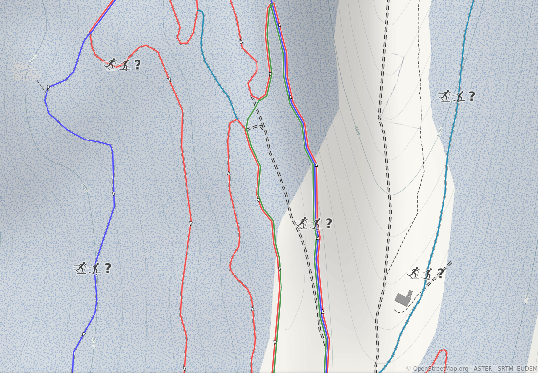
Nordic ski routes in OpenSnowMap [1] | © OpenSnowMap, ASTER, SRTM, EUDEM | map data © OpenStreetMap contributors
Mapping
- Pascal Neis has been updating his data on the areas that remain unmapped on OpenStreetMap.
- Voting on the
emergency=disaster_responseproposal has started and will run until Thursday 18 January.
Community
- Anne-Karoline Distel celebrated the 4th anniversary of the #osmIRL_buildings project in County Kilkenny, Ireland.
- Włodzimierz Bartczak shared a reflective summary of 2023 and his ambitious plans for 2024.
- Some contributors looked back on their activities in 2023:
- Nakaner shared
 statistics on OpenStreetMap (OSM) activity at the OpenStreetMap Assembly during 37c3.
 - Engelbert Steve Modo Levo, president of the OSM club at the National Higher School of Public Works in Yaoundé, highlighted the importance of qualitative data in addressing challenges during a field mapping exercise around the P11 road in Nkolbisson, Cameroon.
- This video is a celebration of the 700th issue of weeklyOSM, where the OSM Fukushima community discussed the latest issue of weeklyOSM.

 statistics on OpenStreetMap (OSM) activity at the OpenStreetMap Assembly during 37c3.
 is a celebration of the 700th issue of weeklyOSM, where the OSM Fukushima community discussed the latest issue of weeklyOSM.
OpenStreetMap Foundation
- Kamil Monicz has initiated an independent project to monitor and report the availability statistics of OSM services.
Local chapter news
- The Queens Name Explorer project has been expanded and the Queens Gazette reported on how partnerships have flourished with various organisations, including Wikimedia NYC and OpenStreetMap US.
Events
- OpenStreetMap India have recently celebrated a successful field mapping party held in Yelahanka, Bengaluru, where over 450 changes were made to the OpenStreetMap database.
OSM research
- T.M. Logan et al have analysed the phenomenon of the isolation of US coastal settlements due to sea level rise, using road network data from OpenStreetMap and sea level rise prediction data from NOAA. The results of the analysis are presented in the following interactive map. In a follow-up study, Kelsea Best et al concluded that there are certain demographic groups that are particularly affected by this isolation phenomenon. This research was also covered in several online media, such as AzoCleantech, ScienceBlog, and The Ritz Herald.
- The Morning Bike Sharing project focuses on the different types of multi-modal origin-destination (OD) networks during the morning peak period.
- The Proceedings of OSM Science 2023, a scientific conference focused on OpenStreetMap during the State of the Map EU November 2023, have been published.
Humanitarian OSM
- Two areas have been published for mapping on the Tasking Manager for the earthquake that occured on 1 January 2024 in Wajima, Suzu and Noto on the Noto peninsula: task number 15887 and task number 15888.
Maps
- Andy Townsend wrote about the improvements that have been made to the maps at map.atownsend.org.uk.
- Christoph Hormann delved into the often overlooked world of parking, highlighting its significant yet underrepresented presence in urban geography and maps.
OSM in action
- Maël presented the futur.eco/voyage app, a web map based on OpenStreetMap. The source code is available on GitHub.
- The International Institute for Strategic Studies has released the ‘IISS Conflict Trends Map’, an OpenStreetMap-based map that visualises data on conflict zones with troop deployments from G20 member states from 2016 to 2023.
- At the Chaos Communication Congress 2023, a presentation highlighted ► a project by the Centre for Urban Justice in Luxembourg, which was also reported ► on netzpolitik.org. This project aimed to verify the regulatory compliance of zebra crossings in Luxembourg. The team utilised the zebra crossing data from OpenStreetMap, obtained through an Overpass API query.

Open Data
- OpenLandMap provides a comprehensive compendium of global gridded environmental datasets.
- Laurent Toustou, of IGN, discussed ► the evolution of geodata services, highlighting the Cartes.gouv.fr project.
- The Overture Maps Foundation have released the Overture 2023-12-14-alpha.0 dataset, now with additional building data from Google Open Buildings. This adds approximately one billion new buildings to the Overture Maps dataset.
- Samapriya Roy has added shoreline and land cover data from the Daylight Map Distribution to the Google Earth Engine platform.
 shoreline and land cover data from the
 Software
- [1] yvecai informed us that Nordic ski route relations with a
colour=*tag are now rendered automatically on OpenSnowMap. He is interested in feedback if you notice bugs. - OsmAnd continued their tradition, for the sixth time, of writing up their New Year resolutions. Their main goal for 2024 is to provide the ultimate trip computer experience. They also plan to focus on different external map sources, including OSM Custom Maps. Finding a better and easier way to encourage more people to contribute to OpenStreetMap is also on their list.
- Alejandro Cruz has released Mapitas, an iOS app to display Mapbox maps of specific regions as desktop wallpapers.
- The Osmose QA tool now has a feature to expand clustered categories. Just click on the plus symbol.
- Random OSM Note provides a way of exploring random OpenStreetMap notes, which are used to report map bugs or improvements.
- firebird8541154, the developer of Sherpa-map (a cycling route navigation app), has added a road surface detection feature that uses AI.
- vorpalblade discussed the ongoing process of migrating the JOSM plugin repository from Subversion (svn) to Git.
Programming
- Radu Mariescu-Istodor has released an OpenStreetMap-themed web programming walkthrough video of a self–driving car simulation, using road and building data from OpenStreetMap. The source code of this simulation is available on GitHub.
- Danysan95 explored QLever, a new query engine for OpenStreetMap data.
- luziferius described ► how he installed OpenStreetMap on his Kenwood car radio with integrated Garmin navigation software.
- un1matri1x has created an Overpass query to search for old OSM objects tagged with the
demolished,removed,razed, ordestroyedlifecycle tags. - Cody Bernardy released a video explaining how to utilise OpenStreetMap data to perform OSINT-based geolocation using taginfo and overpass turbo.
Releases
- Bayram Sarıipek announced the addition of a dark mode for the Mapilio app, a platform for sharing street-level imagery.
- The RapID editor has a new release focusing on crossings.
- StreetComplete version 56.0 has been released.
- SCEE (StreetComplete for advanced users) version 56.0 has been released.
Did you know …
- … the OpenStreetMap Foundation has a free membership scheme for active OSM contributors?
- … RicoElectrico has created two useful bookmarklets for OSM users to view a snapshot of the OSM data at the time a note was created and to provide a translation feature for OSM notes?
- … the City Roads project is an innovative tool that allows users to render every single road within any city?
- … that you can access various statistics about OpenStreetMap?
OSM in the media
- Juan Manuel Delgado, of Computer Hoy, reviewed ► 18 map apps that can be used as alternatives to Google Maps.
- Monika Gemmer highlighted ► the draft of the new German Federal Forestry Act (we reported ► earlier), which has caused a stir among outdoor enthusiasts, in a digital look back at the year 2023.
- Periodismo.com reviewed ► OpenRailwayMap, a map of the world’s railway lines using data from OpenStreetMap.
- Markus Wienken, of the daily Kreiszeitung, interviewed ► Thomas Froitzheim, an OpenStreetMap contributor and founder of outdoor navigation-based startup Naviso ►.
- CHIP presented ► some apps that can be used to find public toilets, including an overpass turbo query.
- Bloomberg interviewed Martin Lucas-Smith, co-founder of CycleStreets, about navigation for cyclists.
 ►
►Other “geo” things
- Dylan Matthews, from Vox, reviewed some maps and charts of the world’s languages.
- Economics of Tech have written an in-depth exploration of Google Maps.
- The c3nav team released an indoor map application to use at the 37th Chaos Communication Congress. This application is equipped with indoor routing capabilities between building floors. The source code can be accessed via GitHub.
- Based on analysis of GNSS data, a research team from Japan’s geospatial information authority has concluded that the earthquake, which shook the Ishikawa Prefecture on Monday, 1 January 2024, had the potential to shift the Noto Peninsula up to 1.3 metres to the west.
- Fernando Paolo et al have analysed satellite imagery data and GNSS vessel movement data using AI technology to detect fishing and mining industry activities in high seas areas. Their research suggested that around 72–76% of fishing activity on the world’s high seas escapes public monitoring systems. The Verge’s Justine Calma reported on this research in an article.
- A video from Logically Answered explored Google Maps’ revenue model.
- Ana-Marija Autischer recognised ► a gap in existing travel safety apps and has developed Vigilios.
- The Quairading Shire Council has erected signs advising drivers not to blindly follow satnav instructions, such as from Google Maps.
Upcoming Events
| Where | What | Online | When | Country |
|---|---|---|---|---|
| Bruxelles – Brussel | OpenStreetMap meetup in Brussels | 2024-01-04 |  | |
| 臺北市 | OpenStreetMap x Wikidata Taipei #60 | 2024-01-08 |  | |
| München | Münchner OSM-Treffen | 2024-01-09 |  | |
| San Jose | South Bay Map Night | ✓ | 2024-01-10 |  |
| OSMF Engineering Working Group meeting | 2024-01-10 | |||
| Brest | Brest: rencontre du groupe local | 2024-01-10 |  | |
| Berlin | 187. Berlin-Brandenburg OpenStreetMap Stammtisch | 2024-01-11 | | |
| Bochum | OSM-Stammtisch Bochum | 2024-01-11 | | |
| Hannover | OSM-Stammtisch Hannover | 2024-01-13 | | |
| København | OSMmapperCPH | 2024-01-14 |  | |
| Hilversum | OSGeo.nl OSM-NL QGIS-NL New Year’s Party | 2024-01-14 |  | |
| Budapest | OSM Hungary Meetup | 2024-01-15 |  | |
| Lyon | Réunion du groupe local de Lyon | 2024-01-16 | | |
| Map-py Wednesday | 2024-01-17 | |||
| Karlsruhe | Stammtisch Karlsruhe | 2024-01-17 | | |
| Gent | OpenStreetMap meetup & MapComplete workshop at TomTom | 2024-01-18 | | |
| Washington | Mapping USA | ✓ | 2024-01-19 – 2024-01-20 | |
Note:
If you like to see your event here, please put it into the OSM calendar. Only data which is there, will appear in weeklyOSM.
This weeklyOSM was produced by MatthiasMatthias, PierZen, SeverinGeo, Strubbl, TheSwavu, TrickyFoxy, barefootstache, derFred, mcliquid, renecha, rtnf.
We welcome link suggestions for the next issue via this form and look forward to your contributions.
Opensnowmap screenshot nicely illustrates how the nordic pistes are rendered when piste:difficulty is not mapped 😛