11/07/2023-17/07/2023
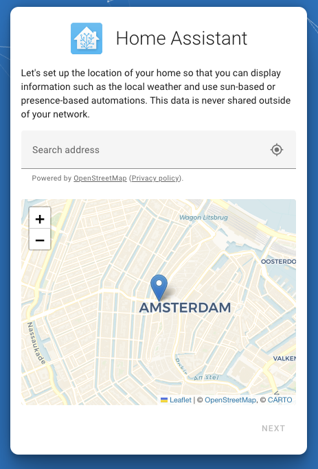
Home Assistant now with a map from OSM in the user onboarding step [1] © OpenStreetMap contributors
Mapping
- deptho wonders why one would map sidewalks/pavements separately from the associated road and not use the
sidewalktag on the road object. Commenters say that it can improve pedestrian routing and mapping kerb drops can help people with limited mobility, but that just mapping sidewalks separately isn’t a panacea. - The RapiD editor has allowed users to trace from Google’s Open Buildings layer since 2022. Recent changes have made more data available and the licence is now compatible with OSM. Particularly useful is that this dataset includes a precision threshold, which should help mappers avoid false positives (which have been a problem with the default Microsoft Buildings layer).
Community
- AngocA crafts a real “hold it in your hands” OSM model, which was inspired
 > by a Wikpedia model.
 - b-unicycling and a friend of hers started a regular’s table called the “Kilkenny History Mappers”. The local newspaper and radio station reported about it.
- courtiney (formerly of Tomtom, now a freelance writer and a member of OSM’s Communications Working Group) elaborates on how to use OSM channel data for effective communications. She is looking into developing an open-source version of the tool she used to share with the community.
- LFF_490_Alexander reflects on the “sustainability of OSM communities”.
- The German “Focus of the Week” (a weekly mapping activity started during the coronavirus pandemic) has been suspended until further notice, as fewer people have been taking part recently.
- SGorskiy describes > in detail how he finds drinking water with the help of Organic Maps and OsmAnd.
- ShresthaSR shared his experience while participating in the FOSS4G Prizren 2023 conference.
 >
> 
 >
> OpenStreetMap Foundation
- The next monthly video-meeting of the OSMF board,
will take place on Thursday 27 July 2023 at 15:00 UTC in the video room
(opens ~20 minutes before the meeting). The preliminary agenda is on the wiki and this is where the draft minutes will be added.The topics are:- Treasurer’s report
- Secretary’s report
- Sovereign Tech Fund application
- Board rules of order regarding circulars
- Review Strategic Plan revision
- Corporate Membership revision
- Change to Courtney Williamson’s status to volunteer, cancellation of contract
- Support as financial intermediary to regional State of the Map sponsorships
- EU Transparency Register
- Vector tiles
- Monthly presentation – OSM community in the Democratic Republic of the Congo
Local chapter news
- OpenStreetMap US, in partnership with Mapillary, will be running a 360 degrees camera grant programme for OSM community members in the United States.
Events
- The annual Wikimania conference will take place in Singapore and online from 16-19 August.
Andy Mabbett indicates that several sessions on maps are planned and asks if any OSM contributors are going.
Education
- Miku has released a progress report on her Google Summer of Code 2023 project. The project focuses on customising Nominatim’s address lookup algorithm based on the address system used in Japan.
OSM research
- Val Ismaili looked at the validity of OSM data in a region in the UK on Medium. He contrasts data collected by Transport East (Norfolk, Suffolk, Essex, Thurrock and Southend-on-Sea) with OSM found data in several tables. The approach (actually comparing a range of OSM data with what local people thought was present) is significantly better than some studies that only look at one factor (e.g. “land area occupied by buildings” was one recent one).
Maps
- Lisa Hornung shared on Mastodon a map of gelaterias in Italy. The publication of the map generated a short discussion on why there are fewer gelaterias in southern Italy on OpenStreetMap.
 on Mastodon a map of gelaterias in Italy. The publication of the map generated a short discussion on why there are fewer gelaterias in southern Italy on OpenStreetMap.
switch2OSM
- [1] Home Assistant, an open source home automation application, now uses OpenStreetMap and Nominatim in its user onboarding feature.
- Andy Townsend updated the “switch2osm” OSM tile server installation guide page for the Debian 12 operating system.
Open Data
- Google released Open Buildings V3 that contains 1.8B building detections in Africa, Latin America, Caribbean, South Asia, and Southeast Asia. The data is shared under the CC BY-4.0 and ODbL v1.0 license. An import proposal derived from this dataset is currently under discussion. As noted in that thread, an important feature of this dataset that should help avoid false positives is a confidence score.
Software
- Jochen Topf, the developer of Taginfo, describes the external links he has added to Taginfo’s Tags pages with instructions on how to extract / analyze them from external tools (Overpass, OSM Tag History, and ohsome). ohsome gives the option to select countries to analyze historical OSM data.
- Eugene describes how to use OsmAnd more efficiently with the help of the “online map plugin”.
Programming
- Mustapha Mekhatria describes how he creates a map with Highcharts and OSM data.
- richlv uses the LearnOverpass app to learn how to create Overpass queries.
Releases
- The GraphHopper Maps Android app released a new version and it can be found in the F-Droid app store.
Did you know …
- … steveattewell’s GitHub attempts to support retrieving map features from OpenStreetMap?
- … Robert Whittaker’s OpenStreetMap Stuff?
OSM in the media
- Darkonus discovered the use of OpenStreetMap maps in the film “Mission Impossible: Fallout (2018)”.
Other “geo” things
- Anders Sundell used an algorithm to find the countries that look the most like each other.
- HeiGIT announces that the ohsome dashboard got extended to be able to compute data quality metrics for OpenStreetMap through the ohsome quality analyst (OQT) which is also developed by HeiGIT.
- Jake Coppinger wrote an in-depth analysis of the operational management of traffic lights in the Sydney region.
- Neal Agarwal released the “Wonders of Street View” website to collect and explore unique places in the world captured by Street View photos.
Upcoming Events
| Where | What | Online | When | Country |
|---|---|---|---|---|
| Rēzekne | Kartēšana Rēzeknē | 2023-07-21 |  | |
| City Of Vincent | Social mapping Sunday: Leederville and Lake Monger | 2023-07-23 |  | |
| Bremen | Bremer Mappertreffen (Online) | ✓ | 2023-07-24 |  |
| Reunião 2 – OSM Brasil – Mapeamento Aberto para Gestão de Riscos de Desastres [Horário 1] | 2023-07-26 | |||
| OSMF Engineering Working Group meeting | 2023-07-26 | |||
| Richmond | MapRVA Happy Hour | 2023-07-27 |  | |
| Zürich | Missing Maps Zürich Mapathon | 2023-07-26 |  | |
| Düsseldorf | Düsseldorfer OpenStreetMap-Treffen | 2023-07-26 | | |
| Wien | 68. Wiener Stammtisch | 2023-07-27 |  | |
| 大安區 | COSCUP 2023 OpenStreetMap x Wikidata 開放內容議程軌 | 2023-07-30 |  | |
| Reunião 2 – OSM Brasil – Mapeamento Aberto para Gestão de Riscos de Desastres [Horário 2] | 2023-07-31 | |||
| San Jose | South Bay Map Night | ✓ | 2023-08-02 | |
| Missing Maps London Mapathon | 2023-08-01 | |||
| Stuttgart | Stuttgarter OpenStreetMap-Treffen | 2023-08-02 | |
Note:
If you like to see your event here, please put it into the OSM calendar. Only data which is there, will appear in weeklyOSM.
This weeklyOSM was produced by Elizabete, MatthiasMatthias, PierZen, SomeoneElse, TheSwavu, barefootstache, derFred, rtnf.
We welcome link suggestions for the next issue via this form and look forward to your contributions.