24/07/2018-30/07/2018
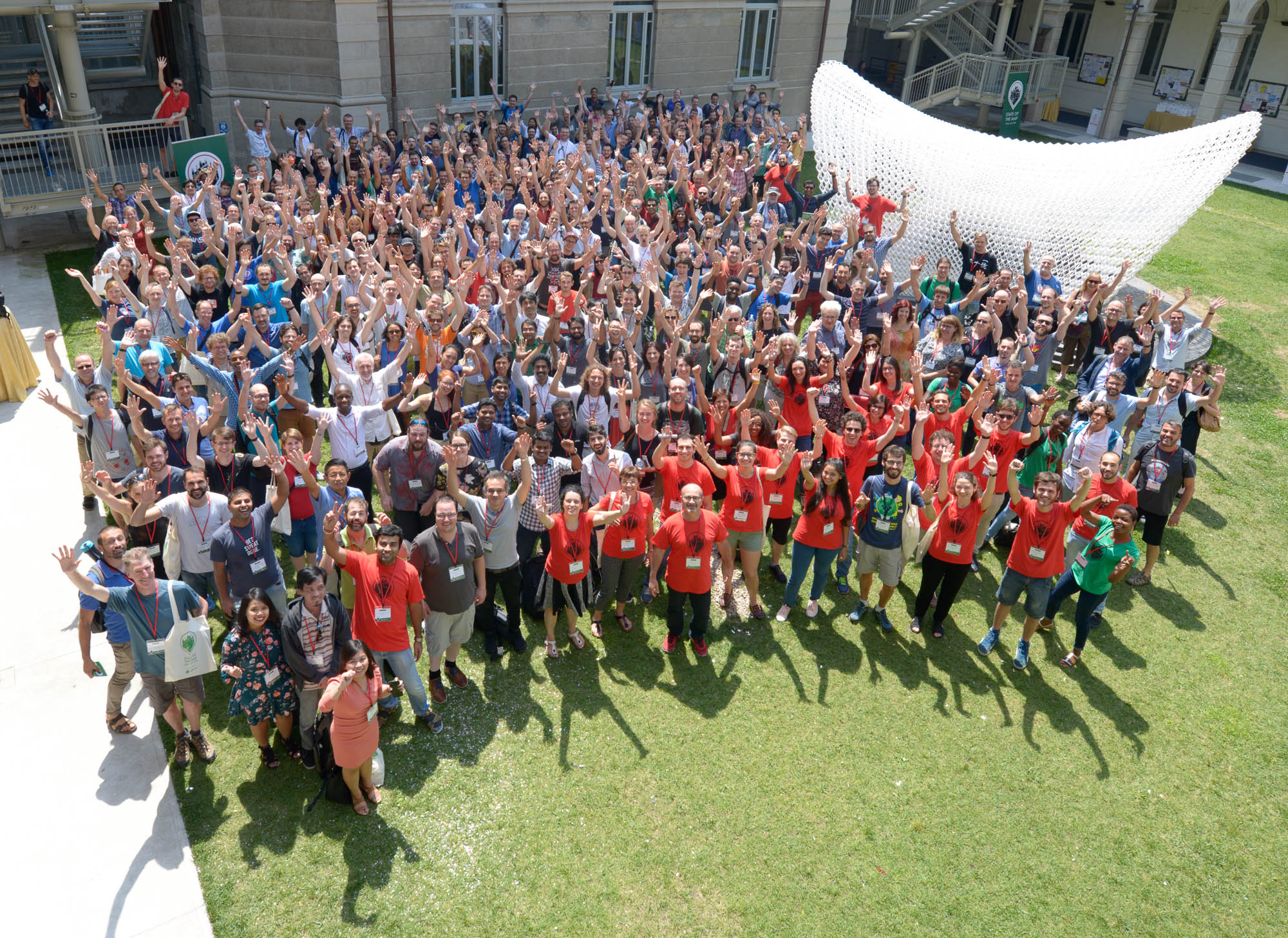
This year’s participants @ SotM 2018 in Milan, Italy 1 | © Photo by Francesco Giunta (own work), CC BY-SA 4.0, via Wikimedia Commons
SotM 2018 Milan
- [1] State of the Map, the global OpenStreetMap Conference, happened last weekend in Milan, Italy from the 28th to the 30th of July 2018. You can watch the recorded videos on their YouTube channel and find all the pictures here.
- We wish to congratulate the winners of the OSM awards 2018:
- Sarah Hoffmann (Core Systems)
- Wikimedia Foundation Collaboration Team (Innovation)
- Christoph Hormann (Influential Writing)
- Matšeliso Thobei (OSM username Tshedy) (Greatness in Mapping)
- Christiane Karch (Expanding the Community)
- Natalia da Silveira Arruda (Latin America)
- Crowd2Map Tanzania (Africa)
- State of the Map Asia 2017 organising team (Asia) and
- Richard Fairhurst (Ulf Möller Memorial Award)
- During SotM Milan Martijn van Exel announced the relaunch of ImproveOSM. This now brings together all of Telenav’s tools for the OSM community.
- From SotM Milan 2018: an overview of the first day’s activities from various presentations.
- On behalf of the Mapbox team at SotM, Jinal said how much they were looking forward to seeing people at in Milan. In case you did not find the time, or live in a part of the world far away from Italy, she gives a list of other OSM related conferences where you will be able to meet the team.
- On the OSM blog Harry Wood says thanks to the visitors and organisers of the SotM in Milan. There are already unedited videos of the two main conference rooms linked from the article.
- During SotM a Memorandum of Understanding between the OSGeo Foundation and Youthmappers was signed. The agreement proposes to establish a collaborative relationship in several areas such as research, education and conference participation.OSGeo is an organisation that promotes the adoption of open geospatial technology, Youthmappers is a university consortium of 120 campuses in 38 countries active in the humanitarian and development sector.
- State of the Map 2019 will take place at Heidelberg University, Germany, from 21st to 23rd September.
About us
- weeklyOSM is now published in Korean. Korean is spoken by about 80 million people, mainly in Korea but it is also an official language in two Chinese regions. OSM-related news can now be read in Japanese, Czech, English, Spanish, French, German and Korean. According to a Tweet from Geoffrey Kateregga we may welcome a Swahili version of our issue soon. Swahili is spoken by about 50 to 100 million people in Tanzania, Kenya, Uganda, Rwanda, Burundi, Mozambique and Congo. 고급협동조합 and Geoffrey are still looking for partners to help them. weeklyOSM is looking for a better flag to use for the Korean language in the WordPress plugin qTranslate.
Mapping
- Rarely has a discussion in OSM escalated so quickly as it did following an email to the talk-us mailing list about unconnected lines that were supposed to become sidewalks.
- jgon6 was dissatisfied that there was no convincing way to tag fairgrounds (showgrounds). A map note gave him a heads up and he looked into the issue again. He wrote an email to the tagging mailing list and published a dairy post, in which he laid out his extensive thoughts and findings about the different ways of tagging to get other people’s views on it.
Community
- Researchers from the Politecnico di Milano investigated criticism of OSM around the unknown quality of data collected by unqualified mappers. In a journal paper they report on the comparison of the number and spatial accuracy of 1 million buildings in OSM and 2.8 million buildings in an authoritative dataset from the Lombardy region in Northern Italy. They concluded that at the 1:5000 scale the quality is at least comparable with the reference data. In terms of completeness OSM has 57% of the buildings found in the public dataset. The researchers also found that 9% of the buildings in OSM were not in the reference dataset.
- Philipp Koster (HSR Rapperswil) published an OSM based Area of Interest (AOI) dataset for Switzerland. Google introduced the AOI concept (high activity areas shown as orange shaded areas on their maps) in 2016 but did not disclose the algorithms used to create it. Prof. Stefan Keller presented this work in the academic track at SotM.
- In his blog “Maps Matter” SK53 wrote about how the completeness of data in OSM can be estimated without using external datasets for comparison. The question becomes particularly important when thinking about the generation of Areas-of-Interest, which requires POIs to be reasonably complete. His idea is that the number of POIs over time should develop similarly to Species Accumulation Curves (at first increasing slowly but then accelerating and finally leveling off ). The article details step by step his approach of investigating the question for shops in the UK using Overpass, Osmium and PostgreSQL. He concluded that there are still a lot of shops to be added, even in the best-mapped places. Some shop types,
shop=supermarketandshop=doityourself, do show signs of slowdown. In terms of the number of distinct values forshop=he found the curve tailed off and suggests that the existing shop tags are sufficient to meet our tagging needs. Joost Schoope pointed out that a similar approach has already been used for roads. - The eighth edition of the Belgian Open Summer of Code project ended last week. It was bigger than ever and used OpenStreetMap heavily, as illustrated by Pieter Vander Vennet’s diary post.
- We are looking forward to the results of the user profgreenington’s bachelor thesis. He reports in a diary post
 (automatic translation) that his topic is the generation of indoor maps, in digital as well as in paper form.
 - Richard Fairhurst wrote a forward-looking blog post about implementing vector tiles, placing this centre stage in a comprehensive overview of the OSM context. He recalled the very first days of OSM, summarised the current situation, noted the constantly repeated argument that OSM is a database not a map, made it clear why we are not and why we don’t want to be Google or Apple maps, touched on contributor motivation and diversity and brought it all together to argue for restylable vector tiles on openstreetmap.org as a tool to generate customised maps. The article also offers refreshingly calm words about machine learning/AI in the OSM environment and visual feedback on maps as a motivator for contributors.
- Ilya Zverev supplemented Richard’s blog post on vector tiles. In his diary post he points out that the OSM carto developers are approaching the change to vector tiles only as a technical task, which he sees as a mistake. His point is that our style is overshadowing our product, i.e. geospatial data. He suggested that users should look elsewhere for nice-looking OSM maps and the OSM website should focus foremost on data and possibilities. He recommends that OSM delivers raw vector tiles coupled with an improved map builder including a style database containing hundreds of styles.
 (automatic
 Imports
- In a tweet Allan Walker points to his visualisation of the number of buildings in OSM compared to Microsoft’s building footprint dataset for the United States. As you can see, in number terms Microsoft is leading, by far, in all states except Massachusetts.
OpenStreetMap Foundation
- Raphael Das Gupta welcomes OSM local chapters to join the dedicated mailing list. Collaboration and exchange of experiences among local chapters is encouraged, as well as interaction with the OSMF Board and the various working groups.
- Some of our OpenStreetMap servers were moved from Imperial College London to their new home at Equinix in Amsterdam. You may have experienced some slower response times during the transition period prior to the move, which was successfully completed on Wednesday, July 25th. updated – thx, Dorothea 😉
Events
- Micro Mapping Party with Mapathon, Hackathon and AskMeAnything in Rapperswil (Switzerland), Friday, August 17, 2018, 14:00-~21:00
- The call for the venue for the State of the Map Africa 2019 is now open. It will be close on September 30th, 2018.
Humanitarian OSM
- HOT Conversations at SotM 2018: you can find the full list of talks, workshops and birds-of-a-feather about OSM and humanitarian activities here. If you missed one of them or wish to rewatch it, videos and slides will be made available on this same page.
- Ebola again in DRC – see task 4947
switch2OSM
- The news site Moneycontrol reports that Uber is working on a plan to move from Google maps to OSM. weeklyOSM has recently reported about Uber’s plan to contribute to OSM in the Delhi region in India.
Programming
- The OSM wiki now supports templates written in the Lua scripting language. It is hoped that this will improve the performance and maintainability of frequently used, complex templates such as the language selection bar.
Releases
- JOSM developers just published release #14066, that brings several bugfixes and improvements.
Did you know …
- … the sources of help if you have questions with regard to OSM? You can ask your question in the OSM forum, on one of the mailing lists and at Q&A site help.openstreetmap.org. Unlike the forum or mailing lists, the site is not intended for discussions, but for factual questions for which there is ideally an objectively correct answer. If you want to help others with your OSM knowledge, take a look at the list of unanswered questions. Maybe you deserve a place in the points list?
OSM in the media
- William Plummer of the French newspaper
Le Figarohas analyzed the naming of streets in Paris with the help of OSM data. In addition to the birth years of the namesakes, the professions were also represented graphically.
Other “geo” things
- The news agency Bloomberg reports that Mapbox claims to have a role in the future of ride-hailing and autonomous cars. With its customers Uber and its rival Lyft, Mapbox has already a foot in the door for the technology that is seen as the future of mobility.
- The ESA has launched four additional Galileo-satellites using Ariane 5. The new satellites, which are expected to have a life span of 12 years, join their 22 peers in space. The Galileo system requires exactly 26 satellites for becoming fully operational. However, another four are still in maintenance mode and reserve satellites will have to be launched later for full coverage.
- The website GIS Lounge reports that hydrologists from two US universities have developed a worldwide river and stream surface dataset. They used Landsat satellite imagery, field measurements from thousand of gauge stations and statistical models in its creation. The Creative Commons Attribution 4.0 licensed dataset, called Global River Widths from Landsat (GRWL) Database, is available for download.
- The photographer Susana Vera (Reuters) visited the two last inhabitants of the old village of La Estrella in the very sparsely populated province of Teruel in northeastern Spain. The result was a photo gallery (Spiegel Online). The village, as well as others in the province, are suffering a rural exodus. Thirty years ago there were still 200 inhabitants living in La Estrella. Once a year the church is used by pilgrims. A sad chapter in the struggle for “survival” in the European province. The two old ones about themselves: “The idiots who stayed”. For the OSM community this means rethinking in
place– tagging.
Upcoming Events
| Where | What | When | Country |
|---|---|---|---|
| Balatonőszöd | Balatonőszöd-Balatonszemes mapping party | 2018-08-04-2018-08-05 | Hungary at Lake Balaton |
| Buenos Aires | Mapatón-taller OSM | 2018-08-04 |  |
| Amagasaki | みんなのサマーセミナー:地図、描いてますか?描きましょう! | 2018-08-05 |  |
| London | Missing Maps Mapathon | 2018-08-07 |  |
| Munich | Münchner Stammtisch | 2018-08-08 |  |
| Urspring | Stammtisch Ulmer Alb | 2018-08-09 | |
| Berlin | 122. Berlin-Brandenburg Stammtisch | 2018-08-10 | |
| Tokyo | 東京!街歩き!マッピングパーティ:第22回 富岡八幡宮 | 2018-08-12 | |
| Viersen | OSM Stammtisch Viersen | 2018-08-14 | |
| Karlsruhe | Stammtisch | 2018-08-15 | |
| Mumble Creek | OpenStreetMap Foundation public board meeting | 2018-08-16 |  |
| Rapperswil | 10. Micro Mapping Party Rapperswil 2018 (inc. OSM-Treffen) | 2018-08-17 |  |
| Lüneburg | Lüneburger Mappertreffen | 2018-08-21 | |
| Derby | Pub Meetup | 2018-08-21 | |
| Lübeck | Lübecker Mappertreffen | 2018-08-23 | |
| Dar es Salaam | FOSS4G & HOT Summit 2018 | 2018-08-29-2018-08-31 |  |
| Buenos Aires | State of the Map Latam 2018 | 2018-09-24-2018-09-25 | |
| Detroit | State of the Map US 2018 | 2018-10-05-2018-10-07 |  |
| Bengaluru | State of the Map Asia 2018 | 2018-11-17-2018-11-18 |  |
| Melbourne | FOSS4G SotM Oceania 2018 | 2018-11-20-2018-11-23 |  |
Note: If you like to see your event here, please put it into the calendar. Only data which is there, will appear in weeklyOSM. Please check your event in our public calendar preview and correct it, where appropriate.
This weeklyOSM was produced by Anne Ghisla, Kateregga1, Nakaner, Polyglot, Rogehm, SK53, Spanholz, SunCobalt, Tordanik, derFred, doktorpixel14, odetteaida.