19/09/2017-25/09/2017
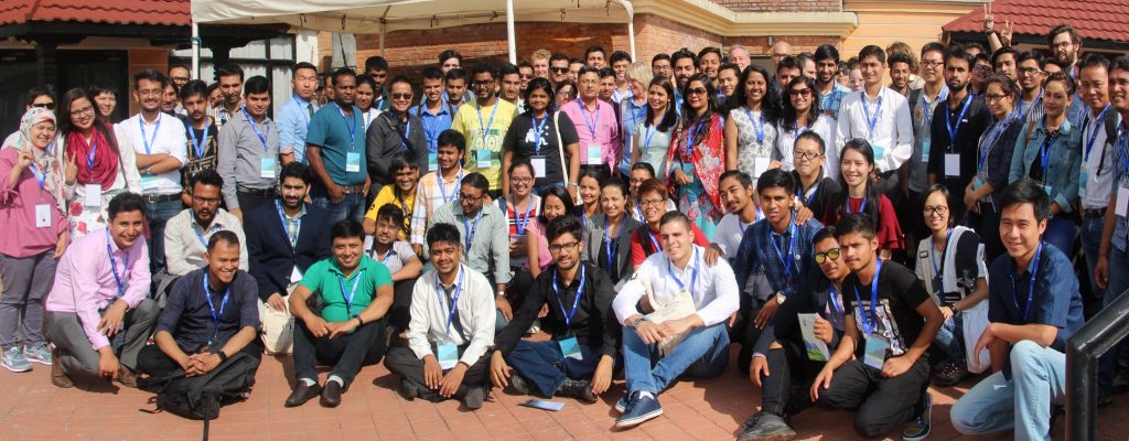
State of the Map Asia 2017 took place in Kathmandu last weekend (23-24 Sep 2017). 1
Mapping
- Pierre Béland tweets his analyses on OSM Contributors profiles vs Contributions (ie objects edited) based on the HDYC changesets classification.
- Ciarán Staunton wonders why the Bing Imagery in southern Africa has suddenly been re-aligned. A Microsoft employee makes it clear that the new images have not yet been adjusted to the offset
- Williaug GC initiates a discussion on the tagging mailing list with the question, whether
shop=doorshould be replaced bycraft=window_construction. - Mark Bradley asks in the Tagging mailing list on how to tag “agricultural centers”. Discussion ensues as there are multiple aspects to be considered.
- Ilya Zverev shares a proposal for Metro Mapping, with a hope to have a uniform way of mapping these features. Comments welcome.
- On the Tagging mailing list, SwiftFast proposes the tags
slogan=*for slogans andlogo=*for links to a company’s logo on Wikimedia Commons. Discussion threads: slogan, logo. - Simon Poole asks for opinions about the use of the tags
shop=appliancevsshop=electronics. - Selfish Seahorse started the discussion about swimming pool facilities mapping to clarify the tagging of the various cases.
- “westnordost” (the person behind the StreetComplete mobile phone app) started a discussion
 (automatic translation) about tagging cycleway where cyclists can go in both directions on a street that is oneway to motor vehicles.
 - Maripo published a new JOSM plugin “EasyPresets”, which helps with easy creation of your own personal tagging presets.
- Leigh Dodds writes about mapping wheelchair accessibility in the centre of Bath.
- Osmose checks now, whether
maxspeed=*andsource: maxspeed=*match and complains about e. g.maxspeed=30in combination withsource:maxspeed=DE:urban, because 50 km/h are allowed in Germany. - User erkinalp proposes a new tagging system to unify existing tags for all kinds of educational institutions. The new system would introduce some new tags but also change many existing tags.
- User erkinalp wants to propose a new tag for magnetic levitation trains. The tracks they use are incompatible with conventional rails.
 (automatic
 Community
- Adrien Pavie has created Whatosm, a tool that, depending on the difficulty level, desired time, and whether you want to map outdoors or at home shows different possibilities of how to contribute to OpenStreetMap. The source code can be found here, and you can help with the translation of the tool into different languages here.
- The OSM blog published the results of the projects related to OpenStreetMap of this year’s Google Summer of Code.
Imports
- User GeoKitten asks for help on the mailing list “imports” for importing building data in Allegheny County, Pennsylvania. This member is at the first stage of an import, while it’s good to disseminate that an import is in the works, it would be important to follow up as the import progresses. This might bring in more people to help this member and also be instructive about the many details of doing something this complicated.
- Vincent Frison has the intention to import building heights in Nice. More detailed information on the project can be found in the wiki page.
- Vivek Bansal asks for reviews of the San Jose, California sidewalk (pavement) import.
- To bring in line the 40,000 wikidata tags that do not fit the Wikipedia URLs Yuri Astrakhan suggests to resolve the problem with a script. On the mailing list, Osmose and MapRoulette are mentioned as alternatives which would involve the community.Yuri Astrakhan’s second post leads yet again to a longer discussion about missing wikidata tags and if they should be added automatically. In the mean time Yuri started a mechanical edit and received a bunch of complaints due to the bad quality of his edits.
OpenStreetMap Foundation
- The data working group asks mappers to participate in an opinion survey, concerning a policy for organized and paid mapping. On the talk mailing list there is a discussion. Christoph Hormann explained in his blog, why such a policy is needed.
- Michael Spreng asks for feedback from the OSM Foundation members on the Membership Working Group’s proposal of the Membership Fee Waiver Program.
- Dorothea from OSMF writes about joining the OpenStreetMap Foundation to help shape the future of OpenStreetMap. She emphasizes on this being an opportunity to be a voice in the governance of the Foundation – the organization which owns and maintains the servers, holds the license, runs the State of the Map, coordinates local chapters. Sign-up now!
Events
- [1] State of the Map Asia 2017 took place in Kathmandu, Nepal over the last weekend. It was a conference that got the OSM Asian community together in one place. There were 15 country presentations (1) which highlighted the current state of OSM in their own nations. Followed by some amazing talks on different OSM tools, research around OSM data, Nepal earthquake and the lessons learnt from that, a government panel discussing the co-relation between data, government and so much more.#SotMAsia was one of the top trending hashtags in Nepal. You can look up photos from the event here and here. Some of the presentations were livestreamed, find them here.
- State of the Map Asia 2018 is announced! This conference will be hosted in Bangalore, India.
- Prior to the start of State of the Map Asia in Nepal, there was a preconference mapathon held at the conference venue which aimed at mapping all the trails and buildings of Western Nepal.
- Launched by the association OpenStreetMap Cameroon, the State of the Map (SotM) Cameroun or National Geomatics Days announced by Jacques Landry Atangana via Facebook.
- All videos of the presentations at SotM 2017 in Japan are online. A link to the slides for each presentation is also included.
Humanitarian OSM
- Mapillary tweets about Microsoft sharing 4.9M images to help with disaster recovery in Florida and Texas.
- Mhairi O’ Hara has announced the release of version 3.0 of the Export Tool.
- In the context of hurricane Maria, the Humanitarian OpenStreetMap Team (HOT) has opened a task to map of buildings in Puerto Rico. The Guajataca Dam is at risk of collapse and the area underneath is being evacuated. At this time, the mapped areas have yet to be checked.
Another task was opened in connection with the earthquake in Mexico. Advanced mappers are welcome to help here.
Maps
- Stephan Bösch Plepelits reports on his blog, that the OpenStreetBrowser now shows excerpts from articles and images from Wikimedia Commons in the detail view. Wikipedia is found under the ‘Special’ menu item.
Licences
- SwiftFast asks the Legal-Talk mailing list for opinions on licence issues when publishing simple scripts on the OSM Wiki.
Software
- Saikat Maiti points out a new Android application called Disaster Reporting System to gather information regarding natural disasters.
- Frederic Rodigo announces on the mailing list Talk that Osmose-QA is experimenting by adding missing sign tags on OSM from Mapillary detected signs on pictures.
Releases
- Mapbox Plugins for iOS comes with a new traffic layer plugin for the Mapbox iOS SDK.
- The latest release of Mapbox Navigation SDK for iOS v0.8.0 comes with various improvements to guidance timing, voice instructions, and UI (including
name:pronunciationsupport)
Did you know …
- Rob Nickerson starts the discussion on the resurrected mailing list local-chapters on how to better collaborate in the future.
- MicroMappers reports about the work of Qatar Computing Research Institute (QCRI) to detect damages to buildings using a CNN (Convolutional Neural Networks) and imagery from UAVs.
- … the OSM Software Watchlist and the Boundaries-Map from wambacher?
Other “geo” things
- Indoor Navigation: The Next Frontier
Upcoming Events
| Where | What | When | Country |
|---|---|---|---|
| Lübeck | Mappingparty Lübeck | 2017-09-30 |  |
| Brisbane | West End Mapping Party, West End | 2017-09-30 |  |
| Ise | 伊勢河崎でマッピングパーティ | 2017-09-30 |  |
| La Paz | Mapas Digitales para Periodistas, El Alto | 2017-09-30 |  |
| Turin | Viverone mapping party, Viverone, Biella | 2017-10-01 |  |
| Budapest | OSM Meetup Budapest | 2017-10-02 |  |
| Essen | Mappertreffen Essen | 2017-10-04 | |
| Stuttgart | Stuttgarter Stammtisch | 2017-10-04 | |
| Montreal | Les Mercredis cartographie | 2017-10-04 |  |
| Dresden | Stammtisch Dresden | 2017-10-05 | |
| Salt Lake City | Mapping Night | 2017-10-05 |  |
| Dortmund | Mappertreffen Dortmund | 2017-10-08 | |
| Fukuchi Machi | 福智町の歴史・文化まち歩きプロジェクト~自分のチカラで世界中にタカラ発信!~ | 2017-10-08 | |
| Rennes | Réunion mensuelle | 2017-10-09 |  |
| Lyon | Rencontre mensuelle ouverte | 2017-10-10 | |
| Munich | Stammtisch | 2017-10-10 | |
| Rostock | Rostocker Treffen | 2017-10-10 | |
| Viersen | OSM Stammtisch Viersen | 2017-10-10 | |
| Berlin | 112. Berlin-Brandenburg Stammtisch | 2017-10-13 | |
| Jacou | Opération libre à Jacou | 2017-10-13-2017-10-15 | Hérault France |
| Boulder | State of the Map U.S. 2017 | 2017-10-19-2017-10-22 | |
| Buenos Aires | FOSS4G+State of the Map Argentina 2017 | 2017-10-23-2017-10-28 |  |
| Brussels | FOSS4G Belgium 2017 | 2017-10-26 |  |
| Lima | State of the Map LatAm 2017 | 2017-11-29-2017-12-02 |  |
| Yaoundé | State of the Map Cameroun 2017, lors des premières Journées nationales de la Géomatique | 2017-12-01-2017-12-03 |  |
| Bonn | FOSSGIS 2018 | 2018-03-21-2018-03-24 | |
Note: If you like to see your event here, please put it into the calendar. Only data which is there, will appear in weeklyOSM. Please check your event in our public calendar preview and correct it, where appropriate.
This weeklyOSM was produced by Anne Ghisla, Nakaner, Peda, PierZen, Polyglot, SK53, SomeoneElse, Spanholz, Spec80, TheFive, YoViajo, derFred, jinalfoflia, seumas.