16/07/2019-22/07/2019
ImproveOSM editor by telenav – proposals should be checked on the ground! 1 | © Telenav, JOSM – Map data © OpenStreetmap contributors
Mapping
- Marc Zoutendijk thinks
landuse=village_greenis being misused as a tag for all grass covered areas in villages. His post to the mailing list provides the detailed background to his view. - The mapping, by Amazon Logistics relying on their own GPS data, of service roads to buildings provoked much discussion in the Germany forum (some comments in German) and a user blog entry.
- StephaneP provided interesting background on the geodetic datum used by OSM: WGS84. He explained why it is not an accurate description of a position due to tectonic movement and use of differing, largely national, datums for imagery.
- A mapper complained
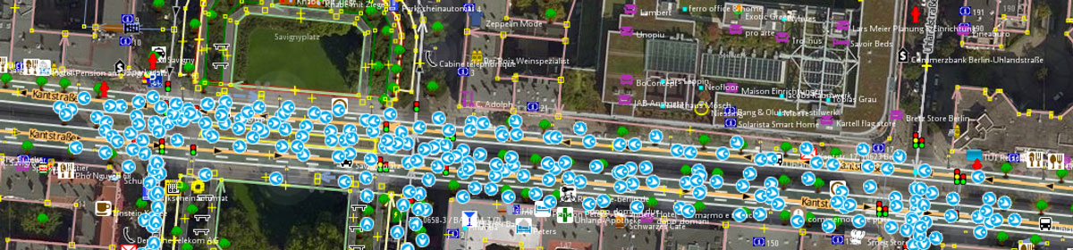
 (automatic translation) in the German forum that another mapper has mistakenly added a oneway tag to a road based on the suggestion of Telenav’s site improveosm.org. However, the issue was apparently one that all QA tools have in common: Hints are perceived as instructions and resulting changes are made without local knowledge.
 (automatic
 Community
- Christoph Hanser from the Trufi Association, an NGO for informal transport in emerging countries, asked (translation) on the German mailing list for volunteers who could help with adding route relations to OSM. However, he received questions about the maintainability and verifiability of the route relations as well as the concern, that an area with too many relations in comparison to the other data could scare off new mappers. He was pointed to the possibility of dealing with the routes outside of OSM using Pfaedle and GTFS-Flex.
- The OSM forum has been given a responsive (i.e. smartphone-capable) style, Air3, which replaces Victory.
Imports
- After the Thailand and Indonesia imports, Facebook plans to start another computer vision “import” in Malaysia.
OpenStreetMap Foundation
- Joost Schouppe, a member of the OSMF board, asks Foundation members whether the existing rules for becoming a local chapter should be changed.
Events
- The group OSM at SBB, formed by employees of the Swiss Federal Railways, will host (translation) a mapping party on 12 August 2019 in Freiburg/Fribourg.
- The German OSMF chapter FOSSGIS invites (translation) interested parties to the 13th FOSSGIS-OSM-Hacking-Event (translation) from 29 November to 1 December at the Linuxhotel (translation) in Essen, Germany
- The hands-on slides (translation) and video of FOSS4G HOKKAIDO held on 12 and 13 July were published. Related tweets are summarised here .
 (
(Humanitarian OSM
- Alex Glynn advertised the latest HOT newsletter and points to a new two minute tutorial on adding buildings to OpenStreetMap.
- The website undark.org published an article about how female cartographers and crowd-sourced Maps improve the lives of women in Latin America.
Maps
- Frank Schmirler shows on his Beacon Map all sorts of beacons and navigational aids in different modes. You may see real fire sectors or the picture from a mariner’s view marking your own position. A new feature allows an OSM background layer instead of Google Maps or a satellite image.
Licences
- The next OsmAnd version will attribute OSM better, with “Powered by OpenStreetMap data.” text on the loading screen.
Software
- On the Overpass-Turbo website you can now choose a Russian server (in settings): http://overpass.openstreetmap.ru/cgi/. Many users note that this server is significantly faster than others.
- Russian OSM user AlexPS created a “dark” theme for the online editor iD.
Programming
- azaadshatru has drafted instructions on how to set up a tile server with the OSM Bright map style, which represents the boundaries of India as required by Indian law.
- mmd’s GitHub issue to remove the Expanding Bounding Box API function, which was once required to upload a changeset, triggers an idea to block certain areas from being edited at all to prevent vandalism.
- If you ever wanted to turn your hobby into a career (and you are a US citizen) you might be interested in Development Seed’s job offer as Map Data Engineer.
Releases
- A new release of Cygnus+, a map comparison tool, is out: Cygnus+.
Did you know …
- … the tool Antipodes from Datadaptive? The tool shows you the point located on the opposite side of the world from any other position.
- … Surveillance under Surveillance?
- …that the Russian company Urbica created an interactive GULag History Map? (GULag – Main Directorate of Camps and Places of Incarceration)
- …that the Russian company NextGIS together with the Russian State Archive of Ancient Acts created a geoinformation system “Drawings of the Russian state of XVI-XVII centuries”?
OSM in the media
- “All the stations” YouTube channel are traveling around the Isle of Man vlogging and visiting all of the railway stations; having previously visited all the stations in England, Scotland and Wales, and more recently all those on the island of Ireland.
In the latest vlog they mention that there is no good mapping resource for the electric railway on the Isle of Man, save for OpenStreetMap. The presenters made a point, in the video, of thanking all the OSM contributors for their hard work in making the map so detailed.
Other “geo” things
- The Esri User Conference, which took place 8 to 12 July 2019 in San Diego, California, shows the winner of the 2019 Map Gallery.
- DuckDuckGo, the privacy-focused search engine, has added new features to its map services. The features have been added using Apple’s MapKit JS framework.
- Did you know what the maps of the future will be? Sergei Golubev thinks (translation) that they will be made as an app with augmented reality technology. Ilya Zverev suggests (translation) that they won’t exist anymore.
- Mapbox’ blog reports that the company has added two million boundaries, from different sources such as the US Census and European NUTS, to its Mapxbox Boundaries product.
- Minecraft Earth, an augmented reality game developed by Microsoft based on OSM data, could become a strong competitor to Pokemon Go. In the summer of 2019 you can register here for a beta test.
 (
(Upcoming Events
| Where | What | When | Country |
|---|---|---|---|
| Düsseldorf | Stammtisch | 2019-07-31 |  |
| Dumaguete | Pista ng Mapa 2019 | 2019-08-01-2019-08-03 |  |
| Bochum | Mappertreffen | 2019-08-01 | |
| Dresden | Stammtisch Dresden | 2019-08-01 | |
| Kyoto | OpenStreetMap誕生日 前祝い会! | 2019-08-04 |  |
| London | Missing Maps Mapathon | 2019-08-06 |  |
| Stuttgart | Stuttgarter Stammtisch | 2019-08-07 | |
| San José | Code for San José Summer Mixer [1] | 2019-08-08 |  |
| Cottbus | 134. Brandenburg-Berlin Stammtisch | 2019-08-09 | |
| Taipei | OSM x Wikidata #7 | 2019-08-12 |  |
| Bordeaux | Réunion mensuelle | 2019-08-12 |  |
| Salt Lake City | SLC Mappy Hour | 2019-08-13 | |
| Zurich | OSM Stammtisch Zurich | 2019-08-13 |  |
| Hamburg | Hamburger Mappertreffen | 2019-08-13 | |
| Munich | Münchner Stammtisch | 2019-08-14 | |
| Minneapolis | State of the Map U.S. 2019 [3] | 2019-09-06-2019-09-08 | |
| Edinburgh | FOSS4GUK 2019 | 2019-09-18-2019-09-21 | |
| Heidelberg | Erasmus+ EuYoutH OSM Meeting | 2019-09-18-2019-09-23 | |
| Heidelberg | HOT Summit 2019 | 2019-09-19-2019-09-20 | |
| Heidelberg | State of the Map 2019 [4] | 2019-09-21-2019-09-23 | |
| Dhaka | State of the Map Asia 2019 | 2019-11-01-2019-11-02 |  |
| Wellington | FOSS4G SotM Oceania 2019 | 2019-11-12-2019-11-15 |  |
| Grand-Bassam | State of the Map Africa 2019 | 2019-11-22-2019-11-24 |  |
Note: If you like to see your event here, please put it into the calendar. Only data which is there, will appear in weeklyOSM. Please check your event in our public calendar preview and correct it, where appropriate.
This weeklyOSM was produced by Mateusz Konieczny, Nakaner, Polyglot, Rogehm, SK53, Silka123, Softgrow, SunCobalt, TheSwavu, YoViajo, derFred, geologist, jinalfoflia.