Author: weeklyteam

주간 OSM 571

Sorry, this entry is only available in English, Čeština, Deutsch, Español, Français, Italiano, 日本語, Polski, Português, Русский, Turkish and 台灣中文.

22/06/2021-28/06/2021

lead picture

A natural language interface to search OSM – monuments in Hull [1] | © Simon Will NLMaps | map data © OpenStreetMap contributors

Mapping campaigns

  • CartONG hosted an online bilingual (FR/EN) mapathon on World Refugee Day on 21 June to map refugee locations. This event was organised jointly with MAMAPA, HuMap Trier and OSM Ghana.

Mapping

  • Wille Marcel produced some statistics about the usage of different editors in each region of the world over the past 10 years. He also provided some insights based on the data.
  • James Pain detailed what he has been mapping in the Riverside Estate, Colchester (England).
  • User Mapman029 has been concentrating their mapping on features which are likely to represent ecological corridors. Whilst doing so they remarked (fr) > en
    on how few hedges have been mapped in Brittany, and invited others to join in rectifying this omission on OSM.
  • fanfouer’s proposal on substation=*, to improve power substations and transformers mixing on the same node for small substations, awaits comments.
  • Pascal Neis introduced two quality assurance features to ‘How did you contribute to OpenStreetMap?‘ profiles. They now contain some information about the user’s reverted map edits and rollbacks carried out by the user. Pascal is asking for feedback.
  • Veniamin Veselovsky wrote a blog post on ‘An Automated Approach to Identifying Corporate Editing Activity’.

Community

  • As part of the Everywhere She Maps program, YouthMappers is launching an internship match program. This will help organisations match qualified YouthMappers students who identify as women and/or non-binary with internship opportunities. Details are contained in a Google Document.
  • Jerry Clough (OSM user SK53) marked the 10th anniversary of the East Midlands local group (UK) with some remarks about the group and their meetings.
  • Pedro Tharg described (pt) > en his personal journey to becoming an OSM mapper.
  • Rob Nickerson, from OSMUK, explained how 27 million addresses in the UK could be opened up using two existing open datasets and deriving address centroids, which can then be used for mapping (e.g., using MapComplete).
  • Robhubi wrote (de) > en about why he is turning away from Mapillary and towards Kartaview (formerly OpenStreetCam).

OpenStreetMap Foundation

  • Mikel Maron invited people who are part of a local chapter or a local community, putting together an organised project or developing software, to present it at an OSMF Board meeting.
  • Christoph Hormann described, in great detail the ‘good and bad things’ in the OSMF’s draft of the new attribution guidelines. The phrase ‘a few words’ in the title is no doubt intended ironically, after all there are more than 3,600 of them ;-).
  • One of the OSMF Board members has changed her name to Amanda McCann.

Local chapter news

  • FOSS4G/SotM Oceania are having a logo contest for their joint 2021 conference.
  • Jess Beutler, of OSM-US, provided advice on how OSM mapping can help emergency responders. Although the advice is pitched at US mappers, much is probably just as salient elsewhere. There are also a couple of examples of the direct benefits of using OSM in these situations.

Events

  • State of the Map 2021 is taking place online from 9 to 11 July. Here are the programmes for:

    SotM 2021 is present on Twitter and Youtube.

  • From 19 to 21 September, FOSS4G-IT 2021 (it) > en will be held online, organised by GFOSS.it and Wikimedia Italia.
  • Charles Millet and Antoine Riche, from the French association Mieux se Déplacer à Bicyclette, organised (fr) > en a bicycle parking themed two-day mapping party. Through the weekend, four hundred locations were added to OpenStreetMap and more than a hundred notes are (fr) still pending.
  • Ilya Zveryev provided an overview (ru) > en of State of the Map for Russian speakers.

OSM research

  • The team at HeiGIT has written a walkthrough on how to train your own building detector using ohsome2label and the TensorFlow Object Detection API. You can find all the necessary scripts and detailed walkthrough tutorials in the GitHub repo.
  • Users of the MeinGrün App in Dresden and Heidelberg are being asked one last time to take part in a survey and provide information for possible future development. On 28 June, HeiGIT and their research partners in Dresden, will present the results of the research (de) > en and the meinGrün (de) web portal at the Dresden Land Use Symposium (DFNS). The app is based on OSM data.
  • The team at HeiGIT has published a tutorial on how to analyse which country has the longest coastline, using OSM data. They used the ohsome platform, which makes OpenStreetMap’s full-history data more easily accessible for various kinds of OSM data analytics tasks.

Humanitarian OSM

Maps

  • Randall Munroe’s xkcd cartoon featured a map of US placenames easily confused with better known places.

switch2OSM

  • Neuland21 (de) is in the process of creating a ‘forest fire app(de) > en to help Brandenburg fire departments fight forest fires.

Licences

  • Peter Wells, formerly of the UK Open Data Institute, raised some interesting points on sui generis database rights and the EU Data Act. In the Twitter thread he points to a consultation response by Paul-Olivier Dehaye, which raises issues regarding copyleft licences such as ODbL. Dehaye notes that OpenStreetMap have not responded to the CEC consultation.

Software

  • [1] NL Maps provides a natural language interface to search OSM. It’s already been tested by Jez Nicholson (director of OSMUK) and Allan Mustard (chair OSMF)
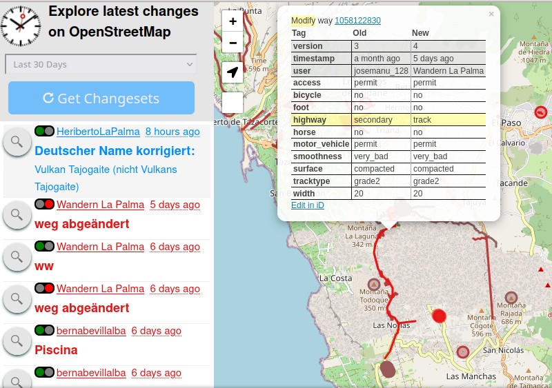
  • Miroslav Suchý created a script, greeter-osm, that sends greeting messages to new users in your region or country. It utilises Pascal Neis’s Latest OSM Contributors feed. The script is fully configurable using a config file and made to be run as a cron job. An Ansible role for easier deployment is provided. greeter-osm is based on a similar non-public script from the Slovak OSM community.
  • After a test run, user Escallic recommends mapping curved features by tracing with a mouse or a suitable touch gesture. To enable this they have released an open source patch for the iD editor. To avoid overloading drag operations this is enabled in-editor as a distinct mode.
  • Tom MacWright promises that Placemark will be the fast and powerful way to edit geospatial data.

Programming

  • The Regionalverband Ruhr has used the potential of HeiGIT’s openrouteservice (ORS) in a new QGIS extension. The tool, ‘Location and Route Optimisation of Addresses’, allows you to search and locate addresses and to find the optimal routes between them.
  • Matija Nalis has recently implemented RSS feeds to announce when the weekly created BitTorrent files (in total 428 GB) of the complete OpenStreetMap data are available to download.
  • CycleStreets have released an R package to interface with their routing API. Routes are returned with extensive metadata and, as with any client, access requires an API key.

Releases

  • The current version of QGIS (QGIS 3.20.0 ‘Odense’) was released on 18 June and is named after the third largest city in Denmark. This version has a number of data management improvements including basic support for coordinate epochs of dynamic reference systems. For a description of the other changes made you can read the change log.

Did you know …

  • CyclOSM? This is one of two bicycle maps featured as layers on the main OSM site.
  • … Anvaka has made a tool to render a map of all the streets of a city, in a free selectable two colour mode? The result can be saved for other purposes, such as printing on a mug.
  • … Erick De Oliveira Leal has a tutorial on using the Strava high resolution layer for OpenStreetMap (JOSM or iD)?
  • … the broad spectrum of services provided by the Heidelberg Institute for Geoinformation Technology (HeiGIT) in the form of technologies, projects and case studies?

OSM in the media

  • Techtimes presented the best Google Maps alternatives from a privacy perspective. Of course, OSM is number one.

Other “geo” things

  • The Guardian took a look at Cool Walks, which maps shady spots to guide Barcelona walkers along cooler routes. Cool Walks aims to help pedestrians avoid dangerous heat and find public drinking fountains. Last year we reported on a similar service for Heidelberg and Dresden.

Upcoming Events

WhereWhatOnlineWhenCountry
OSM Africa Monthly Mapathon: Map Nigeria osmcalpic2021-07-02 – 2021-08-02
Bogotá Distrito CapitalResolver notas de Bogotá creadas en OpenStreetMap osmcalpic2021-07-03flag
臺北市OpenStreetMap x Wikidata Taipei #30 osmcalpic2021-07-05flag
Missing Maps London Mapathon osmcalpic2021-07-06
Landau an der IsarVirtuelles Niederbayern-Treffen osmcalpic2021-07-06flag
StuttgartStuttgarter Stammtisch (Online) osmcalpic2021-07-06flag
JOSM Training and Mapathon Hosted by the YouthMappers Validation Hub osmcalpic2021-07-07
Berlin157. Berlin-Brandenburg OpenStreetMap Stammtisch osmcalpic2021-07-08flag
Nordrhein-WestfalenOSM-Treffen Bochum osmcalpic2021-07-08flag
State of the Map 2021 osmcalpic2021-07-09 – 2021-07-11
Saint-LouisGeomatica Mapathon: Réserve de Guembeul osmcalpic2021-07-10 – 2021-07-11sn
Bogotá Distrito CapitalResolver notas de Bogotá creadas en OpenStreetMap osmcalpic2021-07-10flag
Missing Maps Online Mapathon osmcalpic2021-07-12
20095Hamburger Mappertreffen osmcalpic2021-07-13flag
AlbuquerqueMapABQ July virtual meetup osmcalpic2021-07-16flag
Bogotá Distrito CapitalResolver notas de Bogotá creadas en OpenStreetMap osmcalpic2021-07-17flag
DerbyEast Midlands OSM Pub Meet-up : Derby osmcalpic2021-07-20flag
Bonn141. Treffen des OSM-Stammtisches Bonn osmcalpic2021-07-20flag
BerlinOSM-Verkehrswende #25 (Online) osmcalpic2021-07-20flag
LüneburgLüneburger Mappertreffen osmcalpic2021-07-20flag
LüneburgLüneburger Mappertreffen (online) osmcalpic2021-07-20flag
BerlinMissing Maps Ärzte ohne Grenzen Mapathon osmcalpic2021-07-21flag
Virtueel treffen OpenStreetMap NL osmcalpic2021-07-24

Note:
If you like to see your event here, please put it into the OSM calendar. Only data which is there, will appear in weeklyOSM.

This weeklyOSM was produced by Lejun, Nakaner, Nordpfeil, SK53, TheSwavu, YoViajo, derFred, richter_fn.