21/09/2021-27/09/2021

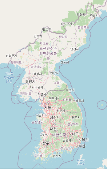
Korea presents own website, own tile server, and a taginfo instance [1] map data © OpenStreetMap contributors
Mapping
- jgruca shared details on the design choices underpinning the new way rendering of golf courses in the latest Carto release.
- qeef wants to inspire us by mapping highway radars and mirrors using the Damn-Project.
- The German OSM chapter FOSSGIS received
>
a complaint from the local authorities about the mapping of Mandichosee, a popular reservoir near Augsburg. A large increase in people intruding into an area dedicated for the protection of breeding birds has occurred. This is partly due to features on OSM, and the way they are displayed in the Komoot application.
- Requests have been made for comments on the following proposals:
boundary=border_zonefor tagging areas near borders that have special restrictions on movement.man_made=boreholeto map a narrow shaft bored in the ground for purposes not covered by the existing tagsman_made=petroleum_wellorman_made=water_well, or the proposedman_made=injection_well.man_made=injection_wellto tag a narrow shaft bored in the ground for the purposes of forcing in a fluid.
- Voting is underway for the following proposals:
currency:crypto:*=yes,no, to extend thecurrencykey to support cryptocurrencies (till Friday 22 October).foraging=*to indicate whether or not foraging for plants/fruit/fungi etc. is permissible for a given location or plant (till Wednesday 20 October).natural=fumaroleto map an opening in our planet’s crust, which emits steam and gases (till Tuesday 12 October).landuse:secondary=*for mapping multiple land uses in a single area (till Tuesday 12 October).
Community
- The new Korean OpenStreetMap Community presented their website, their own tile server, and a Taginfo instance, summarising the Korean regional OpenStreetMap database, running on the osm.kr
>
server (including publicity for weeklyOSM).
- ztzthu defended himself, in his diary, against what he considers to be unobjective and insulting accusations against China and Chinese mappers, and refuses to accept that an accusation of vandalism is not directed sweepingly against China as a country and sweepingly against ‘the Chinese mappers’.
OpenStreetMap Foundation
- The OSM Tech team announced that new server infrastructure has been installed in Dublin, Ireland.
Events
- OSM France are co-ordinating
activities to celebrate their tenth anniversary.
Education
- Gregory Marler has created a video tutorial in which he explains how to add churches, mosques, synagogues, temples and other places of worship to OpenStreetMap. He is using Field Papers and the iD Editor.
Maps
- Several professional geologists and vulcanologists have commented on Twitter about the speed of mapping during the current volcanic eruption on La Palma.
Software
- Trufi has developed and launched a ‘one click, all modes’ journey planner app — car, carpool, taxi, bus, train, bike share, cargo bike, personal bike, and more — for Herrenberg, Germany. Based on Trufi Core system, new features developed for Herrenberg will be ported to apps used in developing countries.
Programming
- OSMF Board Member Mikel Maron proposed, via a GitHub pull request, that long-time iD maintainer Bryan Housel be removed from the list of interim maintainers.
Did you know …
- … how many people currently produce the corresponding language version of weeklyOSM week after week? The languages in alphabetical order:
Language CZ DE EN ES FR IT JA KO PL PT-BR PT-PT TR ZH Editors 1 6 7 3 4 5 2 1 3 1 2 10 2 - … that colonial cartographers hid the profile of an elephant in contour lines of a map created during a 1923 survey of Ghana (known then as the Gold Coast)?
- … StreetComplete, the Android app for your craftmapper activities? The list of all possible tasks can be found in the OSM wiki.
- … about osm.wikidata.link, a website that allows users to easily add Wikidata tags to elements in OpenStreetMap?
Other “geo” things
- The Mapbox Workers Union Twitter account has complained about apparent retaliation by Mapbox of the union organisers, following the loss of the union recognition vote (as we reported earlier).
- A troll has mapped
>
a trollface by posting spam reports of bad smells emanating from a landfill in Kasubia (the area around Gdansk). The ‘Smell Map’ has been online for 8 years as a community initiative.
- xkcd came up with another geographical cartoon. The OSM reddit had a small discussion about it.
Upcoming Events
Note:
If you like to see your event here, please put it into the OSM calendar. Only data which is there, will appear in weeklyOSM.
This weeklyOSM was produced by Nordpfeil, PierZen, SK53, Sammyhawkrad, TheSwavu, YoViajo, conradoos, derFred.
Der Link zur Abstimmung von “currency:crypto:*=yes,no” ist falsch, der richtige lautet https://wiki.openstreetmap.org/wiki/Proposed_features/Cryptocurrencies_with_payment_tag