14/09/2021-20/09/2021
b-unicycling: Survey → StreetComplete → Notes → Editor → OSM Data [1] © b-unicycling | map data © OpenStreetMap contributors
Mapping
- Requests have been made for comments on the following proposals:
natural=fumaroleto map an opening in a planet’s crust, which emits steam and gases.outlet=*to map culvert or pipeline outlets with more details.historic=creameryfor tagging an industrial building where butter, cheese or ice cream was made from milk.
- The proposal
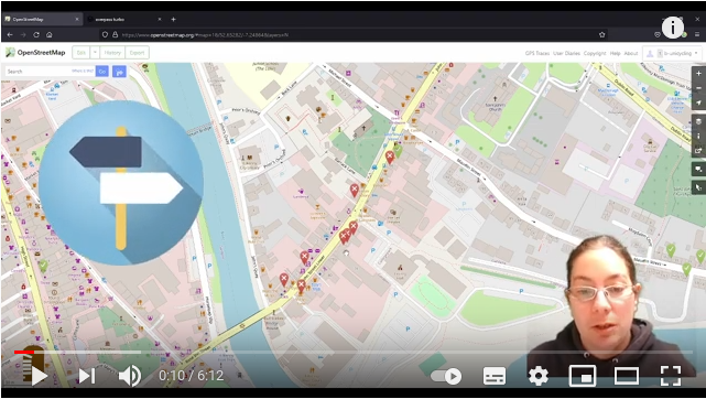
club=cadet, intended to be used to map the locations where various Youth Cadet groups meet, together with details of each group, has been approved with 15 votes for, 0 votes against and 1 abstention. - [1] Anne-Karoline Distel aka b-unicycling, an Irish craftmapper, showed in a video how to capture details of vacant properties in OSM. When walking on site, she uses StreetComplete to leave notes in OSM, which she then edits in iD.
- Carl Myhill complained to Komoot that it was routing cyclists in Richmond Park (London) on paths where cycling is forbidden, and subject to a £60 fine. Komoot requires formal notification of such issues and this was provided by the Royal Parks. In the UK ways mapped as track, service, or path cannot be assumed to allow any access mode other than private without other explicit tagging. Komoot, however, does not follow these defaults.
- Over a period of five days, participants of University Battle Mapping 2021 mapped over 93,000 buildings in Indonesia.
- Barry McGuire suggested a large scale revision of how the
highway=trunkandhighway=primarytags are used in the UK, including an associated proposal on the wiki. Unfortunately, instead of assessing feedback on the mailing list, and the wiki, he made a number of edits following his new scheme. Judging by changeset comments these were not popular and have now been reverted. - On the forum NicoHood asked about using the
class:bicyclekey for the left and right sides of highways. Most responses suggest using alternative, more objective, tags. - LysSioS reported
 >
>
that they have finished mapping addresses in the commune of Alès. Mapping rural addresses proved to be much more time consuming than urban ones. - mariotomo described in detail how to capture missing road sections using Strava’s low-res heatmap. However, he notes slightly ironically: ‘The mapping practice described here is completely manual, and its speed is obviously inversely proportional to the desired precision’.
- mdroad has come up with a decision matrix for classifying roads. For beginners, the wiki pages Highways and Highway_tagging_samples/out_of_town with their pictures are also very helpful.
- Reddit user sporesofdoubt has now completed micro-mapping the 183 city parks in Phoenix, Arizona over the summer (we reported them reaching the 100 park milestone earlier).
 >
> 
Community
- The recordings of HOT’s webinar Local OSM Community Building: Tips, Tricks and Challenges are now available.
- cmoffroad outlined their experience of being a new OSM mapper in Thailand. AlaskaDave, nitinatsangsit and Bernhard Hiller tried to ease the frustrations of the beginner with their local knowledge.
- Free Local Mappers from Guinea, in its drive to promote GIS and openness of spatial data, recently conducted > a series of GIS and remote sensing training sessions for employees of an international firm based in Conakry.
- The State of the Map conference has begun uploading videos from July to YouTube and media.ccc.de. The talks that had audio translations into other languages will be uploaded when they have been finalised by the volunteer translators.
- Trufi Association has hired a staff of five professionals, graduating from the public transport mapping organisation’s two-year run as an all-volunteer NGO.
- User Tirkon complained > , on the German forum, about OSM tiles not refreshing. The ensuing discussion covers a lot of ground regarding how map updates get to users’ screens.
 >
> OpenStreetMap Foundation
- The Engineering Working Group of OSMF is looking for people with knowledge of the technologies used in OSM’s key systems: Rails port, Ruby on Rails in general, and the cgimap implementation of the OSM API. Knowledge of user interface design would be also welcome.
Humanitarian OSM
- OSGeo and HOT signed a memorandum of understanding with the goal of fostering the use of open-source geospatial software, to enable participatory community-driven development.
Maps
- The French air quality observatory ATMO’s Atmo Data released a map showing measured data nationwide which uses OpenStreetMap as a baselayer.
- Tracestrack is inviting people to trial its tile service. Users can do this for free until March 2022. The map is based on the OSM-Carto style, with some unique characteristics: support for several extra tags, such as
highway=busway,embankment=yes, andlanduse=aquaculture, semi-transparent highway areas, separated language labels and 3D buildings. Unfortunately the appropriate attribution is hidden.
switch2OSM
- SomeoneElse has provided additional documentation for building a tile server on Ubuntu 21.04. This is not a long-term support release so Ubuntu 20.04 LTS is still the preferred platform for production. He also notes a couple of issues which may occur whilst following these instructions.
Open Data
- The website datos.gob.es, a platform where the Spanish government promotes open data, has included the Organic Maps > app in its catalogue, highlighting that it is an open source app and is based on OpenStreetMap data.
 the
the Licences
- Owen Boswarva reported that open data on power infrastructure in the UK are scheduled for release in October. Jo Walsh (ultrazool) asked about which licence would be used, resulting in a short discussion about the suitability of various open licences for non-government open data.
Software
- Just in time for the beginning of autumn in the northern hemisphere, the OpenSnowMap for mobile devices has been comprehensively revised.
Programming
- The Overpass API Python Wrapper project is looking for a new maintainer. Martijn van Exel started this project 7 years ago, but he has indicated that he does not have the time to maintain it any more. The project has been starred on GitHub more than 260 times.
Did you know …
- … the English county of Devon has adopted special notation on road signs? The goal is to indicate that specific roads or routes are not suitable for various types of vehicles, including those towing caravans.
- … the wiki page on homonymous keys? The page is largely maintained by Minh Nyugen, and it identifies keys that mean different things according to how they are used.
- … the complete tools collection for OpenStreetMap built by Pascal Neis?
Other “geo” things
- GeoHipster is planning to publish a calendar again for 2022 and is asking for submissions of your maps.
- Ars Technica reported on new technical analyses of the Vinland Map (of the North American Atlantic coast), long suspected of being a fake. The new data remove any residue of doubt that it is, indeed, a fake. X-ray fluorescence spectroscopy was used to analyse the elemental composition of the entire map. This confirmed the presence of titanium dioxide, a pigment which only started being used in the 1920s, throughout the lines and text of the map. A true medieval gall ink would have had considerable quantities of iron instead.
- Jdanni’s diary is less about whether smartphone track logs pollute the OSM map, but much more about GNSS position accuracy in various scenarios reported in the links.
- The Thermal Energy Company of Gdynia has published >
a map showing thermal energy losses across the city and adjacent communities. - Yarik32 has written > a tutorial on how to create OSM-based memes using Overpass Turbo and QGIS.
 >
>  >
> Upcoming Events
| Where | What | Online | When | Country |
|---|---|---|---|---|
| OSM Africa Monthly Mapathon: Map Malawi | 2021-09-04 – 2021-10-04 | |||
| FOSS4G 2021 Buenos Aires – Online Edition | 2021-09-27 – 2021-10-02 | |||
| Bremen | Bremer Mappertreffen (Online) | ✓ | 2021-09-27 |  |
| Grenoble | Mapathon Missing Maps – Cartographier des cartes humanitaires sur un mode collaboratif et libre. | 2021-09-28 |  | |
| San Jose | South Bay Map Night | ✓ | 2021-09-29 |  |
| Derby | East Midlands OSM Pub Meet-up : Derby | 2021-09-28 |  | |
| Bruxelles – Brussel | Virtual OpenStreetMap Belgium meeting | ✓ | 2021-09-28 |  |
| okres Žilina | Missing Maps mapathon Slovakia online #4 | 2021-09-30 |  | |
| 京田辺市 | 京都!街歩き!マッピングパーティ:第26回 Re:一休寺 | 2021-10-02 |  | |
| 臺北市 | OpenStreetMap x Wikidata Taipei #33 | 2021-10-04 |  | |
| Greater London | Missing Maps London Mapathon | 2021-10-05 | | |
| Landau an der Isar | Virtuelles Niederbayern-Treffen | ✓ | 2021-10-05 | |
| Stuttgart | Stuttgarter Stammtisch (Online) | 2021-10-05 | | |
| Greater London | London pub meet-up | 2021-10-06 – 2021-10-07 | | |
| Hlavní město Praha | Online validation mapathon | ✓ | 2021-10-07 |  |
| Nordrhein-Westfalen | OSM-Treffen Bochum (Oktober) | 2021-10-07 | | |
| UN Mappers: MaPathon – le Università a servizio della cooperazione internazionale | 2021-10-08 | |||
| Berlin | 160. Berlin-Brandenburg OpenStreetMap Stammtisch | ✓ | 2021-10-08 | |
| Henrietta Township | Journey to the Centers of Michigan | 2021-10-09 | | |
| Zürich | OSM-Treffen Zürich | 2021-10-11 |  | |
| Hamburg | Hamburger Mappertreffen | 2021-10-12 | | |
| OpenStreetMap Michigan Meetup | 2021-10-15 |
Note:
If you like to see your event here, please put it into the OSM calendar. Only data which is there, will appear in weeklyOSM.
This weeklyOSM was produced by Nordpfeil, PierZen, SK53, Strubbl, TheSwavu, YoViajo, arnalielsewhere, derFred.
You spelled Jidanni wrong.
“Im Vereinigten Königreich kann nicht davon ausgegangen werden, dass Wege, die als „track“, „service“ oder „path“ kartiert sind, ohne weitere explizite Kennzeichnung eine andere Zugangsart als die private zulassen. Komoot hält sich jedoch nicht an diese Vorgabe.”
da sollte man m.E. weniger Komoot den Vorwurf machen, in OSM sind highways wie path ohne weitere tags erstmal öffentlich und wenn es anders sein soll, dann muss man Access-tags setzen. Wenn die Mapper in jedem Land eigene und vor allem andere bzw. gar gegensätzliche Regeln aufstellen würden, dann könnte man OSM bald vergessen. Solange es nur in UK gemacht wird, funktioniert halt dort das Routing mit den meisten apps nicht.
The Jidanni item reads like it starts in the middle of the story. Who is this person and why are you evaluating her/his diary? What made you (or anyone) think that the diary was saying that “smartphone track logs pollute the OSM map”? Why did you change your mind? What do other people think?
Most important, how did is this person’s diary and their views stimulate this very odd contribution to the OSM Weekly? How about some context!
It’s me, the miracle whiz kid!
Hi Charlotte, i think weeklyOSM is not about giving and explaining context. It is about showing what is going on in the OSM universe. Maybe you can direct some questions to the comments of the diary entry itself?
The decision of the author of this item to add it to weeklyOSM might be to provoke thinking about the view of this article’s content. Nothing special about the person who wrote the article. I think there are a lot of people who are monitoring all blog posts being published to the OSM blogs. This is easily possible via RSS subscription.
@Dieterdreist If I can get it right for cycle.travel (staff: me, part-time) then I think Komoot, with a full-time staff of 75 and numerous freelance employees, can be reasonably expected to put a tiny bit of effort in.