06.06.2023-12.06.2023

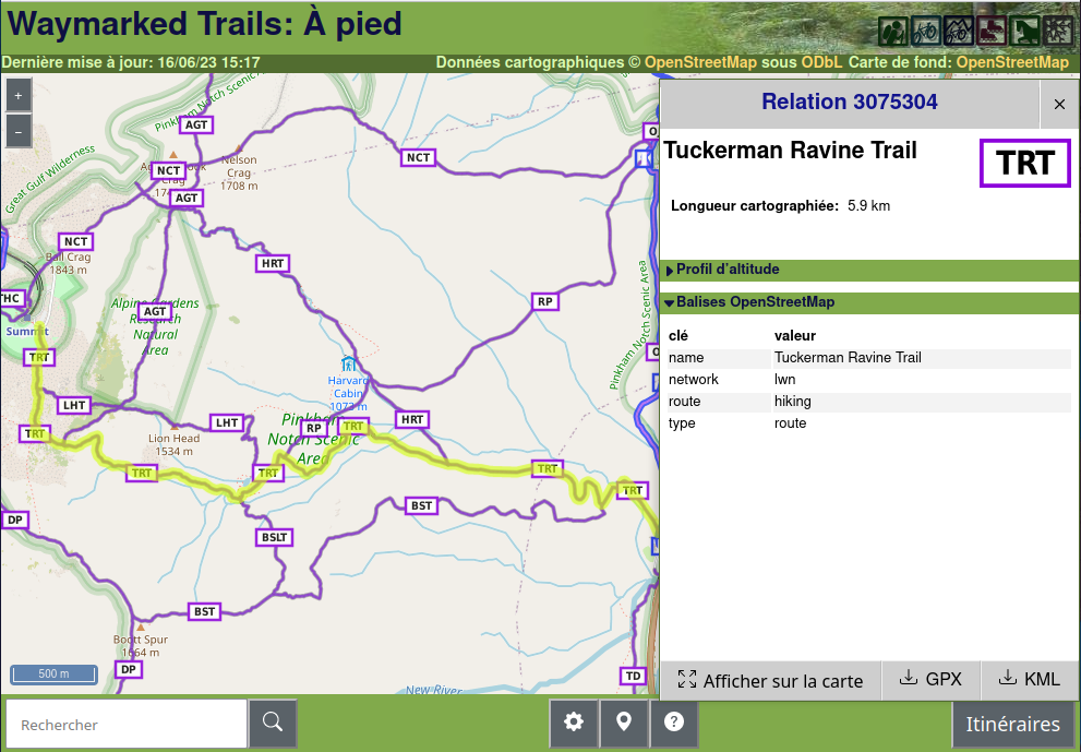
Waymarked trails — туристические маршруты для пеших, велосипедных, конных и других прогулок [1] © waymarked trails | Данные карты © Участники OpenStreetMap
Картографирование
- Анна-Каролина Дистель рассказала о станциях пополнения запасов питьевой воды и записала ролик о том, как создать для них пресет в OsmAnd.
- Пользователь publicerination импортировал набор данных о граффити в Сан-Франциско.
- Идёт голосование:
- предложение отказаться от
maxspeed:seasonal:winterв пользуmaxspeed:conditionalс@ winter(до 4 июля)
- предложение отказаться от
Картографические акции
- Команда Champs-Libres рассказала об обозначении доступности ж/д платформ.
Сообщество
- Пользователь adreamy обобщил ►
сходства и различия между
emergency=assembly_point(место сбора или временное убежище),bunker(более надежное убежище) иamenity=shelter(убежище от плохой погоды). - DW Chung примет участие в Google Summer of Code и будет работать над Python-обёрткой для OSRM (Open Source Routing Machine).
- JM-Lemmi обновил все тропинки леса Weinsberger Berge, Германия, проехав для этого на электровелосипеде 515 км.
События
- На сайте OSMScience 2023 (о котором мы сообщали ранее) теперь можно подать заявку на доклад (до 1 августа).
Карты
- Крис Вонг сделал интерактивную карту, которая показывает изохроны пути от выбранной вами станции Нью-Йоркского метрополитена, используя данные GTFS из Управления городского транспорта Нью-Йорка и библиотеку Turf.js.
Программирование
- Кшитиджрай Шарма исследует возможности Segment Anything Model для обнаружения объектов на аэроснимках и последующего отображения их в редакторах OSM.
- ZeLonewolf рассказал как запустить собственный сервер векторных тайлов OpenMapTiles на AWS за 20 долларов в месяц.
Релизы
- Июньское обновление Organic Maps с поддержкой импорта GPX треков!
А вы знаете …
- [1] … о Waymarked Trails, сайте показывающем отмеченные в OSM туристические маршруты? Сайт может показать уровень сложности, символы троп, профили высот маршрутов и экспортировать из в форматы kml и gpx.
Другие “гео” события
- Натали Стечисон (CBC News) обсудила снижение навыков чтения карт в эпоху GPS.
- С 2007 года между Германией и Швейцарией ведутся переговоры ►
об уточнении границы проходящей по Высокому Рейну. После реконструкции моста через Рейн и новых замеров геодезистов обнаружилось, что границв переместилась на 8 м в сторону Швейцарии.
- gontsa показывает спутниковые снимки Sentinel-2 затопленных территорий после разрушения плотины Каховской ГЭС.
Предстоящие события
Примечание: Если вы хотите видеть своё мероприятие здесь, добавьте его в календарь. Данные оттуда автоматически появятся в еженедельнике. Не забудьте указать город и страну.
Над этим выпуском работали: MatthiasMatthias, Strubbl, TheSwavu, TrickyFoxy.