22.12.2020-28.12.2020

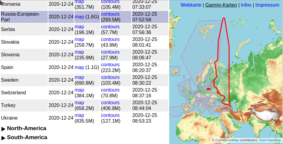
OpenTopoMap: Garmin-карты для всего мира 1 | © OpenTopoMap | map data © OpenStreetMap contributors
О нас
- Благодарим всех читателей вестника от имени команды weeklyOSM и поздравляем с Новым 2021 годом!
Картографирование
- Предложения, ждущие комментариев:
water=reservoir: для водохранилищ, вместоlanduse=reservoir,highway=cart_path: для дорожек, по которым ездят машины для гольфа,traffic_calming=circle_bumps: для лежачего полицейского, но не единого, а в виде множества кружочков,- Power storage: попытка систематизировать способы хранения энергии,
addr:range: уточнение, как интерпретировать содержимоеaddr:housenumberс дефисом (например,addr:housenumber=190-196),spring:name: для имени родника.
- Идёт голосование:
man_made=pump: разнообразные насосы,- Rescue Stations: расширение списка значений
emergency=.
- Голосование закончено:
hazard=: принято, 35 голосов за и 0 против,vaccination=: принято, 25 голосов за и 0 против.
- Андерс Торгер спрашивает в списке рассылки, нужно всё-таки мапить нечёткие области или нет. Под такими областями он понимает именованные плато, полуострова и подобные объекты.
- Карлос Брайс написал
>
простую инструкцию по редактированию OSM c помощью приложения «Osm Go!».
- Тейлор Смок добавил в JOSM-плагин Mapillary новый режим «Smart Edits», позволяющий быстро добавлять автоматически распознанные объекты. При клике на маркер теперь появляется диалог с уже заполненными полями.
- Польские мапперы поставили рекорд, закрыв за декабрь более 2000 заметок. Пользователь eBin писал о нужности этой работы и личным примером воодушевлял других. Посмотрите статистику по заметкам в своей стране и не забудьте тоже закрыть хоть немножко.
- Пол Дютрон (polo0000) сравнил
>
данные OSM с лионским официальным набором данных о пунктах сбора стеклотары. Координаты пунктов оказались точнее в OSM, но туда оказалась внесена только треть этих пунктов.
- Тобиас Джорданс рассказал о велокреплении для камеры, которое он придумал для Mapillary-съёмок.
- Map Bundles — новый сервис от компании Protomaps, позволяющий скачивать векторные тайлы, данные на которых обновляются практически синхронно с данными OSM. Есть примеры HTML и стилей. Более подробно можно почитать в дневнике Брендона Лиу.
Сообщество
- Джикка Дефиньо рассказывает о разочаровании, которое испытывают некоторые мапперы-новички при взаимодействии с сообществом. Она даёт несколько советов, например, использовать хештег #newbie в описаниях правок.
Местные отделения OSMF
- Вдохновившись французским Projet du mois
>
и немецким Wochenaufgabe, OSM US запустило похожий проект «12 месяцев OSM». Тема января — снегоходные и лыжные трассы, а также зимние аварийные маршруты.
Гуманитарный OSM
- Огужан Эр рассказал о работе организации Yer Çizenler, выполняемой на средства от HOT. Планируется добавить поддержку турецкого языка в инструменты для работы с OSM, а также увеличить штат добровольцев.
- Организация Yer Çizenler выложила собранные данные, полученные после недавнего землетрясения в Эгейском море.
- Адхитья Дидо Видьянто пишет о результатах деятельности Тихоокеанского отделения.
- Джеффри Катерегга делится своими мыслями о локализации работы с сообществами с помощью организации региональных центров.
Карты
- Вальтер Нордманн (Wambacher) подготовил карту здравоохранения, отображающую больницы, аптеки и центры вакцинации.
- [1] Начиная с 25 декабря OpenTopoMap публикует карты для устройств Garmin, покрывающие все регионы мира.
Программы
- «Санта: успеть за 15 минут» — игра от автора A/B Street, в которой вам нужно успеть доставить подарки в городе Сиэтл. Вы получаете больше очков при доставке в густонаселённые районы, а пополнять запас подарков нужно в магазинах. Есть приложения для Windows, Mac и Linux, а также можно поиграть прямо на сайте (но могут быть проблемы со скоростью и не будет музыки).
- В продолжение новости о выпуске MAPS.ME с урезанным функционалом (#544): в треде на HackerNews всё ещё идёт обсуждение различных альтернативных вариантов.
- WHODIDIT заработал снова после обновления ПО на сервере.
Релизы
- Продолжается работа по развитию StreetComplete. Там улучшился интерфейс, стало можно отмечать факт закрытия POI прямо из приложения, а также максимальная разрешённая высота теперь спрашивается для дорог, которые проходят под мостами.
А вы знаете …
- … что поддержка Adobe Flash заканчивается в начале 2021 года? Перестанут работать приложения, использующие эту технологию, и среди них — Potlatch 2. На замену ему можно скачать Potlatch 3, использующий Adobe AIR и работающий на Windows и Mac (поддержка Linux тоже планируется).
- … о списке британских объектов, которые, скорее всего, именованы, но у которых нет тега
name=? - … о списке OSM Editor Layer Index, содержащем подложки, которые можно использовать при редактировании OSM? Его эквивалент для JOSM — на соответствующей вики-страничке.
- … о простом калькуляторе, показывающем длину геодезической линии между точками на карте? Кроме этого, калькулятор может рассчитать расстояние до горизонта или расстояние от точки до линии.
- … что у MapRoulette есть собственный блог?
Другие “гео” события
- Вот уже более ста лет Колледж короля Вильгельма, частная школа на острове Мэн, проводит среди учеников адскую викторину на общую эрудицию. Изначально ученики проходили тест дважды: первый раз — в последний день перед рождественскими каникулами, а затем ещё один, после каникул, во время которых они могли искать ответы на уже известные им вопросы. Обычно в тесте есть вопросы на знание географии (например, в этом году это третья из восемнадцати групп вопросов), впрочем, они ничуть не проще, чем все остальные. Средний балл при первом прохождении теста составляет 2 из 180, а лучшие результаты — в районе 50.
- Анализ данных с метеостанций около Эвереста показывает, что ощущаемая высота может меняться в пределах 740 метров. Это значит, что К2 может казаться выше, чем Эверест.
- В eBikeNews появился обзор
>
Bryton Rider 750 — нового велокомпьютера с навигационной системой.
- Австралийский филиал The Guardian подготовил подборку забавных (и иногда не слишком приличных) австралийских топонимов.
- Geolab, подразделение американского университета «Колледж Вильгельма и Марии», выложило годовой отчёт о своей работе. Geolab обеспечивает работу сайта GeoBoundaries, а также проводит исследования в области машинного обучения.
Предстоящие события
Примечание: Если вы хотите видеть своё мероприятие здесь, добавьте его в календарь. Данные оттуда автоматически появятся в еженедельнике. Не забудьте указать город и страну.
Над этим выпуском работали: Nordpfeil, rogehm, TheSwavu, richter_fn.