14/03/2023-20/03/2023
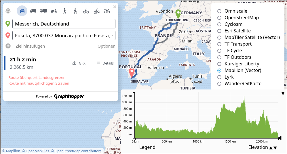
GraphHopper’s new Routing Engine 7.0 [1] | © GraphHopper © Mapilion © OpenMapTiles | map data © OpenStreetMap contributors
Breaking news
- The public meeting of the OSMFoundation on Thursday, 30 March 2023 at 13:00 UTC was, as usual, only announced last Friday. Severin Menard has already summarised his remarkable thoughts on the agenda in a blog post. There are also already some reactions in the comments.
Mapping
- Valerie Norton stumbled across a horse corral (a fenced area for holding horses and other stock) and wondered how to map it. She only found one other reference in the OSM help forum, which led her to choose
tourism=trail_riding_stationfor this particular example. - Valerie also asked how to tag areas where camping is prohibited.
- Requests have been made for comments on the following proposals:
- a redrafted
landcover=*version 2 to formalise the usage of the keylandcover=*and deprecate a number oflandusetags. crossing:horna tag onrailway=level_crossingandrailway=crossingnodes to denote that the crossing is subject to non-standard train horn operations.
- a redrafted
- The proposal
 ► for standardising the mapping of Parque Escolar in Portugal was approved unanimously, with 9 votes in favour.
 ►
►
Community
- The OpenStreetMap blog reviewed the major events held by the Local Chapters and Communities WG in 2022, and provided video links to online sessions of the Local Chapters Congress held in November (as we reported earlier).
- The Trufi Association is looking for a Technical Writer / Documentation Writer to create tutorials and guides on customising their app and setting up the backend. The Trufi Association supports OSM communities, and their applications use OSM data.
- YoViajo recommended ► the use of certain tags to label health infrastructure in Bolivia. Comments added by user 5m4u9 are worth considering.
 ►
►OpenStreetMap Foundation
- The OSMF welcomed TomTom, their first Platinum Corporate Member. They are happy to announce that TomTom is joining them as their first platinum tier corporate member. TomTom’s contribution provides crucial direct financial support to OSM operations and infrastructure, which is essential to accompany the growth and ensure the long-term sustainability of the world’s largest crowdsourced geospatial project. Read more on TomTom’s announcement.
Events
- The FOSSGIS 2023 conference talks are now available online.
- In 2023, OpenStreetMap will participate once more as a mentoring organisation in the Google Summer of Code, a program to bring new contributors into open source software development. Originally targeted at students, the program now also accepts people new to open source in general. Applications are open until Tuesday 4 April. Visit the GSoC 2023 wiki page to learn what the OSMF is looking for and browse their project ideas.
- The team developing the RapiD editor at Meta are hosting three days of webinars for the RapiD 2.0 launch. Each day is a webinar that is time zone friendly for Europe/Africa/Middle East (4 April), Americas (5 April) and Asia-Pacific/Oceania (6 April). The new RapiD editor will be demonstrated and Q&A with the team will follow.
- OpenStreetMap France announced that their annual State of the Map France conference will take place from 9 to 11 June in Marseille.
 online.
Education
- UN Mappers have started their training course in Portuguese. Participants got an introduction to #UNMaps, #OpenStreetMap, and the Learning Hub. The UN Mappers were excited to see what they will be able to achieve after the nine planned sessions.
OSM research
- Inspired by the Nolli map, Ester Scheck is working on the use of OSM data for mapping urban public space. She has developed a script for automated geodata processing on this topic.
- HeiGIT presented its ohsome quality analyst (OQT) software at the FOSSGIS conference in Berlin. This tool is used to analyse OSM data and see how it changes over time.
- Helga Tauscher and Subhashini Krishnakumar presented on how simplified indoor data can be extracted from digital building models. The data can be converted into formats such as CityGML or IndoorGML and used to increase OpenStreetMap’s indoor data.
Humanitarian OSM
- What’s going on in the Humanitarian Open Mapping Community? Have a look at Pete Masters’ diary.
- Pete Masters presented a really amazing video ( with subtitles) from Dr Uçum on the critical role that OpenStreetMap data has played in ensuring high quality public health programming in one of the tent cities for displaced people in Turkey as part of the earthquake response.
 with
with  subtitles) from Dr Uçum on the critical role that OpenStreetMap data has played in ensuring high quality public health programming in one of the tent cities for displaced people in Turkey as part of the earthquake response.
Maps
- Michal Paszkiewicz analysed spatial features of bus stops in London, using the TfL open data feed. He then visualised London and other places in the UK using OSM data.
switch2OSM
- AutoEvolution reported that GuruMaps now provide OSM-based offline maps for CarPlay.
Software
- The OPENER next project has set itself the goal of making public transport more accessible: especially for people who need specific adaptations related to mobility, sight or hearing. As part of this, the TU Chemnitz is developing the app OpenStop , which uses crowdsourcing to record how well developed current stops are. The idea is to ask users short and comprehensible questions about accessibility and thus improve the OpenStreetMap (OSM) dataset bit by bit, in a similar manner to StreetComplete.
- The mobile application QField is a simplified touch optimised interface for QGIS to use in the field. There is also synchronisation available, in case you are working in a team.
- Matt Whilden explained how to sort out font size problems with JOSM on Windows.
Programming
- Jochen Topf summarised his six month project to add various generalisation features to osm2pgsql. The work was supported by the Prototype Fund of the German federal government.
- Martijn van Exel experimented with asking ChatGPT to produce a Python program for extracting metadata from OSM changesets. He was pleasantly surprised by how little he had to correct and amend to get a functional program.
- Martijn was not the only person to experiment with using ChatGPT for processing OSM data. John Wiseman tried creating Overpass queries with the help of GPT-4.
Releases
- GraphHopper has released its Routing Engine 7.0. In their blog, Peter Karich presented some of the highlights: the handling of more complex turn restrictions, customisable routing, and visualising changes to areas.
Did you know …
- … FediPhoto-Lineage, the Android app to quickly post photos to the Fediverse? Here you’ll find the source code.
- … that there is a Mastodon bot that toots under-mapped small towns (fewer than 1,000 inhabitants) in the USA? The bot was created by Matt Whilden, and the code is available on GitHub.
OSM in the media
- t3n, a digital technology magazine, recommended ► two OSM-based apps (OSMAnd and Organic Maps) as alternatives to Google Maps.
- Chip reviewed ► alternatives to Google Maps for cycle touring, and liked OpenCycleMap. It is described as initially confusing, but practical and worth the download for planning purposes.
Other “geo” things
- The SwissTopo blog discussed ► the curious question of why hillshading on their national maps is lit from the Northwest. Intriguingly, the default setting for hillshade direction in QGIS is also Northwest.
- AtlasObscura showed a satellite photo of Mont Saint-Michel taken during the Autumn. The colour profile used creates an effect similar to an Impressionist painting.
- Viders Haslum, a professor of Nordic Studies, has been collecting place names in the commune of Birkenes since he was a young man. Now he has published a book based on his research, containing over 7,000 names, many in danger of being forgotten. (OSM has about 350 names associated with the ‘place’ tag, but may have more linked to woods, streams, etc.).

Upcoming Events
| Where | What | Online | When | Country |
|---|---|---|---|---|
| Denver | A Synesthete’s Atlas – Eric Theise & Carl Ritger | 2023-03-24 |  | |
| iD monthly meetup | 2023-03-24 | |||
| Nantes | Découverte du projet cartographique OpenStreetMap | 2023-03-25 |  | |
| Shire Of Mundaring | Social Mapping Sunday: Lake Leschenaultia | 2023-03-26 |  | |
| Bremen | Bremer Mappertreffen (Online) | ✓ | 2023-03-27 |  |
| San Jose | South Bay Map Night | ✓ | 2023-03-29 | |
| City of Nottingham | OSM East Midlands/Nottingham meetup (online) | ✓ | 2023-03-28 |  |
| Formação UN Mappers: OpenStreetMap e o mapeamento humanitário – sessão 2 | 2023-03-29 | |||
| Brno | Missing Maps Brno mapathon March 2023 | 2023-03-29 |  | |
| Formation UN Mappers : OpenStreetMap et la cartographie humanitaire – session 9 | 2023-03-30 | |||
| Düsseldorf | Düsseldorfer OpenStreetMap-Treffen | 2023-03-31 | | |
| MapRoulette Monthly Community Meeting | 2023-04-04 | |||
| OSMF Engineering Working Group meeting | 2023-04-04 | |||
| Missing Maps London Mapathon | 2023-04-04 | |||
| Berlin | OSM-Verkehrswende #46 (Online) | ✓ | 2023-04-04 | |
| Formação UN Mappers: OpenStreetMap e o mapeamento humanitário – sessão 3 | 2023-04-05 | |||
| Madison | A Synesthete’s Atlas – Eric Theise & upright bassist Ari Smith | 2023-04-06 | | |
| Stuttgart | Stuttgarter Stammtisch | 2023-04-05 | | |
| København | OSMmapperCPH | 2023-04-09 |  | |
| Zürich | OSM-Stammtisch | 2023-04-11 |  | |
| München | Münchner OSM-Treffen | 2023-04-11 | | |
| Formação UN Mappers: OpenStreetMap e o mapeamento humanitário – sessão 4 | 2023-04-12 | |||
| Salt Lake City | OSM Utah Monthly Map Night | 2023-04-13 | | |
| Southeast | FOSSASIA | 2023-04-12 – 2023-04-14 | sg |
Note:
If you like to see your event here, please put it into the OSM calendar. Only data which is there, will appear in weeklyOSM.
This weeklyOSM was produced by ChristopherGS, LuxuryCoop, MatthiasMatthias, Nordpfeil, SK53, Strubbl, TheSwavu, andygol, barefootstache, derFred.
We welcome link suggestions for the next issue via this form and look forward to your contributions.