01/02/2024-07/02/2024
Musical OSM [1] | Copyright © Alex Chiu | map data © OpenStreetMap contributors
Mapping
- Inspired by Koreller’s edits to Pyongyang and the recently updated imagery provided by both Mapillary and Esri, CactiStaccingCrane has embarked on mapping the urban areas of Hanoi.
- L’imaginaire reached one million map change edits and pondered some philosophical questions about OpenStreetMap itself.
- Requests for comments have been made for these proposals:
hairdresser=barberto introducehairdresser=barberas a sub-key of theshop=hairdressertag, for indicating a type of hairdresser that traditionally specialises in cutting masculine styles and providing other male grooming services such as beard trimming.highway_construction:*=*for tagging the type of highway construction.
- Voting for the
community_adopted=*proposal, a tagging scheme for mapping the voluntary cleaning or minor maintenance of community facilities, is open until Monday 19 February.
Community
- Arnalie Vicario shared her experience of attending OpenStreetMap Philippines’ 2024 Year-Starter mapping party #OSMPHarin2024.
- Cyberjuan blogged his ideas on topics which to map to help mitigate climate change: trees, water sources, solid waste, noise pollution, gardens, and coastlines.
- Inspired by the SmallTownUSA Mastodon bot, Kai Poppe has started a thorough analysis of places in Europe that may require further mapping, complementing Pascal Neis’ unmapped places. He blogged about his analysis and included some interesting statistics. Kai has already created some MapRoulette challenges.
- The Austrian OpenStreetMap community in Vienna held
 its 70th gathering event on Thursday 25 January.
 - Xvtn called for experienced mappers to mentor newbies who asked for help and showed how to find them.
 its 70th gathering event on Thursday 25 January.
OpenStreetMap Foundation
- The OpenStreetMap Foundation Board has decided to set a maximum budget deficit limit for 2024 of £85,820. This has resulted in a reduced budget allocation for every working group this year.
- The OpenStreetMap Operation Working Group has submitted its 2024 budget request to the OpenStreetMap Foundation Board.
- OpenStreetMap has been officially registered with the Digital Public Goods Alliance, a multi-stakeholder United Nations-endorsed initiative. The official recognition of OpenStreetMap as a public good gives it additional legitimacy.
Local chapter news
- Arnalie Vicario welcomed OpenStreetMap Belgium as the newest OpenStreetMap Foundation Local Chapter.
- Jochen Topf has published ► the minutes from the meeting of the OpenStreetMap Germany community discussion that was held online on Friday 2 February.

Events
- Hans Hack tooted the registration link for Maptime Berlin, which will be held on Thursday 29 February at CityLAB Berlin.
- OpenStreetMap Colombia, in collaboration with FLISoL Colombia, will host ► ‘Open Beer Bogotá 2024’, a community gathering for the open technology enthusiasts of Bogotá, on Friday 23 February.
- OpenStreetMap US has released video recordings of the talks delivered at the State of The Map US 2023.
- The OpenStreetMap Local Chapters and Community Congress 2024 will be held online on Saturday 2 March, at 13:00 UTC.
 ►
►Education
- The UN Maps Crowdsourcing team is thinking about organising an online training session on OSM data validation, aimed at experienced OSM mappers, using the training materials recently published on the UN Maps Learning Hub. It would aim to strengthen both the global OSM community and the group of validators among UN mappers. To learn more about the interest in potentially training and joining a UN Mappers Validation Group, and more broadly about the validation practices of the global OSM community, the UN Maps crowdsourcing team has designed a survey, which should take about 5 to 10 minutes to complete. The survey will remain active until Thursday 15 February, and the results will be published on the UN Mappers blog.
Maps
- OpenStreetMap France showcased Carte de France du train vélo, a webmap that combines open data from SNCF (French national railway company) and OpenStreetMap data to show bicycle travel times from SNCF railway stations.
- Adam Steer has created an illustrative bike journey map using Strava, OpenStreetMap, and QGIS.
- Researchers from the University of Minnesota and the University of Southern California have used OpenStreetMap data to automatically generate synthetic maps in a historical style, which allowed them to improve text recognition on real old maps using modern machine learning models.

OSM in action
- MapAmore showcased the Quezon City monthly air quality maps. The maps use a Stamen Design background layer that utilises OpenStreetMap data.
- Hans van der Kwast has made a video tutorial on how to do flood analysis by combining building footprint data from OpenStreetMap with DTM and DSM elevation data.
Open Data
- Friederike von Franqué wrote ► a column discussing the importance of free licences for geodata.
Software
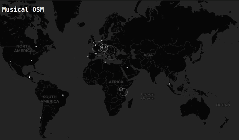
- Alex Chiu has created ‘Musical OSM‘, a web application that features audiovisual visualisations of the latest OpenStreetMap edits. For every OSM edit made, a random musical note is played.
Releases
Did you know …
- … this could be the node with the most tags in OSM? The tagging models the entirety of the lighthouse’s light characteristics. But for something that appears this interesting on OpenSeaMap, real-life is a bit of a let down.For those who are curious about what the complex notation in OpenSeaMap means,
Oc(2)G.8sfor example represents an occulting green light, where a pair of brief dark intervals repeats every eight seconds.
Other “geo” things
- DevSeed’s Data and Annotation Team is separating to become an independent company owned by the employees called GeoCompas based in Ayacucho, Peru. They will continue working with OpenStreetMap data and providing high-quality geospatial data and training datasets for machine learning.
- @larstransportworld tooted the 2024 edition of their map of Germany’s long-distance railways. Compared to DB’s official ICE and IC network map, this map focuses more on systematic connections and their frequencies for better understanding, rather than just showing every line.
- William Gallagher, of AppleInsider, reported on several accidents that have occurred in Scotland due to outdated data in Apple Maps.
- Dzima Buko et al. have released a book titled Kut, which is a collection of photographs of the wildlife of Belarus. They explained in detail the creative process behind the map illustrations in the book.
Upcoming Events
| Where | What | Online | When | Country |
|---|---|---|---|---|
| Berlin | 188. Berlin-Brandenburg OpenStreetMap Stammtisch | 2024-02-09 |  | |
| København | OSMmapperCPH | 2024-02-11 |  | |
| Budapest | 2024 februári OSM meetup – urbanisztika az Urbanumban | 2024-02-12 |  | |
| Grenoble | Mapathon Missing Maps à Grenoble | 2024-02-12 |  | |
| Hannover | OSM-Stammtisch Hannover | 2024-02-13 | | |
| Salt Lake City | OSM Utah Monthly Map Night | 2024-02-15 |  | |
| München | Münchner OSM-Treffen | 2024-02-14 | | |
| Lorain County | OpenStreetMap Midwest Meetup | ✓ | 2024-02-15 | |
| Rostock | Rostocker Treffen | 2024-02-14 | | |
| Map-py Wednesday | 2024-02-15 | |||
| Bochum | OSM-Stammtisch Bochum | 2024-02-15 | | |
| Görlitz | 1. Stammtisch Görlitz | 2024-02-19 | | |
| Lyon | Réunion du groupe local de Lyon | 2024-02-20 | | |
| San Jose | South Bay Map Night | ✓ | 2024-02-21 | |
| Bonn | 172. OSM-Stammtisch Bonn | 2024-02-20 | | |
| City of Edinburgh | OSM Edinburgh pub meetup | 2024-02-20 |  | |
| [Online] Map-py Wednesday | 2024-02-21 | |||
| Windsor | OSM WINDSOR-ESSEX: MAP NIGHT | 2024-02-22 |  | |
| Berlin | Geomob Berlin | 2024-02-21 | | |
| MapComplete Community Call 2024-01 | 2024-02-23 | |||
| Localidad Teusaquillo | OpenBeer Bogotá 2024 | 2024-02-24 |  | |
| Karlsruhe | Karlsruhe Hack Weekend February 2024 | 2024-02-24 – 2024-02-25 | |
Note:
If you like to see your event here, please put it into the OSM calendar. Only data which is there, will appear in weeklyOSM.
This weeklyOSM was produced by MatthiasMatthias, PierZen, SeverinGeo, Strubbl, TheSwavu, barefootstache, derFred, rtnf.
We welcome link suggestions for the next issue via this form and look forward to your contributions.
Re “William Gallagher, of AppleInsider, reported on several accidents that have occurred in Scotland due to outdated data in Apple Maps.” The article mentions that the changes were made to the street in question in October 2023. OSM was updated 4 October 2023! https://www.openstreetmap.org/way/1212970110/history
> Did you know this could be the node with the most tags in OSM?
[There’s more to this story](https://www.openstreetmap.org/user/Minh%20Nguyen/diary/403488)!
OK, I subscribed to the weekly newsletter sent via email, and I saw something I had never seen before.
First it was 1.5 megabytes big. A big email.
Then the From and Subject were very long, off the side of one’s mail reader.
Indeed, they contained each language’s version of the From and Subject… enough “funny” characters to set off spam bells depending on what one’s spam detector settings are if any.
A long subject line that the average reader would only understand a fraction of, and that fraction might even be off the side of their screen.
Words in your mailbox summary that you don’t understand… resemble spam.
And then there is the message itself, or should I say several messages… each language’s version all packed into one big email. A new Internet first.
I have an idea: just let the user subscribe to the language version they want.
That’s how big and little companies do it with their newsletters.
If the user really wants more than one language, well they can subscribe each extra version they want.
We have put your good idea into our backlog. Thank you very much.