15/01/2019-21/01/2019

The OSMF Membership Working Group (MWG) investigated the unusual signups in advance of the recent OSMF board elections. 1 | © MWG © Map data OpenStreetMap contributors
Breaking News
- The OSMF Membership Working Group investigated the unusual signups in advance of the recent OSMF board elections. The MWG concluded that the signup of 100 employees of the Indian subsidiary of GlobalLogic, an outsourcing firm providing OSM/mapping services to clients like Apple and Grab, was an orchestrated and directed campaign and that the applicants did not sign up voluntarily, personally and individually. The MWG expressed concerns that it was a possible attempt to influence the OSMF board election. The full report details all facts found during the comprehensive analysis of the signups. The report, which has been made available by Guillaume Rischard on the OSMF mailing list, has been sent to the OSMF board in advance (2018-12-26), but the board has not yet taken a stance on it. Also, the company GlobalLogic has not provided comment yet.
Mapping
- Quite a few OpenStreetMap communities have responded to Facebook’s 10 Year challenge by showing how OSM has developed in 10 years:
- Cameroon;
- OpenMap Chile chose to highlight trees;
- and the well-known Then and Now site was used for Lannion in France.
- Saeed Hubaishan challenged the table in the OSM wiki that shows the *_link type for roads that connect different highway types. The following discussion revealed that it seems there is no documented consensus and *_link roads are mapped more intuitively. The Wiki table mentioned was marked as not generally accepted during the discussion.
- The OSM wiki says that the level tag for buildings is defined as a 0-based-index i.e. the ground floor starts with a zero. However, Tobias Zwick found a lot of buildings that have probably been mapped with a one-based-index in mind. There exist different conventions across the world how levels are numbered.
- OSM UK has selected mapping of places in UK Food Standards Agency Hygiene Rating System as the 1st quarter task in 2019. This OSM wiki page explains how.
- In his OSM diary Andres Gomez Casanova exhibits
 his bicycle gear. He is using the equipment for 360-degree photography for Mapillary in Bogotá, Colombia.
 - Peter Rukavina explains in his blog how he created missing features in OSM and updated existing ones while he was linking anything with a geographic location from his blog posts to OSM.
- François Lacombe’s proposal for additional attributes on pipeline and waterway valves has been approved.
 his bicycle gear. He is using the equipment for 360-degree photography for Mapillary in Bogotá, Colombia.
Community
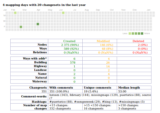
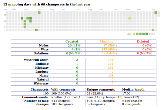
- [1] Pascal Neis’ s mapper information How Did You Contribute now shows whether a mapper is an “active contributor” in accordance with article three of the Contributor Terms. An active contributor is allowed to vote in the case of a licence change and is eligible for the new OSMF fee waiver program.derFred questions the term “active mapper” as it is defined in the OpenStreetMap Contributor Terms and proves this with three impressive examples.
- Jonah Adkins reports a couple of important items from the board of OSM-US. SotM-US will be held in Minneapolis in September, and as of January 2019, they do not have an Executive Director. Apparently, the person hired and the organisation proved to be “not the best fit for each other”.
- 889 mappers who have been active in North Korea at some point received a direct message from Wonyoung asking about their mapping motive. The message is discussed in the German forum (automatic translation). The correspondent for weeklyOSM in Korea LuxuryCoop has taken care of the matter on that site.
Imports
- Sloppy mistakes during the import of building data in Canada have led other mappers to demand stopping the import and thinking about reverting. For now the import has been put on hold.
OpenStreetMap Foundation
- Martin Koppenhoefer reminds the board that they were going to come back with some responses on the topic of Crimea. Heather Leson promised to respond “within the week” on January 7th.
Events
- As the number of mappers steadily increases in the region around Louvain-la-Neuve in Belgium, a first meetup will be organised there on February 11th to get to know each other.
Humanitarian OSM
- The Red Cross Belize helps their Government with disaster training, procurement of equipment and OSM training to better understand risks and how to respond to those risks.
Education
- OpenSchoolMaps, an initiative of Swiss OSM for promoting open maps in education, announced a new education package for creating thematic online maps with uMap and a workshop about open maps and the open source software H5P, that can be used for creating educational material.
Maps
- Maarten Hermans wrote a guide on how to query data from OSM, process the data with R’s sf and dplyr packages and interactively display the result on OSM and historical map backgrounds using Leaflet or as a WMS web service. In his example he was looking for roads with “gangen” (Dutch name for small historical passages within the inner city) in their name and displayed the result in OSM and historical maps after he processed the data.
switch2OSM
- Quique Pernas provides a twitter thread explaining the usefulness of Osmhydrant.org for foresters and other fire fighters.
- The search engine DuckDuckGo changed its maps from Mapbox to Apple Maps.
Software
- The premium version of the Blender-OSM plugin has been released!
- Fabian Kowatsch, from HeiGIT, explains how to use historical OSM data from the ohsome API to compare different regions based on their attribute completeness over time with a simple API call. He uses the tag surface=*. for streets as an example.
Releases
- OSM’s main map style, Carto, has received another update. As the maintainer Daniel Koć wrote in his OSM diary, version 4.19.0 has added the rendering of
boundary=protected_areaand revised it for reserve boundaries. The new version also added more barrier icons and support ofamenity=vending_machineand improved a lot of other things.
Did you know …
- … Emily Grubert’s map of US power plants by capacity, age, and fuel on an OSM basemap?
OSM in the media
- A news article from the publisher Heise repeats (automatic translation) the position of a forest owner who blames online maps, which allow users to share information, for being partly responsible for unfettered biking in forests and thus causing problems. The one-sided article repeats the demand for a ban on providing online geospatial information about the property of a third party.
- Teresa Jolley pointed in a tweet to a video interview with Brian Prangle from OpenStreetMap UK about the question as to whether the public sector should make more use of OSM.
- A collaboration between the Belize Red Cross and the American Red Cross made it to the local news on Channel 5 Belize according to a tweet from Belize GEO.
 (automatic
Other “geo” things
- Richard Fairhurst’s New Adlestrop Railway Atlas has been appreciated by fans of old railways from around 2004 when it first appeared. However, it never covered the whole of the British Isles. Certain minor distractions in the ensuing period (including Potlatch, Potlatch2, cycle.travel, tilemaker) have limited additions. Now Richard hints at a completely new edition.
- GBIF (Global Biodiversity Information Facility) has analysed how much of its data on the location of biological organisms originated from citizen scientists. The answer is over 500 million records making up more than 50% of the total.
- As Andy Mabbett wrote in his mail to the talk mailing list, the ARIADNEplus Project, a new European initiative for Digital Archaeology and Cultural Heritage, uses OpenStreetMap to display the locations of its records.
- A number of German media outlets (public Radio Deutschlandfunk (automatic translation) and ARD’s Tagesschau (automatic translation)) reported about Google Maps’ inability to calculate even simple routes between Palestinian towns but, on the other hand, how Google can easily provide routes in the same area if the destinations and sources are Israeli settlements.
The reports close by saying that the locals help themselves with “other mapping apps that are kind of Wikipedia”. - Kashmir Hill of Gizmodo elaborates on the dilemma of a South African family living in Pretoria, for whom imprecise IP geolocation services regularly bring uninvited guests accusing them of internet-related crimes. If it happened in South Africa, it supposedly always happens at the coordinates of their property.
- Atlas Obscura reports about David Garcia’s cartographic representation of the 100 largest islands summarised in one chart.
- The German IT publisher heise.de reported (automatic translation) possible problems with older GPS devices on April 6th, due to a “week count rollover” in the GPS system. The week in the GPS system is encoded with 10 bits and hence, it can only address 1024 weeks. The last rollover was in 1999. As the system will be changed and the resolution of the week counter will be increased to 13 bits, the next rollover will be in 8192 weeks.
Upcoming Events
| Where | What | When | Country |
|---|---|---|---|
| Lübeck | Lübecker Mappertreffen | 2019-01-24 |  |
| Mannheim | Mannheimer Mapathons e.V. | 2019-01-24 | |
| Greater Vancouver area | Metrotown mappy Hour | 2019-01-25 |  |
| Bremen | Bremer Mappertreffen | 2019-01-28 | |
| Viersen | OSM Stammtisch Viersen | 2019-01-29 | |
| Fontaine | OpenStreetMap – Un projet collaboratif de cartographie libre | 2019-01-29 |  |
| Fontaine | Dessine ta ville – communs numériques et territoire | 2019-01-29 | |
| Arlon | Réunion au Pays d’Arlon | 2019-02-04 |  |
| London | Missing Maps Monthly Mapathon London | 2019-02-05 |  |
| Toulouse | Rencontre mensuelle | 2019-02-06 | |
| Stuttgart | Stuttgarter Stammtisch | 2019-02-06 | |
| Helsinki | Missing Maps Mapathon at Finnish Red Cross HQ – Feb 2019 | 2019-02-07 |  |
| Dresden | Stammtisch Dresden | 2019-02-07 | |
| Berlin | 128. Berlin-Brandenburg Stammtisch | 2019-02-08 | |
| Ulm | ÖPNV-Mapathon Ulm | 2019-02-09 | |
| Rennes | Réunion mensuelle | 2019-02-11 | |
| Bordeaux | Réunion mensuelle | 2019-02-11 | |
| Zurich | OSM Stammtisch Zurich | 2019-02-11 |  |
| Lyon | Rencontre mensuelle pour tous | 2019-02-12 | |
| Salt Lake City | SLC Mappy Hour | 2019-02-12 |  |
| Munich | Münchner Stammtisch | 2019-02-13 | |
| Dresden | FOSSGIS 2019 | 2019-03-13-2019-03-16 | |
| Portmarnock | Erasmus+ EuYoutH_OSM Meeting | 2019-03-25-2019-03-29 |  |
| Montpellier | State of the Map France 2019 | 2019-06-14-2019-06-16 | |
| Angra do Heroísmo | Erasmus+ EuYoutH_OSM Meeting | 2019-06-24-2019-06-29 |  |
| Heidelberg | Erasmus+ EuYoutH_OSM Meeting | 2019-09-18-2019-09-23 | |
| Heidelberg | HOT Summit 2019 | 2019-09-19-2019-09-20 | |
| Heidelberg | State of the Map 2019 (international conference) | 2019-09-21-2019-09-23 | |
| Grand-Bassam | State of the Map Africa 2019 | 2019-11-22-2019-11-24 |  |
Note: If you like to see your event here, please put it into the calendar. Only data which is there, will appear in weeklyOSM. Please check your event in our public calendar preview and correct it, where appropriate.
This weeklyOSM was produced by Nakaner, Polyglot, Rogehm, SK53, SunCobalt, TheSwavu, YoViajo, derFred, jcoupey, jinalfoflia, kartonage, keithonearth.