13/11/2018-19/11/2018
State of the Map Asia 2018 brought together the mapping enthusiasts from around 12 countries across the globe. It was two days of interesting sessions and workshops. Find more information on the website and event tweets on this hashtag: #SotMAsia18.
Mapping
- Dave Swarthout wrote on the tagging mailing list that he just learnt about the power of multipolygon relations. He was applying his new knowledge by mapping bays in Alaska. However, he discovered the disadvantages of mapping very large structures, in his case the Cook Inlet that stretches over 290 km. He asked whether it would be easier to draw a simple shape rather than using a relation with dozens of member ways. However, the following lengthy discussion also brought a simple place node into play and focused on many other problems, mainly rendering. In the end the whole discussion did not result in solving the problem Dave brought up.
- How to deal with multilingual names is a common question in OSM and there has been a lot of previous discussion about how best to deal with them. Here’s a discussion
 (automatic translation) about bilingual “city limit” traffic signs in Austria from the Austrian mailing list last week.
 - Simon Poole estimates that half of all addresses in Switzerland have been mapped in OSM already.
- According to a blog post from Anton Khorev the different floor numbering traditions from country to country make it difficult to understand values in
level=. In his comprehensive post, he explains the issue and why it is not as easy to solve as it might appear. - The voting for
office=diplomatic(formerly Consulate) is underway. It intends to distinguish between diplomatic, consular and other types of government-to-government liaison offices. The proposal was prepared by an expert in this area, an ambassador. - Jukka Nikulainen has brought his proposal for mapping tram tracks on highways to voting. Tram tracks are usually mapped on separate OSM ways, even when they are embedded in the highways. For cyclists this presents a danger, so it’s interesting to know where this is the case, so such streets can be avoided for bicycle routing.
- François Lacombe is asking for comments on his proposal for additional attributes on pipeline and waterway valves.
- Joseph Eisenberg is seeking advice on how to tag Neighborhood Gateway Signs as they exist in Indonesia and other parts of the globe like Portland and San Diego.
 (automatic
 Community
- Pascal Neis, since October 2018 Professor for Geo-Government at Mainz University of Applied Sciences, made the average number of OSM contributors per country of the twelve-month rolling period available for download as a csv file. According to his tweet, this is the data he is using for osmstats.neis-one.org.
- The Czech OSM community informs us about the establishment of the organisation OpenStreetMap Česká republika z.s.. The organisation has 14 founding members and will apply to become a local OSMF chapter once fully operational. Tomáš Kašpárek, Marián Kyral and Jakub Těšínský were elected as members of the first board.
- Jakob Miksch prepared an appealing description of OSM, covering the data model, tags, editing, visualisation and the licence, on his blog. Interesting for beginners!
- From 5th till 9th of November OSM and GIS training sessions were held for International Humanitarian Organisations in Mali. They were organized at OCHA building by OpenStreetMap Mali community with the support from Francophony international volunteers in Mali.
- OSM Diaries published a short YouTube video about Gregory Marler’s OSM editing history. In the video he compares editing OSM ten years ago with now.
- OpenStreetMap Benin – with the support of its International Volunteer of La Francophonie – organised a 3-day workshop on OpenStreetMap digital mapping for young women from various socio-professional backgrounds. The training took place at the Francophone Digital Campus in Cotonou.
OpenStreetMap Foundation
- Rob Nickerson asked the OSMF representation about the status of the Fee Waiver Program, which was decided in 2014 with target date for implementing it by the end of that same year.
- Paul Normann officially announced the OSMF Fee Waiver Program on the OSMF mailing list on November 15th. The fee waiver program allows those to join who couldn’t previously due to a lack of reasonably priced money transfer options or for whom the cost is prohibitive compared to incomes in their part of the world.
- The minutes of the Licence Working Group meeting of November 8 has been published. One of the topics was the Directive on dealing with DMCA copyright complaints.
- The sponsorship for the server that is used to build JOSM and offers the download ends soon. The German local OSMF chapter FOSSGIS has received a request for funding (automatic translation) for a new one. A new server is needed anyway as the old one has reached its limits.
- Michael Collinson published the official set of questions to the candidates for the upcoming OSMF board elections. The seven candidates are asked to submit their answers and manifesto via email by 30 November. They will be published together.
- Christoph Hormann describes his impressions of the OSMF board meeting on 15 November in a blog post that he titled The most surreal and memorable OSMF board meeting yet. He names the person he thinks is in charge of softening the Organised Editing Guidelines and criticises that a policy draft from an anonymous company remains locked away.
- The Data Working Group of the OSM Foundation published its decision that the Crimean peninsula belongs to Russia – OSM border data-wise. The decision lays down rules for the (non-) use of
addr:country=*as well as requirements for changeset comments in the region. This decision replaces the previous rules.
Events
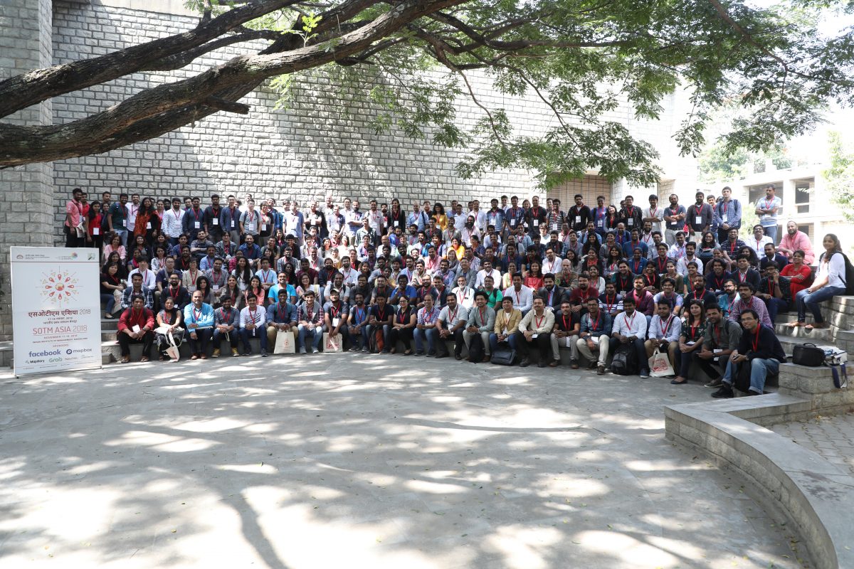
- SotM Asia happened this weekend! It was attended by around 280 participants from 12 countries around the globe for two days filled with enthusiasm, excitement, interesting sessions, panels, workshops related to using OpenStreetMap for conservation, mapping, data visualisation and everything maps. The organising team is thankful to one and all for making this event a success!The SotM Asia Twitter account gives you an idea of the presentations and talks held as well as many visual impressions. It is planned to upload the presentations on a dedicated YouTube channel, so stay tuned!
- The FOSDEM 2019 in Brussels, a long standing free-software conference that attracts 6000+ developers, will take place on the 2nd and 3rd of February 2019. For a few years the conference has included a Geospatial devroom, which is now calling for talk proposals.
- More than 110 people, invited by Doctors Without Borders, came (automatic translation) on Friday 16 November to the UPNA to map two crisis protected areas in Caracas and Niger by satellite imagery.
 (automatic
 Humanitarian OSM
- Melanie Eckle has published the minutes of the HOT board meeting of 8th November. It was the first board meeting that was open to the membership.
- HOT is using open source tools to fight against malaria in Guatemala. In an article HOT explains how they partner with the Clinton Health Access Initiative and the Guatemala Ministry of Health. HOT added more than 1,600 buildings to OpenStreetMap in the area of Escuintla to help the coordination of indoor residual spraying.
- On 28th November CartONG and the refugee community SINGA Grenoble invite (automatic translation) you to a special mapathon in La Coop. The mapping is done in pairs so that people with a migrant background or hardly any technical know-how can expand their knowledge together.
Maps
- With the newest update, OpenStreetBrowser supports drawing patterns (e.g. arrow heads) on ways, which is now used on the cycle routes map and the public transport map.
The cycle routes map gets the directions from the ways’ role (forward/backward), the public transport map from the connection to the previous/next way (as defined in PT Schema v2). read more. To prepare for the Christmas season, there’s a new “Christmas features” category.
switch2OSM
- Gmaps, claiming to be the number one map module for ExpressionEngine, changed its name using the formula Gmaps – Google = Maps. Google’s fee increase and the cuts to its free services caused a shift by the developers towards open source and the support of a couple of map providers, including OSM.
Software
- Richard Fairhurst wrote that his bike route-planning website cycle.travel now also covers Scandinavia and parts of Eastern Europe.
- The surveyor app StreetComplete reached 1000 stars on GitHub.
Programming
- The GIScience HD github repository already contains over 50 open source repositories and it’s still growing. Most are somehow related to OSM, from routing, processing, managing, analysing to visualising, etc. Who wants to participate? https://github.com/GIScience
- If you’ve always wanted the upload of edits to be faster, now’s your chance to help. The upload of changes has been completely reimplemented and testers are wanted (automatic translation) to test the code with iD, Potlatch or JOSM. mmd also published instructions on how to help with testing in English, so not speaking German is no longer an excuse 😉
Releases
- Martijn van Exel upgraded MapRoulette to version 3.1.1 on maproulette.org. In his user blog Martijn explains the new features, which include the availability of Mapillary images on MapRoulette, rebuilding tasks and a public Leaderboard for each challenge
- Wambacher has updated his comprehensive listing of OSM related software. Most recent updates include Naviki Android 3.1810.1, OpenStreetCam Android , Traccar Server 4.2 and Vespucci 11.2.0.
- Potlatch 2 is still alive and actively maintained. Richard Fairhurst announced two small updates.
Did you know …
- … the service Shareloc that allows you to create and share OpenLayers maps?
- … the German city Schnöggersburg? The city, which is used as a training ground for armed forces, was featured by a news magazine (automatic translation) in 2012. A mapper “rediscovered” the city which sparked a new discussion (automatic translation) in the German forum about tagging and mapping of military installations.
Other “geo” things
- Doug Rinckes launched a Plus code grid service on grid.plus.codes. The Plus code system, or the Open Location Code as it is officially called, was originally developed by Google. The system is seen as controversial in OSM and has caused heated discussions on GitHub, the mailing list and other places.
- The New York Times published an article titled A Map of Every Building in America that provides different perspectives on the development of settlements in the USA and the arrangement of buildings in that context. The article discusses maps at different scales, from a nationwide figure-ground diagram to a map of the squiggly suburbs in Mesa, Arizona. A behind-the-scenes article in the New York Times covers the story of how the maps were drawn using the building footprints that Microsoft released this year (and are available for use in OSM as well).
- The biking website road.cc has tested the bar-mounted GPS Hammerhead Karoo. In the article the author, Dave Atkinson, explains why the device is the best available GPS for its purpose, nevertheless he thinks there is still room for improvement.
Upcoming Events
| Where | What | When | Country |
|---|---|---|---|
| Melbourne | FOSS4G SotM Oceania 2018 | 2018-11-20-2018-11-23 |  |
| Lübeck | Lübecker Mappertreffen | 2018-11-22 |  |
| Alajuela | ES:State of the Map Costa Rica | 2018-11-23-2018-11-25 |  |
| Manila | 【MapaTime!】 | 2018-11-24 |  |
| Dublin | Monthly Mapping Party | 2018-11-24 |  |
| Ivrea | Incontro mensile | 2018-11-24 |  |
| Graz | Stammtisch Graz | 2018-11-26 |  |
| Bremen | Bremer Mappertreffen | 2018-11-26 | |
| Arlon | Espace public numérique d’Arlon – Formation Contribuer à OpenStreetMap | 2018-11-27 |  |
| Reutti | Stammtisch Ulmer Alb | 2018-11-27 | |
| Düsseldorf | Stammtisch | 2018-11-28 | |
| San José | Civic Hack Night & Map Night[1] | 2018-11-29 |  |
| Tångstad | Foundation board elections discussion period opens | 2018-11-30 | – |
| Minamishimabara-shi | 南島原マッピングパーティ #1 「世界文化遺産『原城』をマッピングしよう!」 | 2018-12-01 |  |
| Toronto | Mappy Hour | 2018-12-03 |  |
| London | London Missing Maps Mapathon | 2018-12-04 |  |
| Praha – Brno – Ostrava | Kvartální pivo | 2018-12-05 |  |
| Stuttgart | Stuttgarter Stammtisch | 2018-12-05 | |
| Toulouse | Rencontre mensuelle | 2018-12-05 |  |
| Bochum | Mappertreffen | 2018-12-06 | |
| Dresden | Stammtisch Dresden | 2018-12-06 | |
| Tångstad | Foundation board elections voting opens | 2018-12-08 | – |
| Rennes | Réunion mensuelle | 2018-12-10 | |
| Lyon | Rencontre mensuelle pour tous | 2018-12-11 | |
| Zurich | Jubilee Stammtisch Zurich with Fondue | 2018-12-11 |  |
| online via IRC | Foundation Annual General Meeting | 2018-12-15 |  |
| Heidelberg | State of the Map 2019 (international conference) | 2019-09-21-2019-09-23 | |
Note: If you like to see your event here, please put it into the calendar. Only data which is there, will appear in weeklyOSM. Please check your event in our public calendar preview and correct it, where appropriate.
This weeklyOSM was produced by LuxuryCoop, Nakaner, PierZen, Polyglot, Rogehm, SunCobalt, TheSwavu, YoViajo, derFred, geologist, jinalfoflia.