17/12/2019-23/12/2019
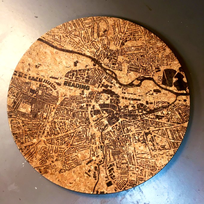
“Reading map” etched cork tray showing only buildings and rivers by Tony Short 1 | | © Tony Short | Map data © OpenStreetMap contributors
Mapping
- Jan Michel asked for comments on his proposed tagging of new types of electric mobility devices such as scooters, pedelecs or electrical bicycles as the usage is regulated in many countries.
- Francesco Ansanelli has updated the roundtrip page and created a (so far empty) closed loop proposal which started a lengthy discussion about this topic on the tagging mailing list.
- jmkennedyie published a nice animation of OSM’s evolution in Ireland since 2006.
- The proposal of
telecom=distribution_pointfor tagging telecommunication equipment, allowing one or more households to connect to a single telecom local loop upstream cable, has been accepted.
Community
- Roland Olbricht announced the availability of a user manual for the Overpass API in English, French and German. The manual, which has been created with a focus on long-term stable functionality and translatability, isn’t a manual in the conventional sense but a guided tour.
Imports
- An import of addresses in Maine (USA) is proposed and seeking review. On the talk-us mailing list Alex Hennings is looking for help with the process.
OpenStreetMap Foundation
- Nakaner has published a transcript of the OSMF board meeting of 23 December 2019 in the German Forum.
 (automatic translation)
 (automatic
 Events
- Lindsey Higgins reports on the Mapillary Blog about SotM Africa and about the regional conference “Understanding Risk West and Central Africa” in Abidjan.
Humanitarian OSM
- Global Healthsites Mapping Project and the Heidelberg Institute for Geoinformation Technology/GIScience Research Group announced the signing of a memorandum of understanding recently. The cooperation has been agreed to improve analyses, sharing and use of OpenStreetMap health facility data.
switch2OSM
- SomeoneElse explains in his diary entry why “Switch2OSM” was moved from WordPress to Github. He also explains how to suggest changes or improvements to the site.
Open Data
- Following the recent publication of the articles What is OSM? and How To Use the OpenStreetMap Wiki on the Transport for New South Wales Open Data blog, Andrew Harvey reminds them that OSM can’t use any of their open data without an attribution waiver and asks if there is any chance of obtaining one.
- The Open Data Day 2020, an annual celebration of open data, will take place on 7 March 2020. You are invited to join one of the events around the world or host your own.
Software
- Randy Meech and his team announced StreetCred for iOS and Android. StreetCred is a gamified data enrichment app to improve OSM. The app allows you to create and update POI data.
Releases
- Quincy Morgan announced the updates to iD in v2.17.0. Other than improvements such as a single click function to add tunnels or bridges and the continued visibility of select features even when zoomed out, the release notes include some non-core changes like the addition of a privacy policy, the ability to opt out of icons loaded from third-party sites, the new iD blog and the removal of Maxar imagery layers following the announced suspension of service.
Did you know …
- … 19 amazing maps? Mapbox’s list of 19 maps that they thought stood out in 2019.
- … that you can map playground equipment in a playground as separate OSM elements with the tag Key:playground?
- … the important Wiki page on the topic of quality assurance?
- … the Wiki Site, where you can submit pictures as showcase examples of the OSM project and suggest candidates for picture of the week?
OSM in the media
- The Hindu, one of India’s largest newspapers, features an article on Shriphani Palakodety, who creates nice-looking maps and visualisations with OSM data.
Other “geo” things
- Technology Review reported on mysterious attacks on ship-borne GPS devices in China. The spoofed GPS positions appear to be arranged in circles, which perplexed some of the exports consulted by the journal.
- DW News tweeted about a young Zimbabwean man who, in his own time, is working to make his continent better mapped on Google StreetView.
- Timetable information for the Verkehrsverbund Rhein-Neckar (VRN) and the myVRN app offer door-to-door routing throughout Germany based on OSM data (automatic translation).
- Ayman Jaddaa suggests a redesign of Apple Maps and introduces an impressive design proposal of their own, which received positive feedback on Reddit. One suggestion is to improve crowdsourcing of map data. Probably unknown to the author, Apple Maps already uses OpenStreetMap in some countries.
- You can watch 35 years of climate change in the Arctic in just over two minutes in a time-lapse video released by the American Geophysical Union.
- Stages Cycling has released a GPS unit with an OSM-based map doctored for cyclists to allow you to wander around with confidence without a preset route. The map highlights not only bike paths and bike lanes but also things like coffee shops, bike shops, and restrooms.
- Geospatial World reported that Geoalert has completed the very first version of its ambitiously big map data project – Urban Mapping, 54 million buildings all over Russia, data for which is available through their platform’s API.
Upcoming Events
| Where | What | When | Country |
|---|---|---|---|
| Alice | PoliMappers Adventures 2019 | 2019-12-01-2019-12-31 |  |
| Düsseldorf | Stammtisch | 2019-12-27 |  |
| hosted by Chaos Communication Congress 36C3 | OpenStreetMap assembly | 2019-12-27-2019-12-30 | |
| London | Missing Maps London | 2020-01-07 |  |
| Hanover | OSM-Bearbeitung mit JOSM | 2020-01-08 | |
| London | Geomob LDN (featuring OSMUK) | 2020-01-08 | |
| Stuttgart | Stuttgarter Stammtisch | 2020-01-08 | |
| Berlin | 139. Berlin-Brandenburg Stammtisch | 2020-01-09 | |
| Bochum | Mappertreffen | 2020-01-09 | |
| Nantes | Rencontre mensuelle | 2020-01-09 |  |
| Montrouge | Rencontre mensuelle locale des contributeurs de Montrouge et alentours | 2020-01-09 | |
| Salvador | Mapeia Bahia | 2020-01-11 |  |
| Toronto | Toronto Mappy Hour | 2020-01-13 |  |
| Cologne | Köln Stammtisch | 2020-01-15 | |
| Ulmer Alb | Stammtisch Ulmer Alb | 2020-01-16 | |
| Dortmund | Mappertreffen | 2020-01-17 | |
| Riga | State of the Map Baltics | 2020-03-06 |  |
| Valcea | EuYoutH OSM Meeting | 2020-04-27-2020-05-01 |  |
| Cape Town | State of the Map 2020 | 2020-07-03-2020-07-05 |  |
Note: If you like to see your event here, please put it into the calendar. Only data which is there, will appear in weeklyOSM. Please check your event in our public calendar preview and correct it, where appropriate.
This weeklyOSM was produced by Nakaner, NunoMASAzevedo, Polyglot, Rogehm, SK53, SunCobalt, TheSwavu, YoViajo, derFred.
Other “geo” things:
“DW News tweeted … to make his continent better mapped on Google StreetView.”
Switch2OSM 😉