21/08/2018-27/08/2018
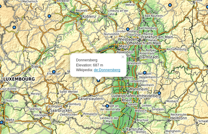
Map of extremal peaks [1] | © gsa |
Leaflet | Map data © OpenStreetMap contributors, SRTM | Imagery © OpenTopoMap (CC-BY-SA)
Mapping
- Frederik Ramm has published a code snippet on the dev mailing list, which he used to search for the way with the most relation memberships. The most curious and abstruse discoveries are mentioned in the follow-up messages.
- The question “How to tag an address that has no housenumber?” has been raised on the Talk mailing list. The ensuing thread is an object lesson in the difference between the theory of an address being a unique identifier and the reality out there.
- Jyri-Petteri Paloposki wrote on the Tagging mailing list that the tagging proposal for
winter_service, that was originally developed by malenki, has been put up for voting. - The deletion of trekking sites (legal wild camping) in the northern Black Forest had the unwanted side effect of triggering a discussion about keeping them secret on the German OSM forum
 (automatic translation). Normally you only get the specific location of the sites after making a reservation and paying a small fee. The idea behind this is to protect the sites from abuse and vandalism, which could eventually lead to their abolition.
 (automatic
 Community
- Displeasure about the quality of Facebook imports and their collaboration with the community grows. Two of the most active mappers in Thailand are about to throw in the towel and stop mapping.
- Printed hiking maps were previously often primarily published by state surveying authorities using their own, official, data. A hiking blog shares (automatic translation) their positive experience with a printed hiking map based on OSM which replaces the out-of-print map from the state survey.
- aHaSaN wrote a post in his user diary about the initiative of government institutions and civil society organisations in Bangladesh to use participatory OSM mapping for improving the capacity of communities in climate vulnerable areas as part of the LoGIC (Local Government Initiative for Climate Change) initiative.
- User gsa created a map which shows all mountain peaks with a special property. Standing on a summit and looking around horizontally, most of the time one observes a higher mountain. On some peaks, however, which he called “extremal” peaks, this is not the case: If you stand on the top, you are looking down on every surrounding point. The computation of these “extremal” points from the OSM “natural=peak” (and “natural=volcano”) data was performed with GNU Octave. The code is available on Gitlab.
- Christoph Hormann sees a need for OSM to have its own system for project organisation and related communication, task and issue tracking. He sees the widespread use of GitHub repositories to track a host of OSM-related activities, both by OSMF and related parties, as a clear signal that issue tracking is important within the OSM community. Because GitHub’s orientation is towards software development it can be an unfamiliar environment for many OSM contributors. In addition there may be issues of principle, due to GitHub’s commercial status, for others. He therefore suggests setting up our own self-hosted open source solution.
- Martijn van Exel has recently introduced a new tool called meet your mapper, which lets you find mappers in a particular area. Now he has improved the tool based on user feedback. The main change, described in his user diary, is the addition of rectangular bounding boxes to select an area. These supplement the previous use of OSM relations. Other new options include: an alternative Overpass API server and a local quantitative assessment of the mappers in the area, similar to Pascal Neis’ How Did You Contribute.
- Pierre Béland published a new blogpost on OpenDataDRC (an initiative from OSM-DRC and Potentiel 3.0) and he proposes quality indicators and map visualisations to identify irregular geometries and overlaps of buildings to help OSM communities assess and correct quality problems for their area.A sample from the 12 cities that have started participating in the Open Cities Africa project was used. He found out that on average 27.8% of buildings in the sample have an irregular geometry and 5.6% have overlaps or are an invalid polygon. However, there are important variations and some peaks with Pointe-Noire having over 24% of buildings with overlapping ways or invalid polygons and Victoria with more than 72% of all buildings with irregular, i.e. non-rectangular, form.Various explanations are proposed such as the lack of good imagery for the area, dense urban areas, mapathons with inexperienced contributors and low number of local contributors.
OpenStreetMap Foundation
- The minutes of the OSMF board meeting on August 16 have been published. Topics included: introduction of mutli-annual or life membership categories; the “Microgrants” program currently under development; GDPR; and the activities of the Advisory Board.
Events
- Paul Desgranges and others from the French community provide another perspective on the recent SotM 2018 conference. As well as reports on a selection of individual talks, the section “La tendance générale” looks at implications for the general direction of OSM. (automatic translation).The selection of talks available as videos on the YouTube channel have meanwhile been extended.
 (automatic
 Humanitarian OSM
- luc_kpogbe wrote a diary post on how HOT microgrants have helped in mapping the northern regions of Benin, in order to have a better knowledge of the territory and be able to react effectively in the event of crises or epidemics, since these regions are still poorly mapped,F not only on OSM. Thanks to a microgrant, OSM in Benin was able to acquire smartphones for field data collection.
- Rebecca Firth wrote an article at the HOT website about her thoughts on inclusion at the SotM. As Rebecca laid out she felt a change in topics around inclusion, particularly gender, and explains the reasons for her positive impressions.
Maps
- Daniel Koć, one of the maintainers of OSM Carto Map Style, wrote a diary entry about his personal design principles of the map style. His intention is to start a series of articles to introduce the OSM community to general map rendering challenges using OSM data from the project maintainer’s point of view.
- Discostou36 suggests (automatic translation) in the German forum that a special map could be developed listing facilities relevant for families with small children. amilopowers realised the idea in the form of a uMap map.
switch2OSM
- Neil Gunto, the maker behind crazyguyonabike, a website hosting bicycle touring journals, forums and other resources, wrote a comprehensive article about his switch to OSM. The recent Google Maps price hike led him to look for alternatives. In this article he explains in detail how and why he switched to Stadia Maps, OpenCage Geocoder and Leaflet. In his conclusion he wrote: This is an example of why switching to OSM is actually a Step Forward – it gives you far more control than you had with Google.
Open Data
- The Belgian cadastre is now available as open data as Joost Schouppe reported on the Belgian mailing list. He notes there are some quality issues with the data.
Licences
- Maurizio Napolitano noticed the Community Data License Agreement from the Linux Foundation and asked on the Talk mailing list whether it was compatible with OSM. His interest was whether it would permit the import of whosonfirst data, which is released under that licence.
Software
- Since Garmin removed their app Navigon from the market in May, the unrelated app Navigone from Sygic has appeared. Navigone is a renamed version of the OSM-based navigation app Be on Road.
Programming
- Kevin Kenny wrote on the Talk-US mailing list that he has been using the code Phil Gold and Richard Weait developed to render US highway shields for several years now. However, over years during which he used the code and made a number of changes, he became out of sync with the main development line. Since he considers the distinction among highway shields is really necessary for the map in the US, he has created a repository to share his code. Kevin is inviting anyone to help with his project.
- Christoph Hormann wrote a blog post about the rendering of ways on embankments. Unlike
man_made=embankment, the additional tagsembankment=andcutting=onhighwayorrailwaywill not be rendered by the standard OSM Carto style. In his article he explains why this problem is more tricky than it appears and suggests a possible solution.
Releases
- A JOSM hotfix has been released to improve the robustness against a Debian/Ubuntu bug caused by the GNOME ATK wrapper. The new version also includes some minor improvements.
- Nominatim 3.2.0 has been released. GeoJSON and GeocodeJSON have been added as new output formats. The reverse geocoding algorithm has been rewritten to improve results in sparsely populated areas and when looking up administrative entities.
Did you know …
- … the robot that draws OSM data with a pen?
- … the website Visit Scotland, where you can plan your trip with OSM?
Other “geo” things
- Oliver Beattie complained on Twitter that he had to turn off his popular radius tool because of Google’s price increase. Soon after the first response suggests he starts using OSM.
- An article on Geospatial World describes how technologies such as remote sensing, GIS, and satellite imagery have played a crucial role in disaster management during and after the massive deluge in the southern Indian state of Kerala.
- The UK plans to start working on a satellite system to rival the EU’s Galileo, because, as a third party country, it will not have access to the more precise, non-public service of the Galileo system, after Brexit.
Upcoming Events
| Where | What | When | Country |
|---|---|---|---|
| Dar es Salaam | FOSS4G & HOT Summit 2018 | 2018-08-29-2018-08-31 |  |
| London | Missing Maps Mapathon | 2018-09-04 |  |
| Praha – Brno – Ostrava | Kvartální pivo | 2018-09-05 |  |
| Stuttgart | Stuttgarter Stammtisch | 2018-09-05 |  |
| Bochum | Mappertreffen | 2018-09-06 | |
| Lyon | Rencontre mensuelle pour tous | 2018-09-11 |  |
| Berlin | 123. Berlin-Brandenburg Stammtisch | 2018-09-13 | |
| Munich | Münchner Stammtisch | 2018-09-13 | |
| Posadas | Mapatón de parajes y caminos | 2018-09-15 |  |
| Berlin | Berliner Hackweekend | 2018-09-15-2018-09-16 | |
| Grenoble | Rencontre mensuelle | 2018-09-17 | |
| Cologne Bonn Airport | Bonner Stammtisch | 2018-09-18 | |
| Lüneburg | Lüneburger Mappertreffen | 2018-09-18 | |
| Nottingham | Pub Meetup | 2018-09-18 | |
| Lonsee | Stammtisch Ulmer Alb | 2018-09-18 | |
| Karlsruhe | Stammtisch | 2018-09-19 | |
| Mumble Creek | OpenStreetMap Foundation public board meeting | 2018-09-20 |  |
| Buenos Aires | State of the Map Latam 2018 | 2018-09-24-2018-09-25 | |
| Detroit | State of the Map US 2018 | 2018-10-05-2018-10-07 |  |
| Bengaluru | State of the Map Asia 2018 | 2018-11-17-2018-11-18 |  |
| Melbourne | FOSS4G SotM Oceania 2018 | 2018-11-20-2018-11-23 |  |
| Lübeck | Lübecker Mappertreffen | 2018-09-27 | |
| Manila | Maptime! Manila | 2018-09-27 |  |
| Düsseldorf | Stammtisch | 2018-09-28 | |
Note: If you like to see your event here, please put it into the calendar. Only data which is there, will appear in weeklyOSM. Please check your event in our public calendar preview and correct it, where appropriate.
This weeklyOSM was produced by Nakaner, PierZen, Polyglot, Rogehm, SK53, SunCobalt, TheSwavu, YoViajo, derFred.