01/10/2019-07/10/2019
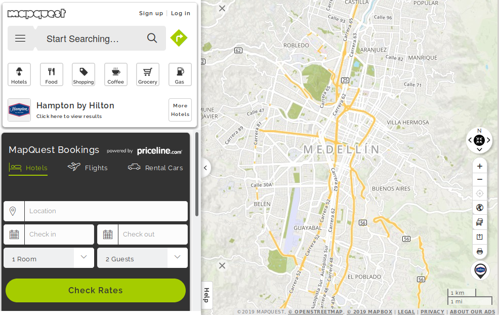
An eulogy for Mapquest 1 | © Mapquest © Mapbox – Map data © OpenStreetMap contributors
Mapping
- Richard Fairhust points out, on the talk mailing list, that most EuroVelo routes are very out-of-date.
- Toy libraries have been mapped in a very limited way on OSM for several years. Now a proposal to formalise the usage has been made. In the discussion on the tagging list a plea is made to ensure that libraries with facilities for children with disabilities are appropriately tagged.
- Carlos Brys described the work of the local community following the government of Paraguay’s decision to create 10 new national routes and redefine the existing road network.
- Where rendering is not (yet) prepared for extensive micromapping, here
natural=cliff, it will lead to conflicts (automatic translation). - The author of the app GPSLogger, an open-source Android GPS tracker, blogged about his mapping activities during a holiday at Marmari on the Greek island Evia.
- The voting for
traffic_calming=dynamic_bump, intended for the new type of dynamic traffic calming, whose impact depends on the driver’s speed, has started. - The question about “structural separation” of roads and their representation as single separated ways in OSM led to a fierce discussion in the forum
 , in a changeset comment and an error note . As at time of writing , the discussion, which resurfaces regularly , has not led to agreement or other consequences but spilled over to the tagging mailing list.
 , in a
 Community
- On talk-at the user PPete drew attention (automatic translation) to a changeset in which relation polygons of districts and municipalities in Tyrol and Voralberg were extended with the additional terms “municipality” and “district”. This led to a partly heated discussion and shows that there is currently no consensus. It also showed that the problems are dealt with differently in each country.
- Habr.com/ru interviewed (automatic translation) Natalya Kozlovskaya. She explains how she came to OSM, suggests why so few women in Russia are active in OSM and tells, at the end, a funny story about the difference between mapping in winter and summer. 😉
Imports
- Russ Phillips asked for the opinion of the local community on the possibility of an import of UK postcode data. As the data in question represent just a mathematically calculated centrepoint for each postcode, he received a lot of opposition.
OpenStreetMap Foundation
- The minutes of the meeting of the Licensing Working Group on 12 September 2019 have been published. The topics were the Attribution Guideline, a guideline for machine learning with OSM data and a data leak from the iD editor that passes user data to Facebook.
- The OSM Foundation Scholarship program for 2019 supported 22 scholars from around the world to travel and participate in the State of the Map 2019 in Heidelberg. You can read the Write-Ups about their experiences at this conference and view videos of presentations by some of them.
Events
- Christoph Hanser invites mappers to the first “Trufithon” (Trufi Hackathon), a mapathon to collect data for and work on the Trufi app, an app for public transport and informal traffic for Cochabamba, Bolivia.
- If you ever wondered who is who at weekly/hebdo/semanal/semanario/… Betaslb published two photos taken at SotM2019 with the weeklyOSM editors.
- The 36C3 or 36th Chaos Communication Congress (automatic translation) will take place from 27 to 30 December 2019 in Leipzig, Germany. A space at the Open Infrastructur Orbit is offered to OSM, so volunteers to represent OSM there for the 11th year in a row are welcome. Join the thread in the German forum if you are interested.
- The FOSSGIS, besides being the meeting for open geodata and software, is Germany’s main local OSM event. It will take place from 11 to 14 March 2020 and has started the Call for Papers (automatic translation).
Humanitarian OSM
- Felix Delattre informs us about the development progress of the new HOT Tasking Manager and lays out the current roll-out plan.
- MapSwipe, a mobile app used since 2015 in the humanitarian area for identification of settled places, has introduced two new functions as HOT and MissingMaps have reported. Volunteers can indicate where buildings are inaccurate or of low-quality and a rework in OSM is required following changes on the ground .
- The USA independent media NPR featured an article from the freelance journalist Joanne Lu about the critical role of OpenStreetMap for the Hurricane Dorian response in Bahamas. The journalist also presented the vision of the Missing Maps Project to support OpenStreetMap before disasters arise. She was pleased to have rapidly mapped buildings and expected experienced contributors to come later and make corrections.
Maps
- [1] Greg Sterling has written a eulogy for Mapquest, which still exists but nobody knows, and what a competitor’s search engine has to do with the decline. Some enterprises can take the correct use of (C) as an example of good behaviour.
switch2OSM
- The Scandinavian gaming website IGN Nordic provides some insight about the upcoming augmented reality game Minecraft Earth. The map in the game is based on OpenStreetMap. Minecraft’s creative director recommends that players join OSM for editing, something that people with Pokémon GO in mind may hear with mixed feelings. The Guardian featured Minecraft Earth in article titled “Minecraft Earth is coming – it will change the way you see your town” and included three sections about OSM.
- Syna, the network subsidiary of Süwag Energie AG, is providing a new (automatic translation) fault portal through which citizens and municipalities can report faults in street lighting. Until now, the online fault report was just a form. The portal is based on the GIS of Syna; OpenStreetMap is used as background map.
Software
- MapTiler reports that Vector tiles from #OpenStreetMap in Rijksdriehoekstelsel coordinate system using the latest @OpenLayers v6 are ready to use.
Releases
- With the release of 15390 JOSM has reached stable version 19.09. The new version makes layer handling easier by displaying the layer number, hence, allowing toggling between layers using shortcuts. The new version also includes a lot more medium and minor enhancements.
- After approximately one year, the open-source relational database management system PostgreSQL has been upgraded to version 12. The new features include: improved performance, particularly of partitioned tables and index rebuilding, additional new functions, such as the SQL / JSONPATH-functions, optimisations of specific queries, and many more.
Did you know …
- … of the list of OSM-related Telegram-Groups? If you notice a group is missing, feel invited to add it to the wiki.
- … Martijn van Exel announced that there is a Machine Learning wiki page on the OSM wiki. Machine Learning (ML) is something that is often seen sceptically, for quality reasons as well as from a community building perspective. However, the increased transparency about ML activity in the OSM environment is welcome.
- … about the Wiki pages with Overpass_turbo examples and Overpass_API examples?
OSM in the media
- The Austrian Alpine Club compares the four map types: OpenStreetMap, Outdooractive, Topo-Maps and the Alpenvereinskarte/Alpine Club Map used on alpenvereinaktiv.com in the latest issue of Bergauf. You can find it on page 22 of the printed edition, in the version for online browsing or the PDF edition .
Other “geo” things
- Emina Demiri-Watson pointed to an article about the efforts of the British Department for Environment, Food and Rural Affairs (Defra) to employ satellite data to identify and map disease outbreaks among ash and oak trees.
- Owen Boswarva reports that a tweet of his concerning an open-source equivalent of What3Words has been removed by Twitter at the request of W3W’s lawyers.
- Jack Cornish, who describes himself as an Artist-Walker with the goal to walk 2019 miles (3,249 km) in 2019, including every street in London, provided an update on his recent activity.
- A drone equipped with CrocSpotter AI algorithm has streamed a live video in which it seeks to and identifies crocodiles with 93% accuracy with a latency of under one second.
- A new tutorial for the 3DGeo’s LiDAR simulation software HELIOS has been posted to the GIScience repository’s wiki page.
Upcoming Events
| Where | What | When | Country |
|---|---|---|---|
| San José | Civic Hack & Map Night | 2019-10-10 |  |
| Nantes | Réunion mensuelle | 2019-10-10 |  |
| Bochum | Mappertreffen | 2019-10-10 |  |
| Berlin | 136. Berlin-Brandenburg Stammtisch | 2019-10-11 | |
| Zurich | 110. Zürcher Stammtisch | 2019-10-11 |  |
| Grenoble | Village des sciences sur le campus de l’UGA [1] | 2019-10-11-2019-10-12 | |
| Pilsen | Missing maps Hackathon Pilsen / Hackathon s Lékaři bez hranic | 2019-10-11-2019-10-13 |  |
| Berlin | Berlin Hack Weekend Oktober 2019 | 2019-10-12-2019-10-13 | |
| Greater Manchester | Joy Diversion 8 | 2019-10-12 |  |
| Santa Fe | State of the Map Argentina 2019 | 2019-10-12 |  |
| Bordeaux | Réunion mensuelle | 2019-10-14 | |
| Grenoble | Rencontre mensuelle | 2019-10-14 | |
| Taipei | OSM x Wikidata #9 | 2019-10-14 |  |
| Cologne Bonn Airport | Bonner Stammtisch | 2019-10-15 | |
| Lüneburg | Lüneburger Mappertreffen | 2019-10-15 | |
| Viersen | OSM Stammtisch Viersen | 2019-10-15 | |
| Arlon | Espace public numérique d’Arlon – Formation Contribuer à OpenStreetMap | 2019-10-16 |  |
| Berlin | Missing Maps Mapathon – Putting the Wolds’s Vulnerable People on the Map | 2019-10-17 | |
| Karlsruhe | Karlsruhe Hack Weekend | 2019-10-19-2019-10-20 | |
| Nottingham | Nottingham pub meetup | 2019-10-22 | |
| Žilina | Missing Maps Mapathon Žilina #6 | 2019-10-22 |  |
| Arlon | Espace public numérique d’Arlon – Formation Les itinéraires balisés et OpenStreetMap | 2019-10-23 | |
| Lübeck | Lübecker Mappertreffen | 2019-10-24 | |
| Prizren | State of the Map Southeast Europe | 2019-10-25-2019-10-27 |  |
| Rapperswil | 11. Micro Mapping Party Rapperswil (OpenStreetMap Mapathon) | 2019-10-25 | |
| Yosano-chō | 京都!街歩き!マッピングパーティ:第13回 ちりめん街道 | 2019-10-27 |  |
| Bremen | Bremer Mappertreffen | 2019-10-28 | |
| Düsseldorf | Stammtisch | 2019-10-30 | |
| Dhaka | State of the Map Asia 2019 | 2019-11-01-2019-11-02 |  |
| Brno | State of the Map CZ+SK 2019 | 2019-11-02-2019-11-03 | |
| Wellington | FOSS4G SotM Oceania 2019 | 2019-11-12-2019-11-15 |  |
| Encarnación | State of the Map Latam 2019 | 2019-11-14 |  |
| Grand-Bassam | State of the Map Africa 2019 | 2019-11-22-2019-11-24 |  |
| Cape Town | State of the Map 2020 | 2020-07-03-2020-07-05 |  |
Note: If you like to see your event here, please put it into the calendar. Only data which is there, will appear in weeklyOSM. Please check your event in our public calendar preview and correct it, where appropriate.
This weeklyOSM was produced by Nakaner, NunoMASAzevedo, PierZen, Polyglot, Rogehm, SK53, Sammyhawkrad, SunCobalt, TheSwavu, YoViajo, derFred, geologist.