07/07/2020-13/07/2020
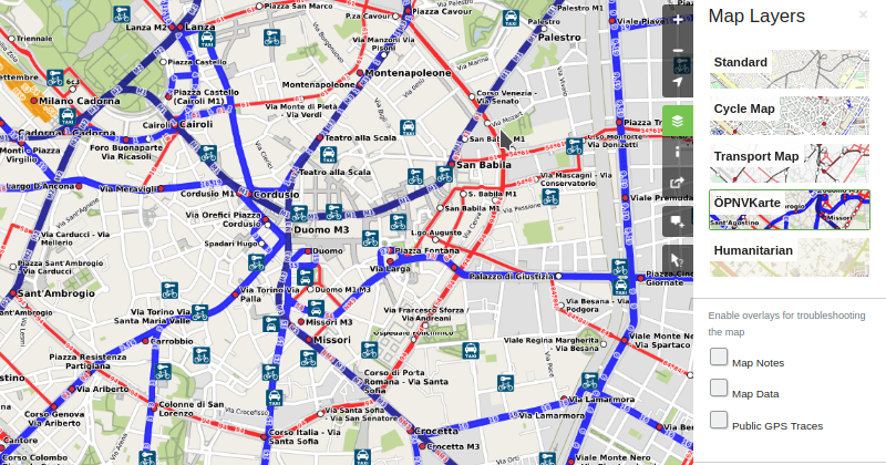
OSM con la mappa dei trasporti pubblici ÖPNV 1 | © Wikipedia | Map data © OpenStreetMap contributors
Mappatura
- Mateusz Konieczny vuole
 (traduzione automatica) sapere se ci sono dei tag per distinguere gli uffici aziendali in cui il pubblico può entrare e quelli in cui, se si provasse, si finirebbe per essere scortato fuori dalla sicurezza.
 - Michael Montani ha richiesto (traduzione automatica) commenti sulla sua proposta di introdurre un tag
natural=bare_soilper “un’area coperta dalla terra, senza vegetazione”. - Matthew Woehlke vuole (traduzione automatica) un feedback sulla sua proposta di
junction=intersection. Il nuovo tag identificherebbe porzioni di autostrada che fanno parte di un incrocio. - Skyler Hawthorne ha chiesto (traduzione automatica) alla lista di tagging se c’è un modo accettato per taggare gli edifici a terrazza che hanno un nome.
- Mike Thompson ha notato che
networkha diversi significati e possibili valori a seconda del tipo di percorso a cui viene aggiunto. Ha chiesto (traduzione automatica) alla lista di tagging perché il tag networknon può avere un significato coerente in tutti i tipi di percorso. - Qualcuno ha creato una relatione per le mura aureliane di Roma. Martin Koppenhoefer chiede (traduzione automatica) ai lettori della lista di tagging se questo ha senso.
- “Speciality coffee” è un termine che indica il più alto grado di caffè disponibile. Jake Edmonds sta cercando (traduzione automatica) suggerimenti su come etichettare i bar che servono questi caffè speciali.
- Continua la serie di streaming di Martijn van Exel del martedì sera su JOSM. È alla ricerca (traduzione automatica) di suggerimenti su ciò che potrebbe coprire nelle sessioni future.
- Fabian Kowatsch ha introdotto (traduzione automatica) il nuovo parametro filter disponibile nella piattaforma OpenStreetMap History Data Analytics (ohsome).
- higa4 ha analizzato (traduzione automatica) la quantità di cambiamenti in Giappone utilizzando ohsome.
- Il Partito Verde belga ha lanciato un nuovo strumento (traduzione automatica) per aiutare il crowdsource di informazioni sulle riserve naturali e le foreste. Lo strumento utilizza e contribuisce direttamente a OpenStreetMap.
 (
( (
(Comunità
- Nella mailing list Talk-at, il collaboratore plepe ha presentato (traduzione automatica) il suo tool ogd-wikimedia-osm-checker. Esso confronta le voci di diversi set di dati OGD con Wikidata, Wikipedia, Wikimedia Commons e OpenStreetMap. È stato fornito anche il codice sorgente.
- Lo scherzo del pesce d’Aprile di OSM del 2017 (adattamenti alla tettonica a piastre (traduzione automatica)) non è stata riconosciuta come tale da ScubbX e recentemente è stata avviata (traduzione automatica) una discussione in merito sulla mailing list Talk-at.
- I risultati del sondaggio svolto nelle scorse settimane nella comunità OSM Italia sono ora disponibili, è possibile inserire commenti e suggerimenti in un pad.
- Il membro del direttivo dell’OSMF Rory McCann riferisce (traduzione automatica) sulle sue attività di giugno – sia all’interno che all’esterno del direttivo.
- Harry Wood intende chiudere la decennale tradizione delle “featured images” settimanali, a meno che altri non siano disposti a farsi avanti e ad assumere il suo ruolo.
- Dara Carney-Nedelman ha scritto un articolo (traduzione automatica) della sua gioia per la scoperta della comunità OSM. Dara chiama anche tutti gli studenti, giovani e meno giovani, se i loro programmi estivi non sono come li immaginavano, ad imparare una nuova abilità: la mappatura.
 (
(Import
- Homy sta chiedendo (traduzione automatica) un feedback su una proposta di importazione di stazioni pubbliche di riparazione di biciclette nel Baden-Württemberg, Germania.
OpenStreetMap Foundation
- Il verbale (traduzione automatica) della riunione non pubblica del direttivo dell’OSMF dell’11 giugno 2020 è stato pubblicato. L’ordine del giorno comprendeva la selezione delle mozioni di microgrant, la richiesta di adesione di un possibile trasgressore di ODbL e le controversie dell’iD Editor.
- Il Data Working Group ha pubblicato (traduzione automatica) il suo rapporto di attività per il secondo trimestre del 2020. Oltre al numero di ticket, contiene descrizioni concise di alcuni casi in sospeso.
- Il direttivo dell’OSMF ha modificato (traduzione automatica) il proprio regolamento interno.
- Il verbale della riunione del Licensing Working Group dell’11 giugno è stato pubblicato (traduzione automatica).
- John Whelan ha spiegato (traduzione automatica) perché preferisca TransferWise a PayPal quando effettua pagamenti o donazioni all’OSMF.
- È stato pubblicato (traduzione automatica) il verbale della riunione del OSM System Administrators Group del 4 giugno.
Eventi
- I primi video dello State of the Map 2020 virtuale sono stati pubblicati su media.ccc.de.
OSM e l’azione umanitaria
- HOT è alla ricerca di un responsabile della comunità (traduzione automatica) per gestire il Community Team di HOT. Le candidature chiudono il 26 luglio 2020.
- HOT sostiene (traduzione automatica) il progetto di sviluppo integrato e resiliente di Accra per proteggere le comunità dalle inondazioni.
Mappe
- Martin Zdila ha esteso il supporto di freemap.sk ad Austria, Bosnia ed Erzegovina, Bulgaria, Croazia, Repubblica Ceca, Ungheria, Kosovo, Macedonia del Nord, Romania, Slovacchia, Svizzera e parte di Albania, Germania, Italia, Polonia e Ucraina.
- [1] La mappa dei trasporti pubblici ÖPNVKarte è ora disponibile come layer di mappa su OpenStreetMap.org. Il blog di OpenStreetMap presenta un articolo (traduzione automatica) sull’arrivo del nuovo layer.
- Stai pianificando un’azione e hai bisogno di una mappa? Con lo strumento Aktionskarten puoi creare una mappa in cinque minuti.
- Un utente olandese di OsmAnd vorrebbe (traduzione automatica) visualizzare le linee di livello ogni metro, una richiesta non irragionevole per un residente del paesaggio relativamente piatto della Olanda.
Licenze
- L’utente di Reddit brezherov ha chiesto (traduzione automatica) se Google Maps stia copiando OSM. Il dubbio è sorto quando ha notato, dopo aver aggiunto le attività e gli edifici locali a OSM, che nel giro di un paio di settimane Google Maps ha aggiornato in modo significativo quelle stesse aree.
Software
- Sam Crawford ha spiegato (traduzione automatica) come funziona il Trail Router. Trail Router è un pianificatore di percorsi il cui algoritmo di instradamento favorisce il verde e la natura, e ha dei pregiudizi nei confronti delle strade trafficate.
- Openbloc ha creato una nuova libreria JavaScript per la creazione di mappe 3D. Una demo può essere trovata qui.
Programmazione
- SviMik ha creato uno strumento per sincronizzare i vostri pfofili Mapillary e OpenStreetCam. C’è un thread (traduzione automatica) di discussione sul forum di Mapillary.
- L’utente K_Sakanoshita ha annunciato un aggiornamento a Town Walk Map Maker . L’aggiornamento migliora la rappresentazione della mappa, le informazioni sui POI e l’interfaccia.
Lo sapevi che…
- … esiste l’opportunità di contribuire a OSM ogni giorno, anche poco per volta? Ilya Zverev vi darà un piccolo compito quotidiano con il suo telegram bot “OSM Streak”.
- …esiste MapRoulette, che ti offre piccoli e semplici compiti che potete completare in meno di un minuto per migliorare OpenStreetMap?
Altre cose “geo”
- Harald Schernthanner ha distribuito una mappa (traduzione automatica) divertente via Twitter. Si suppone che mostri come una persona viennese immagini l’Austria su una mappa.
- Più si è ricchi, più si crea inquinamento luminoso. Asmi Kumar spiega (traduzione automatica) come il machine learning può stimare la ricchezza di un’area confrontando le immagini satellitari diurne e notturne.
- Il Long Beach Post ha riferito (traduzione automatica) su come hanno analizzato un registro dettagliato dei dati di ogni persona che il Dipartimento di Polizia di Long Beach ha fermato o arrestato nell’arco del 2019. Hanno usato OpenRefine per la pulizia dei dati e la creazione di impronte digitali n-gram per riconciliare i nomi delle strade non corretti con una lista canonica da loro creata utilizzando i dati OpenStreetMap dei nomi ufficiali delle strade e degli incroci di Long Beach.
- Un test di ingresso standardizzato all’università di Taiwan, Advanced Subjects Test, si è tenuto il 3-5 luglio a Taiwan. Il quiz di Geografia (traduzione automatica) è stato molto più relativo alla tecnologia rispetto ai test degli anni precedenti. La mappa che chiedeva di determinare dove acquistare mascherine per prevenire la diffusione del COVID-19 è uno degli argomenti del quiz che mostra il concetto di GIS.
Prossimi Eventi
NunoMASAzevedo
| Dove | Cosa | Quando | Nazione |
|---|---|---|---|
| Budapest | Auguszt patisserie test & drinks in La Piazza | 2020-07-16 |  |
| Colonia/Bonn | 129. Bonner OSM-Stammtisch (Online) | 2020-07-21 |  |
| Nottingham | Nottingham pub meetup | 2020-07-21 |  |
| Luneburgo | Lüneburger Mappertreffen | 2020-07-21 | |
| Berlino | 13. OSM-Berlin-Verkehrswendetreffen (Online) | 2020-07-21 | |
| Budapest | Cziniel patisserie test & hake on bank Római | 2020-07-21 | |
| Ludwigshafen a.Rhein (Stadtbibliothek) | Mannheimer Mapathons e.V. | 2020-07-23 | |
| Düsseldorf | Düsseldorfer OSM-Stammtisch | 2020-07-29 | |
| Londra | London Missing Maps Mapathon (ONLINE) | 2020-08-04 | |
| Stoccarda | Stuttgarter Stammtisch | 2020-08-05 | |
| Kandy | 2020 State of the Map Asia | 2020-10-31-2020-11-01 |  |
Nota: Se vorresti vedere qui elencato il tuo evento, per favore inseriscilo nel calendario. Solo i dati che sono lì inseriti appariranno nel notiziario. Per favore controlla il tuo evento nella nostra anteprima pubblica e correggilo, dove appropriato..
Questa Notiziario Settimanale OSM è stato prodotto da AnisKoutsi, LorenzoStucchi, Mannivu, Nakaner, Nordpfeil, Rogehm, TheSwavu, deeplPro API Call, derFred, geologist.