05/05/2020-11/05/2020
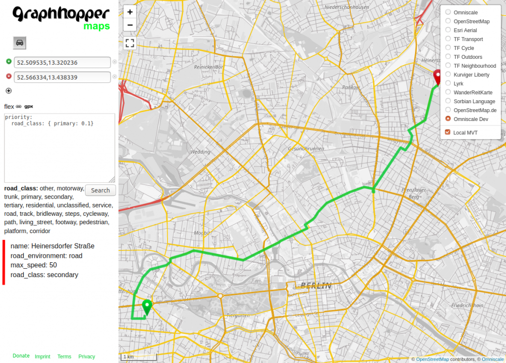
GraphHopper needs feedback – people can influence the route of GraphHopper. 1 | © GraphHopper | map data © OpenStreetMap contributors
Mapping
- _PG_ published
 (automatic translation) a list of techniques in his diary and tips for using JOSM that he has learned recently. Some things in the list may be new to even seasoned users of JOSM.
 - Jan Michel proposed improving vehicle tagging by including
electric_bicycle=andspeed_pedelec=into the schema for access rights. - Joseph Eisenberg wrote about how the proposal for
amenity=motorcycle_taxiwas not approved in a wiki vote. He makes a number of points, one which highlights how tag voting is dominated by people from first-world countries. - OpenStreetMap contributor IsStatenIsland shows a commendable attention to detail in their account of making the boundary of New York State on Ellis Island more accurate.
- higa4 describes (automatic translation) how to analyse and manipulate OSM data tagging with OpenRefine.
- Micromapping does not stop at playgrounds. In the German forum a discussion started (automatic translation) about the tagging of a tree house in a playground.
 (automatic
  (automatic
  (automatic
 Community
- The portal Ça reste ouvert is now active in Italy and the user interface has been translated into Italian. restiamoaperti.it allows users to visualise and update businesses’ availability and other specific information during the COVID-19 emergency. All of the data available in the map are based on OSM and are actively updated by the local OSM community. (automatic translation)
- Maggie Cawley and Alyssa Wright, from OSM US, are interviewed in Sustain Ep. 28, a podcast about sustainable FLOSS.
- User Silka123 summarised (automatic translation) a ‘Couchmapping’ project of the Russian community. 37 mappers helped to improve the data for Yegoryevsk, a town in the region of Moscow. This couchmapping was different than previous remote mapping activities as there was much more social interaction, not just conversations but also live streams during the mapping and a lot of knowledge transfer. Hence, it is not surprising that one commenter on Silka123’s blog post describes his personal, positive experience.
 is now active in Italy and the user interface has been translated into Italian.
  allows users to visualise and update businesses’ availability and other specific information during the COVID-19 emergency. All of the data available in the map are based on OSM and are actively updated by the
 OpenStreetMap Foundation
- Tobias Knerr started a talk on the OSMF mailing list titled: ‘Framework for the foundation’s hiring practices’ and initiated an ongoing discussion.
- The announcement of the application by Geolibres to become a local chapter of the OpenStreetMap Foundation in Argentina prompted a discussion about the legal barriers to becoming a member that exist in the by-laws of local chapters. Craig Allan noted that only the local chapter in Iceland has unlimited open-door membership.
- The OSMF Data Working Group published activity reports for the first and second quarters of 2019. The reports disclose noteworthy events of vandalism and copyright violations and are an interesting read, particularly regarding a novel type of vandalism termed ‘Anti-Pokemon’.
- The minutes of the meeting of the OSMF Licensing Working Group on 9 April have been published.
Events
- The Programme for the online conference State of the Map 2020 (4 and 5 July) has been published.
Humanitarian OSM
- HOT presented the new Tasking Manager. The improved frontend with integrated iD editor and mapping roles such as Validators, Mapper and Project Manager are intended to assist collaborative mapping.
- Sawan Shariar, from the OpenStreetMap Bangladesh Foundation, blogged about his background, HOT’s role in the humanitarian mapping world and his new role as Data Quality Intern for HOT. The hire of a ‘Legendary Mapper (Highly Active)’ in a position intended to care about data quality will hopefully lower the number of complaints about data quality issues.
Open Data
- Researchers from the University of Southampton have created the first global, open-access, harmonised spatial datasets of wind and solar installations. The data are based on power infrastructure objects in OpenStreetMap. They analysed global distribution and estimated output through a combination of techniques including other third-party external data. The datasets are available in a range of formats: geopackages, shapefiles, or comma-delimited text. Last but not least their data pipeline is documented and can be re-run anytime. It is worth checking in OpenInfraMap whether the power infrastructure around your area is mapped correctly.
- Mikel Maron, from Mapbox, described how mobility data and map data can be used to analyse the risks which arise from a ‘re-opening’, or the different types thereof, to help communities and policymakers.
- The OpenStreetMap Croatia team has processed and published two sets of data from the Zagreb City Office for the Strategic Planning and Development of the City, for which permission has been granted for use in OpenStreetMap. These are topographical data (automatic translation) and POI data (automatic translation) for the city.
Programming
- [1] GraphHopper needs feedback for a new feature where even people without programming or Java knowledge can influence the routes produced by GraphHopper.
- Jochen Topf continues his blog posts about osm2pgsql. Last month he wrote about the technical details and changes he made to reduce the ‘technical debt’ in the code. He now continues with a blog post about his work on adding ‘flex output’, an output option for osm2pgsql which allows the user to specify the handling, transformation and database storage options for each OSM object.
Releases
- Joseph Eisenberg announced the release of v5.2.0 of the OpenStreetMap Carto style sheet, which is the style for OSM’s main map. The changes include adding rendering of
man_made=goods_conveyorandwaterway=canalwithtunnel=flooded, removing rendering of residential, unclassified, cycleway, path, and track highway areas, and many more changes, which are as usual listed on GitHub. - With v19 Tobias Zwick has released a large update for StreetComplete. The most important additions are statistics and achievements through which users are introduced to OpenStreetMap, its editors, community and related projects. In the release notes, he mentions that this will probably be the last big update for some time.
Did you know …
- … that Ed Pratt cycled around the world and used maps.me and OSM to navigate his way? The rest of his videos are enjoyable as well.
- … OSM Streak, the gamified web application that encourages you to do small tasks for OpenStreetMap every day? There is also a channel on Telegram named @osm_streak.
Other “geo” things
- Bloomberg’s CityLab features an article on how forms and functions of maps change during the coronavirus. The article also highlights the efforts of the Library of Congress to collect maps and visualisations of the coronavirus pandemic and includes an interview with John Hessler, from the Library of Congress.
- These maps reveal how COVID-19 has influenced our mobility patterns.
Upcoming Events
Many meetings are being cancelled – please check the calendar on the wiki page for updates.
Note: If you like to see your event here, please put it into the calendar. Only data which is there, will appear in weeklyOSM. Please check your event in our public calendar preview and correct it, where appropriate.
This weeklyOSM was produced by AnisKoutsi, Nakaner, PierZen, Polyglot, Rogehm, SK53, Sammyhawkrad, SunCobalt, TheSwavu, YoViajo, derFred, hbogner, jinalfoflia.
Graphhopper also needs contributors / java devs to help with offline routing
https://discuss.graphhopper.com/t/future-of-offline-routing/5264/3
Hi there
I’m searching a way to link the OSM opening hours of a shop to a calendar file on a website.
Is there a common standard how I could e.g. link a iCAL file where a shop owner could set Opening hours, hollydays, etc.
If something like that not exist where could I put that propose?
Please note that we do not provide support for OSM.
Please contact
* the mailing lists, https://lists.openstreetmap.org/listinfo
* the forums https://forum.openstreetmap.org/
* or the help. https://help.openstreetmap.org/