28/04/2020-04/05/2020
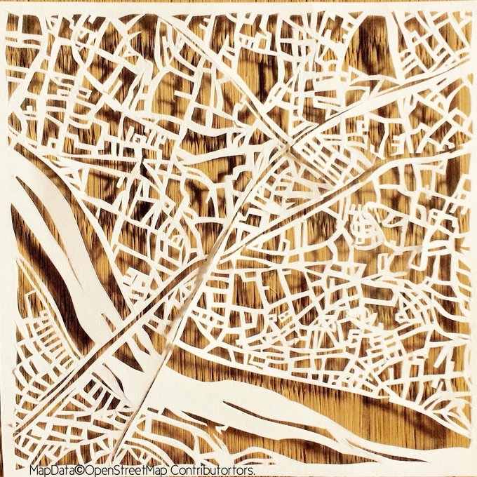
UtaArts paper cutout art of OSM map 1 | © あいかうたう / 切り絵の地図屋 | map data © OpenStreetMap contributors
Mapping
- muramoto tweeted about a list of Mapillary related tools he has made available.
- Richard Fairhurst points to a curious reason for sticking with volunteer on-the-ground mapping. A local mapper added a
highway=trackto OSM, which Richard assumes to be correct. An Amazon Logistic mapper changed it to a service road and a Mapbox remote mapper raised a note complaining that a driver could not use this way. - Joseph Eisenberg plans to drop the tag
healthcare=pharmacyin favour of the 2006 approved and widely usedamenity=pharmacy. According to the proposal,healthcare=pharmacywas unilaterally implemented as a preset in one editor two years ago. - Valor Naram wants to replace the prefix
contact:*=on all occurrences of contact keys such asphone=,email=and others. His last try failed five months ago with a high turnout of 45 in favour and 61 votes against. Hence the new venture wasn’t appreciated by the readers of the tagging mailing list. - Martin Koppenhoefer started a proposal for
ele:regional=and asks for comments. The new key should provide a space for elevation based on a ‘regionally common reference system’. - DeBigC summarised his experience of the Irish #StayHomeAndMapIRL mapping sprint, which was held after everyone in Ireland was instructed to stay home.
- Chris Beddow, a Mapillary solutions engineer, hosted a webinar on how to improve the map in the fight against COVID-19.
- The voting for
traffic_signals=crossing_onlyfor traffic lights which control a pedestrian crossing, as opposed to an intersection, has started. It seems that the Request for Comment period was not used to discuss the proposal properly, but the discussions have started now, in the voting section and on the German forum (automatic translation).
 - The latest Mapillary for JOSM release brings new features for the JOSM plugin: more flexible filters, enhanced changeset tagging, support for organisations, and more. In a blogpost Chris Beddow, from Mapillary, provides some background information.
 (automatic
 Community
- OSM Ireland summarised the outcome of its recent #StayHomeAndMapIRL mapathon. 91 mappers added 39,208 buildings. There are still tasks to work on.
- The OSMF board member Rory McCann recaps his OSM activity in a blog post on OSM.org. The summary covers his board activities as well as his work for the Communication Working Group, hacking, mapping and socialising and a mystic puzzle titled ‘For later’.
- The minutes from the OpenStreetMap U.S. meetings on 3 February and 27 March are now available online.
- Maria Popova was looking (automatic translation) for a solution to map Sosnovsky’s Hogweed, an invasive plant species that causes burns when skin is exposed to sunlight after touching it. An even bigger problem is that without intervention, it continues spreading. On Yandex maps she was able to mark it as points, but her organisation ‘Antiboroshevik’ really needed the ability to draw polygons. She was pointed to uMap and the contributors of patches of Hogweed were pleasantly surprised by the amount of detail on the background map. We also previously reported on a Sosnovsky’s Hogweed map based on remote sensing.
- Valeriy Trubin continues his series of interviews with people in OSM. This time he spoke with one of those who use OSM in their eco-projects – Nikolai Petrov (automatic translation), the founder of the service OpenRecycleMap.
 (automatic
 OpenStreetMap Foundation
- The minutes of the meeting of the OSMF Microgrant Committee of 30 April 2020 have been made available.
Humanitarian OSM
- In their Missing Maps blog post, Jennifer Duong, David Luswata, and Tino Toupane describe mapping activities, both armchair and on-site, in Guinea.
- HOT mapped, with the support of the Response Innovation Lab in Uganda, all shops for energy-saving solutions in the refugee settlement of Bidibidi, in order to better understand the existing market, and to promote the improvement of the refugee population’s access to high-quality energy-saving products.
- In a blog entry HOT reported how the organisation has adapted to the current events caused by COVID-19.
Education
- Eduard Kazakov held an educational webinar about coordinate systems in GIS and their use in QGIS.
Maps
- [1] UtaArts created paper cut art using the OSM map and released the video of the creation process. In the Twitter timeline, you can view various artworks of cutout maps.
switch2OSM
- A new guide has been added to Switch2OSM covering setting up a tile server using Ubuntu 20.04 (Focal Fossa).
Licences
- Christoph Hormann has written a blog post about OpenStreetMap’s attribution. The text is also available on the wiki.
Software
- SharedStreets released Mashnet, a programming library for merging overlapping street networks without breaking existing important connections.
- Heidelberg University’s GIScience Research Group announced a feature upgrade to its maps client on maps.openrouteservice.org. The service now suggests alternative routes, can help with round trips and allows skip-segments parameters to be sent to the API by adding manual waypoints to ‘force openrouteservice to traverse areas of missing data or “unpassable” terrain’.
- westnordost has made a new version of his Android mapping tool StreetComplete available. According to the release notes on Github he has reworked the UI, added a profile screen and made some other fixes and enhancements.
- As we have noted before, OSM user Vascom has started assembling new maps for Maps.Me. Not so long ago he added (automatic translation) new countries: Czech Republic and Poland.
Programming
- The ten year old Stamen toner map style was ported as a vector style to MapTiler Cloud (Mapbox GL).
- Jochen Topf is working on cleaning up the code in Osm2pgsql. This software is used to import OSM data into a PostgreSQL database. Over time it has became bloated which makes it difficult to add new features. This is very important work and he is glad he found Andy Allan, of Thunderforest, and Frederik Ramm, of Geofabrik, prepared to help fund it.
Releases
- Quincy Morgan announced the upgrade of the OSM editor iD to version v2.17.3. In a post to the openstreetmap-website mailing list he details the changes in the new version. The most important change is the new function to allow flagging places which are open during coronavirus lockdowns, along with special opening hours.
Did you know …
- … there is a website (automatic translation) where you can download the latest OSM maps for CIS countries and all regions of Russia, Ukraine and Belarus in PBF format? In addition, there are boundary polygons available and scripts that can be used to create such downloads.
- … about OpenDroneMap, an open source program that you can use to assemble orthophotomaps? Drone owners do not shoot orthophotomaps very often as the software for their assembly is quite expensive. This app is designed to change this situation. By the way, orthophotoplans themselves can be stored on the OpenAerialMap server, from which you can access them for mapping in OSM.
- … it is possible to show photos in a very nice way over an OSM background using Leaflet Javascript Library? Wjst will fix the lack of proper attribution as soon as possible.
- … about the Mapathoner, a plugin for JOSM, that allows you to draw objects quickly and easily?
- … about the nakarte.me website, where you can easily compare various online maps? You can also use it to plan and analyse tourist routes. Not so long ago, its developer posted (automatic translation) detailed documentation. Unfortunately, the website fails to provide an attribution or copyright notice for any of the provided maps.
Other “geo” things
- Massimo points to an animated gif from Jakub Nowosad which shows the distortion of the Mercator projection by zooming the objects from Mercator to the their true size.
- Another sidewalk (pavement) width map, this time of London. The researchers from the _Streets group at the Bartlett (UCL) used detailed Ordnance Survey data to map streets where the width of the sidewalks in total is greater than 6 m wide, defined as being suitable for social distancing.
- Daniel Sokolov explains (automatic translation) on heise.de how the USA initially used the positioning service GPS as a military tool and deliberately deteriorated its accuracy for civilian users over the years.
- The World Economic Forum presented five ways in which swarm intelligence can prevent the spread of the coronavirus in developing countries.
- The Washington Post uses dynamic maps to show how an interstate highway in the western United States cuts through wildlife migration routes that have existed for thousands of years. Due to climate change, more and more animals in the Rocky Mountains are migrating, making the road a hotspot for wildlife accidents.
- Reuters reported: Intel in talks to buy Israel’s Moovit public transit app for $1 billion. The issue is discussed on Hacker News as well. Note that their corporate edits haven’t always fitted in with the way we do things in OSM.
Upcoming Events
Many meetings are being cancelled – please check the calendar on the wiki page for updates.
Note: If you like to see your event here, please put it into the calendar. Only data which is there, will appear in weeklyOSM. Please check your event in our public calendar preview and correct it, where appropriate.
This weeklyOSM was produced by Nakaner, PierZen, Polyglot, Rogehm, SK53, Silka123, SunCobalt, TheSwavu, YoViajo, derFred, keithonearth.
ad Community, Maria Popowa: “Sosnowskys Bärenklau” ist laut Wikipedia ein enger Verwandter des Riesenbärenklau; dieser dürfte ob seiner Gefährlichkeit für Mensch und Natur weitaus bekannter sein. Er ist auch wohl deswegen das Beispiel auf
https://wiki.openstreetmap.org/wiki/Invasive_Non-Native_Species
fürs Tagging solcher Arten.