16/11/2021-22/11/2021
Open Indoor Viewer OpenLevelUp [1] | © OpenLevelUp | map data © OpenStreetMap contributors
About us
- Kai Michael Poppe has extended his multi-purpose-bot to also inform the D-A-CH Telegram group when a new issue of weeklyOSM is published.
- Kai invited other Telegram groups that are interested to make use of this service too, using a new bot.
- We have created a spreadsheet in which we ask administrators to enter the Telegram group that they want to be served directly when a new weeklyOSM is published.
Mapping
- Managing imagery alignment has always been a problem; bdhurkett found a solution for Burnie (Tasmania) as suburb polygons are well aligned with fences and other property boundaries. They outline how they are incrementally adjusting OSM objects to match these alignments more consistently.
- SherbetS showed a setup for river mapping using a PlayStation controller and JOSM.
- SK53 continued his examination of how
natural=heathis used in Wales with a detailed example of a small hilltop heathland which was previously unmapped. - Voting is underway for the following proposals:
motorroad=yes > , to formalise a definition of
 motorroadfor Japan, until Saturday 4 December.ref:EU:bwid=*, to record the unique identifier of a bathing site, until Monday 6 December.
 >
> 
Community
- Canadian cartographers discussed, on the forum, the relevance of special mapping for flood disasters and landslides in various areas of British Columbia.
- The Local Chapters and Communities Working Group presented the ‘OpenStreetMap Welcome Tool’. The tool is designed to make it easy to welcome new mappers to your country or region.
OpenStreetMap Foundation
- On the OSMF mailing list Heikki Vesanto suggested a ‘made with OSM logo’ along the lines of those of Natural Earth and QGIS. Note that this is subtly different from an OSM mark, an idea which was recently revived (as we reported earlier), in that it would be additional to, not a replacement for, existing attribution requirements.
- Michal Migurski, candidate for the OSMF Board, asked on MetaFilter about ‘organisations that form in spite of their grassroots counterparts’, and asked how ‘new members’ could ‘circumvent a community organisation to form something larger and more organised’.
Events
- Both State of the Map Africa and the HOT Summit occurred last weekend (20 and 22 November), a little too late for inclusion of highlights in this week’s weeklyOSM. One talk several people noted on Twitter, was by Alazar Tekle from AddisMap, one of the earliest OpenStreetMap startups anywhere in the world. No videos, at present, but you can view their, virtual, presentation at State of the Map 2010 on YouTube.
Education
- Pascal Neis left a message on the changeset of a Chinese newcomer to ask why they deleted lots of data. Another user in the comments pointed out that this was OSM mapping homework assigned to students by an instructor at Central South University. Other mappers from China also showed their disappointment > with these homework changesets. Should teachers be responsible for such improper behaviour of students? How should we deal with the teacher’s assignment of editing in OSM as homework?
- Videos of presentations by Heidelberg Institute for Geoinformation Technology (HeiGIT), given at the recent FOSS4G conference, are now available online. Subjects include: an OSM Confidence Index developed using the ohsome.org framework, and an introduction and update on MapSwipe .
 >
> OSM research
- Alexander Zipf’s group has received funding to start a new project related to climate change actions – ‘GeCO – Generating high-resolution CO2 maps by Machine Learning-based geodata fusion and atmospheric transport modelling’.
Maps
- Here are some selected OpenStreetMap-based maps from the penultimate week of the #30DayMapChallenge, which we have been following all month:
- Day 17: Land: Steven Kay produced a rotating globe with only the largest islands visible.
- Day 18 : Water: P*C chose an area of Florida with extensive waterways.
- Day 19: Islands: Ross Island, Antarctica (Andrew Tyrell) and the islands of Abu Dhabi (leeolney3).
- Day 20 : Movement: colourful isochrones of cycle times around Dumfries (D&G Placenames).
- Day 21 : Elevation: Tbilisi (Lika Zhvania).
- Day 22: Boundaries: Arctic boundaries with a polar projection (Andrew Zolnai), and a tiny pene-enclave on the Norway-Sweden border (Steven Kay).
Software
- The website Visionscarto announced > the launch of three tools built with OpenStreetMap and uMap to identify available agricultural lands and their uses by the association ‘Terre de liens’.
- Hauke Stieler created a web application called OSM Open to find POIs that are open at a selected point in time. The data can also be filtered by tags and the source code is available on GitHub. He has chosen to hide the OpenStreetMap attribution by default.
 >
> Did you know …
- … the existence of the
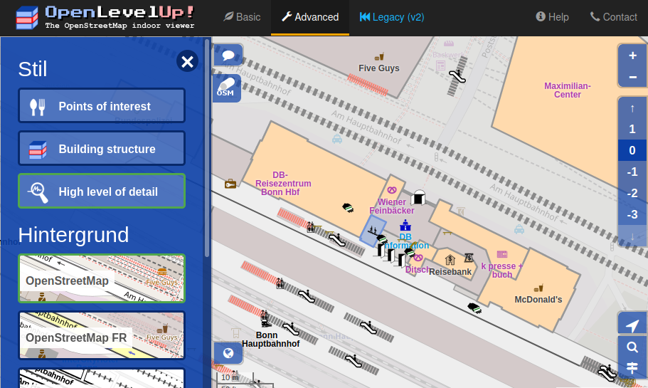
xmas:featurekey? While scarcely used (about 2000 items) and mainly in Germany, this ‘in use’ tag was introduced in 2009 and grows each year by a few hundred or so. Its use has been debated and a merging proposal with thetemporary:namespace was made, but the proposal has been inactive since 2016. - [1] … the Open Indoor Viewer called ‘OpenLevelUp‘?
- … there is a list of new keys recently created in OSM? Most of them involve typos or ignorance of established tagging principles. Comes with direct links to correct them.
- … OSM Streak, the gamified web application that encourages you to do small tasks in OpenStreetMap every day? There is also a Telegram account named @osm_streak_bot, which you can configure to remind you of your daily task.
OSM in the media
- The government of France has unveiled > its action plan for open source software and digital commons which, as its name suggests, aims to strengthen the use of open source and encourage the opening up of public data. A specific objective is to reference open source software and digital commons such as OpenStreetMap, a free and collaborative digital tool from which other tools such as transport.data.gouv.fr > are derived.
Other “geo” things
- Archival geodata are now available > as WMS layers from the Polish national geoportal.
- The general secretariat of the German Red Cross (GRC), based in Berlin, is looking for a ‘Manager Geoinformatics’. The position is responsible for the implementation of the project ‘Development of geoinformatics for the international humanitarian aid activities of the GRC – Strengthening the cooperation with the Heidelberg Institute for Geoinformation Technology’. The person chosen will also help develop programmes and basic approaches for the use and support of OpenStreetMap.
- Reibert wrote > about the official state register [uk] > of permits to harvest timber in Ukraine.
- SkyNews reported that Mapbox’s route to a stock market listing, through a Softbank SPAC (Special Purpose Acquisition Company), has run out of steam.
 >
>  for a ‘Manager Geoinformatics’. The position is responsible for the implementation of the project ‘Development of geoinformatics for the international humanitarian aid activities of the GRC – Strengthening the cooperation with the Heidelberg Institute for Geoinformation Technology’. The person chosen will also help develop programmes and basic approaches for the use and support of OpenStreetMap.
 >
> Upcoming Events
| Where | What | Online | When | Country |
|---|---|---|---|---|
| UCB Brasil + CicloMapa: curso de mapeamento | 2021-11-16 – 2021-11-26 | |||
| UN Map Marathon | 2021-11-22 – 2021-11-26 | |||
| [Online] OpenStreetMap Foundation board of Directors – public videomeeting | 2021-11-26 | |||
| Brno | November Brno Missing Maps mapathon at Department of Geography | 2021-11-26 |  | |
| HOTOSM Training Webinar Series: Beginner JOSM | 2021-11-27 | |||
| Amsterdam | OSM Nederland maandelijkse bijeenkomst (online) | ✓ | 2021-11-27 |  |
| 長岡京市 | 京都!街歩き!マッピングパーティ:第27回 元伊勢三社 | 2021-11-27 |  | |
| Bogotá Distrito Capital – Departamento | Resolvamos notas de Colombia creadas en OpenStreetMap | 2021-11-27 |  | |
| 泉大津市 | オープンデータソン泉大津:町歩きとOpenStreetMap、Localwiki、ウィキペディアの編集 | 2021-11-27 | | |
| Biella | Incontro mensile degli OSMers BI-VC-CVL | ✓ | 2021-11-27 |  |
| 津山のWEB地図作り~OSMのはじめ方~ | 2021-11-28 | |||
| Chamwino | How FAO uses different apps to measure Land Degradation | ✓ | 2021-11-29 |  |
| OSM Uganda Mapathon | 2021-11-29 | |||
| Salt Lake City | OpenStreetMap Utah Map Night | 2021-12-02 |  | |
| Paris | Live Youtube Tropicamap | 2021-12-01 |  | |
| Missing Maps Artsen Zonder Grenzen Mapathon | 2021-12-02 | |||
| Bochum | OSM-Treffen Bochum (Dezember) | 2021-12-02 |  | |
| MapRoulette Community Meeting | 2021-12-07 | |||
| San Jose | South Bay Map Night | ✓ | 2021-12-08 | |
| London | Missing Maps London Mapathon | 2021-12-07 |  | |
| Berlin | OSM-Verkehrswende #30 (Online) | 2021-12-07 | | |
| Landau an der Isar | Virtuelles Niederbayern-Treffen | ✓ | 2021-12-07 | |
| Stuttgart | Stuttgarter Stammtisch (Online) | 2021-12-07 | | |
| CASA talk: Ramya Ragupathy, Humanitarian OpenStreetMap Team | 2021-12-08 | |||
| London | London pub meet-up | 2021-12-08 | | |
| Chippewa Township | Michigan Meetup | ✓ | 2021-12-09 | |
| Großarl | 3. Virtueller OpenStreetMap Stammtisch Österreich | 2021-12-09 |  | |
| Berlin | 162. Berlin-Brandenburg OpenStreetMap Stammtisch | ✓ | 2021-12-10 | |
| [Online] 15th Annual General Meeting of the OpenStreetMap Foundation | 2021-12-11 | |||
| Grenoble | OSM Grenoble Atelier OpenStreetMap | 2021-12-13 | | |
| 臺北市 | OSM x Wikidata Taipei #35 | 2021-12-13 |  | |
| Toronto OpenStreetMap Enthusiasts Meeting | 2021-12-14 | |||
| Washington | MappingDC Mappy Hour | 2021-12-15 | | |
| Derby | East Midlands OSM Pub Meet-up : Derby | 2021-12-14 | | |
| Helechosa de los Montes | Reunión mensual de la comunidad española | 2021-12-14 |  |
Note:
If you like to see your event here, please put it into the OSM calendar. Only data which is there, will appear in weeklyOSM.
This weeklyOSM was produced by Lejun, Nordpfeil, PierZen, RCarlow, SK53, Strubbl, TheSwavu, YoViajo, conradoos, derFred.