23.11.2021-29.11.2021
Verlängern Sie noch HEUTE Ihre kostenlose 42 Tage Mitgliedschaft [1] | © OSMF Vorstand
Mappingaktionen
- Ab 05.12.2021 könnt Ihr über den neuen Schwerpunkt abstimmen, der vom 12. Dezember 2021 bis 8. Januar 2022 läuft. Der „Schwerpunkt der Woche“ umfasst derzeit einen ganzen Monat, damit das Schwerpunktideendepot wieder mit neuen Ideen aufgefüllt werden kann.
Mapping
- Enock4seth hat
 > sich darüber beschwert, wenn die Kommentare zu Changesets nur aus Hashtags bestehen. Diese machen es schwierig, genau zu verstehen, welche Änderungen in Ghana vorgenommen werden.
 >
> 
Community
- LuxuryCoop wurde > im Rahmen der Geomob-Podcastreihe über OpenStreetMap in Südkorea interviewt.
- Der Mitwirkende LySioS hat die „10 Gebote des OSM-Beitrags“ in Bildern mit Texten in illustriert. Lies auch die Kommentare dazu.
 illustriert.
 OpenStreetMap Foundation
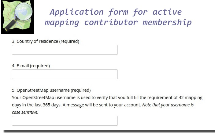
- [1] Welche Mitgliedschaften gibt > es in der OSM Foundation?Beantrage eine kostenlose Mitgliedschaft, wenn Du im letzten Jahr 42 Tage gemappt oder auf andere Weise beigetragen hast.
- OSMF-Mitglieder können ihre Mitgliedschaft bis Samstag, den 4.
MaiDezember [update], über das Antragsformular für die Mitgliedschaft als aktiver Kartierer erneuern > . Dies beinhaltet die Mitgliedschaft als aktiver Mapping Contributor (42 Tage OSM-Mapping im letzten Jahr) - Allan Mustard hat > den Jahresbericht des Vorsitzenden für 2021 veröffentlicht und erinnert > die Mitglieder der Stiftung daran, dass die Jahreshauptversammlung vor der Tür steht (online im IRC-Chatraum #osmf-gm im IRC-Netzwerk irc.oftc.net, am 11. Dezember 2021, um 16.00 UTC). Die Wahl zur Neubesetzung von vier Sitzen im OSMF-Vorstand (sechs Kandidaten) beginnt am 4. Dezember und es gibt auch einen Vorschlag zur Änderung der Satzung, damit die Zeit als assoziiertes Mitglied für die Kandidatur für den Vorstand angerechnet wird. Bitte vergesst nicht, mit abzustimmen!
- Auf dem OSM-Wiki findet > man die Links zu den Antworten der Kandidaten für die OSMF-Vorstandswahl 2021 und deren Manifeste.
- Wusstet ihr, dass die monatlichen Vorstandssitzungen der OSMF > öffentlich sind und live im Internet übertragen werden? Die Termine werden in einem OSS-Kalender veröffentlicht.
Veranstaltungen
- Die State of the Map Africa 2021 fand vom 19. bis 21. November online statt. Eine Auswahl von Überlegungen zu dieser Veranstaltung:
- Erick Tamba STATE OF THE MAP AFRICA 2021: (SMCoSE YouthMappers)
- Maria Nabuwembo Wir feiern die offene Kartierungskultur und ihre Auswirkungen in ganz Afrika
- Vickystickz > Meine Erfahrung @State of The Map 2021
- Sheila Job Entwicklung von Lösungen mit Hilfe von Daten
Ausbildung/Schulung
- stragu veröffentlichte > den RStats- und OpenStreetMap-Workshop, der auf der State of the Map 2021 vorgestellt wurde, und präsentierte ihn erneut auf dem ResBazQld (Research Bazar Queensland).
- Wir berichteten dazu letzte Woche: Der taiwanesische Mapper Supaplex weist > die Community-Mitglieder auf die Richtlinien für die organisierte Bearbeitung > hin, damit sie die offensichtlichen Aufgaben, die ihnen von den Lehrern der Schule gestellt werden, einschränken und ihre Kontaktinformationen und Kartierungszwecke registrieren können. Er bezweifelt jedoch, dass für die Kartografie in China eine staatliche Genehmigung erforderlich ist, was nicht unbedingt ein guter Weg ist, um die Chinesen zu bitten, die Richtlinien für die organisierte Bearbeitung zu befolgen und die Kontaktinformationen und den Zweck des Kartierungsprojekts zu registrieren.
Karten
- Sundellviz zeigt > mit „where to get a drink in Europe“ eine Karte, auf der alle Cafés, Bars, Pubs und Biergärten in Europa als verschiedenfarbige Punkte dargestellt sind. Wie in den Kommentaren dargelegt, scheint die Tatsache, dass jede Art von Lokal in jedem Land mit anderen Begriffen bezeichnet wird, die Ursache für einige farbliche Auffälligkeiten auf der Karte zu sein. Siehe hierzu als Beispiel den Wikieintrag für
amenity=bar. - Bristow erklärt > , wie man in OSMAnd Luftaufnahmen hinzufügt, insbesondere die des französischen Nationalen Geographischen Instituts.
- Hier sind einige ausgewählte OpenStreetMap-basierte Karten aus der vorletzten Woche der #30DayMapChallenge, die wir verfolgt haben:
- Tag 23: GHSL: die zweite Herausforderung, die auf einer Nicht-OSM-Datenquelle basiert. Dror Bogin war der Meinung, dass sie OSM-Daten hinzufügen mussten, um es für Island „interessant“ zu machen.
- Tag 24: Historische Karte: Heikki Vesanto zeigt die laufenden Bemühungen der irischen OSM-Gemeinschaft, alle Gebäude in Irland zu kartieren.
- Tag 25: Interaktive Karte: Zihan Song veranschaulicht die Interaktionen mit einer Karte von Lädenstandorten, die aus OSM extrahiert wurden.
- Tag 26: Choroplethenkarte: Topi Tjukanov, der die Challenge ins Leben gerufen hat, teilt Helsinki nach der nächstgelegenen Lebensmittelkette zu OSM-Gebäuden ein.
- Tag 27: Heatmap: Hans van der Kwast weist auf die Konzentration von Fahrradabstellplätzen in Südholland (Niederlande) hin, die in OSM kartiert sind.
- Tag 28: Die Erde ist nicht flach: Fedir Gontsa zeigt die Abdeckung des größten privaten Post- und Kurierdienstes in der Ukraine anhand von OSM-Daten.
- Tag 29: Null: Ryan Hart findet eine Null Road im OSM-Straßennetz von North Carolina, USA.
- Tag 30: Metamapping: Am letzten Tag der Challenge, während die meisten Teilnehmer eine Pause einlegten, kartierte Marie Anna Baovola Gebäude und Straßen in Kigali, Ruanda, die sie aus OSM-Daten gewonnen hatte.
Open-Data
- Das brasilianische Institut für Geographie und Statistik (IBGE) hat am 27. Oktober die kontinuierliche vektorielle kartographische Basis des Bundesstaates Rio Grande do Sul, Brasilien, veröffentlicht > . Diese IBGE-Daten sind für die Verwendung in Openstreetmap frei verfügbar.
 >
> Programme
- Sarah Heidekorn berichtet > von neuen Möglichkeiten, wie auf die ohsome API, einer Applikation, die es nicht-Programmierern ermöglicht, die reiche Vielfalt an historischen OpenStreetMap (OSM) Daten zu analysieren, zugegriffen werden kann. Tools, die dabei helfen, sind das ohsome-py Paket, das ohsome R Paket, das ohsome QGIS Plug-In und ohsome2x.
Programmierung
- Colin Angus, VictimOfMaths, stellt seit einiger Zeit den R-Code für alle Plots, die er auf Twitter zeigt, zur Verfügung. Ein Nebeneffekt seiner Teilnahme an der #30DayMapChallenge ist, dass der Code für seine Isochronenkarte auf Github verfügbar ist.
Kennst du schon …
- … den Web to OSM Opening Hours converter? Du kannst Webseiten-Inhalt – inklusive Tabellen – per copy&paste in ein Feld kopieren aus dem dann der textuelle Inhalt extrahiert und in einen Wert konvertiert wird, der zum
opening_hours-Schlüssel passt.
Weitere Themen mit Geo-Bezug
- ABC News berichtete > darüber, wie eine detaillierte Lidar-Analyse die Nichteinhaltung strenger Gesetze zum Schutz wertvoller Wassereinzugsgebiete im australischen Bundesstaat Victoria durch das staatliche Holzunternehmen aufgedeckt hat.
- Die Laotian Times berichtete > , dass die Nationalversammlung von Laos ein Gesetz verabschiedet hat, welches Geldstrafen bis 9 Mio loatischer Kip (~ 734 €) für nicht genehmigte Kartierungen und Kartenveröffentlichungen vorsieht.
- BBC News stellte > Geograph vor, eine Website, auf der Teilnehmer geografisch verortete Fotos, gruppiert nach 1 km-Rasterquadraten, veröffentlichen. Obwohl sie ursprünglich von den britischen Inseln stammt, gibt es auch eine deutsche Version. Die Fotografien sind CC-BY-SA lizensiert.
Wochenvorschau
| Wo | Was | Online | Wann | Land |
|---|---|---|---|---|
| MapRoulette Community Meeting | 2021-12-07 | |||
| San Jose | South Bay Map Night | ✓ | 2021-12-08 |  |
| London | Missing Maps London Mapathon | 2021-12-07 |  | |
| Berlin | OSM-Verkehrswende #30 (Online) | 2021-12-07 |  | |
| Landau an der Isar | Virtuelles Niederbayern-Treffen | ✓ | 2021-12-07 | |
| Stuttgart | Stuttgarter Stammtisch (Online) | 2021-12-07 | | |
| CASA talk: Ramya Ragupathy, Humanitarian OpenStreetMap Team | 2021-12-08 | |||
| London | London pub meet-up | 2021-12-08 | | |
| Chippewa Township | Michigan Meetup | ✓ | 2021-12-09 | |
| Bratislava | Missing Maps mapathon Slovakia online #5 | ✓ | 2021-12-09 |  |
| Großarl | 3. Virtueller OpenStreetMap Stammtisch Österreich | 2021-12-09 |  | |
| Berlin | 162. Berlin-Brandenburg OpenStreetMap Stammtisch | ✓ | 2021-12-10 | |
| [Online] 15th Annual General Meeting of the OpenStreetMap Foundation | 2021-12-11 | |||
| Grenoble | OSM Grenoble Atelier OpenStreetMap | 2021-12-13 |  | |
| 臺北市 | OSM x Wikidata Taipei #35 | 2021-12-13 |  | |
| OSMF Engineering Working Group meeting | 2021-12-13 | |||
| Toronto OpenStreetMap Enthusiasts Meeting | 2021-12-14 | |||
| Washington | MappingDC Mappy Hour | 2021-12-15 | | |
| Derby | East Midlands OSM Pub Meet-up : Derby | 2021-12-14 | | |
| Reunión mensual de la comunidad española | 2021-12-14 | |||
| 京都市 | 幕末京都オープンデータソン#15:岩倉具視と岩倉村 | 2021-12-18 |  | |
| Bonn | 146. Treffen des OSM-Stammtisches Bonn | 2021-12-21 | | |
| Lüneburg | Lüneburger Mappertreffen (online) | 2021-12-21 | |
Hinweis:
Wer seinen Termin hier in der Liste sehen möchte, trage ihn in den OSM Kalender ein. Nur Termine, die dort stehen, werden in die Wochennotiz übernommen.
Diese Wochennotiz wurde erstellt von Nordpfeil, SK53, Strubbl, derFred.
Zum Abschnitt OpenStreetMap Foundation:
OSMF-Mitglieder können ihre Mitgliedschaft bis Sonntag, den 4. Mai … erneuern …
Ich verstehe den Termin 4. Mai nicht; eine Erneuerung ist doch immer möglich? Bezogen auf die Jahreshauptversammlung ist m.E. der Termin der 04.12.2021 (siehe: https://lists.openstreetmap.org/pipermail/osmf-talk/2021-November/008224.html), der Hinweis wäre also zeitkritisch.
Außerdem ist der 4. Mai 2022 kein Sonntag sondern ein Mittwoch …