16/08/2022-22/08/2022

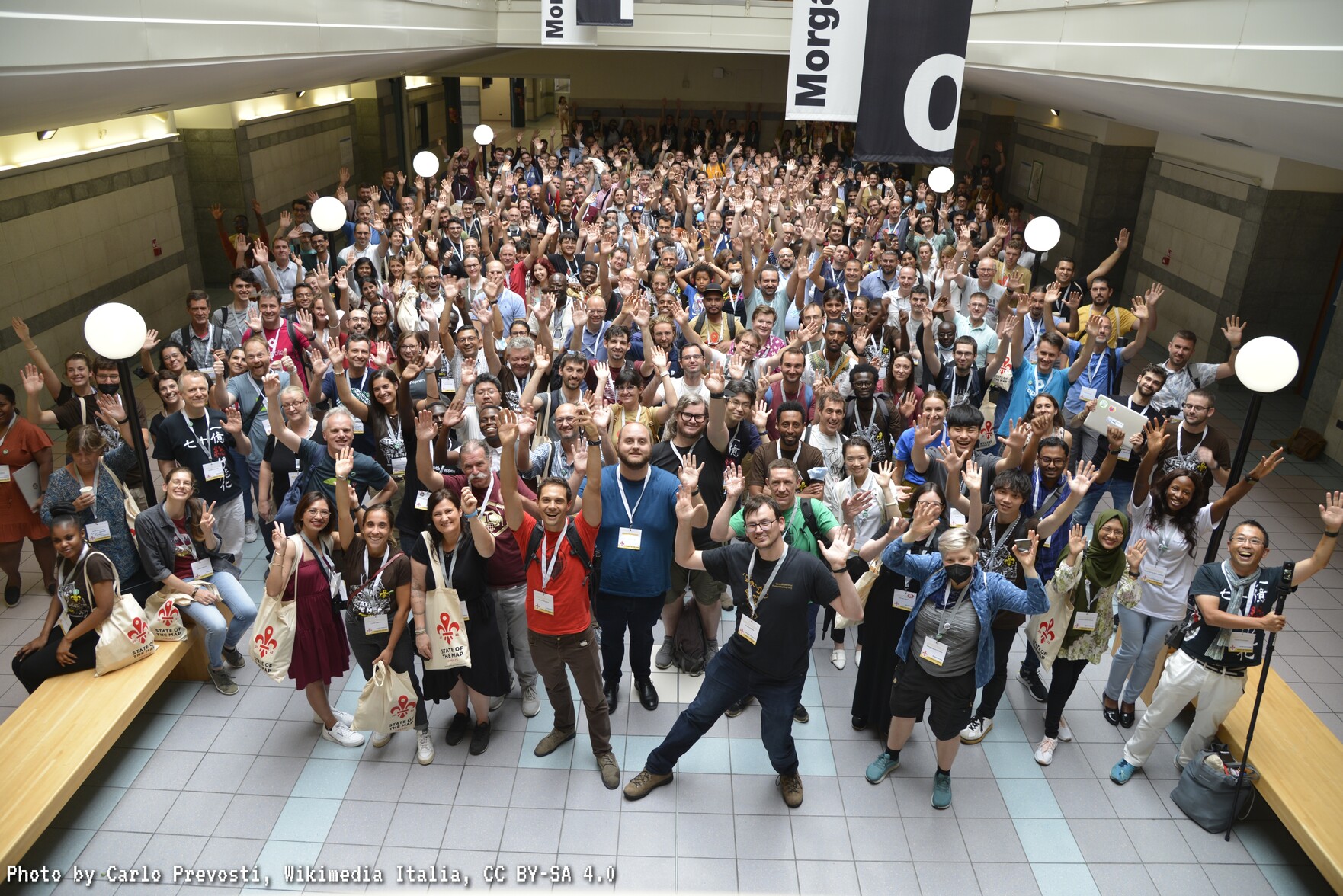
SotM 2022 [1] | © Photo by Carlo Prevosti, Wikimedia Italia, CC BY-SA 4.0
Mapping campaigns
- The Swiss project of the month (PotM CH) for August 2022 is mapping benches on OpenStreetMap. A dashboard shows (
 //) map edits related to this PotM CH made since the beginning of August. A change simply counts as adding or changing any element with the tag
 amenity=bench, for instance adding other tags such ascolour. The data is updated hourly. - New mapping projects, curated by UN Mappers, are available in Somalia. Topics include mapping roads, villages and barriers; all in support of the UNSOS mission.
 /
/ /
/ ) map edits related to this PotM CH made since the beginning of August. A change simply counts as adding or changing any element with the tag
 Community
- Christoph Hormann feels that the OSMF is moving strongly towards an increasing dominance of technical interests and viewpoints, over the social and economic context of OpenStreetMap. He thinks the current situation is seriously out of balance and that this is increasingly affecting the OSM community’s ability to handle the various challenges it faces.
OpenStreetMap Foundation
- Jochen Topf has published the results of his study into the problems with the current OSM data model, possible improvements, and their impact on OSM’s systems (we reported earlier).
Events
- [1] Carlo Prevosti shared this SotM2022 Group Photo.
- As with every OSM event, the State of the Map could not have taken place without a small group of dedicated volunteers. Many thanks to them!
- Poster presentations from the State of the Map 2022 have been uploaded.
- Future cartographers also didn’t want to miss this year’s conference. Students from the joint Cartography M.Sc., run by universities from Munich, Vienna, Dresden and Twente, had a great time this year at #SotM2022 in Italy.
- Thierry Jean reports ► on the participation of six members (actually, at least nine) of the Brazilian OSM community at the OSM World Event in Italy.
- Oscar Zorrilla tweeted about the OSM Spain community present at State of the Map 2022, in Florence, Italy.
 ►
► 
 about the OSM Spain community present at State of the Map 2022, in Florence, Italy.
Maps
- Ellen Poe shared the project Headway, which aims to be a self-hostable maps stack powered by OpenStreetMap. A demo is available at maps.earth.
- Koen Rijnsent has created a clickable map showing a series of murals in Utrecht, NL.
Software
- Sarah Heidekorn presented the 14th entry to the ‘How to become ohsome?‘ series, discussing the convenient and intuitive ohsome dashboard. Boasting more of a user interface than other tools, the ohsome dashboard allows users to select features of interest using a map. A recent update with advanced filter settings now also provides more complex filters.
- Ilya Zverev released version 1.0 of the Every Door app.
Programming
- Paul Jeffrey reported an issue about the OSMAnd app presumably ‘leaking data about users’ travel history’ through a unique identifier. While true, it’s been explained that this randomly generated UUID is used solely to maintain fair usage of the servers’ resources when downloading maps and seemed to be already covered in the privacy policy.
- Sarah Hoffmann announced the release of 1.7.0 of osm2pgsql, a tool to import OSM data into a PostgreSQL/PostGIS database.
- Stamen blogged about Chartographer, which generates visualisations of a supplied Mapbox GL stylesheet to better understand how its layers are rendered per zoom level. Chartographer has special views for areas, lines, icons and labels. It is especially helpful when generating a basemap style for vector tiles.
- Leo van der Meulen used data from the Dutch Bureau for Statistics to visualise the variation in sun hours across the Netherlands, which indicates the expected efficiency of solar panels.
Releases
- The new release of the Open Camping Map integrates user reviews from Mangrove.
- Geospatial analytics provider Kontur added the new OpenStreetMap Road Completeness layer to their free emergency mapping dashboard, Disaster Ninja. It helps to check if all roads are mapped in OpenStreetMap by showing the ratio of OSM road length to Facebook AI-detected road segments, find exactly where the gaps are, and go to the iD editor to fix them.
- The August maintenance release of Vespucci (17.1.6) and the first beta release of 18.0 are available from Google Play, F-Droid, or their GitHub repository now.
Did you know …
- … Table2map, which can put addresses in table format onto an OSM map?
- … OpenStreetMap live edit, where you can watch added changes to OSM?
- … OSM Landuse Landcover? It is a WebGIS application to explore the OpenStreetMap database specifically in terms of landuse and landcover information. Landuse tags were predicted where absent. This was first applied to Germany in 2017 and since 2020, with improved methods, for all EU countries.
- … the SaveEcoBot Map of Ukraine and adjacent areas showing air quality, gamma radiation, and fires?
OSM in the media
- The Italian newspaper La Nazione featured ► an article about State of the Map 2022.
- Daniel Kulesz noticed that modern cars are equipped with headunits that support Android Auto or Apple CarPlay. With the recently added support for Android Auto in OsmAnd, an established open source offline maps and navigation app, his hope for a privacy-friendly solution was re-awakened. Hence, he investigated whether it was practical and possible to use this combination in a data-literate way. He stumbled over several caveats and irritating privacy-invasive issues but also found a semi-satisfactory workaround for the time being.
 ►
► Other “geo” things
- Clara Aberneithie, writing in The New Statesman, asked if the logic behind routing algorithms, and their preferences for certain spatial resources in urban environments, has broader societal implications for poor people.
- The Spanish Geographical Society published ► an article on the avant-garde activities of the cartographers of the Society of Jesus up until the 18th century.
- Brandon Liu explained some of the improvements being proposed for v3 of PMTiles, a single-file archive format for tiled data. A great deal of storage space can be saved by using the Hilbert curve and run-length encoding.
 ►
► 
Upcoming Events
| Where | What | Online | When | Country |
|---|---|---|---|---|
| Firenze | FOSS4G 2022 | 2022-08-22 – 2022-08-28 |  | |
| Puerto López | Hablemos de OpenStreetMap-OSM | 2022-08-27 – 2022-08-28 |  | |
| OSMF Engineering Working Group meeting | 2022-08-29 | |||
| San Jose | South Bay Map Night | ✓ | 2022-08-31 |  |
| Düsseldorf | Düsseldorfer OpenStreetMap-Treffen | ✓ | 2022-08-31 |  |
| Santa Terezinha de Goiás | 2° Validatona da UMBRAOSM – Brasil. | 2022-09-03 |  | |
| 臺北市 | OpenStreetMap x Wikidata Taipei #44 | 2022-09-05 |  | |
| Stuttgart | Stuttgarter Stammtisch | 2022-09-06 | | |
| London | Missing Maps London Mapathon | 2022-09-06 |  | |
| Berlin | OSM-Verkehrswende #39 (Online) | ✓ | 2022-09-06 | |
| Salt Lake City | OSM Utah Monthly Meetup | 2022-09-08 | | |
| Berlin | 171. Berlin-Brandenburg OpenStreetMap Stammtisch | 2022-09-08 | | |
| München | Münchner OSM-Treffen | 2022-09-08 | | |
| Morogoro | Field Mapping is the Future: A Tasking Manager Workflow for Open Data Kit (ODK) | 2022-09-09 |  | |
| Claix | Cartopartie à Claix (Isère, France) | 2022-09-10 |  | |
| San Jose | South Bay Map Night | ✓ | 2022-09-14 | |
| Großarl | 6. Virtueller OpenStreetMap Stammtisch Österreich | 2022-09-14 |  | |
| Chippewa Township | Michigan Meetup | 2022-09-15 | |
Note:
If you like to see your event here, please put it into the OSM calendar. Only data which is there, will appear in weeklyOSM.
This weeklyOSM was produced by Lejun, Nordpfeil, PierZen, Robot8A, SK53, Sammyhawkrad, SeverinGeo, Strubbl, TheSwavu, YoViajo, derFred, mavimsii.
We welcome link suggestions for the next issue via this form and look forward to your contributions.