18/07/2024-24/07/2024
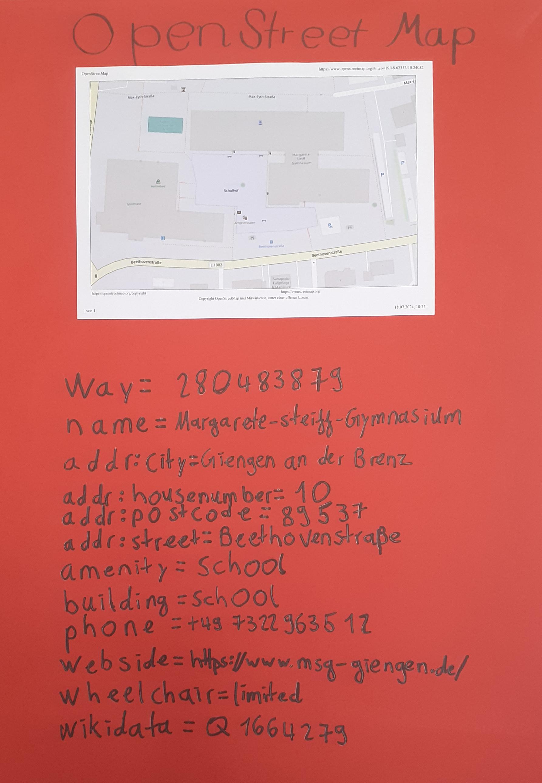
Student project days at Margarete-Steiff-Gymnasium [1] | © kdkeller | map data © OpenStreetMap contributors
Mapping
- The proposal to specify ordering-only phone numbers, SMS-only phone numbers, and related tags is open for voting until Monday 29 July.
Mapping campaigns
- [1] During project days at Margarete-Steiff-Gymnasium, students collected
 and entered ► data for OpenStreetMap and Wikidata using tools such as StreetComplete, Walking Papers, and OsmWikidataLink. They mapped local points of interest and georeferenced data, linking information between OSM and Wikidata. Activities included mapping buildings with house numbers, learning about geographic data structures, and presenting their work at the school festival with interactive projects such as Wikidata Guess and Wiki Trivia.
 - As part of the OSM-US Trails Stewardship Initiative, trail data in southern Utah has been improved to reduce environmental damage and increase safety by correcting digital trail maps, such as identifying and closing unofficial routes that affected the habitat of the Mojave Desert tortoise.
- Martijn van Exel has counted OpenStreetMap changesets that mention MapRoulette, or its short link domain (mpr.lt), and shared the results.
- In Padua Municipality, Italy, technicians appointed by the municipality partnered with citizens to utilise ► OpenStreetMap for mapping plans under the Elimination of Architectural Barriers initiative in infrastructure planning.
 and
and 
 ►
►Community
- Cidomo shared their enjoyable experience of mapping for OpenStreetMap while working across multiple countries.
- In ‘Mapping What Matters’, Christopher Beddow explores the evolving importance of maps, highlighting how they are more than just navigational tools; they shape our understanding of the world, influence decision-making, and reflect cultural and political values. The piece looked at the importance of contextualising data within maps, highlighting the role of cartography in critical social and environmental issues.
- At the State of the Map Europe 2024 conference Moritz Schott, from Heidelberg University, presented a methodology for identifying rare OpenStreetMap edits using a ‘unicorn index’, highlighting unique contributions that enrich the dataset and an interactive website for users to calculate their index.
- The Lemmy community has been discussing StreetComplete, comparing it to Pokémon Go, emphasising its usefulness in improving OpenStreetMap by encouraging users to complete mapping tasks while walking around, thus contributing to a useful public resource.
OSM research
- GeoSynth, an AI model designed to produce satellite images based on user-defined parameters, incorporates high-resolution satellite imagery and OpenStreetMap data in its training data.
Maps
- Apple Maps on the web is available in public beta, allowing users around the world to access Apple Maps directly from supported browsers. It is not available on Linux and does not run with Firefox.
- Vadym Klymenko wrote ► about his new interactive map of possible power outages in Kyiv, Ukraine. The project was implemented based on OpenStreetMap data, allowing users to visualise buildings in the city where the power may be cut off. Vadym Klymenko also expressed his gratitude to the OSM Ukraine team for the opportunity to use their tile server for free.
- MapComplete announced they have a new version that includes a map of gluten-free venues and a new barbecue and firepit theme.
 ►
►OSM in action
- RadlLand Bayern has released ► an OpenStreetMap-based cycle path navigation application for the Bavarian region of Germany.
- DoudouOSM mentioned that the Belgian national newspaper, Le Soir, has used an OpenStreetMap basemap, including 3D buildings, to illustrate an article about the 21 July festivities celebrating the 11th anniversary of King Philip’s reign.
- A Setlist.fm user has created an interactive map of live music venues around the world, including clubs, pubs, nightclubs, restaurants, and more. The project uses OpenStreetMap data and welcomes community contributions to expand and update the map, ensuring comprehensive coverage of live music venues worldwide.
- OpenCage’s Geoweirdness episode this week discussed time zone quirks around the world, starting with a map of global time zones from the tz database and promising a series of examples that highlight these quirks.
- susudata.de is offering historical ordnance survey maps, Swisstopo maps from 1930 and orthophotos, all with interactive sliders to compare these maps with current OpenStreetMap data.
- The Danish company Wind Pro is using OSM data for the geolocation of wind turbines. In the OSM tagging model there is a key dedicated to these objects. Further information can be found on Wikipedia.
 an OpenStreetMap basemap, including 3D buildings, to illustrate an article about the 21 July festivities celebrating the 11th anniversary of King Philip’s reign.
Open Data
- The Open Data Ranking 2024 evaluated ► the German federal states on their open data initiatives, highlighting best practices and areas for improvement. The ranking aims to promote transparency and innovation by encouraging ► the publication and use of open data.
- The Overture Maps Foundation has announced their new Explore site that showcases the potential of its open maps datasets, including easy-to-use tools and interactive maps for better use of geospatial data.
- The Overture Maps Foundation announced the General Availability (GA) of several of its global open maps datasets. The GA release includes four themes: buildings, places of interest, national and regional administrative boundaries, and contextual base layers, including land and water data. The dataset schema also contains detailed address references that enable precise geocoding and data integration.
Programming
- nyampire blogged about the OpenStreetMap Statistics tool, from Piebro, that analyses OSM changeset files and creates graphs from various perspectives.
Releases
- Development Seed has released a new web application in beta. The Clay Explore tool allows interaction with Clay AI, the first open source AI model of the Earth, providing an advanced way to explore geospatial data such as features and locations of interest.
- A new app, AddisMap Transit, has been launched by Bandira AddisMap Enterprise to map Addis Ababa’s public transport routes, including the light rail system, bus routes and minibus taxis. Developed with support from the Digital Transport 4 Africa Innovation Challenge and Trufi Association, the app features route visualisation and real-time bus data, and is available in Amharic and English. The app uses OpenStreetMap data and aims to improve the efficiency of public transport in the city.
- Locus Map highlighted their app’s hidden features such as automatic zoom, terrain shading, dynamic elevation display and audio coaching, demonstrating its versatility for activities such as walking, cycling and geocaching, and emphasising its usefulness for professionals and hobbyists alike.
Other “geo” things
- Map Happenings recounted the history of MapQuest, from its origins with R.R. Donnelley’s cartographic services in 1967 to its rise as a leading online mapping service after launching in 1996, and its eventual acquisition by AOL in 1999 (we reported earlier).
- Hidden Hydrology explored the Atlas of Oblique Maps, a collection of landform representations using oblique aerial photography from 1961 to 1986, highlighting the ability of maps to represent complex geographical features and their historical significance in improving scientific communication with the public.
- Christoph Hormann explained how colour and noise are represented in satellite imagery, discussing the transition to 32-bit colour representation, the use of 16-bit values for image data, and the impact of atmospheric noise on satellite imagery, highlighting methods to reduce noise and improve image quality by aggregating multiple images.
- Google significantly reduced its Maps API prices in India shortly after the launch of rival mapping service Ola. In response Ola is offering free access to up to five million API calls per month for a year to encourage Indian developers to switch from Google Maps.
- Callum Booth examined the reliability and problems associated with Google Maps, highlighting inaccuracies, potential bias and privacy concerns. He discussed how Google’s dominance in digital mapping affects user trust and suggests the need for critical evaluation of the information provided by such platforms.
- Researchers at Caltech have developed a neural network that can autonomously build spatial maps by exploring environments in Minecraft, using predictive coding algorithms to learn and organise information similar to human cognitive mapping.
- The New York Times detailed a trek across Switzerland guided by hand-drawn maps, highlighting the intricate beauty and personal touches of these maps as they lead travellers through scenic landscapes, historical landmarks, and cultural experiences unique to Switzerland.
- Mikhail Sarafanov talked about algorithms for ranking rivers on maps and shared his QGIS plugin, which can rank vector data on rivers (including OSM data).
 about algorithms for ranking rivers on maps and
 Upcoming Events
| Where | What | Online | When | Country |
|---|---|---|---|---|
| Saint-Étienne | Rencontre Saint-Étienne et sud Loire | 2024-07-30 |  | |
| Potsdam | Radnetz Brandenburg Mapping Abend #8 | ✓ | 2024-07-30 |  |
| HOTOSM – Unlocking the potential of Field Mapping Tasking Manager | 2024-07-31 | |||
| Ondres | Panoramax Partie – Pays Basque Sud Landes | 2024-07-31 | | |
| Düsseldorf | Düsseldorfer OpenStreetMap-Treffen (online) | 2024-07-31 | | |
| Pool | State of the Map Congo | 2024-08-01 – 2024-08-03 |  | |
| OSMF Engineering Working Group meeting | 2024-08-02 | |||
| City of Bayswater | Social Mapping Sunday: Bayswater Station | 2024-08-04 |  | |
| Gurgaon | 1st OSM Gurgaon Mapping Party | 2024-08-04 |  | |
| 中正區 | OpenStreetMap x Wikidata Taipei #67 | 2024-08-05 |  | |
| MapRoulette Community Meeting | 2024-08-06 | |||
| Missing Maps London: (Online) Mapathon | 2024-08-06 | |||
| San Jose | South Bay Map Night | ✓ | 2024-08-07 |  |
| iD Community Chat | 2024-08-07 | |||
| Stuttgart | Stuttgarter OpenStreetMap-Treffen | 2024-08-07 | | |
| Bochum | Bochumer OSM Treffen | 2024-08-08 | | |
| Salt Lake City | OSM Utah 20th Birthday Happy Hour | 2024-08-10 | | |
| Grenoble | apéro pour fêter l’anniversaire d’OpenStreetMap | 2024-08-09 | | |
| London | London OSM Birthday Party | 2024-08-10 |  | |
| København | OSMmapperCPH | 2024-08-11 |  |
Note:
If you like to see your event here, please put it into the OSM calendar. Only data which is there, will appear in weeklyOSM.
This weeklyOSM was produced by Raquel Dezidério Souto, Strubbl, TheSwavu, adiatmad, barefootstache, derFred, matheusgomesms, mcliquid, rtnf.
We welcome link suggestions for the next issue via this form and look forward to your contributions.