25/07/2024-31/07/2024
Golf course at the 2024 Olympics in Paris [1] | map data © OpenStreetMap contributors
Mapping
- CloCkWeRX asked about making it easier to import and assess data. He suggested using standard metadata and tools to improve data quality and reliability. The goal is to automate tasks while still checking for mistakes to maintain high standards and save time.
- In Geoawesome, Sebastian Walczak and Nikita Marwaha-Kraetzig discussed the use of GPS tracks to turn digital footprints into urban intelligence. By analysing anonymised GPS data, platforms such as OpenStreetMap and Strava can contribute to improving urban planning, traffic management, and public health initiatives.
- Gregory Peony shared a tip on how to provide efficient feedback to contributors in Tasking Manager projects as a validator.
- Quinn Comendant tooted the usefulness of editing OpenStreetMap. He had marked Nortz Road as private because it goes through a military base. Several mapping tools have been updated within 21 days to now avoid the road.
- StreetComplete How-To explained in a video how to enhance OpenStreetMap by adding data using the ‘Things’ overlay feature in the StreetComplete app.
- Comments are requested on:
- The vote on the proposal to specify ordering-only phone numbers, SMS-only phone numbers, and related tags has concluded with 10 votes in favour, 0 against, and 5 abstentions.
Mapping campaigns
- OpenStreetMap Utah is using Mapillary images to improve the OpenStreetMap data in Utah. Martijn van Exel talked about the current coverage in Salt Lake City, the gaps in recent images, and how people can contribute by taking and uploading images using the Mapillary app. OSM Utah offers tools like a GoPro MAX camera and hosts events to facilitate participation in this project.
Community
- OpenHistoricalMap celebrated its 15th birthday with a retrospective and a terrible pun.
- The OpenStreetMap iD community chat on Wednesday 7 August at 11:00 UTC will cover the new contributor guidelines, the Google Summer of Code 2024 project, and general feedback and discussion. The following meeting is scheduled for Tuesday 3 September at 15:00 UTC.
- Martijn van Exel recommended uMap to a colleague who needed an ad-free interactive map.
- @swyvl_ shared a YouTube short where you can learn how to contribute to global mapping projects and shape the world with OpenStreetMap’s crowdsourced mapping platform.
- TBesse, a newcomer to the community and obvious expert
 on boundary stones in real life, has quickly familiarised himself with the mapping of these small historical monuments in OpenStreetMap. Apparently, Lutz Lange from gk.historic.place had a hand in providing good tips. TBesse described in his blog posts 1 ►, 2 ► and 3 > , and also documented the data with his own publications. Tobias Jordans has provided a suitable overpass query for this mapping in his comment.
 - UN Mappers marked the 20th anniversary of OpenStreetMap by celebrating its role in promoting open geographic data, improving global mapping, and fostering community collaboration.
 on boundary stones in real life, has quickly familiarised himself with the
OpenStreetMap Foundation
- The OpenStreetMap Foundation (OSMF) will be seeking self-nominations for the 2024 Board election until Tuesday 13 August, with at least four of the seven seats up for election. Board members serve two-year volunteer terms and must meet the eligibility criteria detailed on the OSMF wiki.
Local chapter news
- OpenStreetMap Ukraine, in addition to their other social media accounts and website ►, now has a BlueSky account. In their first post ► they promise to publish news from the Ukrainian community. Subscribe to keep up with all the news!
- OSM Brazil will hold an online meeting on Wednesday 7 August at 14:00 UTC. This meeting will focus on the import process for the CNEFE 2022 records and the progress of the humanitarian mapping campaign in the State of Rio Grande do Sul.
 ►
►Events
- Andy Allan was not able to give his presentation at the State of the Map Europe. He has instead made a home recording of his presentation about the development of the OpenStreetMap website over the past twelve months.
Education
- You can watch this video to learn how to easily download OpenStreetMap shapefiles for global regions using Geofabrik’s comprehensive data services.
OSM research
- In Elham Fakharizadehshirazi and Christine Rösch’s paper, on the possible impact of various renewable energy scenarios for Germany, they used OpenStreetMap as one of their data sources.
- A study on detecting ‘non-technical losses’ (theft) in electricity distribution networks used OpenStreetMap masks for pre-annotation.
Humanitarian OSM
- HOT has launched a new self-paced online course focused on humanitarian and community use of OSM. It includes roughly seven hours of training material with real-world workflows and case studies in QGIS, uMap, Disaster Ninja, and Openrouteservice. The course is free and is targeted at communities, organisations, and individuals interested in using OSM more in their work. A certificate of completion is awarded.
Maps
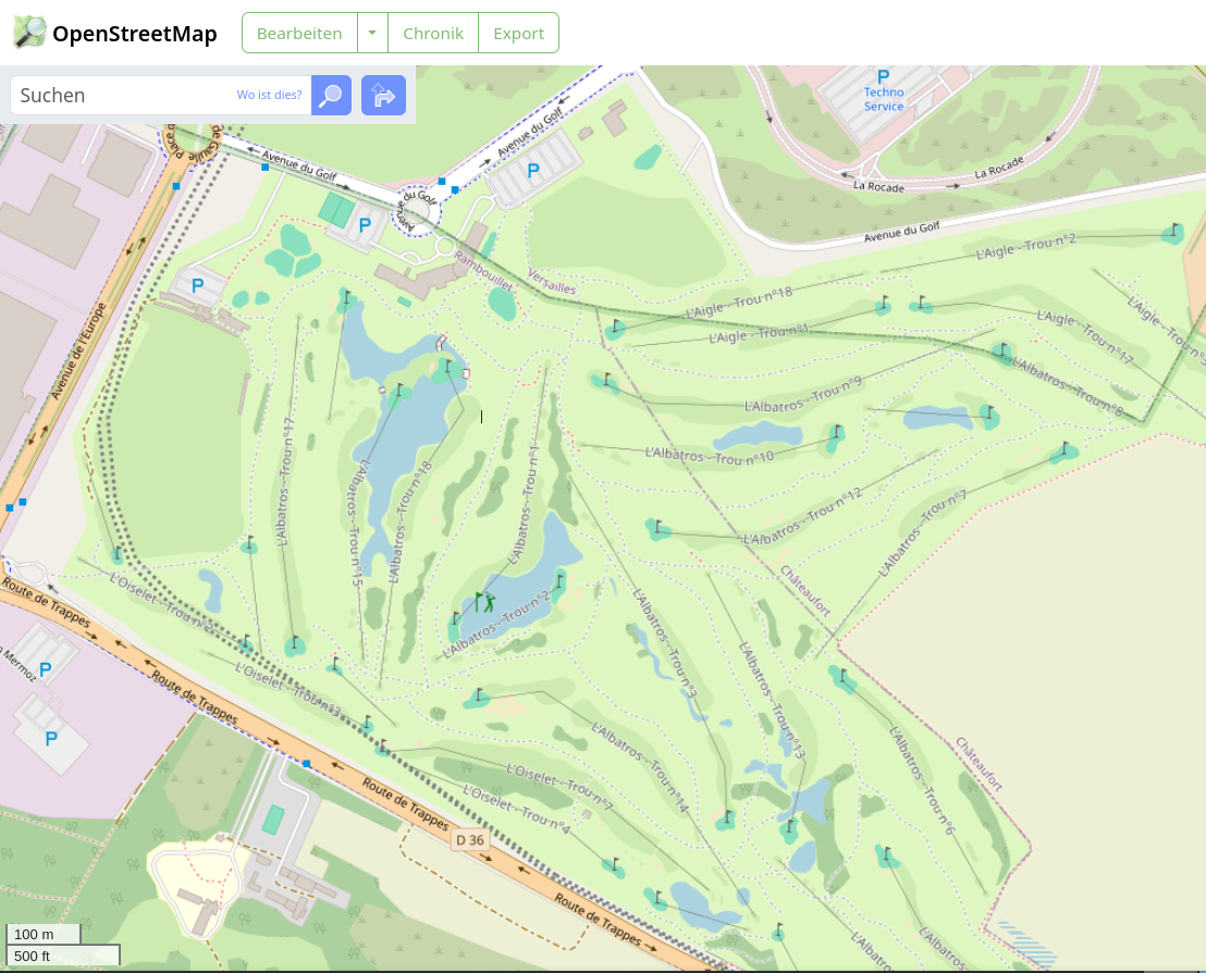
- [1] The list of venues for the 2024 Summer Olympics in Paris is now available on the OpenStreetMap wiki. This list is also available as an interactive uMap map. A nice example of what OSM can do: OpenStreetMap vs market benchmark.
- Andrii Holovin, aka andygol, recently shared ►, on LinkedIn, a quick experiment with OpenStreetMap data. Using Tilemaker, OpenMapTiles styles, the Maputnik editor for styling, MapLibre GL JS for rendering, and a local tileserver-gl, he created a simple map style featuring roads and place names. He challenged viewers to see if they could identify cities from just the road network shapes without labels.
- The Berliner Spielplatzkarte is an interactive web map project that uses data from OpenStreetMap to provide detailed information about playgrounds and play equipment in Berlin, including accessibility, equipment features, and shadow analysis, and encourages public contributions to enhance data accuracy.
- Junior Flores, from GeoCompas, has developed the Urban Public Services Inaccessibility application using OpenStreetMap and WorldPop population datasets. This app provides a comprehensive analysis of population distribution and public service coverage in six priority Asia-Pacific countries: Vietnam, Laos, Myanmar, Nepal, Afghanistan, and Pakistan.
- Tatvic Analytics compared MapMyIndia, Google Maps, and OpenStreetMap. It found that the best choice depends on your specific business needs. MapMyIndia is considered best for detailed local data in India, Google Maps for global reach and comprehensive features, and OpenStreetMap for open-source flexibility and budget constraints.
- An article on CSDN provides a guide on downloading and using OpenStreetMap road data. The article explained the benefits of OSM and offered instructions on obtaining data from the OSM website and Geofabrik. The guide also covers using OSM data in GIS software like ArcGIS.
 a guide on downloading and using OpenStreetMap road data. The article explained the benefits of OSM and offered instructions on obtaining data from the OSM website and
 OSM in action
- The Santa Barbara County Association of Governments, in partnership with UC Santa Barbara (California) and Simon Fraser University (Canada), have received a USD 480,000 grant from the California Department of Transportation to develop a countywide bicycle map using OpenStreetMap and AI technology to improve bicycle safety and infrastructure.
- Boing Boing looked at a map showing US road deaths from 2001 to 2022. Users can explore data on different types of road users and look for trends.
- In August 2023, Peru’s Ministry of Women and Vulnerable Populations launched ► Yanapp, an app designed to prevent violence against women. Using OpenStreetMap data, the emergency section of the app shows the geolocation of the nearest police stations, Women’s Emergency Centre offices, and other resources. With more than 11,000 downloads, it has established itself as an important support tool for women in situations of violence.
 ►
►Software
- In OSMfocus Reborn 1.6 you can now view OSM nodes, ways and relations separately. The application has also become more stable when working with a poor internet connection.
Programming
- Milan Cvetkovic has submitted a proposal to extend the OpenStreetMap API v0.6 with a message API, which has already been adopted. It is now possible for applications to display received and sent messages. An official announcement of this function is still pending.
- The DEV Community showed how to build a custom reverse geocoding resource using .NET Aspire. Setting up a Nominatim API with Docker containers, managing startup dependencies, and implementing health checks was covered in the article.
DevCodeF1 explained how to export OpenStreetMap data with cycle route relationships using the Osmium tool and GeoJSON filters. Step-by-step instructions are provided on setting up Osmium, filtering for specific cycle routes using Osmium tags-filter, and exporting data to GeoJSON format, including necessary options such as –drop-author and –drop-version to handle relations.- GIS Breaks showed how to use Python and the OSM Runner tool to get data from OpenStreetMap. They explained how to set up the environment, define a study area, query OSM data and convert it into different formats for analysis and visualisation. This is useful for GIS professionals and data enthusiasts who want to use OSM data for spatial projects.
- The blog ‘Shallow Thoughts’ published about fetching OpenStreetMap details using OSMPythonTools.
- osm-nominatim-geoserver-postgis provides a Docker-based setup for creating a personal OpenStreetMap tile server with geocoding capabilities, using Nominatim and Geoserver to process and serve OSM data through a local PostGIS database.
- In his fifteenth OpenStreetMap NextGen development diary, Kamil Monicz described attending the State of the Map EU 2024, making changes to the map, adding a new activity chart to user profiles, updating the geolocation icon, and making the map more feature-equal.
- Paolo Melchiorre showed how to create web maps using Django, GeoDjango, SpatiaLite, and Leaflet. They covered setting up a Django project, creating a map with Leaflet, integrating GeoDjango for geographic data, and using SpatiaLite for spatial queries. The guide also shows you how to add and display map markers.
- Prabinoid described moving Tasking Manager from Flask to FastAPI and from psycopg2 to asyncpg. This aimed to improve performance and scalability by using asynchronous programming, modern Python features and optimised database interactions. Despite challenges like learning the new system and changing code, he stated in a community discussion that the move offers benefits including better throughput and simpler API development.
- Milan Janosov showed how to use Python libraries to create isochrones, which show areas accessible within a specific time frame from a starting point. The post guides you through setting up the environment, obtaining OpenStreetMap data, building a graph of the road network, and calculating isochrones. It also demonstrates practical applications of isochrones for urban planning and accessibility analysis.
- Trufi Volunteer of the Month, John Hobson, has generated 470+ webpages – one for each public transport route in Cochabamba, Bolivia.
- Marcos Dione has made an OpenStreetMap tile server in Python as an alternative to renderd. It stores individual tiles instead of storing metatiles of 8×8 tiles to improve its update time performance.
Releases
- OsmAnd 4.8 for Android has been released, with enhancements including terrain colouring, new colour schemes, updated profile views, 3D icons, and improved weather and track visualisation. This update also includes a revamped Quick Actions tool, a detailed track guidance setting, and the removal of login/password authorisation for OpenStreetMap, which now supports OAuth 2.0 for better security.
- Daniel Schep has released documentation for Overpass Ultra, especially on how to use MapLibre styling to make maps.
Did you know …
- … that there is a website that lists new keys that have recently appeared on OpenStreetMap using data from TagInfo? As of 1 August, the site had identified 92 new keys, none of which have been removed.
- … UserBeam, a website providing weekly updated offline maps for Garmin GPS devices, is based on OpenStreetMap data? These maps include POIs like bars, restaurants, bus stops, and shops, making them ideal for hiking, biking, geocaching, and car navigation. The site offers maps for various regions globally, complete with search functionality.
Other “geo” things
- Florian Ledermann tooted that an online user study in cartography is being conducted to improve maps of urban spaces. Participants will spend approximately 10 minutes navigating Street View using a map. The study is for desktop or laptop computers only. Your participation is welcome and appreciated.
- An article on note talked ► about the history of the Yakena Bus Terminal in Uruma, Okinawa. It covered how it was set up, where it has moved to, and its role in the region’s public transport system since 1950. The terminal has moved three times, with the latest move in 2000. The article looked at how bus services have changed and the impact of this on local transport.
- The Brazilian Institute of Geography and Statistics will be hosting the IV Brazilian Symposium on Geospatial Data Infrastructure (4SBIDE ►), from 15 to 18 October, with free access to event streaming. The abstract submission deadline has been extended to Sunday 4 August and presentations can be made remotely.
- The Escape Collective described Sherpa-Map, a new mapping tool created by three cycling enthusiasts that helps riders find gravel roads by using AI to classify road surfaces from satellite imagery and generate custom bike routes based on user preferences.
- Alan McConchie, from Stamen, examined the cartographic phenomenon that is Null Island, the imaginary island located at 0° latitude and 0° longitude, in the Atlantic Ocean off the coast of Africa.
 ►
► ►
►Upcoming Events
| Where | What | Online | When | Country |
|---|---|---|---|---|
| City of Bayswater | Social Mapping Sunday: Bayswater Station | 2024-08-04 |  | |
| Gurgaon | 1st OSM Gurgaon Mapping Party | 2024-08-04 |  | |
| 中正區 | OpenStreetMap x Wikidata Taipei #67 | 2024-08-05 |  | |
| MapRoulette Community Meeting | 2024-08-06 | |||
| Missing Maps London: (Online) Mapathon | 2024-08-06 | |||
| San Jose | South Bay Map Night | ✓ | 2024-08-07 |  |
| iD Community Chat | 2024-08-07 | |||
| Plano Piloto | [on-line] Encontro OSM Brasil – agosto/24 | 2024-08-07 |  | |
| Stuttgart | Stuttgarter OpenStreetMap-Treffen | 2024-08-07 |  | |
| Bochum | Bochumer OSM Treffen | 2024-08-08 | | |
| Nakawa | OpenStreetMap 20th Anniversary Celebration 🎉 | 2024-08-09 |  | |
| Umuarama | [online] 🎁 20 anos de OSM – Oficina do IVIDES para a UNIPAR (Brasil) | 2024-08-09 | | |
| WNAH & Eco Smart Cities Partners Mapathon celebrating OSM @ 20 | 2024-08-09 | |||
| Morogoro | OpenStreetMap 20th Anniversary | 2024-08-09 |  | |
| 논현2동 | OSM 20주년 기념 한국 커뮤니티 모임 | 2024-08-09 |  | |
| شهر تهران | نکوداشت بیست سالگی اوپناستریتمپ | 2024-08-09 |  | |
| Salt Lake City | OSM Utah 20th Birthday Happy Hour | 2024-08-10 | | |
| Grenoble | apéro pour fêter l’anniversaire d’OpenStreetMap | 2024-08-09 |  | |
| Berlin | 194. Berlin-Brandenburg OpenStreetMap Stammtisch | 2024-08-09 | | |
| Localidad Teusaquillo | 20 años OpenStreetMap – GeoBeer en Beeя del Gran Estación, Bogotá | 2024-08-10 |  | |
| Rouen | Apéro OSM Groupe Local Rouen | 2024-08-09 | | |
| Obio/Akpor | Map Nigeria Mapathon Campaign and AI -Assisted Mapping Training | 2024-08-10 – 2024-08-11 |  | |
| Obio/Akpor | Map Nigeria Mapathon Campaign and AI -Assisted Mapping Training | 2024-08-10 – 2024-08-11 | | |
| Karlsruhe | Mappingparty zum 20. OSM-Geburtstag | 2024-08-10 | | |
| London | London OSM Birthday Party | 2024-08-10 |  | |
| København | OSMmapperCPH | 2024-08-11 |  | |
| Rheinau | OSM Geburtstagsfeier am 11. August Badi Rheinau | 2024-08-11 |  | |
| Hamburg | Hamburger Mappertreffen | 2024-08-13 | | |
| München | Münchner OSM-Treffen | 2024-08-14 | | |
| Lorain County | OpenStreetMap Midwest Meetup | ✓ | 2024-08-15 | |
| OSMF Engineering Working Group meeting | 2024-08-16 | |||
| Sankt Augustin | OSM auf der FrOSCon Sankt Augustin | 2024-08-17 – 2024-08-18 | | |
| Hannover | OSM auf der Maker Faire Hannover | 2024-08-17 – 2024-08-18 | | |
| Варна | OpenStreetMap in Varna (на морето) | 2024-08-17 |  | |
| Hannover | OSM-Stammtisch Hannover | 2024-08-17 | | |
| Meerut | 1st OSM Meerut Mapping Party | 2024-08-18 | | |
| Sankt Augustin | Vortrag: 20 Jahre OpenStreetMap | 2024-08-18 | | |
| The Municipal District of Kilkenny City | Citizen Science: Kilkenny Heritage sites & Linked Open Data for Ireland’s National Heritage Week 2024 | 2024-08-19 |  |
Note:
If you like to see your event here, please put it into the OSM calendar. Only data which is there, will appear in weeklyOSM.
This weeklyOSM was produced by PierZen, Raquel Dezidério Souto, SeverinGeo, Strubbl, TheSwavu, TrickyFoxy, adiatmad, barefootstache, derFred, jcr83, mcliquid, miurahr, rtnf, tordans.
We welcome link suggestions for the next issue via this form and look forward to your contributions.
I wonder what the best way to read WeeklyOSM in dark mode would be? It’s too bright today in my dark room.
True, there is no dark theme for this site. Maybe a respective browser plug-in can help out for now, or a subscription per RSS and your reader of your preference to get the news?
Okay. I figured out how to do it using purely Google official Chrome browser Android stuff. There’s some kind of reader mode up there next to the URL bar one can push and then the page becomes real simple and black background!
Please check the news you are reporting a bit better. The arcticle from DevCodeF1 is pure nonsense. Looks like somebody was playing around with ChatGPT or so. You can quickly check that Osmium doesn’t have the options mentioned and the explanations make no sense at all.
Thank you for the feedback, Jochen. In contrast to you, e.g. I, do not know all the osmium options by heart. I do not have osmium locally installed for a quick check. Also i did not have had a suspicion when reviewing the weeklyOSM’s article text for this link.
If i would have had a suspicion, i would search for osmium, then for osmium+osm because of the chemical element and then i get to https://osmcode.org/docs.html. Then i click on tool link https://osmcode.org/osmium-tool/. Then on latest https://docs.osmcode.org/osmium/latest/. Then i select export tool https://docs.osmcode.org/osmium/latest/osmium-export.html and need to check the options. And all these clicks are the direct way to get to the correct documentation subpage for which one needs to know how the osmium components belong to each other. I only found the export man page after landing on several wrong pages in the beginning, where i did not find the desired page. And now i did only check the latest version of the export tool.
So yes, quickly checking is possible if you are the developer of osmium 😉
To not support these kind of articles, we removed the link. Thanks again for pointing this out.