03/01/2023-09/01/2023
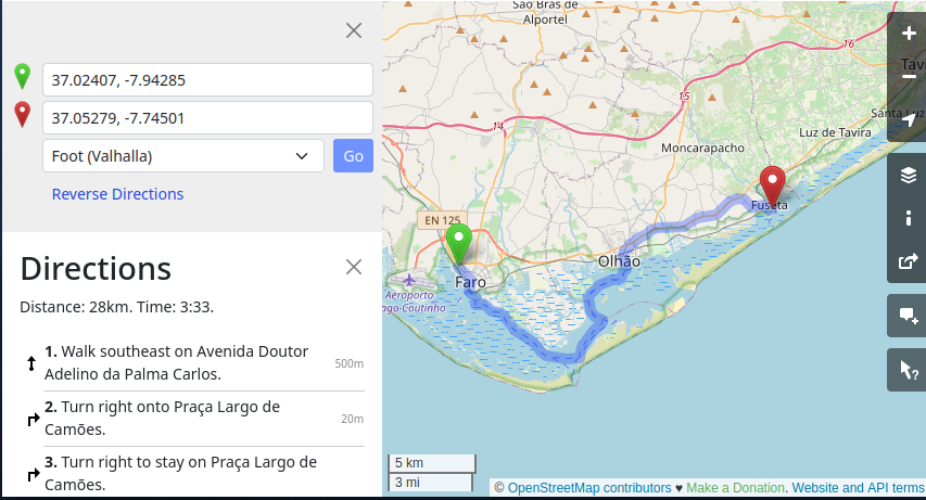
Valhalla – open-source routing engine available on osm.org [1] | map data © OpenStreetMap contributors
Breaking news
- Paul Norman announced the release of version 5.7.0 of the OpenStreetMap Carto Stylesheet, the default map stylesheet for the OSM website, on the mailing list and in his blog. All changes can be found there.The most obvious change, as the OSM Ops team tweeted, is the representation of unpaved roads. Unpaved roads will be rendered with a subtle stipple effect to show them as being not paved. The OSM Ops Team says: ‘Unpaved roads with a suitable tag will be styled differently. Change background: https://github.com/gravitystorm/openstreetmap-carto/pull/3399‘.The Ops team goes on to say ‘this unfortunately leaves a dilemma, many regions in OpenStreetMap unpaved is the presumed default in the absence of a
surface=tag. But! We can fix this, let us map if roads aresurface=pavedorsurface=unpaved(or more specific types)’.The OSM Ops Team then turned to three organisations with a friendly appeal for help: ‘Germany already has 46% of roads surfaces mapped. Zimbabwe it is only 14%. So let us get mapping road surfaces! How about it? @hotosm @osmafrica @youthmappers’.Ways with nosurfacetag can easily be found using overpass turbo.
Mapping
- -karlos- blogged
 ► about ‘area’ as a new object type in the OSM data model, why in his opinion it is a good improvement, and where he expects difficulties to arise.
 - Bob Cameron (bob3bob3) described how he takes photos and audio commentaries on the road and processes them automatically to use them at home for improving OSM.
- Bob Cameron (bob3bob3) explained how he tags
amenity=parkingandhighway=rest_area, having generally adopted a formal vs informal categorisation. - Kai Johnson explained how he distinguishes between
highway=serviceandhighway=track. - Lars Schwarz is experimenting ► with using the 3D Model generated by Polycam to collect infrastructure data for OSM.
- Quite Frankly is embarking on a project to ‘document and update cycle lanes on every street in Melbourne and eventually Victoria in as much detail as possible’ using tagging schemes that he says were developed specifically for the detailed documentation of cycling infrastructure ►. Other tools being used: StreetComplete, iD, JOSM, Vespucci and Hauke Stieler’s Simple Task Manager.
- steveman1123 blogged about his armchair mapping activities and what keeps him motivated while doing so.
- Requests have been made for comments on the following proposals:
emergency=air_rescue_serviceto tag the buildings and base areas of those groups that use aircraft, either fixed-wing or helicopters, for either aerial Search and Rescue, or Aeromedical Evacuation purposes.emergency=water_rescuefor mapping the buildings and base areas, both on and off water, of those groups that are dedicated to the rescue of vessels and/or sailors in distress.
- Voting is open on the proposal to announce proposals on the OSM Community forum as well as the tagging mailing list, until Saturday 21 January.
- Voting on the following proposals has closed:
historic=*, to approve a number of values of thehistorictag, was not successful with 11 votes for, 15 votes against and 1 abstention.fountain:design=*, for specifying what type of fountain anamenity=fountainis, was not successful with 13 votes for, 8 votes against and 1 abstention.
 ►
►
Mapping campaigns
- User kubahahaha has created several MapRoulette quests for populating OSM with Polish government data, published under the CC0 licence. Multiple TagFix and Cooperative challenges are available. Discussion on tagging is ongoing in the Polish OSM Community forum.
Community
- Ciarán Staunton (DeBigC) is full of praise for Anne-Karoline Distel (b-unicycling), who has contributed a whopping 5,000,000 changes to OpenStreetMap. Also read her blog post about this jubilee.
- Courtney Williamson asked for feedback on the proposed changes to the OSM data model (we reported earlier).
- Ronald Ontiveros, from Mexico, is the UN Mapper of the Month for January.
Events
- The next OSM hack weekend in Karlsruhe, Germany, will be held / on 25 and 26 February. Surely you have some unfinished OSM projects or some good ideas for new ones. Bring them with you to Karlsruhe. You will find people to discuss the details with you, or to build something with.
 on 25 and 26 February. Surely you have some unfinished OSM projects or some good ideas for new ones. Bring them with you to Karlsruhe. You will find people to discuss the details with you, or to build something with.
Education
- The UN Maps crowdsourcing team is offering a free online training workshop, in French, about ‘OpenStreetMap and Humanitarian Mapping’, open to anyone who is new to OpenStreetMap. Registration and is open until Tuesday 31 January 00:00 UTC. The two hour workshops will be held every Thursday starting 2 February for nine weeks, a total of 18 hours.
- AddisMapTransit and OpenStreetMap Ethiopia held a series of training workshops for OpenStreetMappers in Addis Ababa, Ethiopia.
 a free online training workshop, in French, about ‘OpenStreetMap and Humanitarian Mapping’, open to anyone who is new to OpenStreetMap.
 OSM research
- Simon Poole noted that fewer people signed up for OpenStreetMap last year and presented some interesting figures and thoughts. Paul Norman, from the Operations Working Group, contributed detailed numbers on where new users come from.
Maps
- [1] Valhalla, a global routing service hosted by FOSSGIS e.V., is now part of the routing selection (with foot, bike and car profile) on the OSM website. For more information there is a wiki page, Simon Poole’s comment on the OSM Community forum, and the GitHub repository.
- Romain de Bossoreille has generated a map Space Industry around the World using data from The Space Devs, Wikidata and OpenStreetMap.
Open Data
- The value of the new road detections datasets provided by Microsoft (as we reported earlier) was discussed on the OSM Community forum.
Software
- User NorthCrab announced the release of ‘osm-revert’, a tool to perform changeset reversion with a simple web interface requiring merely an OSM login, the id of the changeset to be reverted, and the comment for the new changeset. Tom Hughes, an OSM website maintainer, expressed doubts as to whether a ‘point-and-click’ reverter is a good idea.
Programming
- Inspired by Overpass Ultra (we reported earlier) rtnf attempted to install MapLibre GL Native on their Android platform. They documented some of the gotchas that need to be circumvented in order to get a working installation.
- SK53 described a method to find steep paths, which may need review on OSM. In a follow-up he enhanced his process to calculate the slope angles likely to be encountered by walkers.
- TreeTracks has published an article on how Overpass can be used to perform data analytics with OpenStreetMap. As an example, the road infrastructure in cities is compared to that found in the Australian bush.
Did you know …
- … Lejun’s list of geographers represented on Mastodon? On GitHub you can find a collection with many other disciplines and communities ranging from African studies to a community server dedicated to circuses.
- … there is a tool that generates RSS feed links for the various OpenStreetMap Quality Assurance sites for a given area?
OSM in the media
- The Swiss magazine PCtipp published ► ‘six tips for beginners’ in OpenStreetMap on its blog.
- Alex Seidel published ► an article about the Neukölln street map (which we have reported before) in the Kartographische Nachrichten, a newsletter for professional cartographers.
- Heise.de, a German IT news site, asked ► three questions of TomTom’s Michael Harrell in connection with Overture Maps and OpenStreetMap in a commercial guise.
Other “geo” things
- OpenCage has published a new ‘geoweirdness’ – this time on Croatia.
- The Bexhill OpenStreetMap website has added a page describing the origins of street names in the Bexhill area. The information was collected by local historians over several decades, but will be very interesting to enthusiasts of the
name:etymologytag in understanding how streets got their names. - Overture Maps this week:
- Steven Feldman interviewed Marc Prioleau from Meta on the GeoMob Podcast.
- James Killick published his ideas on Overture in a blog post.
- Dorothea has created a summary of what has been published about Overture.
- Meduza, a Latvian blog, reported, in an article referring to TASS, about a ‘bill to ban maps that “call Russia’s territorial integrity into question”‘.
- HERE has introduced ‘Unimap’, mapping technology designed to create maps automatically.
Upcoming Events
| Where | What | Online | When | Country |
|---|---|---|---|---|
| Seattle | World Railway Mapping Online Quarterly Meetup. | 2023-01-14 |  | |
| 臺北市 | OpenStreetMap 街景踏查團工作坊 #6 | 2023-01-14 |  | |
| Budapest | OSM Weaving: Remote help, Aranyvölgy pipeline preparation (online) | 2023-01-16 |  | |
| Grenoble | Rencontre du groupe local de Grenoble | 2023-01-16 |  | |
| 臺北市 | OpenStreetMap x Wikidata 月聚會 #48 | 2023-01-16 | | |
| Lyon | Rencontre mensuelle Lyon | 2023-01-17 | | |
| San Jose | South Bay Map Night | ✓ | 2023-01-18 | |
| 159. Treffen des OSM-Stammtisches Bonn | 2023-01-17 | |||
| London | Geomob London | 2023-01-18 |  | |
| Karlsruhe | Stammtisch Karlsruhe | 2023-01-18 |  | |
| Dar es Salaam | State of the Map Tanzania | 2023-01-19 – 2023-01-21 |  | |
| Budapest | Hiking by the pipeline between Normafa-Stop Shop-Aranyvölgy | 2023-01-21 | | |
| Toulouse | Réunion du groupe local de Toulouse | 2023-01-21 | | |
| Downtime | 2023-01-22 | |||
| Bremen | Bremer Mappertreffen (Online) | 2023-01-23 | | |
| OSMF Engineering Working Group meeting | 2023-01-24 | |||
| Düsseldorf | Düsseldorfer OpenStreetMap-Treffen | ✓ | 2023-01-25 | |
| [Online] OpenStreetMap Foundation board of Directors – public videomeeting | 2023-01-26 | |||
| IJmuiden | OSM Nederland bijeenkomst (online) | ✓ | 2023-01-28 |  |
| 南区 | 京都!街歩き!マッピングパーティ:第35回 六孫王神社 | 2023-01-29 |  | |
| Windsor | OSM Windsor-Essex Monthly Meetup | 2023-01-31 |  | |
| San Jose | South Bay Map Night | ✓ | 2023-02-01 | |
Note:
If you like to see your event here, please put it into the OSM calendar. Only data which is there, will appear in weeklyOSM.
This weeklyOSM was produced by MatthiasMatthias, PierZen, SK53, Strubbl, TheSwavu, YoViajo, conradoos, derFred.
We welcome link suggestions for the next issue via this form and look forward to your contributions.
Thank you for repair file dosis-latin-ext-700.woff2, extended plyphs in font Dosis is now displaying corectly. https://github.com/ruevko/Weekly-OSM/issues/1 Thank you very much!
Thank you for having reported that issue!
Unfortunately that github repo is not related to our website, even though it has the same name. If you want to reach out to us, it is best to write us an email or a comment on the website like you just did.
Ok, it’s great that it is now working.
*extended glyphs.