13/06/2023-19/06/2023
Evaluation of the Swiss OSM monthly task [1] © CC BY 4.0 | map data © OpenStreetMap contributors
Breaking news
- The next OSMF public Board meeting is scheduled for Thursday 29 June at 15:00 UTC in the video room. The preliminary agenda is on the wiki.
Mapping
- CactiStaccingCrane shared ten more things he has learnt while doing OSM mapping in the Vietnam area.
- Friendly Ghost conducted an investigation into SEO ‘advertisement speak’ in OpenStreetMap.
- Longhorn256 created a detailed diary and video on how to tag ‘coloured‘ emergency detour routes in Pennsylvania.
Mapping campaigns
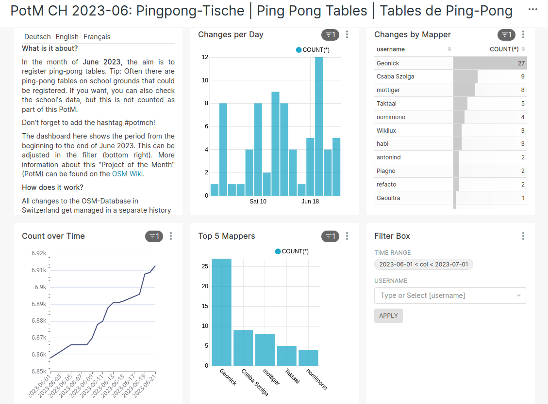
- [1] SwissOSM has declared
 ► the mapping of Swiss ping pong tables to be the task of the month for June. Progress is constantly updated in detail on the project of the month dashboard.
 - sahilister successfully organised their first social mapping meetup on 11 June in Chandni Chowk.
 ►
►
Community
- Brian Sperlongano shared his experiences in building an open-source community around the OpenStreetMap Americana project.
- Rubén Martín, HOT’s Community Strategist and Research Lead, shared analysis data on OSM mapper activity for 2017–2022 in some selected countries with graphs, and identified key questions for further analysis.
- The presentation materials from the State of the Map US 2023 event have been released.
OpenStreetMap Foundation
- Guillaume Rischard tweeted that the OpenStreetMap network infrastructure in the Dublin and Amsterdam data centres has been upgraded.
- The OpenStreetMap Operations team reported that there has been an improvement in the bandwidth of the OpenStreetMap server. They recently set a record for the fastest uplink speed, reaching 1.77 Gbit/s.
Events
- FOSS4G Conference 2023 will be held in Prizren, Kosovo on Monday 26 June and Tuesday 27 June. Christina Ludwig and Marcel Reinmuth, from HeiGIT, will be participating ► by leading a workshop and making a presentation, both related to openrouteservice.
Education
- Branko Kokanovic recorded a video that explains how to use BRouter and Strava heatmaps to create the best routes for your next bike or hike tour. More details can be found in his OSM diary or directly in the how-to video.
- HeiGIT and the German Red Cross is offering ► a master’s degree project about geoinformation for humanitarian aid. The topic will site analysis for mobile civil protection care facilities using GIS-based spatial analysis. Experience with OSM will be an advantage.
OSM research
- Philipp Weigell published a study on the quality of data in OpenStreetMap, concentrating on niche tags, such as those for wayside crosses.
Open Data
- The Overture Maps Foundation has released several documents that discuss their data schema and global entity reference system. They are now looking for community feedback and input on these documents.
Software
- NorthCrab has created ‘OSM Relatify‘, a tool simplifying the process of editing public transport relations within OSM. NorthCrab is asking for your feedback.
- The OpenPlaceReview management team announced that they closed their service on 15 June 2023. They are releasing the data that has been collected under a public domain licence for the next three months. As an alternative project, they recommend Mangrove reviews, which has shown sustained growth in recent years.
- HeiGIT has released version 1 of the OSM Element Vectorisation Tool, a tool for converting OSM elements into feature vectors for attribute investigation and machine learning.
Programming
- Jacob Kackley conducted an analysis of the location of residential areas in Los Angeles that have pedestrian access to nearby public facilities. Jacob will use these results to help find potential residential locations for himself in the city.
Did you know …
- … the informative switch2osm website? It is a guide in making use of OpenStreetMap data to meet your mapping needs.
OSM in the media
Other “geo” things
- heise reported ► that the United States Geological Survey has released a digital terrain model and satellite images of Mars. This data was collected from the Mars Reconnaissance Orbiter (MRO) mission, which has been ongoing since 2006.
- Simon Groß et al. has written a paper ‘Exploring MapSwipe as a Crowdsourcing Tool for (Rapid) Damage Assessment: The Case of the 2021 Haiti Earthquake’. It was presented at the 26th AGILE Conference in Delft, Netherlands. As a pre-assessment step, Mapswipe was used to classify whether image tiles contained :
- buildings that seem damaged, or
- bad imagery.
Upcoming Events
| Where | What | Online | When | Country |
|---|---|---|---|---|
| The Municipal District of Kilkenny City | Kilkenny History Mappers 1st MeetUp | 2023-06-20 – 2030-06-21 |  | |
| Localidad Teusaquillo | Junta Bimensual OSM LATAM – Junio | June | 2023-06-24 | |
| MapRoulette Nights | 2023-06-25 | |||
| Prizren | FOSS4G | 2023-06-26 – 2023-07-02 |  | |
| Bremen | Bremer Mappertreffen (Online) | ✓ | 2023-06-26 |  |
| OSMF Engineering Working Group meeting | 2023-06-28 | |||
| Aachen | 3. Treffen Aachener Stammtisch 2.0 | 2023-06-28 – 2030-06-21 | | |
| London | OSMLondon pub meet-up | 2023-06-28 |  | |
| UN Mappers – OSM and humanitarian mapping training – session #9 (final) | 2023-06-29 | |||
| 中正區 | TomTom x OpenStreeetMap Taiwan Mapping Meetup | 2023-06-30 |  | |
| Düsseldorf | Düsseldorfer OpenStreetMap-Treffen | 2023-06-30 | | |
| 烏日區 | 2023年7月 OpenStreetMap 街景踏查團 | 2023-07-02 | | |
| San Jose | South Bay Map Night | ✓ | 2023-07-05 |  |
| London | Missing Maps London Mapathon | 2023-07-04 – 2030-07-04 | | |
| Stuttgart | Stuttgarter OpenStreetMap-Treffen | 2023-07-05 | | |
| Rulles | OpenStreetMap Belgium – Réunion à Marbehan | 2023-07-06 |  |
Note:
If you like to see your event here, please put it into the OSM calendar. Only data which is there, will appear in weeklyOSM.
This weeklyOSM was produced by MatthiasMatthias, PierZen, Strubbl, TheSwavu, TrickyFoxy, barefootstache, conradoos, derFred, rtnf.
We welcome link suggestions for the next issue via this form and look forward to your contributions.