2021.03.23.-2021.03.29.

국가 지적 대장 시스템 [1] | © Direção-Geral do Território | map data © OpenStreetMap contributors
지도 제작 캠페인
- Code for Charlottesville에서 미국 버지니아주 샬러츠빌의 인도, 횡단보도, 연석을 오픈스트리트맵에 추가하고 있습니다. 이 정보들은 이동 장애인들을 위한 내비게이션에 활용됩니다. 자세한 정보는 여기를 참고하세요.
- 제15회 GeoNight(‘지리의 밤’)를 맞아 4월 8일부터 10일까지 온라인 미싱맵(Missing Maps) 매파톤이 다발적으로 개최됩니다. 이번 매파톤에 참여하는 단체들은 총 15개(프랑스, 독일, 말리, 세네갈, 방글라데시, 네팔, 몽골, 타지키스탄)입니다.
- ‘국제 차별 반대 주간’을 맞아 Disastermappers, CartONG, OSMGhana에서 온라인 매파톤을 4월 7일 새벽 1시 반(한국 시각)에 개최합니다. 해당 매파톤은 하이델베르크 다문화 센터에서 후원합니다. 참가 등록은 여기에서 할 수 있습니다.
- 맵박스(Mapbox) RAVE 팀 소속 Vlada Boitsik이 3월 한 달 동안 프랑스의 철길 건널목을 매핑하는 단체 프로젝트의 성과를 정리했습니다.
지도 제작
- Nielkrokodil가 오스트리아의 코로나19 검사소를 기록하고 유지보수하는 방법을 소개했습니다.
 >
> - 가톨릭 신자들이 성수를 뜨거나, 동전을 던져 기도하는 장소를 나타내기 위해
place_of_worship=holy_well태그를 추가하자는 제안이 인가되었습니다. - Rest of World에서 ‘미스터리한 오픈스트리트맵 기여자’라는, 흥미로운 기사를 게재했습니다. 이 기사에 따르면, 오픈스트리트맵의 NM$L¹이라는 기여자는 중국 정부의 주장에 맞게끔 오픈스트리트맵을 수정하고 있었습니다. 해당 기사는 위키피디아나 오픈스트리트맵과 같은 열린 데이터 프로젝트가 인위적인 조작에 취약하다는 것을 역설하면서, ‘올바른’ 데이터를 지키기 위한 지금까지의 노력을 추가로 소개했습니다.(참고¹: NM$L을 중국어로 읽으면 패드립이 됨. – 역주)
 >
> 
커뮤니티
- 아마존의 제휴 정책이 변경됨에 따라, 독일 아마존이 오픈스트리트맵에 지급하던 수익금이 끊어졌습니다. 이 제휴 정책으로 아마존은 총 2만 3천 유로를 벌어들였지만, 수익률은 점점 감소하는 추세였습니다.
- Médiathèque de Chorges 컨퍼런스에 참가한 Jean-Christophe Becquet APITUX에서 ‘내가 사는 마을을 그리자: 집단 지도 제작 입문‘이라는 제목의 발표로 오픈스트리트맵을 소개했습니다.
- 코로나19 사태 이후 위키피디아의 편집 횟수가 급격히 늘어나고 있다고 위키미디어 독일에서 보고했습니다. > 특히 1차 유행 기간에 편집 횟수가 30~80% 증가했으며, 이 추세는 2020년 여름부터 잦아들기 시작했습니다.
- OSMFJ 소속의 마츠자와 타로(닉네임 smellman) 씨가 “오픈스트리트맵 재단 일본 지부에서 사용하는 타일 서버 제작법”이라는 제목의 기사를 기고했습니다. >
- 최근 오픈스트리트맵 사이트를 통한 스팸이 증가하고 있습니다. 이와 관련해 독일 포럼에서 토론이 진행되고 있습니다.
 >
> 오픈스트리트맵 재단
- 오픈스트리트맵 재단의 Tobias Knerr 이사가 장기간 준회원으로 있던 사람도 이사회 선거에 출마할 수 있도록 정관을 변경하겠다고 발표했습니다. 지금까지는 이사회 선거에 출마하려면 180일 간 정회원으로 있어야 했으며, 준회원 기간은 산입하지 않았습니다.
- 지부 및 커뮤니티 작업반(LCCWG) 중재위원회 소속 Clifford Snow가 OSMF-talk와 talk 메일링 리스트의 중재팀을 구성하고, 기존의 에티켓 지침(이전에 보도한 적이 있습니다)을 재검토하려 합니다. 지금까지 중재위원회에서는 작업 범위를 정의하고 구현 계획을 끝마쳤습니다. 중재팀에 관심 있으신 분은 한번 신청해 보세요. 기간은 4월 10일까지입니다.
지도
열린 데이터
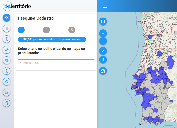
- 포르투갈 국토부에서 오픈스트리트맵을 배경 지도로 국가 지적도 뷰어를 제작했습니다.
- 일본 국토부에서 추진하는 Project PLATEAU를 통해 도쿄 23구의 3D 지도가 ODbL 라이선스로 공개되었습니다. 앞으로 일본 56개 시의 3D 지도가 열린 데이터로 공개될 예정입니다.
소프트웨어
- pocketnavigation.de에서 공식 지형도와 오픈스트리트맵을 결합한 야외 내비게이션용 GPS를 소개했습니다. >
- rainerU가 Osmium으로 오픈스트리트맵 개체를 필터링하는 방법을 설명했습니다. 이 방법을 이용하면 태그의 역사나 개체를 건드린 유저를 기준으로 개체를 분류할 수도 있습니다.
프로그래밍
- Stephan Knauss가 렌더링 스택을 PostgreSQL 13.2 / POSTGIS 3.1.1로 업데이트한 이후 1시간마다 2 GB의 메모리 누수가 발생하고 있다고 밝혔습니다. 아직 정확한 원인은 알 수 없습니다.
알고 계셨나요?
- 역사적 장소를 보여주는 Historic Place를 알고 계셨나요? 이 사이트는 한국어를 포함해 12개국어를 지원합니다.
매체 속 오픈스트리트맵
- 이스라엘의 Haaretz지(紙)에서 온라인 지도를 통해 실수로 공군 기지와 비밀 연구소의 정확한 위치를 노출하고 만 이스라엘의 한 군부대의 사연을 소개했습니다. 이는 오픈스트리트맵에 나와 있는 군사 기지 데이터를 지우지 않고 그대로 가져와서 생긴 일입니다.
기타 ‘지리’ 관련 소식
- Grace Lapointe가 훌륭한 지도가 포함된 판타지 소설 9권(반지의 제왕, 얼음과 불의 노래, …)을 소개했습니다.
- 에버 기븐호가 수에즈 운하에 갇혀 있는 동안, 오픈스트리트맵에서도 에버 기븐호를 볼 수 있었습니다 😉
- Ciaran Staunton이 오픈스트리트맵 기여자와 소비자의 관계를 트윗으로 올렸습니다.
- Yama_Chizu가 전국 도로 구조물 지도를 ‘전국 Q 지도’라는 사이트에 게시했습니다. 이 지도를 이용하면 일본의 다리 72만 개의 명칭과 준공 년도를 볼 수 있습니다.
- nagix가 미니 도쿄 3D 버전 2.8.0을 공개했습니다. 이제 현재 시각 기준 하늘의 색상과 태양의 움직임을 시뮬레이팅할 수 있습니다. 또한 비행기 항로 추적 기능이 개선되었습니다.
다가오는 행사
| 장소 | 명칭 | Online | 일시 | 국가 |
|---|---|---|---|---|
| OpenStreetMap World Discord Spring Mapathon | 2021-04-03 – 2021-04-04 | |||
| 京都市 | 京都!街歩き!マッピングパーティ:第23回 Re:常寂光寺 | 2021-04-04 | jp | |
| Heidelberg | International Mapathon: Weeks Against Racism | ✓ | 2021-04-06 |  |
| London | Missing Maps London Mapathon | ✓ | 2021-04-06 | gb |
| Landau an der Isar | Virtuelles Niederbayern-Treffen | ✓ | 2021-04-06 | |
| Stuttgart | Stuttgarter Stammtisch (Online) | 2021-04-06 | | |
| Numérique Éducatif Libre Webinaire : Quels usages pédagogiques avec OpenStreetMap ? | 2021-04-07 | |||
| OSM Hour: Talking about the motivation of our industrial sponsors, shared to-do lists (online) | 2021-04-07 | |||
| Missing Maps Artsen Zonder Grenzen Mapathon | 2021-04-08 | |||
| Missing Maps Studentendesk Rode Kruis Maastricht | 2021-04-08 | |||
| Dresden | Dresdner OSM-Stammtisch | ✓ | 2021-04-08 | |
| Berlin | 154. Berlin-Brandenburg OpenStreetMap Stammtisch (Online) | 2021-04-09 | | |
| Charlottesville | Cville Sidewalks Mapathon | 2021-04-11 |  | |
| Hamburg | Hamburger Mappertreffen | 2021-04-13 | | |
| Using maps to help prevent and respond to Gender Based Violence | 2021-04-14 | |||
| Chippewa Township | OpenStreetMap Michigan Meetup | ✓ | 2021-04-15 | |
| Zürich | 3. Mapathon Rapperswil mit Missing Maps Zürich (virtuell) | ✓ | 2021-04-14 |  |
| Osborne County | OpenStreetMap U.S. Virtual Mappy Hour | ✓ | 2021-04-15 | |
| Liverpool | University of Liverpool Mapathon 2021! | 2021-04-15 | gb | |
| San Jose | Virtual Civic Hack & Map Night | ✓ | 2021-04-16 | |
| PoliMappers: Humanitarian Mapping with Map For Future | 2021-04-16 | |||
| 138. Treffen des OSM-Stammtisches Bonn | 2021-04-20 | |||
| City of Nottingham | OSM East Midlands/Nottingham meetup (online) | ✓ | 2021-04-20 | gb |
| Berlin | OSM-Verkehrswende #22 (Online) | 2021-04-20 | | |
| Lüneburg | Lüneburger Mappertreffen (online) | 2021-04-20 | | |
| Albuquerque | MapABQ April virtual meetup | 2021-04-22 | | |
| Weggis | Swiss OpenStreetMap Association Annual General Meeting | 2021-04-23 | |
참고: 행사를 여기에 추가하고 싶다면, 캘린더에 행사 일정을 작성해 주세요. 캘린더에 있는 데이터만 주간OSM에 나타납니다. 캘린더 미리보기에서 행사를 확인하고, 만약 행사 정보가 틀렸다면 적절하게 수정해 주세요.
이 주간OSM은 다음 사람들이 제작했습니다. Climate_Ben, LuxuryCoop, Nordpfeil, TheSwavu, derFred, muramototomoya.
The WeeklyOSM wrote:
> The Israeli newspaper Haaretz featured a story about an Israeli military unit which posted a map on the National Emergency Portal with secret bases of the Israel Air Force and Military Intelligence including names and exact locations. According to the screenshot in the article the base map showing the secret bases is the OSM basemap.
Please note that despite the newspaper’s claim that ” The Home Front Command of the Israel Defense Forces removed the classified information from the map after Haaretz asked about it.”, the Home Front Command did not modify the OSM map or data. Instead, the Covid-19 test centers are now shown using an ESRI base map.
Ref:
1. Original article with blurred base name – https://www.haaretz.com/israel-news/israel-army-secret-bases-online-map-1.9643700
2. Current OSM map of the same area – https://www.openstreetmap.org/#map=11/31.7618/34.9825
3. Home Front Command Covid-19 test centers – https://www.oref.org.il/12605-17147-he/Pakar.aspx
“Die israelische Zeitung Haaretz berichtet (en) > de über eine israelische Militäreinheit, die auf dem Nationalen Notfallportal eine Karte mit geheimen Stützpunkten der Luftwaffe und des militärischen Geheimdienstes inklusive Namen und genauen Standorten veröffentlicht hat. Laut dem Screenshot im Artikel ist die Karte, die die geheimen Stützpunkte zeigt, die OSM-Basiskarte.”
Laut dem Screenshot ist die Karte nicht die aktuelle OSM-Basiskarte (ist nicht osm carto), beruht aber wohl auf OSM Daten, evtl. ist es eine ältere Version des Mapnik-Stils. Laut Artikel kamen die “geheimen Daten” komplett von OSM und wurden nicht von der Militäreinheit die die Karte veröffentlicht hat, hinzugefügt: “In a statement, it added the map is from “a civilian website that provides global public services for making maps accessible around the world and in Israel. Marking the IDF camps and bases was not done by the military, but copied from the existing map on the website.”” Wahrscheinlich sind weitere Informationen zu diesen “geheimen” Stützpunkten der Wikipedia zu entnehmen…