20/04/2021-26/04/2021
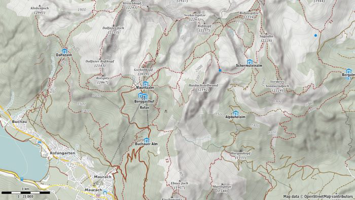
Printing your own hiking map [1] | map data © OpenStreetMap contributors
Mapping campaigns
- Florian Lainez announced
 > on the talk-fr list the launch of the May project, whose objective is to map medical analysis laboratories in France. All details are available on the site projetdumois.fr > .
 - OpenStreetMap Ireland has worked on mapping Ireland’s historic boundaries over the past decade, through this project: http://townlands.ie. These boundaries are now very useful for developers to make new products using the 1911 Census, because it shares the same administrative boundaries. This will allow users to visualise the Census results from 110 years ago as if it was a modern Census. Another great win for OpenStreetMap.
 >
> 
Mapping
- Mapper nitinatsangsit asked in the Thailand Forum whether
man_made=tower+tower:type=stupais a suitable tagging for stupas. Meanwhile the tagging is in use in multiple other countries. - Equalstreetnames has completed the categorisation of street names in Leipzig, Germany. Further analysis and considerations can rely on the interactive map and related statistics. Leipzig is the fifth German city for which this analysis has been done. The GitHub hosted project covers a further nine cities in Belgium and three in the Netherlands, as well as Bern, Switzerland and Belgrade, Serbia.
- Hungerburg has written > a blog post in which he contradicts the view that
landuse=forestexclusively represents economically used forests. This is true in some regions of Germany, but on the other hand it is not internationally tenable. - The German Outdoor-Forum > created an OSM-based shelter map with the help of uMap. Further shelters with photos and additional information can be posted in the forum; user Blauloke will transfer the information to OSM and onto the map.
- Flo Edelmann has revived wiki user Ajojo’s proposal about tagging whether a place offers and/or accepts reusable packaging. It is now open for comments again.
 >
> Community
- In his blog post, Bo Percival described the results from the design sprintathon and points out six problem areas. These start with high technical entry barriers, include the high variance in the quality of the collected data, and finish with the underestimation of the learning process required during mapping.
- OSM Zambia has completed their Facebook Community Impact Microgrant in which they mapped waste collection zones in the rapidly growing city of Lusaka to support the management of waste collection and disposal services.
- To improve field epidemiology and patient tracing in rural Uganda, HOT, with district health teams and community health workers, designed a community participatory mapping exercise across Kisoro and Zombo districts. Health workers were trained to use ODK, an open-source digital data collection application for smartphones.
- Four communities in Eastern and Southern Africa have been selected as recipients of the Facebook Community Impact Microgrant. Congratulations to The Shack Dwellers Federation of Namibia (social housing opportunities), OpenStreetMap Uganda (photo mapping with Mapillary), the Malawi OpenStreetMap community (refugee camp mapping), and the Center for Life Change and Development (mapping of facilities to fight gender-based violence).
- In honour of the 2021 International Women’s Day and Women’s History Month, the HOT Community Working Group (WG) organised two webinars: #ChooseToChallenge: Sexism and Misogyny in the Open Mapping Ecosystem. Arnalie Vicario shared the highlights.
OpenStreetMap Foundation
- FLOSSK have submitted an interim report for their microgrant project focused on mapping villages and settlements in Kosovo. They have led several online mapathons for students in locations across Kosovo with plans to expand activity in the coming months.
- Quincy Morgan and the OpenStreetMap Foundation’s Board made a joint statement on Quincy’s plan to leave the iD project. They will work together to choose and mentor an iD project successor.
- Based on requests from some OSMF working groups and the recommendation of the FOSS Policy Special Committee there is a now an OSM Nextcloud instance including OnlyOffice available for the community. It contains many collaboration tools for documents, calendars, and forms.
- Mateusz Konieczny has submitted a midterm report detailing his progress on a project for tactile maps. He has created tactile patterns and some initial tactile map designs.
Maps
- Street lamps are being equipped with sensors to help motorists find parking. The current status of parking in Düsseldorf is shown on an OpenStreetMap basemap.
- tom79 has investigated > various options for printing your own hiking maps. In addition to a number of geoportals, he also describes the printing of hiking maps using OSM data, including Maperitive, MOBAC and MyOSMatic.
Software
- User K_Sakanoshita announced > an upgrade to Town Walk Map Maker. In addition to being able to display steps, street lights, water tanks, etc., a QR code linking to Wikipedia and the ability to display an overview have also been added. K_Sakanoshita is also looking > for people to design icons for some other map features.
- Bryce Cogswell has issued a new beta of the iOS OSM editor, Go Map!! to TestFlight. One highlight of version 2.1.3 is the addition of a text recognition module for iOS 14-running devices, used to pre-fill opening_hours values.
 >
> Programming
- MapAction and HeiGIT are working together to carry out further research and development, teaching, outreach, and fundraising to support humanitarian mapping. Projects currently being planned include OSM analytics such as Humanitarian OSM Stats, and OSM data-quality assessments and improvements such as the ohsome quality analyst.
- Mapbox released a new tileset and style for bathymetry maps: developers can use these to add information about water depth on custom marine maps.
- Max Weber, of the YouTube channel Flutter Explained, talked about analysing Trufi Core, the basis of many public transport journey planner apps that use OSM.
Did you know …
- … the Photo Geotagging plugin for JOSM? It is used to write latitude and longitude information to the EXIF header of JPEG files.
Other “geo” things
- SkyNews reports that the Japanese SoftBank is in talks to help Mapbox become a publicly traded company through a merger with one of SoftBank’s special purpose acquisition companies (SPAC) called SVF Investment Corp. 3. Mapbox, which was founded in 2010, is already partly owned through SoftBank’s Vision Fund, following the $164m Series C funding round announced back in 2017. According to sources from involved banks Cantor Fitzgerald, Citi, Deutsche Bank, JP Morgan and UBS, the transaction would value Mapbox between $1.5bn and $2bn. So far details such as what new funds the transaction would involve are not known and the deal is still at a stage where it could fail. The deal would not be SoftBank’s first venture in the industry as it already part-owns Grab, a Singaporean multinational conglomerate with ties to OSM.
- A new study led by the University of Washington calls fake photos, created by different people for different purposes but which look like real images of real places, ‘location spoofing’. Given the sophisticated AI technologies available today, researchers warn that such ‘deepfake’ geography could become a growing problem.
- Jason Davies published a post about the intriguing Two-World Perspective globe designed by Edgar N. Gilbert. Explore the interactive globe and try to guess what the underlying visual illusion is.
- According to satirical website wurst.lu, Luxembourg paid the world’s mapmakers to exaggerate its size. The discrepancy was, according to the article, first discovered by a primary school teacher in Peru when a student giving a report on Luxembourg claimed it was larger than Brazil.
- Henry Quinney has reviewed three of the best entry level GPS cycling computers for 2021.
Upcoming Events
| Where | What | Online | When | Country |
|---|---|---|---|---|
| Salt Lake City | Map The U Spring 2021 | 2021-04-30 – 2021-05-01 |  | |
| London | Missing Maps London Mapathon | ✓ | 2021-05-04 | gb |
| Landau an der Isar | Virtuelles Niederbayern-Treffen | ✓ | 2021-05-04 |  |
| 2021-05-05 | ||||
| Stuttgart | Stuttgarter Stammtisch (Online) | 2021-05-05 | | |
| Dresden | Dresdner OSM-Stammtisch | ✓ | 2021-05-06 | |
| Missing Maps DRK Online Mapathon – Einführung JOSM | 2021-05-06 | |||
| OSM Africa Monthly Mapathon: Map Zambia | 2021-05-07 | |||
| gmina Krośniewice | Virtual meeting of the Polish OSM Association | 2021-05-07 |  | |
| 臺北市 | OSM x Wikidata Taipei #28 | 2021-05-10 |  | |
| Zürich | OSM-Treffen Zürich | 2021-05-11 |  | |
| 20095 | Hamburger Mappertreffen | 2021-05-11 | | |
| Köln | Stammtisch Köln | ✓ | 2021-05-12 | |
| Chippewa Township | OpenStreetMap Michigan Meetup | ✓ | 2021-05-13 | |
| Osborne County | OpenStreetMap U.S. Virtual Mappy Hour | ✓ | 2021-05-13 | |
| Berlin | 155. Berlin-Brandenburg OpenStreetMap Stammtisch (Online) | 2021-05-13 | | |
| gmina Krośniewice | Virtual meeting of the Polish OSM Association | 2021-05-14 | | |
| 139. Treffen des OSM-Stammtisches Bonn | 2021-05-18 | |||
| Lüneburg | Lüneburger Mappertreffen (online) | 2021-05-18 | | |
| Decatur County | Mapping USA | ✓ | 2021-05-20 – 2021-05-22 | |
| Mapping USA | 2021-05-20 – 2021-05-22 | |||
| Missing Maps DRK Online Mapathon | 2021-05-20 | |||
| gmina Krośniewice | Virtual meeting of the Polish OSM Association | 2021-05-21 | |
Note:
If you like to see your event here, please put it into the OSM calendar. Only data which is there, will appear in weeklyOSM.
This weeklyOSM was produced by Anne Ghisla, Climate_Ben, MatthiasMatthias, Nordpfeil, PierZen, Polyglot, SunCobalt, TheSwavu, YoViajo, derFred.