10/08/2021-16/08/2021
count addr:housenumber nodes across all EU member states, broken down by country, will run in 30 seconds on an Overpass development branch [1] map data © OpenStreetMap contributors
Mapping
- A long thread on how to tag recreational routes designed for multiple transport modes led Kevin Kenny to suggest that striving for a Platonic ideal of tagging is not necessary.
- oh8mxl wrote a blog post about ‘how to check cycling mapping mistakes and
fixmetags in your area’. - Requests have been made for comments on the following proposals:
- A new role ‘transfer’ for recreational route relations. There is no wiki page but you can find the mail list thread here.
cadet=militaryfor mapping the meeting place of a local military cadet unit.club=cadetfor mapping the meeting place of a local youth cadet group.
- Voting is underway for the following proposal:
man_made=video_wallfor mapping large digital screens (till Monday 23 August).
- Voting has ended for the following proposals:
cultivated=no/semi/fullyto add sub-tags tonatural=scrubwas unsuccessful with 25 votes for, 18 votes against and 2 abstentions.barrier=cycle_barrierto extend the tagging for cycle barriers was approved with 31 votes for, 2 votes against and 0 abstentions.
Community
- OSMF Board member Amanda is now up-to-date with their activity report for the month of July.
- Discussions about using Discourse to replace the OSM forum have been happening
for some time. The French community has migrated their forum from phpBB to Discourse and also migrated > all the existing posts from the old system. On the German forum, the question is raised > how to deal with old posts (for example: NL > 60,000, RU > 260,000 and DE > 300,000) when migrating from https://forum.openstreetmap.org.
 - User mariotomo took a detailed look at the projects hosted on the HOT Tasking Manager, gathering statistics on how many have been started, how many have finished, and how long they have been active.
 >
> 
Imports
- In an email from MSF, GIS officer Roxana Nazarie outlined a planned way to share non-sensitive data collected and approved by field teams with OSM. The context is that the import process is too long-winded when data needs to be shared for a rapid response. Most replies suggested that the proposed method was an import anyway, and a number of other approaches were suggested.
- Attila Kun and Brian Sperlongano are proposing an import of West Virginia State Forests.
OpenStreetMap Foundation
- The draft Etiquette Guidelines, proposed by the Local Chapters and Communities Working Group Moderation Subcommittee, are open for comments until Wednesday 8 September. They will apply to the talk and osmf-talk mailing lists. However, the authors recommend applying them to all OSMF-run platforms (forum, wiki, and national mailing lists) as well. Comments can be written and reviewed on the discussion page.
Maps
- In the streetscape map of Neukölln you can see how streets, sidewalks and street-side parking can be represented with OSM data. Tobias Jordans describes > in his blog post which data is visualised and where it comes from.
- Dirk Brockmann invited people who want a global view of the COVID-19 situation to check out this visualisation.
- Ashley Pinner and Harry Wood discussed, on Twitter, how various OSM maps show railway platforms.
Open Data
- Since 2018 the UK government has been lavishly funding the Geospatial Commission, or at least their contractors: predominantly, management consultancies. It is therefore somewhat of a surprise that their recently published list of geospatial data from trustworthy organisations seems to have lots of gaps. Peter Wells spotted, that the report not only fails to mention OSM at all, but deems that there is no authoritative source of addresses for most of the country.
Licences
- สุทธิสาร ปานสัสดี reflects > on a wide variety of licensing options in the context of OSM. He asks for feedback.
Software
- Yash Srivastava gave a final update, illustrated with screenshots, about his Google Summer of Code Project. The Nominatim Feedback Reporter will allow users to submit OpenStreetMap search (Nominatim) errors. These can then be added as test cases by the developers.
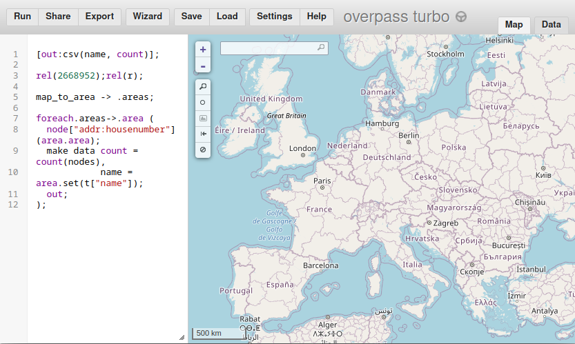
- [1] User mmd demonstrated how a query to count
addr:housenumbernodes across all EU member states, broken down by country, will run in 30 seconds on an Overpass development branch version. ATTENTION: The same query will not run on current production versions. - OrganicMaps (an OSM-based mobile app) has started a donation campaign to help pay for servers and fund development.
Programming
- User mahdi1234 published a short article on building a Matrix chatbot to report statistics from taginfo in the Czech community channel #osmcz:matrix.org.
Did you know …
- … about the Swiss cartographer Eduard Imhof? Our historical map-related item of the week. He was a pioneer of creating maps with shaded relief (as aspect of which we featured last week), and author of an influential text book. He also created, with skilled technical assistants, a number of large scale relief models, some of which can be seen in the Swiss Alpine Museum in Bern.
- … you can keep up to date with the happenings in the OSM software world with Walter Nordmann’s software watchlist?
- … about Pascal’s website Unmapped Places? This tool shows
placetags that don’t have a road within 700 m of them, suggesting the presence of an unmapped settlement.
Upcoming Events
| Where | What | Online | When | Country |
|---|---|---|---|---|
| 潍坊市 | OpenStreetMap(中国大陆)第一次线下聚会 | 2021-08-20 — 2021-08-30 |  | |
| Amsterdam | OSM Nederland maandelijkse bijeenkomst (online) | 2021-08-21 |  | |
| Bogotá Distrito Capital | Resolvamos notas de Colombia creadas en OpenStreetMap | 2021-08-21 |  | |
| Clay County | OpenStreetMap World Discord Summer mapathon | ✓ | 2021-08-21 — 2021-08-22 |  |
| Bremen | Bremer Mappertreffen (Online) | ✓ | 2021-08-23 |  |
| 105. OSM-Stammtisch Viersen und Umgebung | 2021-08-24 | |||
| Derby | East Midlands OSM Pub Meet-up : Derby | 2021-08-24 |  | |
| Zürich | Missing Maps Zürich Mapathon | 2021-08-25 |  | |
| Düsseldorf | Düsseldorfer OSM-Treffen (online) | 2021-08-25 | | |
| Asia Pacific Map and Chat Hour | 2021-08-27 | |||
| [Online] OpenStreetMap Foundation board of Directors — public meeting | 2021-08-27 | |||
| Autrans-Méaudre en Vercors | WikiCamp L’Escandille | 2021-08-28 — 2021-08-29 |  | |
| Bogotá Distrito Capital | Resolvamos notas de Colombia creadas en OpenStreetMap | 2021-08-28 | | |
| Hlavní město Praha | Missing Maps CZ Mapathon 2021 #5 | 2021-08-31 | cz | |
| San Jose | South Bay Map Night | ✓ | 2021-09-03 | |
| Kurmin Musa | Community Webinar: Local OSM community building: Tips, tricks and challenges | 2021-09-03 | ng | |
| Fortaleza | Encontro de usuários OSM do Ceará, Brasil. | 2021-09-04 |  | |
| 京田辺市 | 京都!街歩き!マッピングパーティ:第26回 一休寺 | 2021-09-04 | jp | |
| Greater London | Missing Maps London Mapathon | 2021-09-07 | | |
| Landau an der Isar | Virtuelles Niederbayern-Treffen | ✓ | 2021-09-07 | |
| Stuttgart | Stuttgarter Stammtisch (Online) | 2021-09-07 | | |
| OpenStreetMap Michigan Meetup | 2021-09-09 | |||
| Nordrhein-Westfalen | OSM-Treffen Bochum (September) | 2021-09-09 | |
Note:
If you like to see your event here, please put it into the OSM calendar. Only data which is there, will appear in weeklyOSM.
This weeklyOSM was produced by Nakaner, SK53, Sammyhawkrad, TheSwavu, derFred.
» Es ist daher einigermaßen überraschend, dass ihre kürzlich,,,»
Hätte das nicht «Es ist daher nicht überraschend, dass ihre kürzlich…» 🙂
@Simon DeepL does a reasonably good job of translating. However, in this case it has failed to successfully translate the sarcasm from the EN version.