19/11/2019-25/11/2019
Every single year — The map of the season 1 | © OpenStreetBrowser — Map data © OpenStreetMap contributors
Mapping
- kreuzschnabel suspects
 (automatic translation) that the OSM wiki for the key
 bridge=yes/nois recommending tagging for the renderer, as it suggests adding the bridge name asname=rather than the name of the road on the bridge. However, it appears this usage was documented in 2012 andman_made=bridge, to which thename=tag belongs, in his opinion, was added 2013.
 (automatic
 Community
- The GeoChicas project celebrated its third birthday on 26 November. A map shows a growing trend for the group, which seeks to raise awareness about gender gaps in the OpenStreetMap community.
- The Latin American OpenStreetMap community has published videos of the SotM Latam conference recently held in Encarnacion, Paraguay.
- With the closure of Belarus-based ride-share company Juno, Ilya Zverev and other developers are now employed by OSMF Corporate Member Lyft. This has resulted in suspension (automatic translation) of posting on Ilya’s blog WHATOSM. As Ilya explains Lyft’s employment contract restricts personal blogging without company permission. Hopefully, this will be a short-term problem.
 videos of the SotM Latam conference recently held in Encarnacion, Paraguay.
 (automatic
 OpenStreetMap Foundation
- In her OSM diary post Heather Leson summarises her experiences as part of the OSMF board during the past two years. The blog post focuses on governance, strategic planning in the OSM ecosystem, or the lack of it, and community health and toxic masculinity.
- Imagico decided to repeat last year’s analysis of the OSMF membership by country using the ratio of OSMF members to daily active editors. The pattern was similar to 2018 with English-speaking countries and others in Western Europe having the highest ratios. There were some trends towards greater diversity. Imagico hopes that the proposed membership waiver approach will accelerate this.The data were provided by the Membership Working Group and Pascal Neis’s OSM Stats.
Events
- SotM Africa 2019 tweeted their opening video.
- Kleper has published (automatic translation) in his OSM blog a brief summary about the SOTM Latam 2019 that was held in the city of Encarnación, Paraguay, between 14 and 16 November.
- The 6th Vienna Geo Meetup will take place (automatic translation) on 9 December 2019 with a talk about the vector data at basemap.at and reports about SotM 2019 in Heidelberg; and a Mapathon, organised by Doctors without Borders.
- GeoNews reports (automatic translation) on the second meetup between OSM mappers and mapbox.jp. The next meetup is planned for 4 December.
 (automatic
 Humanitarian OSM
- Under the slogan #MaptheDifference HOT kicks off the Microgrants for 2020 by raising funds for six specific projects and the general fund.
Maps
- Terence Eden has posted a guide, in his blog, on how to create a map using OpenLayers, with emphasis on the South with the Peters projection.
switch2OSM
- Like many other sports and outdoor apps or portals, Polar Flow now also uses OpenStreetMap and mentions as reasons for the choice, among others, «more detailed outdoors data» and «better paths».
Licences
- Guillaume Rischard warns that 308 imagery or map sources in the Editor Layer Index, an index for potential imagery and raster data background layers for OSM editors such as iD and JOSM, have no known licence. Can you help find some of them?
Software
- Java WebStart, which was used by JOSM for starting the editor without an installation, can now be replaced by OpenWebStart.
Releases
- Provided that everything went well the servers for MapOSMatic have been updated. The main reason for this upgrade is that this will bring in Mapnik version 3.0.22, which will mean SVG vector patterns will now finally be included into rendered PDF maps as true vector data, instead of converting them into rather low resolution bitmaps first.
- On 17 November 2019 the Release 1.6.0 of Leaflet was published. There were some minor enhancements and some fixes.
Did you know …
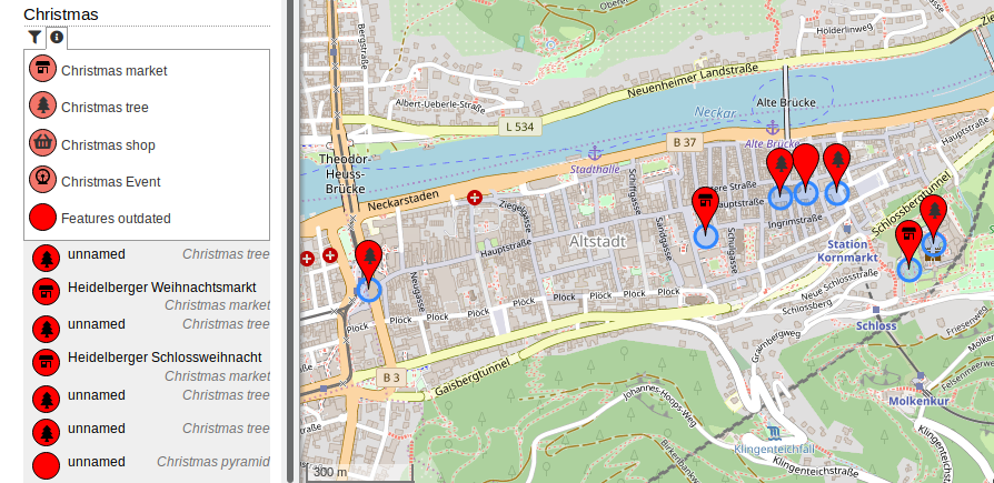
- … that the OpenStreetBrowser map displays Christmas-related features such as Christmas Trees or Christmas Markets?
- … the Soup Map that shows which soups can be found in different parts of Europe?
- … that the list of services that make use of OSM data has been updated on the OpenStreetMap wiki. An example is the multilingual Historic Place.
- … OpenRailwayMap? This OpenStreetMap-based site is actively discussed in the rails_dev discussion list.
- … OsmInEdit, the editor dedicated to indoor mapping? The JavaScript based editor was subject of a talk during the last SotM in Heidelberg.
OSM in the media
- «Projects like Wikipedia, OpenStreetMap and the world of open source software are the kinds of constructive tools that I hoped would flow from the web», writes Tim Berners-Lee, inventor of the World Wide Web
Other “geo” things
- Geoff Boeing, from the University of Southern California in Los Angeles, has developed the open source software package OSMnx. This supports city planners in the creation of maps. The tools use OpenstreetMap as the basis of their data.
- Minecraft Earth, the OSM-based augmented reality game, is now also available in Western Europe as an early access version.
- According to a new study, emergency responders could cut costs and save time by using near-real-time satellite data along with other decision-making tools after a flood disaster.
Upcoming Events
| Where | What | When | Country |
|---|---|---|---|
| Alice | PoliMappers Adventures 2019 | 2019-12-01-2019-12-31 |  |
| Toronto | Toronto Mappy Hour | 2019-12-02 |  |
| Žilina | Missing Maps Mapathon Žilina #7 | 2019-12-02 |  |
| Budapest | OSM Hungary Knowledge Sharing Meeting | 2019-12-02 |  |
| London | Missing Maps London | 2019-12-03 |  |
| Stuttgart | Stuttgarter Stammtisch | 2019-12-04 |  |
| Stuttgart | Stuttgarter Stammtisch | 2019-12-04 | |
| Bochum | Mappertreffen | 2019-12-05 | |
| San José | Civic Hack & Map Night | 2019-12-05 |  |
| Ulmer Alb | Stammtisch Ulmer Alb | 2019-12-05 | |
| Dortmund | Mappertreffen | 2019-12-05 | |
| Digne-les-Bains | Soirée spéciale OpenStreetMap | 2019-12-05 |  |
| Montrouge | Réunion des contributrices et contributeurs de Montrouge et alentours | 2019-12-05 | |
| Belgrade | OSM Serbia Meetup | 2019-12-07 |  |
| AoA and other changes | Voting on OSMF board elections | 2019-12-07-2019-12-14 | world |
| Grande Região Nordeste | Mapeia Nordeste | 2019-12-07 |  |
| Taipei | OSM x Wikidata #11 | 2019-12-09 |  |
| Zurich | 112. OSM Meetup Zurich (Fondue!) | 2019-12-09 |  |
| Lyon | Rencontre mensuelle pour tous | 2019-12-10 | |
| Salt Lake City | SLC Mappy Hour | 2019-12-10 | |
| Hamburg | Hamburger Mappertreffen | 2019-12-10 | |
| Viersen | OSM Stammtisch Viersen | 2019-12-10 | |
| Mannheim | Mannheimer Mapathons | 2019-12-12 | |
| Munich | Münchner Stammtisch | 2019-12-12 | |
| Nantes | Réunion mensuelle | 2019-12-12 | |
| Berlin | 138. Berlin-Brandenburg Stammtisch | 2019-12-13 | |
| Berlin | DB Open Data XMAS Hack | 2019-12-13-2019-12-14 | |
| San Juan | OpenStreetMap Workshop for Metro Manila Bikers | 2019-12-14 |  |
| Lüneburg | Lüneburger Mappertreffen | 2019-12-17 | |
| Nottingham | Nottingham pub meetup | 2019-12-17 | |
| Digne-les-Bains | HÉRuDi : l’Histoire Étonnante des Rues de Digne | 2019-12-17 | |
| Biella | Incontro Mensile | 2019-12-21 |  |
| Cape Town | State of the Map 2020 | 2020-07-03-2020-07-05 |  |
Note: If you like to see your event here, please put it into the calendar. Only data which is there, will appear in weeklyOSM. Please check your event in our public calendar preview and correct it, where appropriate.
This weeklyOSM was produced by PierZen, Polyglot, Rogehm, SK53, Guillaume Rischard (Stereo), SunCobalt, TheSwavu, YoViajo, derFred, geologist, jinalfoflia, keithonearth.