06/03/2018-12/03/2018
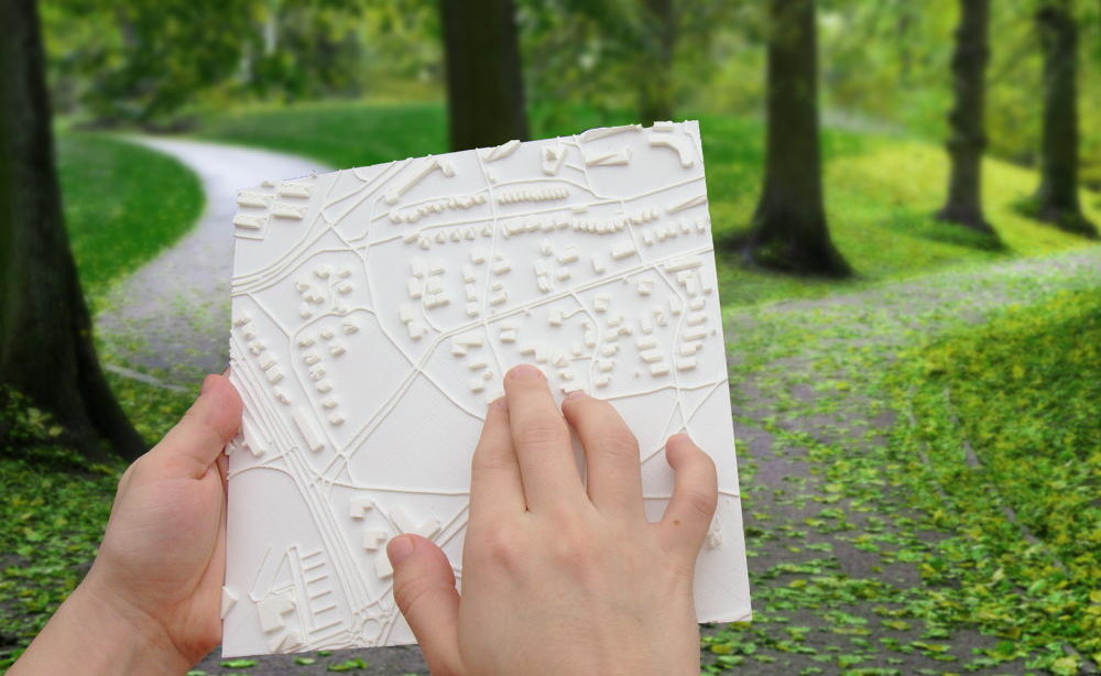
Example of a tactile map from TouchMapper 1 | Image from TouchMapper
About us
- The Czech weeklyOSM team decided to move (automatic translation) all content out of the OSM wiki, due to continued editing conflicts.
Mapping
- At FOSS4GUK, the British bird protection society, RSPB, presented their work on using drones to monitor bird reserves (abstract). Some of the collected data was added to OSM.
- Wiki fiddlers are changing the definition of the
aeroway=runwaytag. - How would you map a house number like 9 3/4? The Tagging mailing list weighs the use of Unicode ( ½ ) versus ASCII (1/2) and also discusses how other map providers handle this. Mappers from different regions pitch in with their local experience in mapping such fractions.
- Matthijs Melissen starts a thread on the tagging mailing list about the upcoming change in the rendering of boundaries announced by the developers of OSM Carto, the default stylesheet of osm.org. The discussion that follows tries to distinguish tagging issues (how to accurately tag different features) from mere tagging-for-the-renderer. Most participants agree that the information for the accurate rendering of boundaries worldwide is already there, and that the renderer can aggregate them on its own instead of asking for duplication of information.
- Gregory Marler has started making OSM Diaries, talking to a camera when he goes out mapping. They’re not intended to be tutorials, but a casual glance at what one mapper notices or how he uses different tools. Hopefully, they’re intriguing or inspirational, and will continue if popular.
Community
- Bryan Housel requests support on Twitter to generate an index of local resources for the various OSM communities, in order to help new mappers find relevant information easily.
- Harry Wood reports about London OpenStreetMap Q&A events, a new format that is becoming quite successful. The events feature a few presentations and plenty of time for chats among the participants.
- Heather Leson summarizes the recently held discussion on ‘OSM and Gender’ and some of the ways in which it could be taken forward.
- Nathalie Sidibe is the newest Mapper of the Month! She shares her experience of mapping places in Mali with minimal internet access and how OSM empowers her activism.
- Selene Yang examined the gender ratio among the nominees and winners of OSM Awards and invited the community to continue work in growing more diverse and inclusive. The answers to her diary entry try to find the possible causes of women’s under-representation in OSM, and most agree that removing these barriers would benefit the whole community.
Imports
- Ilya Zverev would like to import 59,000 gas stations from NavAds’ database into OSM. Christoph Hormann points out that the database spans across several countries and therefore, integration of the respective local communities is necessary.
OpenStreetMap Foundation
- The minutes of the Licensing Working Group meeting of March 8th is online. Topics included the Basic Data Protection Ordinance and the protection of minors.
- The Chat minutes of the Communications Working Group meeting of March 8th is online.
Events
- OSM Ireland will hold its first Annual General Meeting (AGM) on March 24th to set up a formal organization. So far, it has been a loose collective of like minded people contributing to OSM for over a decade.
Humanitarian OSM
- The University of Northern Colorado’s Geography and GIS Club maps out first responder routes in Bogota, Colombia to prepare for when disaster strikes.
- On the occasion of International Women’s Day, HOT throws light on some of the gender equality initiatives within the HOT community — including those funded by Micro grants and Device grants. It also suggests ways in which one could support gender equality in HOT and in the OSM community.
- Aerial imagery clearly shows that militias are burning down entire villages in DR Congo, causing people to flee and seek refuge in Uganda. It is unclear why the violence suddenly flares. Political motivations are suspected.
- In Belgium, the third National Missing Maps Mapathon will be organised across 8 university campuses on Saturday, March 24th, by the National Committee of Geography, in collaboration with OpenStreetMap Belgium to improve the map in Northern Nigeria and enable MSF to fight the ongoing Meningitis C epidemic.
Maps
- The Wheelmap now uses
 parking data of Parkopedia, a commercial project.
 parking data of Parkopedia, a commercial project.
Software
- The Openrouteservice for Disaster Management by HeiGIT now provides OSM updates more frequently. Africa, South America and South Asia are available as stable instances with hourly update intervals.
Programming
- The application phase for participating in this year’s Google Summer of Code is now open. The OSM-Blog invites students who would like to participate in open source projects in the OSM environment.
Releases
- Version 0.10 of the open source routing engine GraphHopper has been released on March 8th.
Did you know …
- … the open source geo data search engine Geoseer? The query for «OpenStreetMap» returns this record.
- … TouchMapper, a service that creates custom 3D maps?
OSM in the media
- The Unna district in central North Rhine-Westphalia, Germany received recent aerial imagery, which OpenStreetMap is allowed to use to improve the map.
Other “geo” things
- Google Maps for iOS now supports public transport routing for passengers in a wheelchair.
- Co-founder shares an article about how Mapbox started.
Upcoming Events
| Where | What | When | Country |
|---|---|---|---|
| Lannion | 3e concours de contributions OpenStreetMap | 2018-03-01-2018-03-23 |  |
| Lüneburg | Lüneburger Mappertreffen | 2018-03-20 |  |
| Cologne Bonn Airport | Bonner Stammtisch | 2018-03-20 | |
| Nottingham | Pub Meetup | 2018-03-20 |  |
| Karlsruhe | Stammtisch | 2018-03-21 | |
| Toulouse | Réunion mensuelle | 2018-03-21 | |
| Cologne Bonn Airport | FOSSGIS 2018 | 2018-03-21-2018-03-24 | |
| Lübeck | Lübecker Mappertreffen | 2018-03-22 | |
| Quezon City | MAPAbabae: OpenStreetMap Workshop with Women and for Women | 2018-03-22 |  |
| Turin | MERGE-it 2018 | 2018-03-23-2018-03-24 |  |
| 8 university campuses | Third National Mapathon | 2018-03-24 |  |
| Bremen | Bremer Mappertreffen | 2018-03-26 | |
| Graz | Stammtisch Graz | 2018-03-26 |  |
| Rome | Incontro mensile | 2018-03-26 | |
| Essen | Mappertreffen | 2018-03-27 | |
| Dusseldorf | Stammtisch | 2018-03-28 | |
| Osaka | もくもくマッピング! #15 | 2018-03-28 |  |
| Poznań | State of the Map Poland 2018 | 2018-04-13-2018-04-14 |  |
| Disneyland Paris Marne/Chessy Railway Station | FOSS4G-fr 2018 | 2018-05-15-2018-05-17 | |
| Bordeaux | State of the Map France 2018 | 2018-06-01-2018-06-03 | |
| Milan | State of the Map 2018 (international conference) | 2018-07-28-2018-07-30 | |
| Dar es Salaam | FOSS4G 2018 | 2018-08-29-2018-08-31 |  |
| Bengaluru | State of the Map Asia 2018 (effective date to confirm) | 2018-11-17-2018-11-18 |  |
Note: If you like to see your event here, please put it into the calendar. Only data which is there, will appear in weeklyOSM. Please check your event in our public calendar preview and correct it, where appropriate.
This weeklyOSM was produced by Anne Ghisla, Nakaner, Polyglot, Rogehm, Spec80, SrrReal, TheFive, Tordanik, YoViajo, derFred, jinalfoflia, sev_osm.