04/07/2024-10/07/2024
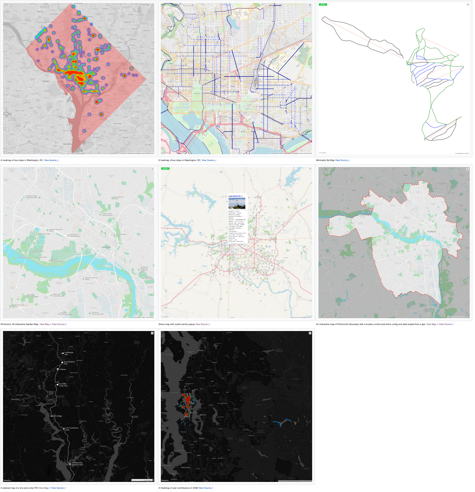
Gallery of Overpass Ultra map examples [1] | © dschep | map data © OpenStreetMap contributors
Mapping campaigns
- The humanitarian collaborative mapping campaign in response to the 2024 Rio Grande do Sul Floods (Brazil) is ongoing. The effects of the disaster that led to landslides, floods, and a dam collapse persist and 5,000 people are still homeless in the state. Everyone can collaborate in the open projects.
OpenStreetMap Foundation
- OpenStreetMap experienced a DDoS attack on Thursday 11 July, causing significant access issues and intermittent service disruptions, which the technical team is actively working to resolve.
Events
- The State of the Map Working Group is happy to announce that ticketing and programme websites for SotM 2024 are now accessible. Early bird tickets are available at a discounted price until Wednesday 31 July.
- Did you miss the call for general and academic presentations for the State of the Map 2024? You can still showcase your project or map visualisation by submitting a poster before Sunday 25 August. For inspiration take a look at the posters from SotM 2022.
- The SotM France 2024
 ► videos are now available on PeerTube .
 - The State of the Map US 2024 highlighted some new developments in pedestrian mapping, the integration of AI into mapping processes, and climate and historical data projects, with presentations on accessibility mapping, OpenStreetMap data validation, and participatory GIS for public land management.
 ►
►
Education
- The IVIDES.org carried out a hybrid workshop on collaborative mapping with OpenStreetMap and Web mapping using uMap, for a group of geography students from the Federal University of Ceará (Brazil), Pici campus (Fortaleza) and the general public. Raquel Dezidério Souto wrote about this experience in her diary ► and the files and video are available in Portuguese.
 ►
►OSM research
- Lasith Niroshan and James D. Carswell introduced DeepMapper, an end-to-end machine learning solution that automates updates to OpenStreetMap using satellite imagery.
Maps
- [1] TrailStash, ‘the home for #mapping projects by @dschep’, tooted that they have created a gallery of Overpass Ultra map examples.
OSM in action
- Bristow_69 noted that the Dialogues en Humanités festival is using a nice OpenStreetMap-based map, but unfortunately has not given proper credit to OpenStreetMap.
- EMODnet’s (European Marine Observation and Data Network) map viewer includes base and feature layers from OpenStreetMap.
- NYC Street Map represents an ongoing effort to digitise official street records, bring them together with other street information, and make them easily accessible to the public. The app was developed with OpenMapTiles and OSM contributors’ data. Users can find the official mapped width, name, and status of specific streets and how they may relate to specific properties. It is possible see how the street grid has changed over time in a chosen area.
- Ola Cabs have replaced Google with OSM in their Ola Maps navigation application. The change aimed to reduce costs and provide faster, more accurate searches and improved routing. This transition is part of Ola’s broader strategy to improve users’ experience and independence of navigation technology, which was first introduced in its electric vehicles with MoveOS 4 earlier this year.
- UtagawaVTT ► maintains the web platform Opentraveller, where contributors can register their mountain bike and electric bike travel routes and consult online data.
Software
- HOT has released the production version of fAIr, an assistant for mapping with AI, to a wider audience of OSM communities. The software has been tested and the production website is now accessible (login with your OSM account).
- Adam Gąsowski has introduced his OSM Helper UserScript, designed to streamline the use of community-built tools by automatically generating relevant links based on what the user is looking at. Future plans include integrating AI for automated tagging and developing a browser extension for Chrome and Firefox.
- Gramps Web, the open-source, self-hosted family tree application, has added a historical map layer based on OpenHistoricalMap.
- The 20.1.0.1 beta release of Vespucci included numerous updates, such as the removal of pre-Android 5 code, improvements to error handling and memory management, enhancements to the property editor, and new features such as GeoJSON label support and layer dragging.
Programming
- MapBliss is an R package for creating beautiful maps of your Leaflet adventures. It allows users to create print-quality souvenir maps, plot flight paths, control label positions, and add custom titles and borders. The package integrates several dependencies and is open for contributions and feature requests.
- Mattia Pezzotti is documenting his progress in integrating Panoramax with OpenStreetMap as part of Google Summer of Code 2024, providing weekly updates on new features and improvements such as viewing 360-degree images, adding filters, and improving the user interface. This ongoing project was previously covered in weeklyOSM 723.
- JT Archie described how they optimised large-scale OpenStreetMap data by converting it to a SQLite database, using full-text search and compression techniques, in particular the Zstandard seekable format, to handle data efficiently and improve query performance.
Did you know …
- … the release of Taiwan TOPO v2024.07.04 continues ► the tradition of weekly updates started in September 2016? Taiwan TOPO provides detailed topographic data for Taiwan.
 ►
►OSM in the media
- In an op-ed in The New York Times, Julia Angwin criticised society’s overreliance on turn-by-turn navigation in Google Maps and calls for greater investment in OpenStreetMap as a public good.
Other “geo” things
- The Ammergauer Alpen natural park has implemented ► a visitor monitoring system using sensors and GPS data to manage and protect natural areas while supporting sustainable tourism.
- Geomob has tooted about the release of the episode #241 of their Geomob podcast, which covers a wide variety of issues, such as the distortion of some electoral maps and the use of drones in agriculture.
- The Olympic torch relay route can be viewed on the Paris 2024 official website. The uMap Trajet Flamme Olympique 2024, created by @IEN52, shows all the 67 stages of the parcours, including overseas territories. Some other uMaps show the passage of the Olympic Torch in selected cities.
- The Philippines’s Second Congressional Commission on Education and the Department of Education are partnering to conduct a comprehensive nationwide mapping of private schools starting this July. This initiative aims to inform government policies, optimise resource allocation, and enhance complementarity between the public and private education systems.
- TomTom and East View Geospatial have partnered to provide Australia’s Department of Defence with global map data, leveraging TomTom’s Orbis Maps for accurate geospatial information critical to national security and disaster response. TomTom’s Orbis Maps is made by conflating open data from Overture and OSM with TomTom partners’ data and TomTom’s proprietary data in a controlled environment.
- Marcus Lundblad has published his annual ‘Summer Maps’ blog post for 2024, with updates to map visualisations, improvements to search functionality and dialogue interfaces, the addition of a playground icon, support for public transport routing, and the introduction of hill shading for showing terrain topology.
- Researchers at the Sun Yat-sen University, in collaboration with international experts, have detailed, in the Journal of Remote Sensing, a framework for building extraction using very high-resolution images in complex urban areas, addressing the limitations of existing datasets for urban planning and management.
 ►
►Upcoming Events
| Where | What | Online | When | Country |
|---|---|---|---|---|
| Salt Lake City | OSM Utah Monthly Map Night | 2024-07-11 |  | |
| Lorain County | OpenStreetMap Midwest Meetup | ✓ | 2024-07-11 | |
| Amsterdam | Maptime Amsterdam: Summertime Meetup | 2024-07-11 |  | |
| Berlin | DRK Online Road Mapathon | 2024-07-11 |  | |
| Wildau | 193. Berlin-Brandenburg OpenStreetMap Stammtisch | 2024-07-11 | | |
| Zürich | 165. OSM-Stammtisch Zürich | 2024-07-11 |  | |
| Bochum | Bochumer OSM-Treffen | 2024-07-11 | | |
| Bangalore East | OSM Bengaluru Mapping Party | 2024-07-13 |  | |
| Portsmouth | Introduction to OpenStreetMap at Port City Makerspace | 2024-07-13 – 2024-07-14 | | |
| København | OSMmapperCPH | 2024-07-14 |  | |
| Strasbourg | découverte d’OpenStreetMap | 2024-07-15 |  | |
| Richmond | MapRVA – Bike Lane Surveying & Mapping Meetup | 2024-07-16 | | |
| England | OSM UK Online Chat | 2024-07-15 |  | |
| Missing Maps London: (Online) Mid-Month Mapathon | 2024-07-16 | |||
| Bonn | 177. OSM-Stammtisch Bonn | 2024-07-16 | | |
| Hannover | 2024-07-17 | | ||
| Łódź | State of the Map Europe 2024 | 2024-07-18 – 2024-07-21 |  | |
| Zürich | Missing Maps Zürich Mapathon | 2024-07-18 | | |
| Annecy | OSM Annecy Carto-Party | 2024-07-18 | | |
| OSMF Engineering Working Group meeting | 2024-07-19 | |||
| Cocody | OSM Africa July Mapathon – Map Ivory Cost | 2024-07-20 |  | |
| München | Mapathon @ TU Munich | 2024-07-22 | | |
| Stadtgebiet Bremen | Bremer Mappertreffen | 2024-07-22 | | |
| San Jose | South Bay Map Night | ✓ | 2024-07-24 | |
| Berlin | OSM-Verkehrswende #61 | ✓ | 2024-07-23 | |
| [Online] OpenStreetMap Foundation board of Directors – public videomeeting | 2024-07-25 | |||
| Lübeck | 144. OSM-Stammtisch Lübeck und Umgebung | 2024-07-25 | | |
| Wien | 72. Wiener OSM-Stammtisch | 2024-07-25 |  |
Note:
If you like to see your event here, please put it into the OSM calendar. Only data which is there, will appear in weeklyOSM.
This weeklyOSM was produced by Aphaia_JP, MatthiasMatthias, PierZen, Raquel Dezidério Souto, Strubbl, TheSwavu, YoViajo, barefootstache, derFred, mcliquid, miurahr, rtnf.
We welcome link suggestions for the next issue via this form and look forward to your contributions.