06/06/2024-12/06/2024
Virtual OSM-Globe [1] | © openglobus | map data © OpenStreetMap contributors
Mapping
- Shinji Enoki recounted
 ► his experience with on-foot mapping using StreetComplete and EveryDoor. He enjoyed the gamified elements of both apps, but cautions readers about the risks of frequently stopping or looking at the screen while walking, as he has nearly tripped several times.
 - OSM contributor une abeille blogged about mapping focused on people and not just on vehicles or commerce, pointing out that OSM can be useful for a more humanised urban map.
- The proposal to deprecate the
cycleway=oppositefamily of tags can be voted on until Saturday 22 June.
 ►
►
Mapping campaigns
- Mikko Tamura reported that in the span of just three weeks, since the OM Guru Climate Change Challenge 2024 began, more than 250,000 buildings, 11,000 km of roads, 15,000 POIs, and 8,000 km of waterways have been mapped. More than 4 million tiles were swiped, 11,000 Tasking Manager tasks completed, and 16,000 MapRoulette tasks finished.
Community
- Arjun Gangadharan has written a blog post about his passion and motivations for mapping in OSM. He encouraged others to contribute to OSM and listed the various benefits of contributing.
- hobbesvsboyle published a diary entry about how they collect road surface information during bike rides and the workflow thereafter to efficiently add the information into OSM using JOSM.
- The Trufi Association released an update to its mission statement by expanding its operational scope from ‘public transport’ to ‘sustainable transport’ and ‘transportation justice’.
- Kshitijraj Sharma conducted qualitative and quantitative analyses of the Overture Maps dataset version 2024-05-16-beta.0.
- Martin Kokos has started a discussion on improving OSM tags for the visually impaired.
- In the tenth edition of his OpenStreetMap NextGen development diary, Kamil Monicz has invited people to contribute to the project. There are openings for translators, graphic designers, and software testers.
- Sawan Shariar is searching for students to volunteer as campus ambassadors to engage with their university community and to promote SotM Asia and SotM Bangladesh 2024. He is also calling for designers and creatives to help by creating a SotM Asia logo.
- The UN Mapper of the Month is Angie Lorena Trujillo, an Environmental Engineer and GIS specialist from Colombia, who joined the UN Mappers OSM validation course.
Imports
- Kai Johnson analysed the GNIS import that was done from 2008 to 2011 and concluded that there is still a lot to be done.
OpenStreetMap Foundation
- Andrew Wiseman has provided a progress update on the vector tiles development currently being done by the Engineering Working Group of the OpenStreetMap Foundation.
Events
- The State of the Map Europe 2024 tooted that the preliminary conference schedule for SotM EU 2024 is available and tickets can now be bought.
- There’s only one week left to register ► for the 10th SotM France conference ►, to be held in Lyon from Friday 28 to Sunday 30 June.
 ►
►Education
- Raquel Dezidério Souto reported ► that the IVIDES ► had organised a workshop on mapping trees and vegetation in OpenStreetMap using iD, JOSM, and the FastDraw plugin.
- Severin Menard tooted about the educational activities carried out by UN Mappers since 2021. A complete report of this successful experience can be found on their blog.
 ►
►OSM research
- Herrera-Murillo et al. have published a conference paper titled ‘Process Analysis in Humanitarian Voluntary Geographic Information: the case of the HOT Tasking Manager’, in which they analyse two years of individual contributors’ actions from the Tasking Manager logs, and process them from the perspectives of control flow, time, organisation, and outcomes of the mapping tasks that comprise a project. OSM data is also extracted for the analysis from the Bunting Labs OSM extracts service.
Maps
- David Thompson shared OpenSidewalkMap, an OpenStreetMap-based webmap that displays the location of sidewalks.
OSM in action
- Peter Van Geit explained how to use OpenStreetMap for planning a Himalayan traverse over multiple days and passing through many valleys. OpenStreetMap POIs such as human settlements, streams, peaks, and camp sites along the planned route can be imported into QGIS for processing the data, and the processed data can then be imported into a phone app, for example OsmAnd, to use during the hike.
Open Data
- Using OSM AddisMapTransit has mapped over 2,300 public transport stops and 443 routes in Addis Ababa, Ethiopia. These routes were then converted from OSM to standardised open transport data (GTFS) and submitted to the DigitalTransport4Africa repository.
Software
- franzpc reported that GISCARTA has developed Geodata AI, a web API tool to extract OpenStreetMap data using natural language and AI.
- Emerson Rocha has released SDM v0.5.0 beta, a web application to aid in OpenStreetMap data conflation.
- llya Zverev (@zverik) is pleased to announce that he now has the support of OpenCage in the development ► of his Level0 OpenStreetMap editor.
- Tim Hirrel has released TdhOGR, a GUI tool for converting various geospatial data formats, including OpenStreetMap, to another data format (based on the GDAL library), or to another coordinate reference system (based on the PROJ library).
 ►
►Programming
- Volodymyr Agafonkin, creator of mapping library Leaflet, has authored a tutorial showing how to programme a web map from scratch, with only a few lines of code.
- There’s a discussion on GitHub about whether to switch the ‘OSM Carto’ raster map style to osm2pgsql’s flex output. A previous pull request for this is here.
Releases
- OpenAndroMaps has released an updated version of their summer 2024 edition, with improvements to the LiDAR-based elevation display feature and the e-bike charging station display.
Did you know …
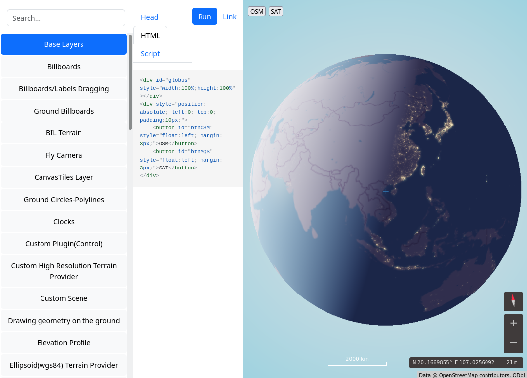
- [1] … OpenGlobus is a TypeScript/JavaScript library for visualising high-precision virtual globes and various geospatial data using WebGL? It’s open source and available on GitHub.
- … that one of the standard parking signs in the United States refers motorists to the uMap-powered website CityParkingWeb.com?
- … that a proposal process is active? This is a way to introduce and discuss new OSM tags for features and properties.
OSM in the media
- geoObserver discussed ► a very interesting video, titled ‘Urban Mapping: City Maps with QGIS and QuickOSM’.
 ►
►Other “geo” things
- Sebastiano Ferraris has published a numerical study that attempted to verify whether the seven famous cathedrals that form the ‘Sword of St Michael’ really lie in a straight line.
- Daniel praised the What3Words team’s marketing skills shown during their presentation at Geomob Berlin on Wednesday 5 June, while also warning about its inherent technical flaws, which were discussed in depth by Cybergibbons in a 2021 article.
- EO Solar ►, created by the Deutsche Luft- und Raumfahrtzentrum (German Aerospace Centre), shows ► which building roofs are well suited for photovoltaic systems. This dataset lists the solar energy potential of around 20 million buildings.
Upcoming Events
| Where | What | Online | When | Country |
|---|---|---|---|---|
| Marseille | Cartopartie : accessibilité voirie et l’écologie urbaine | 2024-06-15 |  | |
| Defence Colony Tehsil | 9th OSM Delhi (Indoor) Mapping Meetup – Session 1 | 2024-06-15 |  | |
| Kalkaji Tehsil | 9th OSM Delhi (Indoor) Mapping Meetup – Session 2 | 2024-06-16 | | |
| Hannover | OSM-Stammtisch Hannover | 2024-06-16 |  | |
| England | OSM UK Online Chat | 2024-06-17 |  | |
| Missing Maps London: (Online) Mid-Month Mapathon | 2024-06-18 | |||
| Lyon | Réunion du groupe local de Lyon | 2024-06-18 | | |
| Bonn | 176. OSM-Stammtisch Bonn (Juni 2024: 20 Jahre OSM – 15 Jahre Stammtisch Bonn) | 2024-06-18 | | |
| City of Edinburgh | OSM Edinburgh pub meetup | 2024-06-18 | | |
| Utrecht | OSGeo.nl Open Zomerpodium – OSGeo.nl Open Summer Stage | 2024-06-19 |  | |
| Karlsruhe | Stammtisch Karlsruhe | 2024-06-19 | | |
| Stainach-Pürgg | 13. Österreichischer OSM-Stammtisch (online) | 2024-06-19 |  | |
| OSM-Deutschland Vernetzungstreffen | 2024-06-20 | |||
| OSMF Engineering Working Group meeting | 2024-06-21 | |||
| Rio de Janeiro (on-line) |  UCM (Maputo, MOZ) – Oficina sobre mapeamento com OpenStreetMap! UCM (Maputo, MOZ) – Oficina sobre mapeamento com OpenStreetMap! | 2024-06-21 |  | |
| Dover | Coffee and Mapping! | 2024-06-23 |  | |
| Bielefeld | OSM Ostwestfalen-Lippe | 2024-06-25 | | |
| City of Edinburgh | Geomob Edinburgh | 2024-06-25 | | |
| Kaiserslautern | OSM Einführung und Schulung | 2024-06-25 | | |
| San Jose | South Bay Map Night | ✓ | 2024-06-26 | |
| [Online] OpenStreetMap Foundation board of Directors – public videomeeting | 2024-06-27 | |||
| Lübeck | 143. OSM-Stammtisch Lübeck und Umgebung | 2024-06-27 | | |
| Lyon | SotM-FR 2024 – Lyon | 2024-06-28 – 2024-06-30 | | |
| Düsseldorf | Düsseldorfer OpenStreetMap-Treffen (online) | 2024-06-28 | | |
| 中央区 | マッピングパーティ in 北海道神宮 | 2024-06-30 |  | |
| Tartu linn | FOSS4G Europe 2024 | 2024-06-30 – 2024-07-07 |  |
Note:
If you like to see your event here, please put it into the OSM calendar. Only data which is there, will appear in weeklyOSM.
This weeklyOSM was produced by Aphaia_JP, PierZen, Raquel Dezidério Souto, Strubbl, Ted Johnson, TheSwavu, barefootstache, conradoos, derFred, freyfogle, isoipsa, miurahr, rtnf.
We welcome link suggestions for the next issue via this form and look forward to your contributions.