18/01/2022-24/01/2022
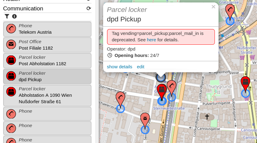
The recently approved proposal for amenity=parcel_locker available in [1] | © OpenStreetBrowser | map data © OpenStreetMap contributors
Mapping campaigns
- Organic Maps presented the results of their Subway Validator. This is a regularly updated status overview of all known networks. Networks with errors might be fixed directly in OSM with the help of the metro mapping guide.
Mapping
- roptat described
 > the different methods and apps for mapping by foot and car. He concluded that for him it is most efficient to collect as much information as possible and map later on a computer.
 - Florian Lainez pointed out that there is no need to update the coastlines dramatically changed by the Honga Tonga volcanic eruption. They have already been revised in OpenStreetMap using 30 cm PléiadesNeo imagery.
- AngocA continued his series of articles about OSM notes. In one article > he described the different types of notes one may encounter, while in another > he lists several useful techniques for resolving them.
- Littltebtc shared his thoughts about the new section of National Freeway 4 and Section of Provincial Expressway No. 74, opened just before the Lunar New Year Holiday in Taiwan. He said the Taiwan community’s mapping might not be perfect due to the newest satellite images not being available, resulting in some map mistakes after the National Freeway was opened to the public. He observed that the initial mappers of new highways might not check road connections to see if they are correct, warning there might be some risk if you solely depend on OpenStreetMap data for navigation purposes.
- kubahahaha described >
how he was updating bus stops in the GZM metro area (Poland) from a very old style of mapping the stops as nodes on the road. - Should private areas used for personal leisure activities be mapped using
landuse=recreation_ground? This question >
was asked on the German forum and provoked a lot of discussion. - The following proposals are waiting for your comment:
aeroway=airside_crossingto tag a controlled point of a highway or railway where people or traffic pass through the normally restricted airside area of an aerodrome.postal_service:<service>=*for thepostal_service:*-namespace to mark unified tagging for postal services.- to define more clearly the reasons why a tag is deprecated.
- Voting has been completed for the following proposals:
defensive_works=*to tag military constructions or buildings designed for the defence of territories in warfare was approved with 18 votes for, 2 votes against and 3 abstentions.parking:lane:*,parking:condition:*=*to tag conditionals for parking lanes and deprecating the use of certain older tags was approved with 29 votes for, 0 votes against and 1 abstention.bicycle_rental=docking_station; key_dispensing_machine; dropoff_point; shop; ...to tag onamenity=bicycle_rentalwhat type of bicycle rental it is, was approved with 19 votes for, 4 votes against and 2 abstentions.
 >
> 
 >
>  his thoughts about the new section of National Freeway 4 and Section of Provincial Expressway No. 74, opened just before the Lunar New Year Holiday in Taiwan. He said the Taiwan community’s mapping might not be perfect due to the newest satellite images not being available, resulting in some map mistakes after the National Freeway was opened to the public. He observed that the initial mappers of new highways might not check road connections to see if they are correct, warning there might be some risk if you solely depend on OpenStreetMap data for navigation purposes.
 >
>  >
> Community
- Taichi Furuhashi claims that Niantic is free-riding on the OSM community and should show its flag .
- Daniel Akor, a final year undergraduate student in the Geography Department, University of Nigeria Nsukka, reported on how his quest and passion for mapping got him into the LionMappersTeam-Nsukka.
- Joshua Kwame Bensah-Ziwu, who helped found the Survey School Mappers and acts as its president, shared his insight about the impact of COVID-19 on a New YouthMappers Chapter.
- OSM Fukushima members have released a video introducing weeklyOSM 588.
 .
.Local chapter news
- OpenStreetMap US summed up the year 2021.
Events
- State of the Map US will not require vaccination against COVID-19 to attend.
Education
- Aman Sandhu has started a series of introductory videos for OsmAnd. While the first video introduces the app, the second explains how to plan a day trip.
OSM research
- Moritz Schott presented a guide on how to filter OSM data down to only the data you need before starting any analyses or visualisations.
Maps
- The Hidden Cities project will reveal overlooked or obscured histories of selected cities. At the moment it provides five primary case studies: Exeter, Valencia, Hamburg, Deventer and Trento.
Open Data
- Microsoft has released new and updated building footprints for the United States of America, Nigeria, Kenya, South America, Uganda, Tanzania, Canada and Australia, which are licensed under the Open Data Commons Open Database License (ODbL).
Software
- [1] After the recently accepted proposal for
amenity=parcel_locker(we reported earlier), OpenStreetBrowser now includes parcel lockers. - OsmAnd gave away 20 of the ‘All World Maps’ promo codes for iOS and 20 promo codes of OsmAnd Maps+ for Android. Follow this link to join the next OsmAnd giveaway.
- The HOT team has created ‘a new model for Tasking Manager that aspires to get the Tasking Manager back to its community software roots’. Now, they are offering a volunteer position ‘Tasking Manager Collective Guide’.
- After introducing a new routing engine (we reported earlier), OpenSnowMap now renders icons where something is tagged as
piste:type=fatbike,aerialway=t-bar,aerialway=j-bar,aerialway=platteroraerialway=rope_tow. - Hoerli has > written instructions on how to display Google traffic information in OsmAnd.
Programming
- Amanda described, in her OSM Diary, how to find OSM users who comment on changesets but don’t contribute by editing the OSM database. She used her anglosaxon tool, about which we reported earlier.
- osm2pgsql release 1.6.0 has been published, which is a bugfix release only.
Releases
- Martin Raifer released an update of iD’s tagging presets: Version 3.2.0 includes a lot of improvements, new presets and fields, as well as bug fixes and translation updates. Notable changes are the update of the parcel lockers preset to the new
amenity=parcel_lockertag, and the addition of a preset forcrossing=traffic_signals. See the changelog for the full list of changes. - Pieter Vander Vennet reported that MapComplete 0.14 has been deployed. Apart from lots of bug fixes and performance improvements, a new theme showing OpenStreetMap notes has landed. The filter function should come in handy. And of course, there are plenty of (new) themes, such as the street lighting theme (thanks Robin!) or the postboxes and -offices map (by nicolelaine).
Did you know …
- … there is a website that provides basic JOSM installation steps and troubleshooting information?
Other “geo” things
- Sameera Khan showed a couple of European maps filled in by Americans. Could you do better with a map of Africa? Or the Americas?
- Edward Snowden revealed that the CIA station he worked at had a large world map to teach new arrivals the location of countries.
- Yannick Brouwer tweeted a marvellous animated map showing railway passenger traffic in the Netherlands over a 24 hour period.
- Reddit has a post showing a comparison of the 1820 map of Rio de Janeiro, Brazil, superimposed on the current city map, showing land reclamation done over the years that has contributed to the expansion of the city.
- Jeff Foust reported on ESA’s consideration of moving up the launching of a new radar satellite after the Sentinel-1B malfunction.
- Bartosz Ciechanowski wrote an in-depth explanation about how the Global Positioning System works, with a superb animation of the globe and the GPS satellite trajectories around it.
- Steve Coast showed us TomTom’s latest project named ‘RoadRunner’. It is used to automatically create maps based on vast amounts of GNSS traces. One-way streets and road classes are detected automatically. OpenStreetMap is used to provide street names. RoadRunner can be explored via their web application or you can download a PBF.
- An article in The Guardian discussed the use of maps to illustrate literary works. Apparently James Joyce was adamant that no maps should be included in editions of Ulysses: perhaps he was worried people would try and draw routes avoiding pubs.
- Only 11 days separate these 3 satellite images! The images are of Hunga Tonga-Hunga Ha’apai island, on which a volcanic eruption occurred two weeks ago. According to an article published by BBC News, NASA believes that the eruption was hundreds of times more powerful than the atomic bomb dropped on Hiroshima during World War II (the eruption is estimated have been equivalent to somewhere between 4 and 18 megatonnes of TNT).
Upcoming Events
| Where | What | Online | When | Country |
|---|---|---|---|---|
| HOT Training Webinar Series: Advanced JOSM editor | 2022-01-29 | |||
| Bogotá Distrito Capital – Municipio | Reunión Trimestral OSM-LatAm | 2022-01-29 |  | |
| Amsterdam | OSM Nederland nieuwjaarsbijeenkomst (online) | 2022-01-29 |  | |
| Town of Claremont | Social Mapping Sunday: Claremont | 2022-01-30 |  | |
| 京都市 | 京都!街歩き!マッピングパーティ:第29回 鹿王院 | 2022-01-30 |  | |
| Milano | Mappy Birthday OpenStreetMap Italia! | 2022-01-30 |  | |
| Bruxelles – Brussel | Virtual OpenStreetMap Belgium meeting | ✓ | 2022-01-31 |  |
| London | Missing Maps London Mapathon | 2022-02-01 |  | |
| San Jose | South Bay Map Night | ✓ | 2022-02-02 |  |
| Berlin | OSM-Verkehrswende #33 (Online) | 2022-02-01 |  | |
| Landau an der Isar | Virtuelles Niederbayern-Treffen | ✓ | 2022-02-01 | |
| Stuttgart | Stuttgarter Stammtisch (Online) | 2022-02-01 | | |
| Lyon | EPN des Rancy : Technique de cartographie et d’édition | 2022-02-05 |  | |
| Washington | MappingDC Mappy Hour | 2022-02-09 | | |
| Hamburg | Hamburger Mappertreffen | 2022-02-08 | | |
| OSM Utah monthly meetup | 2022-02-10 | |||
| Michigan | ✓ | 2022-02-10 | | |
| Bochum | OSM-Treffen Bochum (Februar) ONLINE | 2022-02-10 | | |
| Berlin | 164. Berlin-Brandenburg OpenStreetMap Stammtisch | ✓ | 2022-02-11 | |
| 臺北市 | OpenStreetMap x Wikidata Taipei #37 | 2022-02-14 |  | |
| San Jose | South Bay Map Night | ✓ | 2022-02-16 | |
| 148.Treffen des OSM-Stammtisches Bonn | 2022-02-15 | |||
| Lüneburg | Lüneburger Mappertreffen (online) | 2022-02-15 | | |
| Köln | Stammtisch Köln | 2022-02-16 | | |
| MSF online validation mapathon | 2022-02-17 |
Note:
If you like to see your event here, please put it into the OSM calendar. Only data which is there, will appear in weeklyOSM.
This weeklyOSM was produced by MatthiasMatthias, Nordpfeil, NunoMASAzevedo, PierZen, SK53, Sammyhawkrad, Strubbl, TheSwavu, conradoos, derFred, muramototomoya.
Please note that State of the Map U.S. highly recommends that all attendees get vaccinated against COVID-19 or present a negative test result. However, OpenStreetMap U.S. and the University of Arizona are legally prohibited from requiring vaccination at this time. We hope weeklyOSM’s note about SotMUS is not misinterpreted as encouraging attendees to come unvaccinated. If anyone has questions about our safety preparations, please contact events at openstreetmap.us. Thank you.
Thank you for your comment. We will take it up again clearly in the current issue. Surely we are allowed to quote your words?
Yes, you may quote me. Attendees can also find more information at the following pages:
https://2022.stateofthemap.us/ (under “Health Protocols”)
https://covid19.arizona.edu/
Thank you for your attention to this important matter.
We always try to do our best. Sometimes it is not enough 😉 But if something can be fixed, we are happy to do it.
Kleiner Hinweis: In dem Beitrag über Rio de Janeiro wurde “landfills” fälschlicherweise mit “Mülldeponien” anstatt “Landgewinnung” übersetzt.
Die Seiten von Bartosz Ciechanowski sind sehr liebevoll gestaltet und informativ noch dazu. Geo-Bezug jedenfalls gegeben!