26/02/2019-04/03/2019
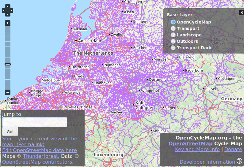
OpenCycleMap presents the existing OSM data very nuanced 1 | Maps © Thunderforest, Data © OpenStreetMap contributors
About us
- We have good news! weeklyOSM will have a version in Brazilian Portuguese (pt-br), aimed mainly at the Brazilian community. Collaborators are welcome! Please contact us if you want to help.
Mapping
- Yuu Hayashi postponed the start of voting for the proposal of Japan Tagging/Road Type. As the content of the proposal has changed due to the discussion, he has asked for further feedback.
- Mateusz Konieczny created wiki pages for tiger:CPI, tiger:CLASSFP, tiger:FUNCSTAT, tiger:LSAD, tiger:MTFCC in an attempt to document unclear meaning of these tags since each is used more than 22,000 times. Anyone aware of the meaning and use of any of these tags is welcomed to contribute. Currently all of them are described as “it is dubious whatever it should be present on any object”.
- The recently released version of JOSM now complains about a popular imprecise tag
shop=yes, used over 149,000 times despite better tagging usually being available. In the next release, available as JOSM-latest, there are some other new warnings, for example about: leisure=nature_reserve on nodes,boundary=administrativeandlanduse=residentialtagged on a single object and suspiciously narrowhighway=pedestrian. - The proposal for the key
departures=, which was designed to indicate the departure times for any given stop, was declined. - The proposals for
natural=peninsulaandnatural=isthmushave both been approved.
Community
- Issues with attributing OSM when using our data are nearly as old as our project. Richard Fairhurst addresses the issue of non-compliant attributions in a comprehensive post on the mailing list. Based on the responses it appears that the issue is not that important for other mappers or they are resigned to current practices. (Nabble)
- The annual general meeting for the Swiss OpenStreetMap Association will take place on Saturday 30 March 2019 in Basel, Switzerland.
- On the occasion of the OSM France’s donation campaign (we reported) ZDNet presents the OSM project under the title “Small fundraising for large project”.
Imports
- Giovanni Cascafico announces the planned import of Italian fuel stations using a dataset from the Ministry of Economic Development (Ministero dello Sviluppo Economico).
- Microsoft has released 12,663,475 computer generated building footprints for Canada under the Open Data Commons Open Database License (ODbL). Canadian contributors signal problems that need to be fixed before import. Please discuss it with the community if you plan to use the data. This follows the release of 125,192,184 building footprints for the USA some months ago.
- After the Digiroad Bus Stop Import by the Finnish Transport Agency (FTA), the Helsinki Region Transport Authority (HSL) is now also planning an import of stop positions in the Helsinki region and announced their intention in the Finnish OSM forum. Further information can be found on the corresponding Wiki page.
OpenStreetMap Foundation
- The minutes of the OSMF board meeting on 20 February were published. They discussed the GlobalLogic issue, Brexit, the 2019 budget, and whether the Etiquette page should stay on the editable OSM wiki.
- FOSSGIS e.V., the German OSMF chapter, will fund
 (automatic translation) the operation of the server infrastructure for openstreetmapdata.com, a data download service provided by Jochen Topf and Christoph Hormann.
 - OpenStreetMap UK reports about the success of their Talent Directory as Andy Mabbett delivered an OSM training event for Open Data Manchester. They hope to announce further exciting projects which any UK-based user can join here.
- Kate Chapman, from the OSMF board, sent an email to all OSMF members and announced a “regular update email to help OSMF members to stay on top of all the latest”. Kate mentioned the following points in her email: OSMF Updates – February 2019, links to the web pages of the Working Groups, the Board of Directors, the Local Chapters and the Advisory Board, and she also mentioned the page where the previous reports can be found.
- The association OpenStreetMap France has published (automatic translation) a post explaining the services provided by the association. It also gives an idea of the change in the demand on their servers and tries to explain its variation.
- The minutes of the Membership Working Group meeting of 22 February have been published.
 (automatic
 Events
- Impressions and recordings of the lectures of last year’s State of the Map Asia, in Bangalore, have now been published.
- OpenStreetMap is offering scholarships to attend the State of the Map 2019 in Heidelberg thanks to funding from sponsors. Three levels of scholarships exist and you can apply until 30 March 2019.
- The call for participation for the State of the Map 2019 is now open. If you can contribute with a talk or presentation for one of the tracks: OSM Basics, Community and Foundation, Mapping, Cartography, Software Development, Data Analysis and Data Model, or User Experiences you are asked to submit a proposal by 25 April 2019. Two innovations need to be highlighted:
- The track “OSM Basics” for presentations intended for people not overly familiar with the OSM ecosystem (20 minutes – like most other lectures), and
- The category “Extended lecture” for “Great ideas” (40 minutes).
Presentations for the “Academic Track” can be submitted until 30 April.
- Melanie Eckle reported about two OSM related events during the International Week against Racism in Heidelberg. On 11 March the Mamapa project is being introduced (teaching immigrants about humanitarian mapping) and on 21 March there is a related mapathon.
Humanitarian OSM
- HOT is asking advanced mappers using JOSM to map buildings in the Colombian region Barranquilla to prepare for a refugee influx from Venezuela as the political situation continues to deteriorate. The call is limited to experienced mappers due to problems with some pre-existing errors from prior mapping.
- HOT is offering a job as an “Advisory Board member” focusing on finance.
- The Heidelberg University details the past and future of MapSwipe, an app for phones that can be used to map human settlements from satellite imagery. During the past 2.5 years the app has helped to identify places that have not been mapped so far. The team is currently working on extending the scope to allow the mapping of individual building footprint geometries.
- CartONG and 510/ Netherland Red Cross have measured the Sustainable Development Goal (SDG) 2.8. “Achieve universal health coverage” in DR Congo and Malawi using the openrouteservice isochrone API to assess the accessibility of health centres. They also developed a demo dashboard using openrouteservice for that. More info.
Maps
- [1] Sara Acosta investigated (automatic translation), on eldiario.es, an image of the cycleway infrastructure of Europe, that is often shared on the Internet, and why this version, created from OSM data, is incorrect. By contacting Andy Allan, developer of OpenCycleMap, she found that the exact origin of the graphic is uncertain. The OpenCycleMap presents the existing OSM data in much more nuanced manner.
 (automatic
 switch2OSM
- A German provider of enclosed bicycle parking (“bicycle boxes”) (automatic translation) is mapping his offerings in OpenStreetMap and received some tips from the community in return. 😉 (automatic translation)
Open Data
- After a two-month competition, OpenStreetCam now has more than 2.2 million images in Australia and New Zealand. The Telenav Map Team used these contributions to train OpenStreetCam so it can now automatically detect more than 80 sign types specific to those countries.
- Esri revealed in the ArcGIS Blog the possibility of displaying large datasets in 3D using the ArcGIS API for JavaScript. This removes the previous limit of 2,000 objects. The article explains, with examples, how to create a 3D map overview with OSM data.
Software
- HeiGIT introduced openfuelservice. This new service offers close to “real world” estimations in terms of fuel consumption (gasoline and diesel), emissions (CO2, CO, NOx, THC) as well as cost assumptions for a growing number of car models. A first experimental version has been integrated into openrouteservice maps. This way you can check for the ecological footprint of your planned route. At the moment it is using a combination of data from the British “Vehicle Certification Agency” and the steadily growing “Open Citizen Science Platform” enviroCar.
- The OSM Tools plugin for QGIS has been superseded by the ORS Tools plugin. Nils Nolde points out the various changes that have been made to the plugin besides the name change. Emphasis is placed on the revamped GUI. The plugin integrates Openrouteservice APIs into QGIS.
Programming
- In his OSM diary user kastellano presented the project Videomapia. It combines georeferenced videos on YouTube in a map view with an OSM layer. The stored trips are displayed as an overlay and make it possible to exactly start the videos at the selected location.
- The OpenLayers project has asked for donations for work on version 6. Of the USD 300,000 collected so far, USD 150,000 have come from Swisstopo.
Releases
- Quincy Morgan announced the update of iD to version 2.14.3. The new version allows the user to toggle validation rules on and off, improves validation functionality, fixes five reported bugs and brings some more improvements.
- A new stable version of JOSM has been released. Version 19.02 mainly introduces support for Canadian English and adds a new function for calculating distance to the nearest GPX point, as well as various other minor enhancements.
- Tilemill 1.0.0 has been released and is a reunion with the fork Tileoven by florianf. Tilemill was originally developed by Mapbox as a development environment for CartoCSS styles, before they switched to JSON-based styles and a proprietary software-as-a-service platform called Mapbox Studio and left Tilemill to its own devices.
Did you know …
- … freemap.sk, the open, interactive map of Slovakia based on OSM?
- … the campaign “Fridays For Future”, the Friday protests of students across Europe which were triggered by the 16 years old Swedish activist Greta Thunberg? The interactive map is based on OSM.
- … the difference between
cycleway= oppositeandcycleway = opposite_lane? Both indicate that cyclists are allowed to ride in either direction down a one-way street. “opposite_lane” additionally adds that the cycle lane is marked.
Other “geo” things
- Clemens Jacobs has been looking into the data quality of citizen science observations of organisms. This research aims at using geographic context as an information source for estimating the plausibility of an observation, e.g. of a bird, which was reported to a citizen science portal collecting such data from volunteers. To this end, approaches were developed which use OpenStreetMap to capture the geographic context. He used the ohsome, OpenStreetMap History Analytics platform by HeiGIT, to predict the plausibility of a new observation of a species.
- For the online magazine CityMetric, Henry Dyer looked at London railway stations that cross borough boundaries. Using OSM data he consolidated his findings into a short list.
- The website Sketchplanations illustrates the coastline paradox in a short sketch in its weekly edition.
Upcoming Events
| Where | What | When | Country |
|---|---|---|---|
| Ivrea | Incontro mensile | 2019-03-09 |  |
| Nantes | Cartopartie “Mail des Chantiers-Île de Nantes” | 2019-03-09 |  |
| Oslo | OSM-beer | 2019-03-08 |  |
| Rennes | Réunion mensuelle | 2019-03-11 | |
| Zurich | OSM Stammtisch Zurich | 2019-03-11 |  |
| Lyon | Rencontre mensuelle pour tous | 2019-03-12 | |
| Salt Lake City | SLC Mappy Hour | 2019-03-12 |  |
| Arlon | Espace public numérique d’Arlon – Formation Initiation | 2019-03-12 |  |
| Munich | Münchner Stammtisch | 2019-03-13 |  |
| Dresden | FOSSGIS 2019 | 2019-03-13-2019-03-16 | |
| Berlin | 129. Berlin-Brandenburg Stammtisch | 2019-03-14 | |
| Kyoto | 京都!街歩き!マッピングパーティ:第6回 善峯寺 | 2019-03-17 |  |
| Chemnitz | Chemnitzer Linux-Tage 2019 | 2019-03-16-2019-03-17 | |
| Taipei | OSM x Wikidata #2 | 2019-03-18 |  |
| Cologne Bonn Airport | Bonner Stammtisch | 2019-03-19 | |
| Nottingham | East Midlands Pub meetup | 2019-03-19 |  |
| Scotland | Edinburgh | 2019-03-19 |  |
| Salt Lake City | SLC Map Night | 2019-03-19 | |
| Lüneburg | Lüneburger Mappertreffen | 2019-03-19 | |
| Toulouse | Rencontre mensuelle | 2019-03-20 | |
| Karlsruhe | Stammtisch | 2019-03-20 | |
| Nagoya | 図書で調べて編集するオープンデータワークショップ | 2019-03-21 | |
| Greater Vancouver area | Metrotown mappy Hour | 2019-03-22 |  |
| Tokyo | ミャンマーに絵本と地図を届けよう~ミャンマーに届ける翻訳絵本作り&自由な世界地図作り~ | 2019-03-23 | |
| Bremen | Bremer Mappertreffen | 2019-03-25 | |
| Joué-lès-Tours | Rencontre Mensuelle | 2019-03-25 | |
| Portmarnock | Erasmus+ EuYoutH_OSM Meeting | 2019-03-25-2019-03-29 |  |
| Graz | Stammtisch Graz | 2019-03-25 |  |
| Montpellier | State of the Map France 2019 | 2019-06-14-2019-06-16 | |
| Angra do Heroísmo | Erasmus+ EuYoutH_OSM Meeting | 2019-06-24-2019-06-29 |  |
| Minneapolis | State of the Map US 2019 | 2019-09-06-2019-09-08 | |
| Edinburgh | FOSS4GUK 2019 | 2019-09-18-2019-09-21 | |
| Heidelberg | Erasmus+ EuYoutH_OSM Meeting | 2019-09-18-2019-09-23 | |
| Heidelberg | HOT Summit 2019 | 2019-09-19-2019-09-20 | |
| Heidelberg | State of the Map 2019 (international conference) | 2019-09-21-2019-09-23 | |
| Grand-Bassam | State of the Map Africa 2019 | 2019-11-22-2019-11-24 |  |
Note: If you like to see your event here, please put it into the calendar. Only data which is there, will appear in weeklyOSM. Please check your event in our public calendar preview and correct it, where appropriate.
This weeklyOSM was produced by Nakaner, Polyglot, Rainero, Rogehm, SK53, SunCobalt, TheSwavu, YoViajo, derFred, geologist, jinalfoflia, kartonage.