14/03/2024-20/03/2024
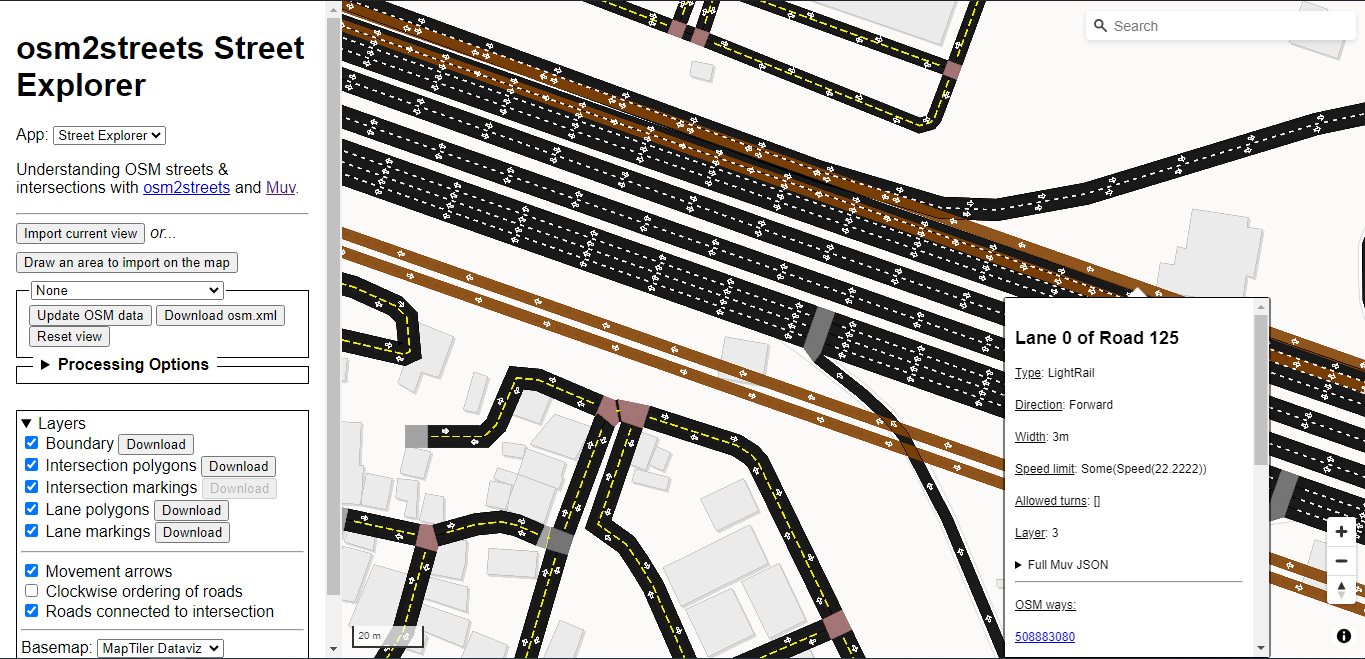
Understanding OSM streets and intersections with osm2streets [1] | © osm2streets | map data © OpenStreetMap contributors
Mapping
- Daniel Capilla wrote
 ► an article discussing the hierarchical classification of the metropolitan road network of Malaga, Spain.
 - Simon asked ► for the best way to map parking infrastructure and if it is okay to split roads for that purpose. In the comments, Tobias Jordans recommends a subtractive alternative, which has been developed by Parkraum OSM ►.
- Voting on the elevator dimensions proposal is open until Monday 25 March.
 ►
►
 ►
►Mapping campaigns
- UMBRAOSM presented the Mapeia Belém mapping project, aiming to update data in the city of Belém, Brazil, for major events that the city will host in 2024 and 2025, such as FOSS4G and COP 30 (United Nations Climate Change Conference).
- Matt Whilden introduced TIGERMap, a web application to help review the imported US TIGER datasets on OpenStreetMap. The app also includes address data from the USA National Address Database.
Community
- OSM France called out to Mapillary users who would like their photos to be migrated to the libre street view alternative Panoramax, which is hosted by OSM France.
- Eka Diweti shared her experience as a volunteer for the OSMF Membership Campaign.
- The YouthMappers UFRJ (Rio de Janeiro, Brazil) celebrated its first anniversary with a special interview with Dr. Rogério Borba, manager of the Brazilian Directory of Geospatial Data of the Brazilian National Spatial Data Infrastructure.
- GOwin celebrated Map-Pi day with the UP Mindanao YouthMappers.
- The OpenStreetMap community in Asia concluded another monthly Map-py Wednesday event with lightning talks by volunteers sharing about community activities and mapping techniques. For March, the three lightning talks were:
- Embracing the OSM Universe by Kiran from TomTom
- Overpass Turbo Queries by Example by Timmy from Kaart
- ‘Bus Friendly’ mapping by the UPI YouthMappers in Bandung, Indonesia
Copies of the slide decks are available, including links to details of the session for next month.
- Norbert Tretkowski tooted about the distribution of OSM stickers on the way to the FOSSGIS conference in Hamburg.
- Rebecca Nyinawumuntu Jeannette shared her experiences of the OSM Rwanda Open Data Day 2024.
- Tommy Hoang Long has exported a list of national parks and nature reserves in Vietnam, and noticed that only half of them have been mapped in OSM.
- Steve, from Map Kibera, shared his experience of mapping for waste management in one of the informal settlements of Nairobi.
- Matt Whilden shared a micromapping bingo card. It was designed by user MapSpot on the OSM World Discord.
 with Dr. Rogério Borba, manager of the Brazilian Directory of Geospatial Data of the Brazilian National Spatial Data Infrastructure.
Local chapter news
- Last quarter a ‘getting to know you’ survey was conducted with local OpenStreetMap communities in the Philippines. GOwin shared his observations from the responses made by the participants.
- The call for papers for the 10th State of the Map France is open on Pretalx ► until Thursday 18 April.
 on
on Events
- Don’t miss the first ever Geomob Edinburgh on Tuesday 26 March. This is reason enough for Ed to direct this week’s geoweirdness focus onto Scotland 🏴.
- Enock Seth Nyamador announced that State of the Map 2024 talk, workshop, and panel submissions are now open until Tuesday 23 April.
Education
- OpenSchoolMaps has made ► a tutorial on how to use uMap to create thematic maps.
- The IVIDES Institute announced a public call for submissions of chapters for a proposed book Case Studies in Collaborative Mapping. The manuscripts can be written in Portuguese (pt-BR) or English (en-US) and will be double-blind peer reviewed. The book is expected to be released in April 2025.
- Volker Gringmuth has released a 40-page book titled Getting started with OpenStreetMap, which is tutorial for people who are ‘generally comfortable with hardware and software and would like to participate in the development of OpenStreetMap, the free world map’.
- Art Glück has presented a video tutorial on creating a schematic map in Adobe Illustrator using OpenStreetMap data.
 a video tutorial on creating a schematic map in Adobe Illustrator using OpenStreetMap data.
Maps
- Martijn van Exel has been working on a ‘Welcome to Salt Lake City’ map, an opinionated map of stuff to see, eat, drink, and do while you’re visiting for the State of the Map US 2024 this summer.
- Christoph Hormann has released a set of satellite images of the Antarctic region to use for mapping in OpenStreetMap.
- Geoobserver reviewed ► NearbyWiki, a web map to explore interesting places nearby that are listed on Wikipedia.
OSM in action
- Gislars found a public transportation route map created using OpenStreetMap data in Blankenese, Hamburg.
- Kachelmann is using OpenStreetMap as the background map for displaying lightning.
- Holly Branson’s conversation with the HOT team highlighted the critical role of open mapping in disaster response and community development, showcasing innovative AI advances and impactful global contributions.
- Prajna wrote a viral Twitter thread about the maximum speed of Indonesian railways based on OpenRailwayMap, which is built using OpenStreetMap data. People in the comments are intrigued and fascinated by the data visualisation of OpenRailwayMap and how OpenStreetMap can store such detailed information about railway specifications. On another occasion, a public transportation analyst utilised OpenRailwayMap as a basis for their argument regarding potential improvements to the current rail system.
 a viral Twitter thread about the maximum speed of Indonesian railways based on OpenRailwayMap, which is built using OpenStreetMap data. People in the comments are intrigued and fascinated by the data visualisation of OpenRailwayMap and how OpenStreetMap can store such detailed information about railway specifications. On another occasion, a public transportation analyst
 Open Data
- The Open Knowledge Foundation tooted that the Learnovation Foundation Network held the Wikidata Loves SDGs 2024 event on Thursday 7 March, at the Mustapha Akanbi Library and Resource Centre in Kwara, Nigeria, to celebrate Open Data Day.
Software
- [1] Dustin Carlino tweeted that OSM2Streets, an OpenStreetMap street and intersection data visualisation tool, has had a major revamp, now switching to the Muv library for parsing OSM lane tagging and some improvements to the Svelte and MapLibre app.
- Kamil Monicz has undertaken a security review of the existing OpenStreetMap website while working on their OSM NextGen project.
- TrickyFoxy is disappointed with cartographers who use inaccurate AI recognition data in places where there is more accurate OSM data available.
- Peter Kontschieder announced the release of Neural Radiance Fields (NeRFs), a 3D space visualisation feature, on Mapillary. These visualisations are created using 2D images that have been uploaded to Mapillary.
Programming
- Isaac Boates, with help from the Karlsruhe Hack Weekend February 2024 attendees, has prepared several Docker images for various OSM-related utilities such as osm2pgsql, osmium, and osm2pgrouting.
Releases
- Ed Freyfogle announced a few improvements to OpenCage’s Geosearch (location autosuggest) service.
- Organic Maps has released an update patch to fix the OSM login feature on Google Play.
Other “geo” things
- HeiGIT, the Heidelberg Institute for Geoinformation Technology, is looking for a new Head of Administration with the power of attorney.
- HeiGIT reported that the University of Heidelberg is seeking applicants for the Robert and Christine Danziger Scholarship until 31 August 2024. The scholarship is intended for doctoral students from Africa (primarily from Ghana or another country in West and Central Africa) who are planning to apply for a doctorate in the field of Geography (with a focus on Geoinformatics) or Political Science at the University of Heidelberg.
- Daniel O’Donohue, from the MapScaping podcast, interviewed Will Cadell, CEO of SparkGeo, on the topic of ‘modern geospatial’ (the intersection of the cloud, smart space, open source data/standards, AI and smart devices).
- Thanks to the European Commission’s Digital Markets Act people in the EU will no longer be able to search ► for an address in Google and click through to Google Maps.
- Mozilla has announced that they will be shutting down the Mozilla location service. Roman Tsisyk, the developer of Organic Maps, has expressed his willingness to continue this work.
Upcoming Events
| Where | What | Online | When | Country |
|---|---|---|---|---|
| Hamburg | FOSSGIS 2024 – OSM-Samstag | 2024-03-23 |  | |
| Kozhikode | FOSSMeet’24 | 2024-03-23 |  | |
| Braga (São Vítor) | Open Knowledge Braga 2024 | 2024-03-24 |  | |
| 東區 | TomTom 成大 OpenStreetMap Workshop | 2024-03-25 |  | |
| Bremen | Bremer Mappertreffen | 2024-03-25 | | |
| Grenoble | Rencontre « OpenStreetMap et territoires » | 2024-03-26 |  | |
| Saint-Étienne | Rencontre Saint-Étienne et sud Loire | 2024-03-26 | | |
| Gent | OpenStreetMap-meetup in Gent | 2024-03-26 |  | |
| iD Community Chat | 2024-03-27 | |||
| [Online] OpenStreetMap Foundation board of Directors – public videomeeting | 2024-03-28 | |||
| Potsdam | Radnetz Brandenburg Mapping Abend #4 | 2024-03-28 | | |
| MapComplete Community Call | 2024-03-29 | |||
| Athens | Mapathon with OpenStreetMap: Improving Athens County’s Mapped Infrastructure @ Ohio University | 2024-03-29 |  | |
| Düsseldorf | Düsseldorfer OpenStreetMap-Treffen (online) | 2024-03-29 | | |
| Mapiripán | Latam meeting – SOTM LATAM 2024 (2) | 2024-03-30 |  | |
| 臺北市 | OpenStreetMap x Wikidata Taipei #63 | 2024-04-01 | | |
| San Jose | South Bay Map Night | ✓ | 2024-04-03 | |
| Berlin | OSM-Verkehrswende #57 | ✓ | 2024-04-02 | |
| Stuttgart | Stuttgarter OpenStreetMap-Treffen | 2024-04-03 | | |
| Dresden | OSM-Stammtisch Dresden | 2024-04-04 | |
Note:
If you like to see your event here, please put it into the OSM calendar. Only data which is there, will appear in weeklyOSM.
This weeklyOSM was produced by LuxuryCoop, MatthiasMatthias, PierZen, SeverinGeo, Strubbl, TheSwavu, TrickyFoxy, YoViajo, barefootstache, derFred, mcliquid, rtnf, tordans.
We welcome link suggestions for the next issue via this form and look forward to your contributions.