2022/01/18-2022/01/24
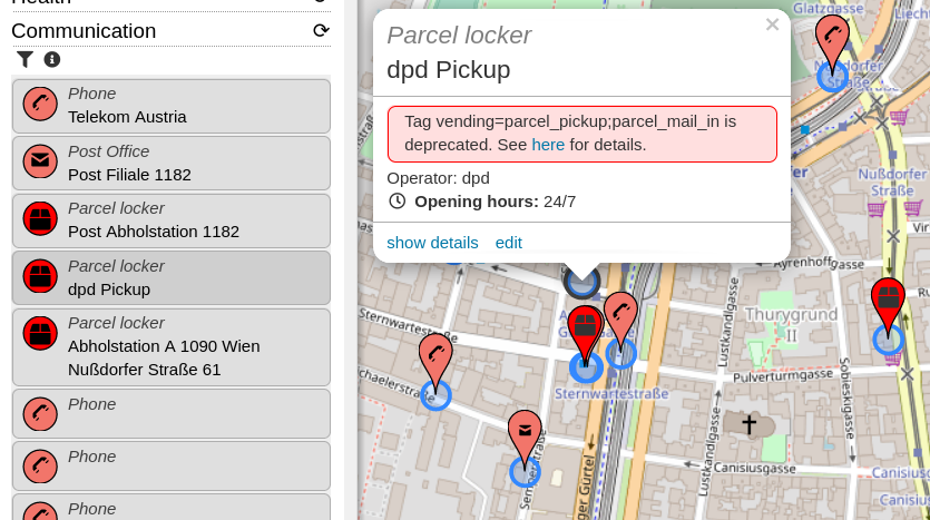
最近通過的提案 amenity=parcel_locker ,標籤已經可以用了 [1] | © OpenStreetBrowser | 地圖資料 © 開放街圖貢獻者
每週練習
畫地圖
- roptat 描述了
 >使用步行與汽車繪製地圖的不同方法與應用程式。他說對他來說,蒐集盡可能多的資訊並在稍後使用電腦繪製地圖是最有效的。
 - 對於 Florian Lainez 來說,無需說明被洪加東加火山噴發摧毀的島嶼的地圖已經在 OpenStreetMap 中使用 30 公分的 PléiadesNeo 影像進行了修改。
- AngocA 繼續他關於註記的系列文章。在一篇文章中>,他描述了人們可能遇到的不同類型的註記,而在另一篇>文章中,他列出了解決這些問題的幾種有用技術。
- Littltebtc 分享台灣農曆連假前通車的國道四號部分路段以及省道快速道路台74線部分的繪製地圖感想。他認為現下沒有最新空照圖情形下,圖客的編輯並不完美,在通車後圖客的編輯仍然有錯誤。他觀察最初繪製計畫中或施工中道路的圖客也許沒有注意道路連結是否正確,所以在台灣只依賴開放街圖圖資來導航的話,是有相當風險的事情。
- kubahahaha 描述了>他如何從一種非常古老的方式(將站點繪製為道路上的節點)更新波蘭 GZM 都會區的公車站。
- 是否應該使用
landuse=recreation_ground繪製用於個人休閒活動的私人區域?這個問題>在德語論壇上被問到,引發了很多討論。 - 以下提案正在徵求評論:
aeroway=airside_crossing用來標記公路或鐵路讓人員或交通工具通過機場通常受限制的空側區域的控制點。postal_service:<service>=*用來作為postal_service:*命名空間用來標記郵政服務的統一標記- 更清楚地定義不推薦使用標籤的原因
- 以下提案的投票已結束:
defence_works=*以 18 票贊成、2 票反對與 3 票棄權通過,用來標記軍事建築或為戰爭中的領土防禦而設計的建築物。park:lane:*,parking:condition:*=*用來標記停車道的條件,並棄用某些舊標籤,以 29 票贊成、0 票反對與 1 票棄權通過。- 在
amenity=bicycle_rental上標記bicycle_rental=docking_station; key_dispensing_machine; dropoff_point; shop; ...區分是哪種類型的腳踏車租賃,以 19 票贊成、4 票反對與 2 票棄權通過。
 >
>
 >
> 台灣農曆連假前通車的國道四號部分路段以及省道快速道路台74線部分的繪製地圖感想。他認為現下沒有最新空照圖情形下,圖客的編輯並不完美,在通車後圖客的編輯仍然有錯誤。他觀察最初繪製計畫中或施工中道路的圖客也許沒有注意道路連結是否正確,所以在台灣只依賴開放街圖圖資來導航的話,是有相當風險的事情。
 >
> >
>社群
- Taichi Furuhashi 聲稱 Niantic 吃 OSM 社群豆腐,其應正式對 OSM 做出貢獻。
- Daniel Akor 是奈及利亞 Nsukka 大學地理系最後一年的學生,他報告了他對製圖的追求與熱情如何讓他加入了 LionMappersTeam-Nsukka。
- Joshua Kwame Bensah-Ziwu 協助建立了 Survey School Mappers 並擔任其領導人,他分享了他對 Covid-19 對新 YouthMappers 分會的影響之見解。
- 福島 OSM 成員發佈了介紹 weeklyOSM 588的影片。
 。
。地區分會消息
- OpenStreetMap US 總結了2021年。
活動
- State of the Map US 不需要接種 COVID-19 疫苗即可參加。
教育
OSM 研究
- Moritz Schott 提供了關於如何在開始任何分析或視覺化之前將 OSM 資料過濾為僅有需要的資料的指南。
地圖
- 隱藏城市專案將揭示選定城市被忽視或模糊的歷史。目前,他們提供五個主要案例研究:埃克塞特、瓦倫西亞、漢堡、代芬特爾與特倫托。
開放資料
- 微軟已為美國、奈及利亞、肯亞、南美洲、烏干達、坦尚尼亞、加拿大與澳洲發布了新的和更新的建築足跡,這些建築已根據 Open Data Commons 的開放資料庫授權 (ODbL) 取得授權。
軟體
- [1] 在最近接受的
amenity=parcel_locker提案(我們報導過)之後,OpenStreetBrowser 現在包含了包裹儲物櫃。 - OsmAnd 捐贈了 20 個適用於 iOS 的 All World Maps 折扣碼與 20 個適用於 Android 的 OsmAnd Maps+ 折扣碼。按照此連結加入 OsmAnd 的下一次贈獎活動。
- HOT 團隊建立了「一個新的任務管理器模型,旨在讓任務管理器回到它的社群軟體根源」。現在,他們提供了一個志願者職位 Tasking Manager Collective Guide。
- 在更新了新的路徑規劃引擎(我們之前報導過)之後,當有標記為
piste:type=fatbike、airway=t-bar、airway=j-bar、airway=platter或airway=rope_tow的東西時,OpenSnowMap 會繪製新圖示。 - Hoerli 已經>編寫了關於如何在 OsmAnd 中顯示 Google 路況資訊的說明。
程式開發
- Amanda 在她的 OSM 日記中描述了如何找到對變更集發表評論但不參與編輯 OSM 資料庫的 OSM 使用。她使用了 anglosaxon 工具(我們之前報導過)。
- osm2pgsql 1.6.0 已經發布,其只是一個錯誤修復版本。
釋出
- Martin Raifer 發布了 iD 標記預設集合的更新:版本 3.2.0 包括許多改進、新的預設集與欄位,以及錯誤修復與翻譯更新。值得注意的變化是包裹儲物櫃預設更新為新的
amenity=parcel_locker標籤,並新增了針對cross=traffic_signals的預設集。有關變更的完整清單,請參閱變更日誌。 - Pieter Vander Vennet 回報說 MapComplete 0.14 已部署。除了許多已修復的錯誤與效能改進之外,顯示 OpenStreetMap 註記的新主題已上線。特別是過濾器功能應該可以派上用場。當然,還有很多新主題,例如街道照明主題(感謝 Robin!)或郵筒與郵局地圖(由 nicolelaine 提供)。
你知道嗎?
- ……提供基本 JOSM 安裝步驟與疑難排解資訊的網站?
其他地理事情
- Sameera Khan 展示了幾張由美國人填寫的歐洲地圖。您能用非洲地圖做得更好嗎?
- 史諾登透露,他工作的中央情報局站點有一張巨大的世界地圖,可以用來教導新進人員各個國家的位置。
- Yannick Brouwer 在一張奇妙的動畫地圖上展示了荷蘭24小時的火車交通情況。
- Reddit 上有人發佈了一則貼文,顯示了1820年巴西里約熱內盧地圖與目前城市地圖的比較,顯示了多年來為城市擴張做出貢獻的垃圾掩埋場。
- Jeff Foust 報導歐洲太空總署在 Sentinel-1B 故障後考慮加速雷達衛星發射。
- Bartosz Ciechanowski 撰寫一篇深入解釋全球定位系統的文章。
- TomTom 的 Steve Coast 向您展示他們名為 RoadRunner 的最新專案。其用於根據大量 GPS 追蹤資料自動建立地圖。自動偵測單行道與道路類型。OpenStreetMap 用於提供街道名稱。RoadRunner 可以透過他們的網路應用程式進行探索,或者您可以下載 PBF。
- 《衛報》的一篇文章討論說明文學作品的地圖。顯然,James Joyce 堅持不應該在《尤利西斯》的版本中包含地圖:也許他擔心人們會嘗試繪製避開酒吧的路線。
- 這三張衛星影像相隔11天!這些影像是上週發生火山爆發的洪加東加-洪加哈派島。根據 BBC 新聞發表的一篇文章,美國太空總署認為這次爆炸比二戰期間投在廣島的原子彈還要強大。
未來活動
| 地點 | 活動名稱 | Online | 日期 | 所在國 |
|---|---|---|---|---|
| Town of Claremont | Social Mapping Sunday: Claremont | 2022-01-30 |  | |
| 京都市 | 京都!街歩き!マッピングパーティ:第29回 鹿王院 | 2022-01-30 |  | |
| Cusano Milanino | Mappy Birthday OpenStreetMap Italia! | 2022-01-30 |  | |
| Bruxelles – Brussel | Virtual OpenStreetMap Belgium meeting | ✓ | 2022-01-31 |  |
| London | Missing Maps London Mapathon | 2022-02-01 |  | |
| San Jose | South Bay Map Night | ✓ | 2022-02-02 |  |
| Berlin | OSM-Verkehrswende #33 (Online) | 2022-02-01 |  | |
| Landau an der Isar | Virtuelles Niederbayern-Treffen | ✓ | 2022-02-01 | |
| Stuttgart | Stuttgarter Stammtisch (Online) | 2022-02-01 | | |
| Lyon | EPN des Rancy : Technique de cartographie et d’édition | 2022-02-05 |  | |
| Washington | MappingDC Mappy Hour | 2022-02-09 | | |
| Hamburg | Hamburger Mappertreffen | 2022-02-08 | | |
| OSM Utah monthly meetup | 2022-02-10 | |||
| Michigan | ✓ | 2022-02-10 | | |
| Bochum | OSM-Treffen Bochum (Februar) ONLINE | 2022-02-10 | | |
| Berlin | 164. Berlin-Brandenburg OpenStreetMap Stammtisch | ✓ | 2022-02-11 | |
| 臺北市 | OpenStreetMap x Wikidata Taipei #37 | 2022-02-14 |  | |
| San Jose | South Bay Map Night | ✓ | 2022-02-16 | |
| 148.Treffen des OSM-Stammtisches Bonn | 2022-02-15 | |||
| Lüneburg | Lüneburger Mappertreffen (online) | 2022-02-15 | | |
| Köln | Stammtisch Köln | 2022-02-16 | | |
| MSF online validation mapathon | 2022-02-17 |
註: 你也可以在這裡展示你發起的活動!只須在行事曆上塡妥活動資訊即可。 只有記載於行事曆上的活動資訊才會在《週刊OSM》列出。你也可以在行事曆預覽檢查你提交的活動, 並作出適當更正。
這期 weeklyOSM 由 MatthiasMatthias, Nordpfeil, NunoMASAzevedo, PierZen, Sammyhawkrad, Strubbl, Supaplex, TheSwavu, derFred, s8321414 編譯 ##team##
Please note that State of the Map U.S. highly recommends that all attendees get vaccinated against COVID-19 or present a negative test result. However, OpenStreetMap U.S. and the University of Arizona are legally prohibited from requiring vaccination at this time. We hope weeklyOSM’s note about SotMUS is not misinterpreted as encouraging attendees to come unvaccinated. If anyone has questions about our safety preparations, please contact events at openstreetmap.us. Thank you.
Thank you for your comment. We will take it up again clearly in the current issue. Surely we are allowed to quote your words?
Yes, you may quote me. Attendees can also find more information at the following pages:
https://2022.stateofthemap.us/ (under “Health Protocols”)
https://covid19.arizona.edu/
Thank you for your attention to this important matter.
We always try to do our best. Sometimes it is not enough 😉 But if something can be fixed, we are happy to do it.
Kleiner Hinweis: In dem Beitrag über Rio de Janeiro wurde “landfills” fälschlicherweise mit “Mülldeponien” anstatt “Landgewinnung” übersetzt.
Die Seiten von Bartosz Ciechanowski sind sehr liebevoll gestaltet und informativ noch dazu. Geo-Bezug jedenfalls gegeben!