20/09/2022-26/09/2022
Integration of the Ohsome Quality Analyst in ohsomeHeX [1] | © HeiGIT | © Map tiles bei Stamen Design | map data © OpenStreetMap contributors
About us
- The Ukrainian version Тижневик OSM, as part of the weeklyOSM family, once again demonstrates the international nature of OpenStreetMap.
Mapping campaigns
- Włodzimierz Bartczak reported
 ► that OpenStreetMap Poland and the Pedagogical University of Kraków are organising ‘Peljesac Cartographic Training Ground’, a week-long training camp for students under the guidance of experienced OSM editors. You can follow their activity by watching for the #peljesac hashtag in OSM changesets by using osmcha.
 ►
► 
Mapping
- Michael Reichert announced that Geofabrik has added two road-related layers to OSM Inspector, relations with
highway=*and out-of-use roads. - Requests have been made for comments on the following proposals:
- to deprecate
passenger_information_displayand promotedepartures_boardinstead. settlement_type=crannogfor mapping prehistoric settlements that are artificial islands constructed in lakes or sea inlets. Usually found in Ireland, Scotland and Wales.privacy=*for indicating how much privacy an amenity, such as a shower or toilet, provides.payment:coins|notes:denominations=*to record information about which denominations of coins or banknotes are accepted at a feature.amenity=training_centreto unify the tagging of facilities that provides various additional or special training, other than universities, colleges, and schools for children.amenity=pickup_pointto tag places that primarily serve as places where products that have previously been ordered (usually online) can be picked up.- replace the tagging mail list with the OSM Community forum for the purposes of announcing proposal requests for comments and voting.
- move proposal voting from the wiki to the OSM Community forum.
- to deprecate
Community
- Thunderforest, one of the sponsors behind the osm2pgsql project, published an interview with Jochen Topf, one of the lead developers in the osm2pgsql project.
- Cartocité ► , an OpenStreetMap consultancy agency based in France, is currently conducting a street-level imagery survey around the commune of Lons-le-Saunier. The collected data will be uploaded on Mapillary to be used in OpenStreetMap.
- During the short outage of OSMCha martien-176 noted some useful alternatives.
 ►
► OpenStreetMap Foundation
- The OSMF Operations Working Group have released their August 2022 report.
Events
- Recordings of the State of the Map 2022 sessions have started to be uploaded to YouTube and media.ccc.de.
- The proceedings of the Academic Track at State of the Map 2022 have been published.
- The committee of SotM Japan announced that SotM Japan 2022 will be held on Saturday 3 December in Kakogawa, Hyogo.
- Topi Tjukanov, the creator of the interactive map ‘Notable-people‘ and organiser of the 30DayMapChallenge, tweeted about several alternative formats for the upcoming challenge. As always, the next 30DayMapChallenge will take place throughout the month of November.
- The OpenStreetMap Switzerland monthly meeting will now be held ► both on site and virtually. You can check the schedule on the wiki ► .
- OpenStreetMap US has announced the online Mapping USA conference, which will be held on 11 and 12 November. This year’s Mapping USA will be a joint event together with WikiConference North America. Attendance will be free. The call for presentations is open until Saturday 15 October.
 that SotM Japan 2022 will be held on Saturday 3 December in Kakogawa, Hyogo.
 ►
► Maps
- Christoph Hormann published a blog post about Landsat 7’s end of operations scheduled for September 2022.
- Take a look at this scalable 2×2 map, which shows how the same part of the world was mapped in OSM in 2008, 2009, 2012 and 2022.
Software
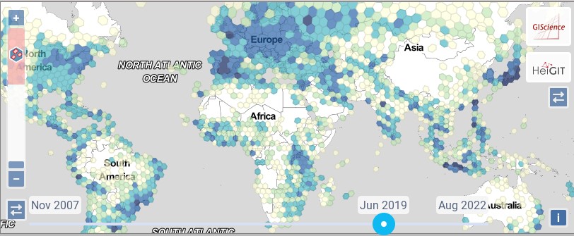
- [1] Rizwan Khan reported that HeiGIT has begun to integrate some of the functionality of the Ohsome Quality Analyst into ohsomeHeX, a tool to visualise maps and time series of data development in OSM. A completeness indicator for mapping saturation now allows the estimation of completeness by looking at the saturation of the data.
- Leaflet just released v1.9.0 followed closely by a fix release the day after.
- Tykayn has created ► a Mastodon bot that shares an ‘OSM tag of the day’ from the French wiki each day. Toots can be followed using the hashtag #rtfw.
Programming
- Amanda McCann blogged about her tool for measuring distances between nearest POIs, inspired by the bank and gunshop example we reported on earlier.
- The Prototype Fund, which is funding Jochen Topf’s osm2pgsql project (as we reported earlier), is also funding ► an OpenStreetMap parking space analysis project. The project aims to provide detailed information on parking in public spaces in the form of interactive maps and prepared data exports. The project group consists of Alex, Lars and Tobias from the OSM Berlin community. In order to support other interested parties to collect parking data, the group is also working to improve the documentation and provide instructions for local mapping campaigns.
Did you know …
- … that the OSM Community forum is configured so you can reply in your native language regardless of the language of the thread? The Discourse translator will then do the translation.
- … that you can use OSM Smart Menu in Google Chrome or Mozilla Firefox to open links related to OpenStreetMap, based on parameters from the current page? It helps OpenStreetMap contributors to easily switch between different maps and analysis tools.
OSM in the media
- Delphine Sabattier interviewed ► Florian Lainez, about OpenStreetMap initiatives regarding the conflict between Ukraine and Russia. Florian is also known for their participation in many projects including ‘ÇaResteOuvert‘ ► , a platform people used during lockdown to share opening hours of nearby shops through
:covid19tagging, or the sillier one ‘Panneau biche‘ which involves gathering knowledge about wildlife road signs.
Other “geo” things
- Do you love 3D maps, fantastic worlds and visualisations? Have a look and enjoy!
- HBO published a map of the fictional world of Westeros from the series Game of Thrones.
Upcoming Events
| Where | What | Online | When | Country |
|---|---|---|---|---|
| Washington | OSM US Mappy Hour | ✓ | 2022-09-29 |  |
| Vern-sur-Seiche | Atelier participatif « Recensement des commerces » | 2022-09-29 |  | |
| Düsseldorf | Düsseldorfer OpenStreetMap-Treffen | ✓ | 2022-09-30 |  |
| IJmuiden | OSM Nederland bijeenkomst (online) | ✓ | 2022-10-01 |  |
| Villa de Cos | Notathon en OpenStreetMap – resolvamos notas de México | 2022-10-01 |  | |
| Berlin | Vortrag auf Konferenz Bits & Bäume: Parkplatzzählung und Parkraumanalysen mit OpenStreetMap | 2022-10-01 | | |
| Hacktoberfest 2022 | 2022-10-01 – 2022-10-31 | |||
| Berlin | Vortrag auf Konferenz Bits & Bäume: Mit OpenStreetMap die Verkehrswende begleiten – Tagging, Tools und Analysen | 2022-10-02 | | |
| 臺北市 | OpenStreetMap x Wikidata Taipei #45 | 2022-10-03 |  | |
| City of Westminster | London pub meet-up | 2022-10-04 |  | |
| London | Missing Maps London Mapathon | 2022-10-04 | | |
| Stuttgart | Stuttgarter Stammtisch | 2022-10-04 | | |
| Berlin | OSM-Verkehrswende #39 (Online) | ✓ | 2022-10-04 | |
| Murray | OSM Utah Monthly Meetup | 2022-10-06 | | |
| Mannheim | Mapathon in der Moschee | 2022-10-06 | | |
| Olomouc | Říjnový olomoucký mapathon – hybridní | 2022-10-06 |  | |
| Град Крагујевац | OSM Serbia regular meetup | ✓ | 2022-10-06 |  |
| Salvador | [online] mapatona UMBRAOSM e YouthMappers Brasil no TECISS 2022 | 2022-10-07 |  | |
| La Chapelle-des-Fougeretz | Atelier participatif « Recensement des commerces » | 2022-10-07 | | |
| Kaiserslautern | OSM Mapping Event Erfassung von Barrieren | 2022-10-08 | | |
| 京都市 | 京都!街歩き!マッピングパーティ:第32回 Re:妙心寺 | 2022-10-08 |  | |
| Polokwane Local Municipality | OSM Africa October Mapathon | ✓ | 2022-10-08 |  |
| Polokwane Local Municipality | OSM Africa October Mapathon | ✓ | 2022-10-08 | |
| Washington | MappingDC Mappy Hour | 2022-10-12 | | |
| München | Münchner OSM-Treffen | 2022-10-11 | | |
| San Jose | South Bay Map Night | ✓ | 2022-10-12 | |
| Frankfurt am Main | Arbeitstreffen Indoor OSM 2022 | 2022-10-14 – 2022-10-16 | | |
| Berlin | 172. Berlin-Brandenburg OpenStreetMap Stammtisch | 2022-10-14 | | |
| Hlavní město Praha | World Railway Mapping Online Quarterly Meetup. | 2022-10-15 | | |
| 156. Treffen des OSM-Stammtisches Bonn | 2022-10-18 | |||
| City of Nottingham | OSM East Midlands/Nottingham meetup (online) | ✓ | 2022-10-18 | |
| Lüneburg | Lüneburger Mappertreffen (online) | 2022-10-18 | | |
| Sélestat | Rencontre des contributeurs.rices en Alsace | 2022-10-19 | | |
| Roma | Incontro dei mappatori romani e laziali – ottobre 2022 | 2022-10-19 |  | |
| Arlon | EPN d’Arlon – Atelier ouvert OpenStreetMap | 2022-10-20 |  |
Note:
If you like to see your event here, please put it into the OSM calendar. Only data which is there, will appear in weeklyOSM.
This weeklyOSM was produced by Approksimator, Lejun, Nordpfeil, PierZen, Strubbl, TheSwavu, derFred, rtnf.
We welcome link suggestions for the next issue via this form and look forward to your contributions.